
Google Earth, a revolutionary platform from the tech giant, has long transcended its initial purpose as a simple digital globe. For millions worldwide, it’s a portal to every corner of the planet, offering unparalleled access to satellite imagery, terrain data, and geographic information. But beyond merely viewing locations, Google Earth offers an experience often described as “flying.” This isn’t just a metaphor for seamless navigation; it’s a literal feature, allowing users to pilot virtual aircraft across breathtaking landscapes. This article delves into the intricacies of Google Earth’s flight capabilities, from its hidden flight simulator to the intuitive navigation that makes global exploration feel like an aerial journey. We will explore how this powerful software empowers everyone, from casual explorers to seasoned professionals, to take to the digital skies.
Unveiling Google Earth’s Aeronautical Prowess
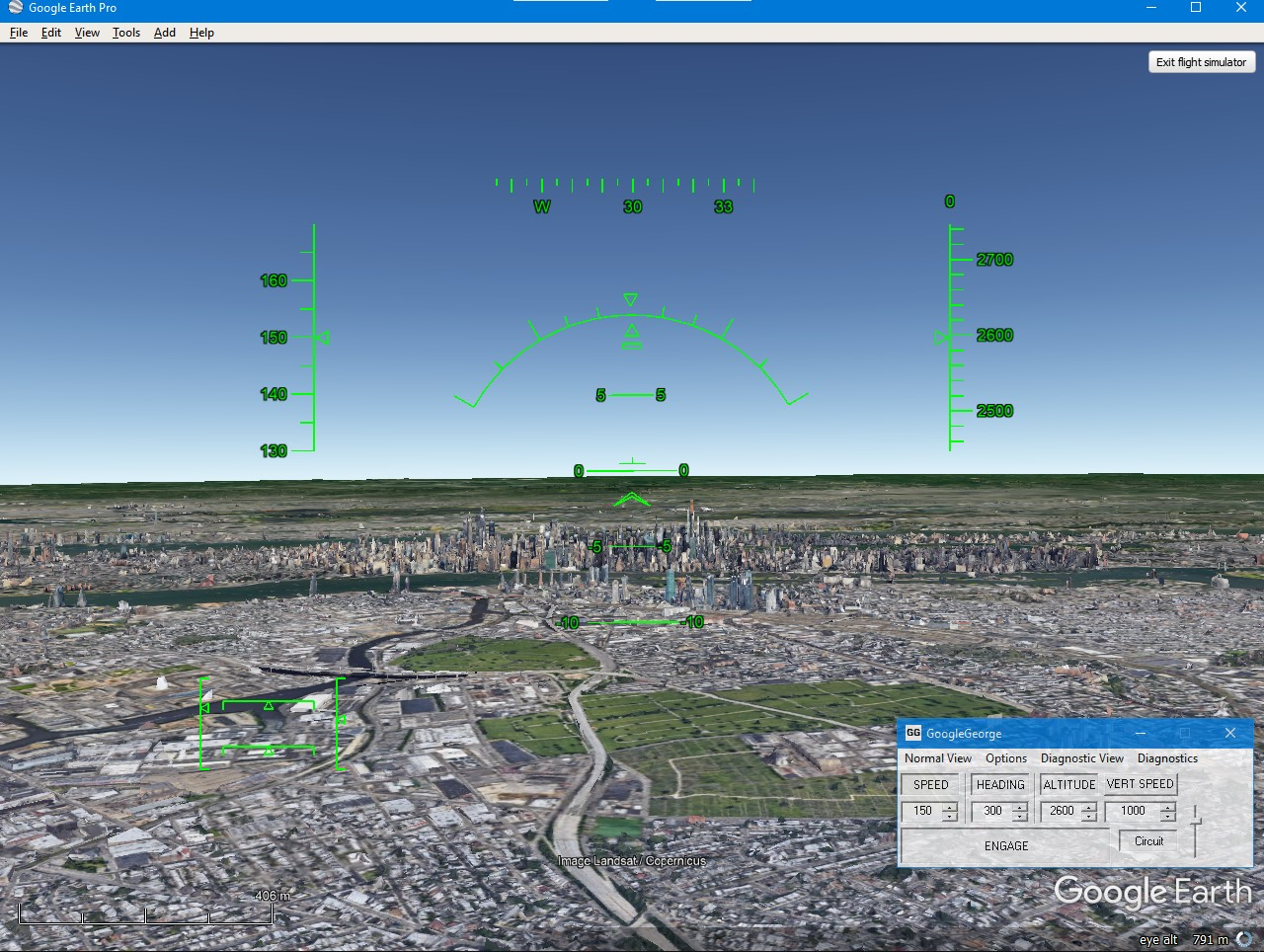
While its primary function is geographical exploration, Google Earth harbors a sophisticated yet accessible secret: a fully functional flight simulator. This feature transforms your computer into a cockpit, enabling you to take control of virtual aircraft and experience the world from a truly unique perspective. Far from a mere gimmick, this simulator offers a surprisingly immersive and educational experience, allowing users to understand basic flight dynamics while navigating realistic terrain.
The inclusion of a flight simulator within Google Earth speaks volumes about the platform’s commitment to delivering comprehensive geospatial experiences. It democratizes flight simulation, removing the barrier of expensive dedicated software and making the thrill of aviation accessible to anyone with an internet connection. Whether you’re interested in practicing navigation, exploring remote regions from above, or simply fulfilling a childhood dream of flying, Google Earth provides an extraordinary and free avenue. Its integration with Google Earth’s high-resolution imagery and 3D terrain data means that every mountain range, city skyline, and ocean expanse you fly over is rendered with impressive accuracy, creating a compelling virtual environment for aerial exploration.
Accessing the Flight Simulator
Activating Google Earth’s flight simulator is surprisingly straightforward, though often overlooked by casual users. It’s a testament to the software’s depth, often tucked away in its menu system awaiting discovery.
To launch the flight simulator:
-
Open Google Earth Pro: Ensure you have the Google Earth Pro desktop application installed, as this feature is primarily available there and not typically in the web version.
-
Navigate to the Tools Menu: In the top menu bar, click on “Tools.”
-
Select “Enter Flight Simulator”: From the dropdown menu, choose the “Enter Flight Simulator” option. Alternatively, a quick shortcut is
Ctrl+Alt+A(Windows) or⌘+Option+A(Mac).
Once activated, you’ll be presented with a selection screen. Here, you can choose your aircraft:
-
F-16 Fighting Falcon: A high-performance jet fighter, known for its speed and agility. Ideal for rapid transit and aerial maneuvers.
-
SR22: A high-performance single-engine propeller aircraft, offering a more leisurely and stable flight experience, perfect for sightseeing.
You’ll also have the option to select your starting airport or begin mid-air at your current Google Earth location. For beginners, starting at a well-known airport offers a structured environment to practice take-offs and landings.
Mastering the Controls: Your First Take-off
Stepping into the virtual cockpit requires understanding the basic flight controls. While dedicated joysticks offer the most authentic experience, Google Earth’s flight simulator is fully operable with just your keyboard and mouse, making it incredibly accessible.
Keyboard Controls:
-
Elevator (Pitch): Controls the nose of the aircraft up and down.
-
Up Arrow /
Alt+Down: Nose down (descend). -
Down Arrow /
Alt+Up: Nose up (climb).
-
-
Ailerons (Roll): Controls the banking of the wings, used for turning.
-
Left Arrow /
Alt+Left: Roll left. -
Right Arrow /
Alt+Right: Roll right.
-
-
Rudder (Yaw): Controls the aircraft’s nose left and right without banking, primarily used for taxiing on the ground and coordinating turns in the air.
-
,(comma): Yaw left. -
.(period): Yaw right.
-
-
Throttle (Speed): Adjusts engine power.
-
Page Up/Shift+Up: Increase throttle. -
Page Down/Shift+Down: Decrease throttle.
-
-
Flaps: Increase lift and drag for slower flight, especially useful for take-offs and landings.
-
F: Extend flaps. -
Shift+F: Retract flaps.
-
-
Landing Gear:
G: Toggle landing gear.
-
Brakes:
-
,(comma) +.(period) simultaneously: Apply wheel brakes. -
Spacebar: Engage/disengage flight pause.
-
Mouse Controls (Alternate):
When using the mouse for controls (selectable at startup), moving the mouse cursor controls the pitch and roll. Left-click acts as a modifier for more precise movements.
Your First Take-off:
-
Select Airport: Choose an airport with a long runway.
-
Increase Throttle: Gradually increase the throttle using
Page Up. Watch your airspeed build. -
Rotate: Once you reach sufficient speed (typically around 100-150 knots, depending on the aircraft), gently pull back on the elevator (down arrow key) to lift the nose and take off.
-
Retract Gear and Flaps: Once airborne and gaining altitude, retract your landing gear (
G) and gradually retract flaps (Shift+F) to reduce drag and increase speed. -
Maintain Level Flight: Use slight adjustments to the pitch and roll to maintain a stable heading and altitude.
Mastering these basic controls is the foundation for truly “flying” in Google Earth, opening up an entirely new dimension of exploration.
Beyond the Cockpit: Navigating the Globe with Intuition
Even outside the dedicated flight simulator, Google Earth’s primary navigation system embodies a sense of “flying.” Its fluid camera movements, dynamic perspective shifts, and seamless transitions between altitudes create an intuitive and immersive experience that feels like soaring above the Earth. This intuitive approach to exploration is a core tenet of Google Earth’s design, making geographical discovery accessible and engaging for everyone. It allows users to glide from a satellite view down to street level, traversing continents and oceans with a mere flick of the wrist.
The elegance of Google Earth’s navigation lies in its ability to mimic natural human perception, even when presenting a global overview. Zooming in feels like descending, panning like moving across the landscape, and tilting like an aircraft banking for a closer look. This carefully crafted user experience transforms what could be a static map into a living, breathing, explorable world, cementing its status as a premier geospatial tool.
Dynamic Camera Controls for Seamless Exploration
The cornerstone of Google Earth’s “flight” experience lies in its dynamic camera controls, which offer unparalleled flexibility in viewing the world. These controls are designed for fluidity, allowing users to effortlessly transition from a stratospheric overview to an intimate street-level perspective.
-
Pan: Simply click and drag your mouse across the map to move your view horizontally, as if gliding over the landscape.
-
Zoom: Use the scroll wheel on your mouse (or the +/- buttons on the navigation panel) to zoom in and out. This creates a sensation of ascending or descending rapidly.
-
Tilt: Hold down the scroll wheel (or middle mouse button) and drag up or down to tilt the view, changing your angle of approach from directly overhead to a more horizon-level perspective. This is crucial for experiencing 3D terrain and buildings.
-
Rotate: Hold down the scroll wheel and drag left or right to rotate your view around a central point, simulating an aircraft circling an area of interest.
-
Street View Integration: For truly immersive ground-level exploration, drag the “Pegman” (the yellow street view icon) onto any blue-highlighted road. This instantly drops you into a panoramic street-level photograph, allowing you to “walk” or “drive” virtually through cities and landscapes, bridging the gap between aerial and terrestrial viewing.
-
Sun & Shadows: An often-overlooked feature, the “Sun” button in the toolbar allows you to adjust the time of day, casting realistic shadows based on the sun’s position. This adds depth and realism to 3D terrain and urban environments, enhancing the visual fidelity of your virtual flight.
These combined controls allow for a highly interactive and personalized exploration experience, simulating the freedom of movement inherent in actual flight.
Leveraging Advanced Navigation Tools
Beyond the basic camera controls, Google Earth offers a suite of advanced tools that deepen the “flying” experience, providing structure, context, and enhanced data for your explorations. These tools move beyond mere visual navigation to offer actionable insights and curated journeys.
-
Search Bar: The simplest yet most powerful tool. Type in any place name, address, or set of coordinates, and Google Earth will instantly “fly” you to that location, often with a dramatic swoop-in animation.
-
Tours and Guided Experiences: Google Earth features pre-recorded tours that automatically navigate you through specific locations or themed journeys, complete with descriptive audio or text. These are excellent for learning about new places or experiencing curated “flights” designed by experts.
-
Measuring Distances and Areas: The ruler tool allows you to measure distances between points or calculate the area of a polygon drawn on the map. This is invaluable for planning routes, assessing land sizes, or understanding geographical scales from an aerial perspective.
-
Historical Imagery: This powerful feature allows you to travel back in time by accessing a chronological archive of satellite and aerial imagery. By clicking the clock icon in the toolbar, you can witness urban development, environmental changes, or landscape evolution over decades, providing a historical dimension to your “flights.”
-
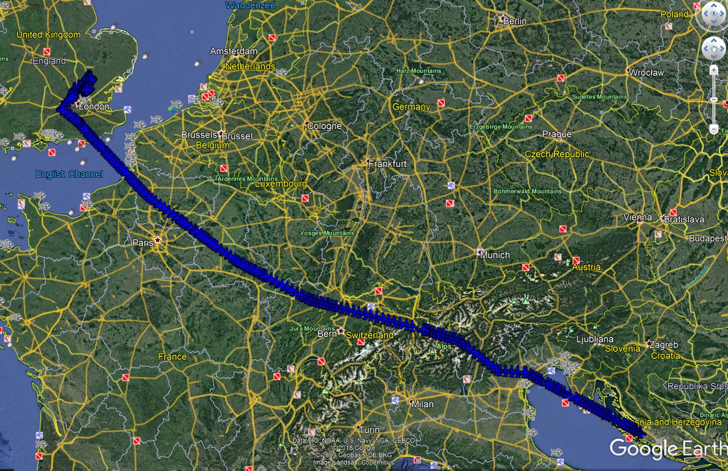
KML/KMZ Import: For users with custom data, Google Earth allows the import of KML (Keyhole Markup Language) and KMZ files. These files can contain placemarks, paths, polygons, and even 3D models, allowing you to overlay your own “flight plans,” points of interest, or custom routes onto the globe, enriching your personal exploration.
By combining intuitive camera controls with these advanced navigation features, Google Earth transforms virtual exploration into an incredibly rich and insightful experience, mimicking the capabilities of professional aerial reconnaissance and personal adventure alike.
Enhancing Your Aerial Journey: Tips and Tricks
To truly master the art of “flying” with Google Earth, whether in the flight simulator or during general exploration, a few expert tips can significantly enhance your experience. These insights range from optimizing performance to tapping into community resources, ensuring your virtual journeys are as smooth and enriching as possible. Understanding how to fine-tune the software and leverage its broader ecosystem can elevate your exploration from casual browsing to an insightful and highly personalized adventure.
Optimizing Performance and Visuals
Google Earth, with its vast datasets and 3D rendering capabilities, can be demanding on your system. Optimizing its performance and visual fidelity is key to a smooth and immersive “flight.”
-
Adjusting Graphics Settings:
-
Navigate to
Tools > Options(Windows) orGoogle Earth Pro > Preferences(Mac). -
Under the “3D View” tab, you’ll find options for graphics mode (OpenGL, DirectX), texture compression, and anisotropic filtering. Experiment with these settings. For older hardware, choosing a less demanding graphics mode or reducing texture quality can significantly improve frame rates.
-
Adjust
Terrain QualityandWater Reflection Qualitybased on your system’s capabilities. Lowering these can boost performance.
-
-
Cache Management: Google Earth stores imagery and terrain data in a cache on your hard drive. A large or corrupted cache can slow things down.
-
In
Tools > Options > Cache, you can clear the disk cache. It’s often beneficial to do this periodically, especially if you experience slowdowns or corrupt imagery. -
You can also adjust the
Disk cache size. A larger cache means more data is stored locally, potentially speeding up re-visiting areas, but it consumes more disk space.
-
-
Hardware Considerations: While Google Earth runs on most modern computers, a dedicated graphics card (GPU) and ample RAM (8GB+ recommended) will dramatically improve performance, especially when viewing detailed 3D cities or flying through complex terrain. Ensure your graphics drivers are up to date.
-
Network Connection: A stable, high-speed internet connection is crucial for quickly downloading high-resolution imagery and 3D models. Slow connections will result in blurry imagery and loading delays, hindering your “flight” experience.
Exploring Add-ons and Community Content
The Google Earth ecosystem extends far beyond its default settings, offering a wealth of add-ons and community-generated content that can enrich your aerial explorations.
-
User-Generated KML Files: The internet is replete with KML/KMZ files created by enthusiasts for specific interests. These can include:
-
Flight Routes: Recreations of historical flights, famous air race paths, or scenic routes.
-
Points of Interest: Collections of historical sites, natural wonders, geological formations, or specific landmarks.
-
Specialized Overlays: Custom maps, weather layers, or real-time data feeds (if available from third parties).
-
Search online forums and dedicated KML repositories to discover these treasures and import them into your Google Earth session.
-
-
The Google Earth Community Forum: This vibrant online community is a treasure trove of information, tips, and shared content. You can find answers to technical questions, discover unique places to explore, and share your own discoveries and custom KML files. Engaging with the community can unlock new ways to interact with Google Earth.
-
Third-Party Tools and Integration: While not direct “add-ons,” many geographical information systems (GIS) and specialized mapping software can export data in KML format, allowing professionals and researchers to visualize their own complex datasets within the intuitive interface of Google Earth. This extends its utility far beyond casual exploration.
By harnessing these optimization techniques and delving into the rich community content, your Google Earth “flights” can become more fluid, detailed, and infinitely more fascinating.
Real-World Applications and Educational Value
The ability to “fly” with Google Earth transcends mere entertainment; it offers profound real-world applications and significant educational value across various domains. From academic research to professional planning and personal enrichment, the platform’s immersive capabilities provide unique perspectives that are difficult to achieve through traditional means. It’s a powerful tool for visualization, analysis, and discovery, bringing complex geographical data to life in an accessible and engaging format.
The simulation of aerial perspective, whether through the dedicated flight simulator or general navigation, makes abstract concepts tangible. Students can visualize geological formations, architects can preview urban designs, and environmental scientists can monitor changes from a bird’s-eye view, all without ever leaving their desk.
Educational Insights and Geographic Literacy
Google Earth stands as an unparalleled educational resource, fostering geographic literacy and providing dynamic learning experiences across numerous subjects.
-
Geography Lessons: Students can virtually explore different biomes, study landforms (mountains, valleys, rivers), understand plate tectonics by observing fault lines, and analyze climate zones. The 3D terrain makes topography tangible, allowing for a deeper understanding of physical geography.
-
Urban Planning and Development Studies: Observing the growth of cities over time using historical imagery or analyzing urban sprawl provides critical insights for students of urban planning and sociology. They can visualize the impact of infrastructure projects or understand population distribution.
-
Environmental Monitoring: “Flying” over endangered ecosystems, deforestation zones, or areas affected by natural disasters (using updated imagery) provides a powerful tool for environmental education and awareness. Students can track changes and understand ecological challenges from a global perspective.
-
Historical Recreation and Archaeology: Overlaying historical maps or KML files of ancient cities and trade routes allows students to virtually traverse historical landscapes, understanding the geographical context of past events and archaeological sites.
-
Global Awareness: Simply exploring different countries and cultures, seeing landmarks and diverse landscapes, broadens horizons and promotes a deeper understanding of global diversity and interconnectedness.

Practical Use Cases for Professionals and Enthusiasts
Beyond education, Google Earth’s aerial capabilities offer practical advantages for a wide array of professionals and enthusiasts.
-
Pre-Flight Planning for Pilots: While not certified for actual flight navigation, Google Earth can be an invaluable tool for pilots to visually study terrain, identify landmarks, and understand approach paths to airports. Visualizing a route in 3D beforehand can significantly aid in situational awareness.
-
Real Estate and Land Surveying: Professionals can use Google Earth to evaluate properties, assess surrounding infrastructure, visualize terrain for construction projects, and even mark boundary lines (though not for legal accuracy). The ability to “fly” around a plot of land provides a comprehensive overview.
-
Adventure Planning (Hiking, Cycling, Tourism): Hikers can trace potential routes, evaluate elevation changes, and identify scenic viewpoints. Cyclists can preview road conditions and gradients. Tourists can virtually explore destinations, plan itineraries, and locate attractions before their physical journey.
-
Disaster Response and Humanitarian Aid: In scenarios where physical access is limited, Google Earth can provide critical early intelligence by offering aerial views of affected areas, helping teams assess damage, plan logistics, and identify safe access routes.
-
Architecture and Construction: Architects can visualize how a proposed building will sit within its environment, consider sun paths and shadows, and even import 3D models of their designs to see them in context.
In essence, “flying” with Google Earth is more than just a digital pastime; it’s a versatile technological capability that informs, educates, and empowers users across countless applications, truly bringing the world to their fingertips.
Google Earth, with its remarkable “flying” capabilities, stands as a testament to the power of geospatial technology. From the exhilarating experience of piloting a virtual F-16 across continents to the serene glide of exploring ancient ruins from above, it offers an unparalleled journey of discovery. This platform democratizes aerial exploration, putting the tools of pilots, cartographers, and adventurers into the hands of anyone with a computer.
Whether you’re harnessing the precise controls of the flight simulator, intuitively navigating the globe with dynamic camera movements, or leveraging advanced tools for specific research, Google Earth continuously redefines what’s possible in virtual exploration. It’s a powerful educational instrument, enriching geographic literacy and offering profound insights into our planet’s physical and human landscapes. For professionals, it’s a practical aid for planning and visualization; for enthusiasts, an endless source of wonder and adventure.
As technology continues to evolve, the future of virtual flight within Google Earth promises even greater immersion and detail. So, next time you open Google Earth, remember that you’re not just looking at the world – you’re preparing for take-off. The entire planet awaits your command, ready to be explored from an entirely new perspective. Embrace the wings Google Earth offers, and let your curiosity soar.
aViewFromTheCave is a participant in the Amazon Services LLC Associates Program, an affiliate advertising program designed to provide a means for sites to earn advertising fees by advertising and linking to Amazon.com. Amazon, the Amazon logo, AmazonSupply, and the AmazonSupply logo are trademarks of Amazon.com, Inc. or its affiliates. As an Amazon Associate we earn affiliate commissions from qualifying purchases.