
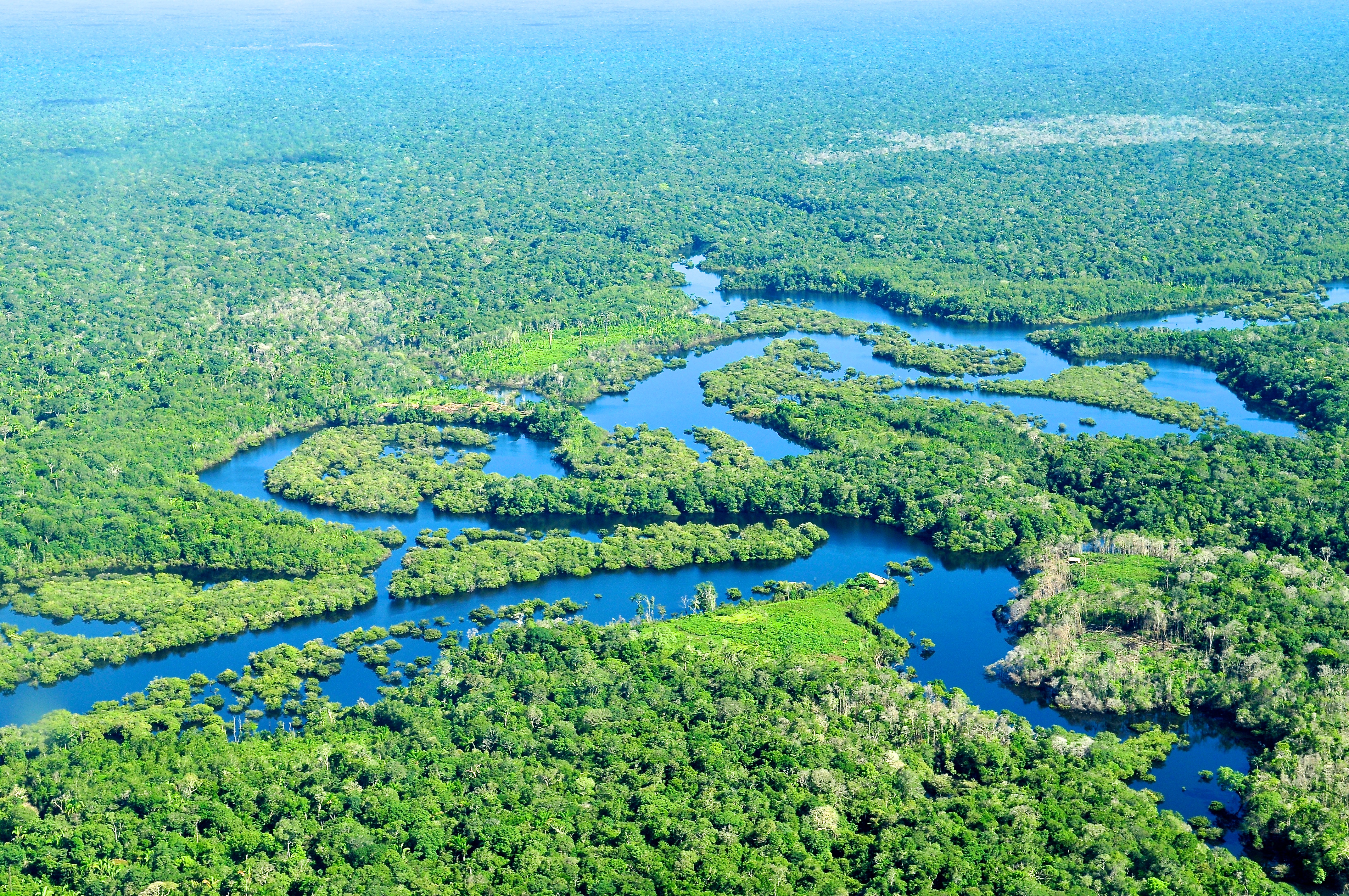
The question “Where’s the Amazon Rainforest?” might seem straightforward, conjuring images of vibrant biodiversity spanning South America. Yet, in the 21st century, with accelerating environmental pressures and the imperative for precise conservation, the answer transcends simple geography. It transforms into a complex inquiry that demands sophisticated technological solutions to locate, monitor, understand, and ultimately protect this invaluable ecosystem. From satellite arrays orbiting hundreds of kilometers above Earth to micro-sensors embedded deep within the forest canopy, technology is redefining our relationship with the Amazon, providing unprecedented insights into its health, threats, and the critical role it plays in global climate regulation. This exploration delves into how cutting-edge technology answers the multifaceted question of the Amazon’s whereabouts and well-being.

The Imperative of Location: Why Knowing “Where” Matters
Understanding the exact spatial and temporal dynamics of the Amazon is no longer a mere academic exercise; it is a critical requirement for effective environmental governance, resource management, and conservation efforts. The rainforest, a vast and often impenetrable wilderness, presents formidable challenges to traditional mapping and monitoring methods. Deforestation, illegal mining, agricultural expansion, and climate change are reshaping its boundaries and internal composition at an alarming rate, making real-time, accurate positional data indispensable.
From Cartography to Real-time Monitoring
Historically, mapping the Amazon was a monumental task, reliant on aerial photography and arduous ground expeditions. The resulting maps, while groundbreaking for their time, were static snapshots, quickly outdated by the rapid pace of human activity and natural changes. Today, the concept of “where” has evolved from a fixed point on a map to a dynamic, continuously updated data stream. High-resolution satellite imagery, combined with advanced geographic information systems (GIS), allows for the creation of living maps that reflect changes almost as they happen. This shift from static cartography to dynamic, real-time monitoring is foundational to tracking the Amazon’s ever-changing landscape. It enables conservationists, governments, and scientists to identify deforestation hotspots, monitor protected areas, and detect environmental crimes with unparalleled precision and timeliness.
The Data Deficit and Remote Sensing Solutions
Despite its global significance, the Amazon has historically suffered from a “data deficit.” Its sheer size, remote accessibility, and complex topography made comprehensive data collection incredibly difficult and expensive. Remote sensing technologies have emerged as a powerful antidote to this challenge. Satellites equipped with various sensors — optical, radar, lidar — can penetrate cloud cover, capture detailed images of the forest structure, and even measure biomass and carbon sequestration. These technologies provide vast quantities of data from above, filling critical information gaps that ground-based efforts alone could never achieve. By transforming inaccessible terrains into analyzable datasets, remote sensing doesn’t just answer “where” the Amazon is, but also “what state it’s in” and “how it’s changing.”
Satellite Surveillance: Eyes in the Sky for Earth’s Largest Ecosystem
At the forefront of answering “where’s the Amazon rainforest” are the constellations of satellites circling our planet. These orbital sentinels provide a constant, global perspective, offering the most comprehensive view of the Amazon’s vast expanse and intricate dynamics. Their capabilities have fundamentally reshaped our approach to rainforest conservation, moving from reactive responses to proactive interventions.
Geospatial Intelligence and AI-powered Analysis
The raw data streamed from satellites is immense, requiring sophisticated processing to become actionable intelligence. This is where geospatial intelligence and artificial intelligence (AI) play a transformative role. AI algorithms, particularly machine learning (ML) and deep learning models, are trained on vast datasets of satellite imagery to automatically identify patterns indicative of deforestation, forest degradation, and land-use change. They can distinguish between natural forest disturbances and human-induced clearings, categorize different types of vegetation, and even predict areas at high risk of future deforestation. This AI-powered analysis allows for the rapid processing of petabytes of data, turning raw images into precise, localized alerts that guide conservation efforts on the ground. Organizations like Global Forest Watch utilize these tools to provide near real-time deforestation alerts, empowering local communities and authorities to respond swiftly.
Detecting Deforestation and Illegal Activities
The ability of satellites to repeatedly image the same areas allows for the detection of changes over time, making them invaluable for pinpointing deforestation. Synthetic Aperture Radar (SAR) satellites are particularly effective, as their microwave signals can penetrate clouds, a common feature over the Amazon, providing continuous monitoring regardless of weather conditions. By comparing images taken at different times, AI systems can highlight newly cleared areas, logging roads, or expanding agricultural frontiers. Beyond deforestation, satellite imagery combined with advanced analytics can identify illegal mining operations, often characterized by distinct land disturbances and sediment plumes in rivers, as well as track the movements of illicit logging convoys. This granular data empowers law enforcement agencies and environmental watchdogs with irrefutable evidence for prosecuting environmental crimes.
Mapping Biodiversity and Ecological Health
Beyond merely detecting destruction, satellite technology is increasingly being deployed to understand and map the Amazon’s unparalleled biodiversity and overall ecological health. Hyperspectral imaging, for instance, collects data across hundreds of spectral bands, far beyond what the human eye can see. This allows scientists to differentiate between various plant species, assess their health, and even detect early signs of stress due to drought, disease, or pest infestations. Lidar (Light Detection and Ranging) technology, which uses laser pulses, can create highly detailed 3D maps of the forest canopy and understory, providing crucial data on tree height, biomass, and carbon storage capacity. These detailed maps are vital for understanding ecosystem functions, identifying critical habitats for endangered species, and guiding restoration efforts to specific, high-impact areas.
Ground-Truthing and Connectivity: Bridging the Digital Divide
While satellites offer the macro view, a comprehensive understanding of “where’s the Amazon” requires boots-on-the-ground validation and localized intelligence. Bridging the digital divide and empowering local communities with appropriate technologies is crucial for effective conservation, creating a symbiotic relationship between remote sensing and on-the-ground action.
Drone Technology for Localized Insights
Drones have become an indispensable tool for localized monitoring and data collection within the Amazon. Unlike satellites, drones can fly at lower altitudes, providing ultra-high-resolution imagery and video, enabling detailed inspections of smaller areas. They are used to verify satellite alerts, monitor specific logging concessions, survey wildlife populations, map indigenous territories, and assess post-deforestation areas for restoration potential. Their agility allows them to navigate challenging terrain and provide rapid situational awareness in areas that are difficult or dangerous for humans to access, offering a crucial “eyes on the ground” perspective that complements broader satellite coverage.

IoT Sensors and Acoustic Monitoring
The Internet of Things (IoT) is extending the reach of technology deep into the rainforest. Networks of small, low-power sensors can be deployed to monitor a myriad of environmental parameters: temperature, humidity, soil moisture, water quality, and even the presence of specific chemicals from illegal mining. Acoustic sensors are particularly innovative, continuously listening to the forest soundscape. AI algorithms analyze these sounds to detect the presence of chainsaws (indicating illegal logging), gunshots (poaching), or vehicle engines, sending real-time alerts to rangers. These silent sentinels provide an invisible layer of surveillance, acting as an early warning system that significantly enhances the ability to protect remote and vulnerable areas of the Amazon.
Empowering Indigenous Communities with Technology
Indigenous communities, as the traditional guardians of the Amazon, possess invaluable knowledge of the forest. Technology is empowering them to leverage this knowledge and protect their ancestral lands more effectively. GPS devices, smartphones equipped with custom mapping applications, and satellite internet access enable these communities to monitor their territories, document illegal incursions, and collect evidence for land claims. Training programs provide indigenous rangers with drone piloting skills and data analysis capabilities, transforming them into frontline data collectors and environmental stewards. This technological empowerment not only answers “where” their lands are being threatened but also gives them the tools to defend their existence and the rainforest itself.
Data, AI, and Predictive Analytics: Forecasting the Future of the Amazon
The quest to locate and monitor the Amazon is increasingly giving way to a more proactive goal: predicting its future. Leveraging vast datasets, sophisticated AI models, and emerging technologies, scientists and conservationists are striving to understand the complex interactions driving change in the Amazon and anticipate future threats, moving beyond mere observation to informed foresight.
Machine Learning for Environmental Modeling
Machine learning (ML) algorithms are crucial for building complex environmental models that simulate various scenarios for the Amazon. By integrating data on climate patterns, land use, socio-economic factors, and historical deforestation trends, ML models can predict future deforestation hotspots, assess the impact of different policy interventions, and forecast changes in biodiversity and ecosystem services. These models help answer questions like “where will deforestation be most prevalent in the next decade?” or “what climate tipping points are we approaching?”. Such predictive capabilities are invaluable for strategic planning, allowing governments and NGOs to allocate resources more effectively and implement preventative measures rather than purely reactive ones.
Blockchain for Supply Chain Transparency and Conservation Funding
The financial architecture supporting rainforest destruction often involves complex and opaque supply chains for products like timber, beef, and soy. Blockchain technology offers a powerful solution for enhanced transparency. By creating an immutable, distributed ledger, blockchain can track products from their origin in the Amazon through every step of the supply chain to the consumer. This transparency helps verify that products are sustainably sourced and do not contribute to deforestation, allowing consumers and businesses to make informed choices. Furthermore, blockchain-based platforms can facilitate direct, transparent funding for conservation projects and indigenous communities, ensuring that funds reach their intended recipients without intermediaries, directly impacting “where” conservation efforts are most needed.
Virtualization and Digital Twins for Research and Public Engagement
Emerging technologies like virtualization and digital twins are creating immersive ways to understand and engage with the Amazon. A “digital twin” of a specific Amazonian region would be a highly detailed virtual replica, continuously updated with real-time data from satellites, drones, and ground sensors. This virtual Amazon could be used by scientists to run simulations, test conservation strategies without impacting the physical environment, and monitor changes with extreme precision. For public engagement, virtual reality (VR) and augmented reality (AR) experiences can transport individuals into the heart of the rainforest, fostering a deeper connection and understanding of its importance, helping answer “where’s the Amazon rainforest?” for a global audience who may never visit it physically.
The Future of Rainforest Preservation: A Tech-Driven Symphony
The journey to truly understand “where’s the Amazon Rainforest” is an ongoing, evolving process, one increasingly orchestrated by technological innovation. The future of its preservation hinges on a sophisticated, integrated approach, combining diverse technologies into a symphony of data collection, analysis, and action.
Collaborative Platforms and Open-Source Initiatives
The scale of the Amazon’s challenges demands global collaboration. Open-source software, data-sharing platforms, and collaborative research networks are crucial for pooling resources, expertise, and insights. Initiatives that make satellite imagery, AI models, and environmental data openly accessible accelerate research, empower a wider range of stakeholders, and democratize access to critical information. These platforms foster a collective intelligence, ensuring that the answer to “where’s the Amazon rainforest” is informed by the best available global knowledge and technology.
Ethical AI and Data Governance in Conservation
As technology becomes more deeply embedded in conservation, ethical considerations and robust data governance frameworks become paramount. Ensuring that AI models are unbiased, that data is collected and used responsibly, and that the privacy and rights of indigenous communities are respected are critical challenges. The deployment of technology must be guided by principles that prioritize equity, transparency, and accountability, ensuring that technology serves the Amazon and its inhabitants, rather than inadvertently creating new vulnerabilities.
The Role of Quantum Computing and Emerging Technologies
Looking further ahead, emerging technologies like quantum computing hold the potential for paradigm shifts. Quantum algorithms could process vast environmental datasets orders of magnitude faster than current supercomputers, enabling more complex simulations, more accurate climate models, and real-time analysis of global environmental trends. Nanotechnology could lead to even smaller, more efficient sensors with longer lifespans, while advanced robotics could explore previously inaccessible areas. These future technologies promise to refine our understanding of “where’s the Amazon rainforest” to an unprecedented degree, offering ever more powerful tools in the urgent fight to protect this irreplaceable natural wonder.
In conclusion, “Where’s the Amazon Rainforest?” is no longer a simple geographical query. It has transformed into a dynamic question that technology helps us answer with increasing precision, depth, and foresight. From monitoring deforestation from space to empowering local communities with digital tools, technology is providing the critical intelligence and capabilities needed to safeguard Earth’s most vital rainforest, illuminating its status, predicting its future, and guiding humanity’s efforts to ensure its enduring presence.
aViewFromTheCave is a participant in the Amazon Services LLC Associates Program, an affiliate advertising program designed to provide a means for sites to earn advertising fees by advertising and linking to Amazon.com. Amazon, the Amazon logo, AmazonSupply, and the AmazonSupply logo are trademarks of Amazon.com, Inc. or its affiliates. As an Amazon Associate we earn affiliate commissions from qualifying purchases.