In an age defined by instant information and interconnectedness, the simple query, “Where is the Carnival Sunshine right now?” transcends mere curiosity. It opens a fascinating window into the sophisticated technological infrastructure that underpins modern maritime navigation, logistics, and passenger safety. Once a question reserved for a ship’s command center or port authorities, the real-time location of virtually any vessel on the world’s oceans is now accessible to anyone with an internet connection, thanks to a robust ecosystem of tracking technologies, satellite networks, and user-friendly digital platforms.
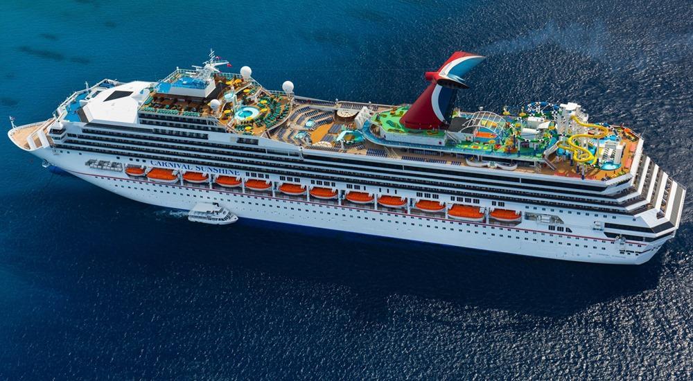
The Carnival Sunshine, a beloved vessel in Carnival Cruise Line’s fleet, regularly carries thousands of passengers across various itineraries, predominantly in the Caribbean. Its dynamic nature – constantly moving, docking, and sailing – makes its current whereabouts a frequent point of interest for prospective cruisers planning trips, family members tracking loved ones, or even maritime enthusiasts keen on observing global shipping patterns. This article will delve into the technological marvels that make such real-time tracking not just possible, but ubiquitous, exploring the systems, tools, and future trends that answer that very specific question, and countless others like it.
The Technological Backbone of Maritime Tracking
The ability to pinpoint a ship like the Carnival Sunshine anywhere on the planet is not magic; it’s the result of decades of innovation in global positioning, satellite communication, and data processing. At the core of this capability lies a mandatory international system designed for safety and efficiency.
AIS: The Global Positioning System for Ships
The Automatic Identification System (AIS) is the cornerstone of modern maritime tracking. Mandated by the International Maritime Organization (IMO) for all international voyaging ships over 300 gross tonnage, all cargo ships over 500 gross tonnage, and all passenger ships regardless of size, AIS transponders continuously transmit crucial data. This data includes the vessel’s unique identification (MMSI number), position (derived from GPS), course over ground, speed over ground, navigational status, rate of turn, destination, and estimated time of arrival.
How does it work? Each AIS-equipped vessel broadcasts this information on specific VHF radio channels. These signals are then picked up by various receivers:
- Terrestrial Receivers: Along coastlines, a network of land-based antennas collects AIS data from ships within their range, typically 20-40 nautical miles, depending on antenna height and local conditions. This is effective for tracking vessels near major shipping lanes and port areas.
- Satellite Receivers: For ships in open ocean, beyond the reach of land-based receivers, low Earth orbit (LEO) satellites are equipped to detect AIS signals. These satellites collect the data and relay it back to ground stations, providing near-global coverage for maritime traffic. This satellite-based AIS (S-AIS) is crucial for tracking transoceanic voyages.
The primary purpose of AIS, as initially conceived, was collision avoidance and vessel traffic management. By allowing ships to “see” and “be seen” by other vessels and shore stations, it significantly enhances navigational safety, especially in congested waters or poor visibility. However, the open nature of this broadcast data has also enabled its secondary use for public tracking, transforming how we monitor global shipping.
Satellite Connectivity and Data Networks
While AIS provides the raw positional data, its widespread availability relies heavily on a sophisticated network of satellite communication and ground-based data infrastructure. Satellite constellations, like those operated by Inmarsat, Iridium, and more recently, emerging low-latency providers such as Starlink, play a pivotal role in ensuring that AIS data from the middle of the Pacific Ocean can reach a server in real-time.
These satellite networks aren’t just for AIS. They also facilitate the continuous stream of operational telemetry from a cruise ship like the Carnival Sunshine to its corporate headquarters. This includes engine performance data, fuel consumption, weather conditions at sea, passenger Wi-Fi usage, and even system diagnostics. Modern cruise ships are floating cities, densely packed with sensors and networked systems. The ability to transmit this vast amount of data reliably, regardless of geographical location, is a testament to the advancements in satellite broadband and mesh networking technologies. Upon reaching land, this data is then fed into secure data centers, processed, analyzed, and often integrated into proprietary fleet management software, ensuring that the Carnival Sunshine’s real-time status is not just known, but leveraged for operational efficiency and safety across the entire Carnival fleet.
Tools and Platforms for Real-Time Vessel Tracking
The complex data streams from AIS and satellite networks are translated into user-friendly interfaces through various digital tools and platforms, making real-time ship tracking accessible to the general public. These platforms leverage advanced mapping technologies and data aggregation to provide a comprehensive view of global maritime activity.
Dedicated Marine Tracking Websites and Apps
For those eager to know the precise location of the Carnival Sunshine, or any other vessel, a range of dedicated marine tracking services are readily available. Websites and mobile applications like MarineTraffic, VesselFinder, and CruiseMapper are prominent examples. These platforms operate by collecting and consolidating AIS data from thousands of terrestrial receivers and satellite feeds worldwide.
When you search for “Carnival Sunshine” on one of these platforms, you are typically presented with an interactive map centered on the ship’s current location. Beyond a simple dot on the map, these tools offer a wealth of information:
- Real-time Position and Trajectory: Showing the ship’s exact coordinates, its current heading, and its recent path.
- Vessel Details: Including its type, flag, gross tonnage, dimensions, year built, and often even a photograph.
- Speed and Status: Displaying its speed over ground, current draught, and navigational status (e.g., “underway using engine,” “at anchor,” “moored”).
- Port Information: Detailing its last port of call, its destination port, and the estimated time of arrival (ETA), which is dynamically updated.
- Historical Data: Many platforms also offer the ability to view a ship’s past voyages and port visits, providing insights into its operational patterns.
These platforms often provide customizable alerts, allowing users to receive notifications when a specific ship departs from or arrives at a port, or when it enters a particular geographical area. The intuitive design, coupled with rich, granular data, makes these tools indispensable for anyone requiring up-to-the-minute maritime information, from casual observers to professional logistics coordinators.
Integration with Cruise Line Apps and Websites
Recognizing the public’s desire for real-time information, major cruise lines, including Carnival, have integrated similar tracking functionalities directly into their official mobile applications and websites. While these might not offer the same level of granular detail or historical data as dedicated marine tracking sites, they provide a curated and brand-specific experience for passengers and their families.
For instance, the official Carnival Hub App often includes features that allow booked passengers to view their ship’s current location, track its journey relative to the itinerary, and see its position on a map. This integration serves several key purposes:
- Passenger Convenience: Passengers can easily orient themselves, confirm the ship’s progress, and share their location with family and friends ashore, fostering peace of mind.
- Itinerary Management: The app can provide real-time updates on port arrivals, departures, and any unexpected changes to the schedule, which is particularly useful during adverse weather conditions.
- Onboard Services: Beyond tracking, these apps typically serve as a central hub for booking shore excursions, making dining reservations, viewing daily activity schedules, and communicating with other passengers or guest services.
By incorporating location services and voyage tracking into their core digital offerings, cruise lines enhance the overall passenger experience, making the journey feel more transparent and connected, even as passengers are sailing across vast oceans. This internal integration leverages the same underlying AIS and satellite data feeds, often combined with the ship’s own internal GPS and navigation systems, to present a reliable and passenger-focused view of the vessel’s movements.
Beyond Location: The Broader Implications of Maritime Data
While answering “where is the Carnival Sunshine right now” is a direct application of tracking technology, the continuous flow of maritime data has far-reaching implications that extend beyond simple location-finding. This vast dataset is a critical asset for operational optimization, safety protocols, and even environmental monitoring within the maritime industry.
Operational Efficiency and Fleet Management
For a company like Carnival Cruise Line, knowing the real-time position of all its ships, including the Sunshine, is fundamental to sophisticated fleet management. This data, combined with a multitude of other telemetry points, allows for:
- Route Optimization: Navigators and shoreside operations teams can use real-time weather data, ocean currents, and traffic congestion information to adjust routes dynamically. This minimizes travel time, reduces fuel consumption, and enhances passenger comfort by avoiding rough seas. Predictive analytics tools can simulate various routes and recommend the most efficient path based on historical performance and current conditions.
- Fuel Management: Fuel is one of the largest operational costs for a cruise line. By continuously monitoring speed, engine performance, and propulsion efficiency against real-time conditions, operators can make data-driven decisions to optimize fuel burn, leading to significant cost savings and reduced emissions.
- Logistics and Supply Chain: Knowing the precise location and ETA of a ship is crucial for coordinating port services, provisioning supplies, passenger embarkation/disembarkation, and connecting ground transportation. This ensures smooth transitions and minimizes delays, which can be costly in the cruise industry.
- Emergency Response: In the event of an emergency, accurate, real-time positional data is paramount for coordinating search and rescue operations, directing assistance vessels, and providing precise information to authorities.
Enhancing Passenger Experience and Safety
The technological infrastructure behind ship tracking contributes significantly to both the perceived and actual safety and comfort of passengers:
- Proactive Safety Measures: Continuous monitoring of a ship’s position relative to weather systems, potential hazards, and restricted areas allows for proactive adjustments to the itinerary, ensuring the vessel remains in safe waters. The ability to monitor vessel speed and course also helps ensure adherence to international safety regulations.
- Transparent Communication: When unforeseen circumstances arise, such as a deviation due to a medical emergency or a weather event, precise location data enables the cruise line to communicate accurate, timely updates to passengers, managing expectations and reducing anxiety. The integration of this data into onboard systems and passenger apps allows for direct, personalized updates.
- Service Delivery: Understanding a ship’s precise location and movement aids in the operational planning of onboard services. For example, knowing the ship’s precise position helps optimize satellite internet connectivity zones or schedule specific deck activities that are sensitive to movement or wind direction.
Economic and Environmental Monitoring
Beyond the immediate operational benefits for cruise lines, the aggregated data from global maritime tracking holds significant value for broader economic and environmental analyses:
- Port Operations: Port authorities use AIS data to manage vessel traffic in and out of harbors efficiently, assign berths, and plan pilotage services, minimizing congestion and turnaround times.
- Maritime Security: Naval forces and coast guards utilize AIS data for surveillance, border control, and to monitor suspicious activities, contributing to overall maritime security against piracy, illegal fishing, and smuggling.
- Environmental Protection: Researchers and environmental agencies use tracking data to analyze shipping patterns, identify high-traffic zones, monitor compliance with emission regulations in specific sea areas, and assess the impact of maritime activity on marine ecosystems. This data is invaluable for formulating policy and implementing conservation strategies.
The Future of Maritime Tracking and Connectivity
The current capabilities of maritime tracking are impressive, but the horizon promises even more advanced, integrated, and intelligent systems, further refining our ability to monitor, manage, and interact with vessels like the Carnival Sunshine.
AI and Machine Learning in Predictive Tracking
The vast datasets generated by AIS, satellite telemetry, and onboard sensors are fertile ground for Artificial Intelligence (AI) and Machine Learning (ML). The future of maritime tracking will increasingly rely on these technologies to move beyond mere observation to predictive intelligence:
- Predictive Route Optimization: AI algorithms can analyze historical weather patterns, ocean currents, traffic density, and a ship’s specific performance characteristics to predict optimal routes with unprecedented accuracy, minimizing fuel consumption and journey times even further.
- Anomaly Detection: ML models can learn typical vessel behaviors and instantly flag deviations – unusual speeds, unexpected course changes, or unscheduled stops – which could indicate equipment failure, security incidents, or navigation errors. This enhances safety and security significantly.
- Automated Incident Response: In the event of an emergency, AI systems could rapidly process all available data (location, weather, proximity to other vessels, onboard sensor readings) to suggest optimal emergency response strategies, coordinate resources, and predict potential outcomes.
Advanced Sensor Integration and IoT on Ships
The “smart ship” concept is rapidly evolving. Beyond basic AIS, future vessels will be even more densely instrumented with Internet of Things (IoT) sensors monitoring every conceivable system: engine diagnostics, hull integrity, waste management, HVAC systems, and even passenger flow. This expanded data stream will be seamlessly integrated with positional tracking:
- Holistic Digital Twins: Each ship could have a “digital twin” – a virtual replica continuously updated with real-time data from all sensors. This digital twin would provide a comprehensive, 360-degree view of the ship’s status, performance, and environment, allowing for proactive maintenance, optimized operations, and enhanced decision-making from shore.
- Enhanced Situational Awareness: Crew members on the bridge, and operational teams ashore, will have access to a richer, more nuanced picture of the ship’s condition and surroundings, integrating weather radar, sonar, camera feeds, and internal system diagnostics with the ship’s geographical position.
Enhanced Satellite Networks and 5G at Sea
The demand for bandwidth at sea is skyrocketing, driven by passenger connectivity needs and the proliferation of IoT devices. Next-generation satellite networks, such as Starlink, OneWeb, and other emerging LEO constellations, are poised to revolutionize maritime connectivity:
- Ubiquitous High-Speed Internet: These networks offer significantly higher bandwidth and lower latency than traditional geostationary satellites, enabling true broadband experiences for passengers and vastly improving the capacity for data transmission from ship to shore.
- 5G at Sea: As 5G technology matures, its integration with satellite backbones will create powerful hybrid networks. This will allow for ultra-reliable, low-latency communication for critical operational systems and enable complex applications like remote vessel operations or real-time augmented reality aids for maintenance.
In conclusion, the simple question, “Where is the Carnival Sunshine right now?” unlocks a complex, dynamic, and ever-evolving landscape of technological innovation. From the foundational principles of AIS and global satellite networks to the futuristic integration of AI and ubiquitous IoT, the ability to track and manage vessels has become a cornerstone of modern maritime safety, efficiency, and connectivity. As technology continues its relentless march forward, our capacity to monitor, understand, and interact with the world’s floating cities will only grow, making the oceans more transparent and journeys more secure and enjoyable for all.
aViewFromTheCave is a participant in the Amazon Services LLC Associates Program, an affiliate advertising program designed to provide a means for sites to earn advertising fees by advertising and linking to Amazon.com. Amazon, the Amazon logo, AmazonSupply, and the AmazonSupply logo are trademarks of Amazon.com, Inc. or its affiliates. As an Amazon Associate we earn affiliate commissions from qualifying purchases.