
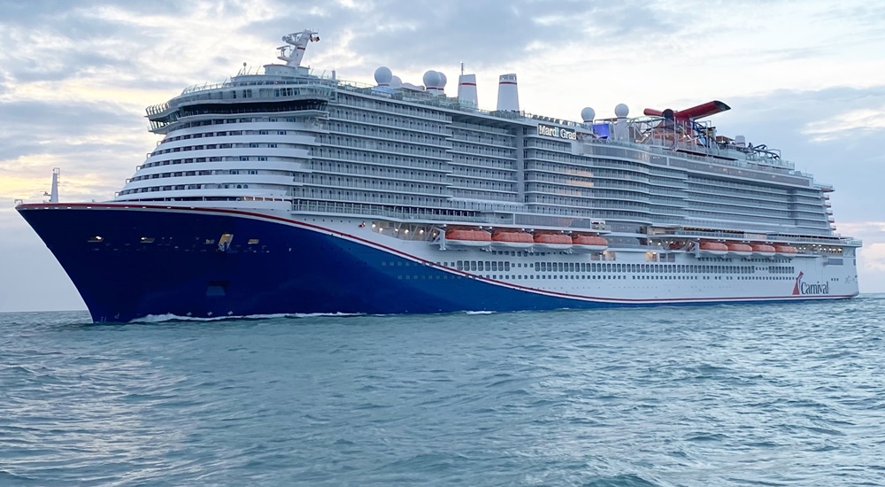
To the casual observer, the question of where a massive cruise ship like the Carnival Celebration is at any given moment might seem like a simple matter of looking at a map. However, the technology required to track a 180,000-ton vessel across the open ocean, providing real-time telemetry to millions of users worldwide, is a marvel of modern software engineering, satellite communication, and geospatial data processing. Finding the “Celebration” right now involves a complex ecosystem of hardware and software working in tandem to bridge the gap between the physical movement of a ship and its digital representation on our screens.
The Mechanics of Global Positioning: Understanding AIS Technology
The primary technology used to locate the Carnival Celebration—or any modern commercial vessel—is the Automatic Identification System (AIS). This is not merely a GPS tracker; it is a sophisticated maritime communication protocol designed for collision avoidance and vessel traffic services.
Class A Transponders and VHF Radio
The Carnival Celebration is equipped with Class A AIS transponders, which are mandatory for international voyaging ships of its size. These devices automatically broadcast the ship’s identity, type, position, course, speed, and navigational status. The system operates in the VHF maritime band, sending data packets every few seconds when the ship is moving.
While GPS provides the coordinates, the AIS transponder packages that data with other essential metadata. This creates a “digital fingerprint” of the ship. For a vessel of the Celebration’s class, which features a length of over 1,100 feet and a guest capacity of over 6,000, this data is critical for the safety of navigation in crowded waterways like the Port of Miami or the Caribbean Sea.
Satellite vs. Terrestrial AIS
One of the major technological hurdles in tracking a ship “right now” is the limitation of VHF radio waves, which generally follow a line-of-sight path. This means that if the Carnival Celebration is near the coast, terrestrial base stations can pick up its signal and relay it to the internet. However, when the ship is in the middle of the Atlantic or deep in the Caribbean, it moves out of range of land-based receivers.
This is where Satellite AIS (S-AIS) comes into play. A constellation of Low-Earth Orbit (LEO) satellites is equipped with AIS receivers that can detect the ship’s signals from space. These satellites then downlink the data to ground stations, which feed it into global databases. When you check a tracking app to see where the Carnival Celebration is, you are likely viewing a composite of terrestrial and satellite data, processed through sophisticated algorithms to filter out signal noise and provide a clean, real-time coordinate.
Connectivity at Sea: Starlink and the New Era of High-Speed Telemetry
Knowing where the ship is located is only half the battle; the ship itself must also maintain a constant digital link to the world to manage its operations, safety protocols, and guest experiences. The Carnival Celebration is part of a revolutionary shift in maritime connectivity, moving away from legacy C-band and Ku-band satellite systems toward the high-speed, low-latency world of Starlink.
The Move to Low-Earth Orbit (LEO)
Historically, cruise ships relied on geostationary satellites orbiting 22,000 miles above the Earth. This distance created massive latency (lag), making real-time data transmission difficult. The integration of Starlink onto the Carnival Celebration utilizes satellites positioned much closer to the Earth’s surface.
This technological upgrade does more than just give passengers faster Wi-Fi. It allows the ship’s onboard servers to sync in real-time with Carnival’s land-based data centers. Telemetry data, including fuel consumption, engine performance from the ship’s Liquefied Natural Gas (LNG) power plant, and current environmental conditions, is streamed continuously. This creates a “digital twin” of the vessel on shore, allowing engineers to monitor the ship’s health and position with unprecedented precision.
Integrated Network Management
The “backbone” of the Celebration’s tracking and connectivity is a sophisticated software-defined wide area network (SD-WAN). This software intelligently switches between different satellite providers and terrestrial 5G links (when near port) to ensure the ship never “goes dark.” For someone trying to locate the ship, this ensures that the data stream is never interrupted, even during a mid-ocean crossing.
The Carnival HUB App: A Masterclass in Micro-Location Services
While global tracking websites tell the world where the ship is located on the planet, the internal technology of the Carnival Celebration tells guests exactly where they are—and where they need to be—within the ship itself. This is known as micro-location or indoor positioning.
Geofencing and Proximity Tech
The Carnival HUB App is the digital gateway for the Celebration’s guests. To provide real-time updates on deck activities, dining wait times, and the ship’s current position relative to the next port of call, the app utilizes a dense network of Bluetooth Low Energy (BLE) beacons and Wi-Fi access points scattered throughout the vessel.
The app uses geofencing to trigger notifications based on a guest’s location. For example, as the ship approaches its destination in Cozumel or San Juan, the app can automatically update its interface to show port maps and shore excursion timings. This is a localized version of “tracking” that enhances the user experience by grounding the digital interface in the physical reality of the ship’s movement.
Synchronized Scheduling Algorithms
The software behind the scenes must handle thousands of concurrent requests. When a user asks “where are we?” via the onboard app, the system queries the ship’s Bridge Integration System. The software then processes the raw GPS data and translates it into a user-friendly format, often overlaying the ship’s icon onto a high-resolution digital map that includes points of interest and estimated arrival times.
The Engineering Frontier: Smart Power and Navigational Automation
The Carnival Celebration is an Excel-class ship, meaning it represents the pinnacle of maritime engineering and automation. The technology that keeps it on course is deeply integrated with its propulsion and power management systems.
LNG Propulsion and Digital Monitoring
As one of the first ships in the Carnival fleet to be powered by Liquefied Natural Gas (LNG), the Celebration uses a highly digitized engine room. Software sensors monitor every aspect of the LNG combustion process, which is significantly cleaner than traditional heavy fuel oil. The tracking of the ship’s “location” is tied to its “efficiency.” Software algorithms calculate the optimal route—taking into account ocean currents, wind speed, and fuel density—to ensure the ship reaches its next coordinate using the least amount of energy possible.
The Integrated Bridge System (IBS)
On the bridge of the Carnival Celebration, the traditional paper chart is a thing of the past. The Integrated Bridge System (IBS) consolidates radar, AIS, electronic charts (ENC), and engine data into a series of touchscreen interfaces. This system uses “sensor fusion” to combine data from multiple sources, providing the captain with a clear picture of the ship’s exact position. This data is what ultimately feeds the public tracking sites; when you see the ship’s position online, you are seeing the output of some of the most advanced navigational software in the world.
Data Security and the Future of the Digital Cruise Experience
As ships like the Carnival Celebration become more connected, the technology used to track and manage them must be shielded from cyber threats. Maritime cybersecurity is a burgeoning field within tech, focusing on protecting the GPS and AIS signals that the world relies on to know where these vessels are.
Protecting Maritime Infrastructure
The vulnerability of AIS to “spoofing”—where a malicious actor sends false location data—is a known challenge. Modern maritime software now includes validation layers that compare AIS data with radar and satellite imagery to ensure the reported location of the Carnival Celebration is authentic. This layer of digital security is essential for maintaining the integrity of global shipping lanes.

AI and Predictive Maintenance
Looking forward, the question of “where is the ship” will evolve into “where should the ship be?” Artificial Intelligence (AI) is being integrated into maritime logistics to predict potential delays due to weather or port congestion before they happen. By analyzing years of historical tracking data, AI tools can suggest slight course corrections to avoid storms, ensuring that the Carnival Celebration remains not only on the map but on schedule.
The ability to track the Carnival Celebration in real-time is the result of a massive, invisible infrastructure. From the VHF pings of an AIS transponder to the high-speed data bursts of a Starlink satellite and the localized Bluetooth beacons of the HUB app, the ship exists in a permanent state of digital visibility. This synergy of hardware and software ensures that whether you are a guest onboard, a family member at home, or a maritime enthusiast, the Carnival Celebration is never truly lost at sea.
aViewFromTheCave is a participant in the Amazon Services LLC Associates Program, an affiliate advertising program designed to provide a means for sites to earn advertising fees by advertising and linking to Amazon.com. Amazon, the Amazon logo, AmazonSupply, and the AmazonSupply logo are trademarks of Amazon.com, Inc. or its affiliates. As an Amazon Associate we earn affiliate commissions from qualifying purchases.