
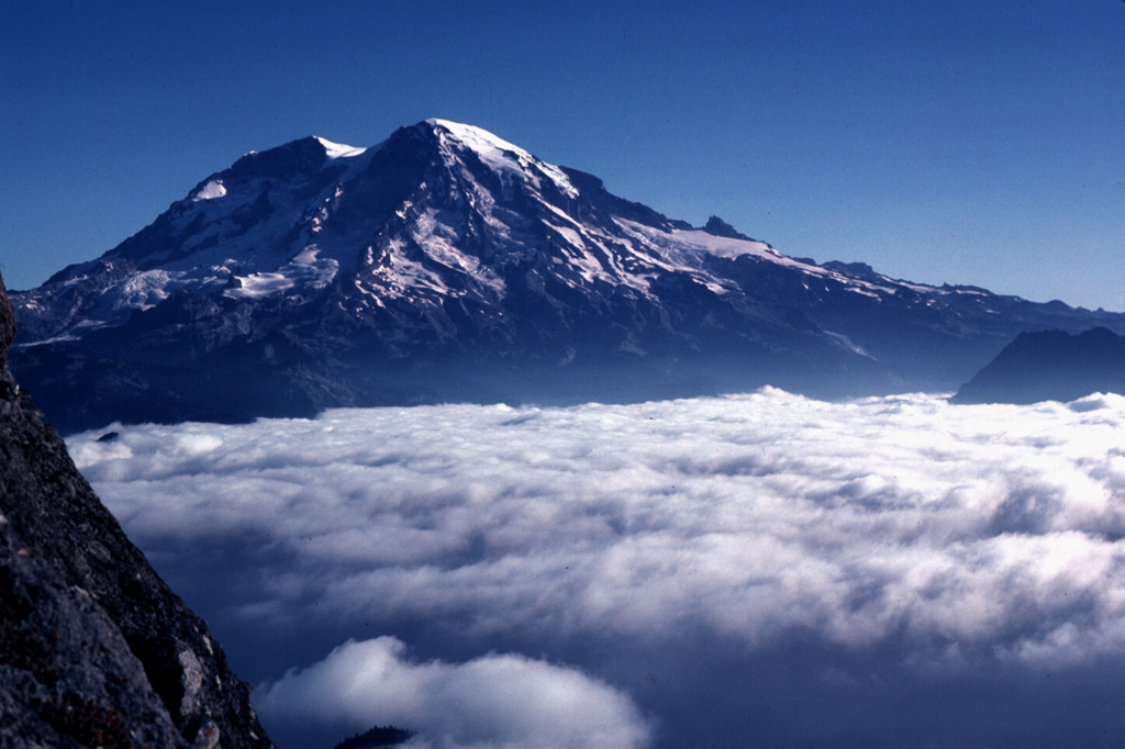
Mount Rainier, an icy sentinel overlooking the Pacific Northwest, is classified by geologists as a stratovolcano (or composite volcano). While its physical structure consists of alternating layers of hardened lava, tephra, pumice, and volcanic ash, the modern understanding of this peak is defined less by its rocks and more by the sophisticated technological ecosystem that monitors its every “breath.” In the world of technology and digital security, Mount Rainier represents one of the most complex case studies in high-stakes environmental monitoring, where AI, IoT sensors, and satellite telemetry converge to protect millions of lives.

To understand what type of volcano Mount Rainier is, we must look through the lens of modern tech—from the software that models its potential lahars to the machine-learning algorithms that parse seismic data in real-time.
The Stratovolcano Architecture: Understanding the Data Points
As a stratovolcano, Mount Rainier is characterized by its steep profile and periodic, explosive eruptions. This specific “type” of volcano poses unique challenges for technology. Unlike shield volcanoes (like those in Hawaii) which offer relatively predictable basaltic flows, stratovolcanoes are prone to sudden, catastrophic failures and high-viscosity eruptions.
Composite Complexity and Sensor Integration
The “composite” nature of Mount Rainier means it is a heterogeneous structure. For engineers and volcanologists, this lack of uniformity requires a dense grid of diverse sensors. To monitor this specific type of volcano, the United States Geological Survey (USGS) and the Pacific Northwest Seismic Network (PNSN) utilize an integrated stack of broadband seismometers. These devices are not merely “microphones” for the earth; they are sophisticated edge-computing nodes that must filter out the “noise” of glacial movement and human activity to detect the specific low-frequency signals associated with magma migration.
The tech stack here involves complex signal processing. Because Rainier is covered in more glacial ice than all other Cascade volcanoes combined, the software must distinguish between “ice quakes” (glaciers shifting) and “volcanic quakes.” This is achieved through automated spectral analysis, where algorithms compare real-time waveforms against a historical database of seismic signatures.
Mapping the Magma: 3D Seismic Tomography
To visualize what is happening inside this stratovolcano, scientists use a tech process known as seismic tomography. Think of this as a “CT scan” for the mountain. By analyzing how seismic waves travel through the volcano’s interior, high-performance computing (HPC) clusters can render 3D models of the magma plumbing system.
The software used for these visualizations allows researchers to identify “mush zones”—areas where the rock is partially molten. Understanding the volume and location of these zones is critical for predicting the scale of a future eruption. This is a Big Data challenge: millions of data points are processed to create a digital twin of the volcano’s internal structure.
Next-Gen Monitoring: IoT and Remote Sensing Technology
Because Mount Rainier is a “Decade Volcano”—one of 16 volcanoes identified by the international community as worthy of particular study due to their history of large eruptions and proximity to populated areas—the technology deployed on its slopes is at the bleeding edge of the Internet of Things (IoT).
InSAR and Satellite Geodesy
One of the most vital technologies used to monitor Mount Rainier is InSAR (Interferometric Synthetic Aperture Radar). Satellites orbiting the Earth emit radar signals that bounce off the volcano’s surface and return to the sensor. By comparing these signals over time, software can detect surface deformation as small as a few millimeters.
If the “type” of volcano (a stratovolcano) begins to “inflate” like a balloon, it indicates that magma is rising. The digital processing of InSAR data requires massive cloud computing resources to subtract atmospheric interference and vegetation changes, leaving only the pure geological signal. This remote sensing tech allows for constant monitoring without the need for human presence on the hazardous upper slopes.
Real-Time Lahar Detection Systems
The greatest technological achievement at Mount Rainier is perhaps its Lahar Detection System. Because of its height and ice cover, Rainier’s primary threat is not lava, but lahars—massive mudflows that can travel at highway speeds.

The monitoring tech here involves a network of Acoustic Flow Monitors (AFMs) and GPS sensors. These IoT devices are programmed to detect the specific ground vibration frequency of a moving mudflow. When a threshold is crossed, the system triggers a series of automated protocols. This is a “Fail-Safe” tech environment: the sensors use redundant communication paths (satellite, radio, and cellular) to ensure that even if one network goes down, the warning signal reaches the Emergency Operations Centers (EOCs) in Pierce County and beyond.
The Role of Artificial Intelligence in Eruption Prediction
As we move further into the decade, the classification of Mount Rainier as a high-threat stratovolcano is being met with increasingly sophisticated Artificial Intelligence (AI) and Machine Learning (ML) tools.
Machine Learning Algorithms for Pattern Recognition
The sheer volume of data coming off a volcano like Rainier is overwhelming for human analysts. AI tools are now being trained to recognize the “precursory patterns” that precede an eruption. By feeding decades of global stratovolcano data into neural networks, researchers can train models to identify subtle anomalies in gas emissions (like CO2/SO2 ratios) or ground deformation that might be missed by the human eye.
For example, a machine learning model can correlate a slight increase in thermal signatures (detected by infrared satellite sensors) with a specific type of micro-seismicity. This multi-modal data fusion is the future of volcanology tech, moving us from reactive monitoring to proactive, predictive analytics.
Big Data and Predictive Modeling
What happens when the volcano does erupt? This is where software like LAHARZ or D-Claw comes into play. These are sophisticated simulation tools that use digital elevation models (DEMs) to predict the path of debris flows.
Modern tech has allowed these simulations to become dynamic. Using high-resolution LiDAR (Light Detection and Ranging) data, engineers create hyper-accurate maps of the river valleys surrounding Mount Rainier. When the volcano’s “type” suggests a specific eruptive volume, the software can run thousands of Monte Carlo simulations to show which neighborhoods in Orting or Puyallup have the highest probability of impact. This digital foresight is essential for urban planning and disaster mitigation.
Digital Security and Resilience of Monitoring Infrastructure
A critical, often overlooked aspect of volcanic tech is the digital security and physical hardening of the monitoring infrastructure. If a stratovolcano like Rainier shows signs of unrest, the integrity of the data becomes a matter of national security.
Hardened Communication Networks
The sensors on Mount Rainier operate in some of the harshest environments on Earth. They must withstand sub-zero temperatures, high winds, and corrosive volcanic gases. The “Tech” here isn’t just in the chips, but in the industrial design. These units are often powered by ruggedized solar arrays and use long-range, low-power (LoRaWAN) communication protocols to ensure data persists during power outages.
Furthermore, the data pipelines are protected against cyber threats. As critical infrastructure, the early warning systems are segmented from public networks to prevent bad actors from triggering false alarms or suppressing real ones. Digital security ensures that when the “type” of activity on the mountain changes, the message reaching the public is authentic and timely.
Open Data and Public Warning Systems
Finally, the “Last Mile” of technology is the delivery of information to the end-user: the public. This involves the integration of USGS data with Wireless Emergency Alerts (WEA) and specialized apps.
The transition from a geological event to a digital notification is a feat of software engineering. It requires low-latency APIs that can push data from a sensor on a glacier to a smartphone in a citizen’s pocket in seconds. This democratization of data ensures that the technological vigil kept over Mount Rainier serves its ultimate purpose—the preservation of life through the power of information.
In conclusion, while Mount Rainier is geologically a stratovolcano, it is technologically a “smart mountain.” It is a massive, natural laboratory where the latest in AI, IoT, and satellite tech are deployed to solve the age-old problem of living alongside a giant. Understanding “what type of volcano” Rainier is helps us choose the right tools to monitor it, ensuring that our digital defenses are as formidable as the mountain itself.
aViewFromTheCave is a participant in the Amazon Services LLC Associates Program, an affiliate advertising program designed to provide a means for sites to earn advertising fees by advertising and linking to Amazon.com. Amazon, the Amazon logo, AmazonSupply, and the AmazonSupply logo are trademarks of Amazon.com, Inc. or its affiliates. As an Amazon Associate we earn affiliate commissions from qualifying purchases.