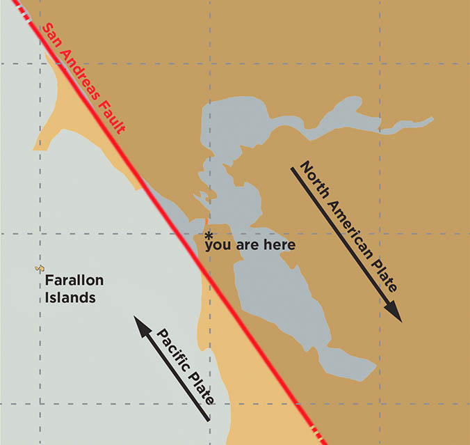
The San Andreas Fault represents more than just a massive geological rift in the Earth’s crust; it is a global laboratory for the most advanced monitoring technologies ever developed. To answer the fundamental geological question—the San Andreas Fault is formed by the boundary between the Pacific Plate and the North American Plate—is to open the door to a complex world of digital observation. As these two massive tectonic blocks slide past one another in a transform motion, they create a high-stakes environment where technology, software, and data science converge to safeguard millions of lives and billions of dollars in infrastructure.
![]()
In the modern era, understanding the relationship between the Pacific and North American plates has moved beyond simple seismology. Today, it is a discipline defined by high-performance computing, the Internet of Things (IoT), and artificial intelligence. This article explores the technological ecosystem built around the San Andreas Fault, focusing on how we track the friction between these two plates through the lens of cutting-edge innovation.
The Digital Twin: Software Modeling of the Pacific and North American Plates
The fundamental challenge of geophysics is that the most critical actions occur miles underground. To bridge this gap, tech companies and research institutions have developed “Digital Twins” of the San Andreas Fault. These are highly sophisticated software environments that simulate the stresses, strains, and potential ruptures of the Pacific and North American plates.
High-Performance Computing (HPC) in Geophysics
Simulating a 800-mile-long fault line requires immense processing power. Modern supercomputers utilize parallel processing to model the elastic rebound theory—the process by which the Pacific Plate (moving northwest) and the North American Plate (moving southeast) store energy like a coiled spring. Software suites like SCEC (Southern California Earthquake Center) programs utilize HPC clusters to run thousands of “CyberShake” simulations. These simulations help engineers understand how ground motion will affect different types of soil and building structures, turning raw geological data into actionable architectural insights.
4D Visualization and Predictive Simulation
We no longer rely on static 2D maps. 4D visualization software integrates the three dimensions of space with the fourth dimension of time. By inputting historical movement data from the Pacific and North American plates, these tools allow researchers to visualize how the fault has evolved over centuries. This software is critical for urban planning, as it allows digital security and infrastructure experts to “see” where the most significant deformation is likely to occur during a major seismic event, enabling more robust software-driven disaster response protocols.
The Internet of Seismic Things (IoST): Sensor Networks on the Fault Line
The boundary between the Pacific and North American plates is perhaps the most instrumented piece of real estate on Earth. The transition from analog sensors to the Internet of Seismic Things (IoST) has revolutionized how we capture data from the San Andreas Fault.
MEMS Sensors and Distributed Acoustic Sensing (DAS)
Micro-Electro-Mechanical Systems (MEMS) are the same tiny accelerometers found in smartphones. When deployed in thousands of nodes across the San Andreas, they create a dense mesh network capable of detecting the slightest micro-tremors. Even more revolutionary is Distributed Acoustic Sensing (DAS). This technology repurposes existing underground fiber-optic cables—originally laid for telecommunications—as seismic sensors. By sending laser pulses through the fiber and measuring the “backscatter” caused by the vibration of the plates, tech firms can turn miles of glass thread into a continuous, high-sensitivity seismic array.
Real-Time Data Streaming and Edge Computing
The latency of data transmission can be the difference between life and death. Modern seismic stations utilize edge computing to process data locally before sending it to the cloud. Instead of transmitting raw, noisy data, the hardware at the site of the fault—where the Pacific and North American plates meet—analyzes the waveform in real-time. If a specific “P-wave” (the fast-moving initial wave) is detected, the system triggers an immediate alert. This decentralized approach ensures that the “ShakeAlert” system can provide seconds to minutes of warning before the more destructive “S-waves” arrive.
AI and Machine Learning: Predicting the Unpredictable

While we cannot yet predict exactly when the Pacific and North American plates will experience a major slip, artificial intelligence is bringing us closer to understanding the patterns hidden within the noise of the Earth’s crust.
Pattern Recognition in Low-Magnitude Tremors
The San Andreas Fault produces thousands of tiny tremors that are often too small for humans to categorize. Machine learning algorithms, specifically Convolutional Neural Networks (CNNs), are now trained to “listen” to these micro-seismic events. By analyzing the massive datasets generated by the movement of the plates, AI can identify “seismic swarms” or specific patterns of deformation that have historically preceded larger ruptures. This is essentially a Big Data problem; the interaction of the North American and Pacific plates produces petabytes of information that only AI can process at scale.
Neural Networks for Early Warning Systems
Early warning software, such as the USGS-developed ShakeAlert, relies on neural networks to distinguish between human-induced vibrations (like a passing truck) and actual tectonic movement between the two plates. As the AI “learns” from every minor tremor along the San Andreas, the accuracy of these systems improves. In the tech-heavy corridors of Silicon Valley and Los Angeles—both situated near the plate boundary—these AI tools are integrated into municipal APIs, automatically slowing down BART trains, opening firehouse doors, and pausing delicate surgical robots when seismic activity is detected.
Satellite Geodesy: Precision Mapping from Orbit
To understand how the Pacific Plate is moving relative to the North American Plate, we have to look up. Satellite technology provides a “macro” view of the fault that ground-based sensors cannot achieve alone.
Interferometric Synthetic Aperture Radar (InSAR)
InSAR is a radar technique used in remote sensing to map ground deformation. Satellites orbiting the Earth bounce radar signals off the San Andreas Fault zone. By comparing images taken at different times, software can generate “interferograms” that show centimeter-scale movements of the Earth’s surface. This allows tech analysts to see exactly where the North American Plate is bulging or where the Pacific Plate is being dragged, identifying “locked” sections of the fault where stress is accumulating at dangerous levels.
GNSS and Sub-Millimeter Movement Tracking
The Global Navigation Satellite System (GNSS), which includes GPS, is used to monitor a network of permanent stations fixed into the bedrock of both plates. These stations track the relentless, slow-motion “creep” of the plates—roughly 2 inches per year, similar to the rate at which human fingernails grow. The integration of high-precision GNSS data into geospatial software allows for the creation of strain maps, which are essential for the maintenance of critical digital and physical infrastructure, such as fiber-optic backbones and power grids that cross the fault line.
The Future of Seismic Tech: Cybersecurity and Resilience
As our monitoring of the Pacific and North American plates becomes increasingly digital, the focus is shifting toward the security and resilience of these technological systems.
Protecting Critical Infrastructure through Digital Security
The data flowing from the San Andreas Fault is a matter of national security. If an adversary were to spoof seismic data or take down the early warning cloud infrastructure, the results would be catastrophic. Consequently, “Seis-Tech” now involves a heavy layer of cybersecurity. Secure APIs, encrypted data transmission from sensors, and redundant cloud storage ensure that the information regarding plate movement remains untampered and available when a crisis hits.
Decentralized Data for Emergency Response
Looking forward, the tech community is exploring blockchain and decentralized ledger technology to manage emergency response data. In the event of a major rupture between the Pacific and North American plates, centralized communications may fail. Decentralized networks could allow autonomous IoT devices—drones, smart valves, and automated breakers—to communicate and act without a central server. This “mesh” of intelligence represents the next frontier in tectonic technology, ensuring that even if the ground breaks, the digital network remains intact.
In conclusion, while the San Andreas Fault is defined by the physical interaction of the Pacific Plate and the North American Plate, its future is being written in code. Through the marriage of hardware, software, and AI, we are turning one of the world’s most dangerous geological features into a data-rich environment that informs the next generation of technological resilience.
aViewFromTheCave is a participant in the Amazon Services LLC Associates Program, an affiliate advertising program designed to provide a means for sites to earn advertising fees by advertising and linking to Amazon.com. Amazon, the Amazon logo, AmazonSupply, and the AmazonSupply logo are trademarks of Amazon.com, Inc. or its affiliates. As an Amazon Associate we earn affiliate commissions from qualifying purchases.