
Few questions carry as much immediate weight and urgency as “What time will the hurricane make landfall?” For coastal communities, emergency responders, businesses, and individuals, this single query can determine the difference between preparedness and peril, between minimal disruption and catastrophic loss. The answer, once a matter of educated guesswork based on rudimentary observations, is now the product of an astonishing convergence of cutting-edge technology, sophisticated data analysis, and international scientific collaboration. This article delves into the technological marvels that empower meteorologists and disaster managers to provide increasingly precise answers, transforming our ability to anticipate, track, and respond to these formidable natural phenomena. From orbiting satellites to artificial intelligence, the quest to pinpoint that critical moment of landfall is a testament to human ingenuity in the face of nature’s power.

The Technological Backbone of Hurricane Prediction
Accurately forecasting a hurricane’s path, intensity, and crucial landfall time is a monumental undertaking that relies on a complex interplay of observation, data collection, and communication technologies. These systems work in concert to paint an ever-clearer picture of the storm’s dynamics, feeding vital information into predictive models.
Satellite Surveillance: Eyes in the Sky
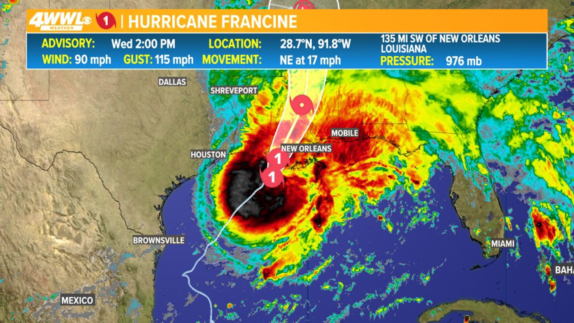
Satellites are the undisputed sentinels of global weather monitoring, providing the first and most consistent line of observation for developing tropical cyclones. Geostationary satellites, like NOAA’s GOES series, hover above a fixed point on Earth, offering continuous, real-time views of vast oceanic regions where hurricanes form and intensify. They capture visible light images, infrared data (measuring cloud top temperatures and inferring storm intensity), and water vapor imagery (revealing atmospheric moisture and steering currents).
Complementing these are polar-orbiting satellites, such as those in the JPSS series, which circle the Earth from pole to pole. While they provide less frequent updates for a given area, their lower orbits allow for higher resolution imagery and more detailed microwave data. Microwave sensors can penetrate upper-level clouds to reveal the storm’s inner structure, including the presence and organization of the eyewall and rainbands, offering critical insights into intensity and potential for rapid intensification—a scenario where a storm’s wind speeds increase by at least 35 mph in 24 hours. Without this constant vigilance from space, many storms would go undetected in their early stages, severely limiting lead times for preparedness.
Radar Systems and Reconnaissance Aircraft
Once a storm approaches land, ground-based radar systems become indispensable. The NEXRAD (Next-Generation Radar) network, operated by the National Weather Service in the U.S., provides detailed, real-time data on precipitation, wind speed, and direction within a hurricane. Utilizing Doppler technology, these radars can detect the rotational velocity of winds, helping to identify tornadic activity embedded within the storm and providing granular data on rainfall rates—critical for flood forecasting. However, radar’s range is limited by the curvature of the Earth and terrain.
This is where specialized reconnaissance aircraft, often referred to as “Hurricane Hunters,” play a unique and perilous role. Operated by the U.S. Air Force Reserve and NOAA, these robust aircraft (like the WC-130J Super Hercules and NOAA’s WP-3D Orion) fly directly into the eye of a hurricane. They deploy dropsondes—GPS-enabled sensors that parachute through the storm, transmitting real-time measurements of temperature, humidity, pressure, and wind speed from various altitudes back to the aircraft. This “in-situ” data is invaluable, providing ground truth for satellite observations and crucial initial conditions for numerical weather models, particularly when a storm is far from land-based radar.
Ocean Buoys and Subsurface Gliders
The ocean itself is a critical factor in hurricane development and intensity. Automated ocean buoys, strategically positioned in hurricane-prone regions, continuously transmit data on sea surface temperature, air temperature, atmospheric pressure, wind speed, and wave height. This data helps forecasters understand the energy available to a storm from the warm ocean waters.
More recently, autonomous underwater gliders equipped with sensors are being deployed to collect data on subsurface ocean temperatures and salinity. Hurricanes draw energy from the warm water layer near the surface. If a storm moves over an area where mixing with cooler, deeper water occurs (a process called “upwelling”), it can weaken. Conversely, a deep layer of warm water can fuel rapid intensification. These gliders provide a three-dimensional view of ocean heat content, offering unprecedented insights into the potential for a storm to strengthen or weaken as it traverses the ocean, directly impacting landfall intensity and, by extension, the severity of the expected impact at the moment of landfall.
Supercomputing and Algorithmic Forecasting
The vast quantities of data collected by satellites, aircraft, buoys, and radars are merely raw ingredients. To transform this data into actionable predictions, an even more sophisticated layer of technology is required: supercomputing and advanced algorithms that simulate the Earth’s complex atmospheric and oceanic systems.
Numerical Weather Prediction (NWP) Models
Numerical Weather Prediction (NWP) models are the cornerstone of modern hurricane forecasting. These are highly complex mathematical models, run on some of the world’s most powerful supercomputers, that use a series of equations representing the fundamental laws of physics governing atmospheric and oceanic processes. Scientists input current atmospheric and oceanic conditions (the “initial state” derived from observed data) into these models, which then calculate how these conditions will evolve over time.
There are various NWP models, including global models like the U.S. Global Forecast System (GFS) and the European Centre for Medium-Range Weather Forecasts (ECMWF) model, which cover the entire planet. Regional models, such as the Hurricane Weather Research and Forecasting (HWRF) model or the High-Resolution Rapid Refresh (HRRR) model, focus on specific areas with higher resolution, allowing for more detailed hurricane simulations. A critical technique is “ensemble forecasting,” where a single model is run multiple times with slightly perturbed initial conditions, generating a range of possible outcomes. This provides forecasters with an estimate of the uncertainty associated with a prediction, indicating the probability of a storm following a particular track or reaching a certain intensity. The continuous improvement of these models, driven by better physics, higher resolution, and increased computational power, is directly responsible for the dramatic improvements in hurricane track forecasting over the past decades.
Artificial Intelligence and Machine Learning
While NWP models are physics-based, the emerging fields of Artificial Intelligence (AI) and Machine Learning (ML) are increasingly augmenting and enhancing forecasting capabilities. AI algorithms can excel at identifying subtle patterns in massive datasets that might be missed by human observers or traditional models. For instance, ML models are being trained on historical satellite imagery and hurricane data to predict rapid intensification more accurately, a notoriously difficult challenge for NWP models alone.

AI can also improve data assimilation, intelligently combining disparate data sources to create a more accurate initial state for NWP models. Furthermore, ML techniques are being applied to post-process NWP outputs, correcting systematic biases, refining predictions for specific impact parameters like storm surge or rainfall distribution, and even generating localized micro-forecasts. While AI is not yet replacing the foundational physics of NWP, it is becoming an indispensable tool for extracting deeper insights from the data, speeding up analysis, and ultimately refining the accuracy and confidence in critical predictions like the precise time of hurricane landfall.
Dissemination and Application: Bridging Data to Decision
Even the most accurate forecast is useless if it doesn’t reach the right people in time. Technology plays an equally crucial role in ensuring that the answer to “what time will the hurricane make landfall?” translates into effective preparedness and response. This involves robust communication networks and user-friendly platforms that empower both emergency services and the general public.
Advanced Communication Networks
Modern hurricane warnings rely on a sophisticated array of communication technologies. High-speed internet allows meteorological agencies to rapidly disseminate advisories, graphics, and model outputs to the public and media outlets. Satellite communication ensures that critical information can be sent and received even from remote locations or when terrestrial networks are compromised. Emergency broadcasting systems (radio and television) remain vital for reaching broad audiences, especially during power outages.
Perhaps most impactful for individual preparedness are mobile phone-based systems. Wireless Emergency Alerts (WEA) can push critical information—such as hurricane warnings, evacuation orders, and flash flood alerts—directly to mobile devices in targeted geographical areas, often overriding user settings. Government agencies and private weather providers also leverage dedicated mobile applications, which integrate official forecast data with user-friendly maps, radar overlays, and push notifications, allowing individuals to monitor a storm’s progression in near real-time. Geographic Information System (GIS) platforms are also critical, allowing emergency managers to visualize potential impact zones, map vulnerable populations, and pre-position resources based on predicted landfall and intensity.
Public & Private Sector Tech for Preparedness
The application of technology extends beyond official warnings, permeating various aspects of public and private sector preparedness. Commercial weather applications (e.g., The Weather Channel, AccuWeather, Dark Sky) democratize access to sophisticated forecast data, often adding value through personalized alerts, crowd-sourced information, and interactive features. These apps integrate official National Hurricane Center forecasts with proprietary models and local radar data, providing a comprehensive picture.
For emergency services, specialized disaster management platforms facilitate coordinated response. These platforms allow agencies to share information, track resources (personnel, equipment, shelters), manage evacuation routes, and communicate with the public. Smart home devices and the Internet of Things (IoT) are also finding a role. Homeowners can use smart cameras to remotely monitor their properties, smart thermostats to manage energy consumption during outages, and even water sensors to detect flooding before it becomes catastrophic. Social media platforms, while presenting challenges with misinformation, also serve as powerful tools for real-time situational awareness, allowing agencies to monitor public sentiment, identify emerging problems, and disseminate rapid updates. The collective use of these technologies helps bridge the gap between scientific prediction and practical action, ensuring that communities are not just informed, but also empowered to act decisively when a hurricane’s landfall time is announced.
The Horizon of Hurricane Forecasting Technology
While current capabilities are impressive, the pursuit of even greater accuracy and longer lead times for hurricane forecasting is relentless. The next generation of technology promises to push the boundaries further, offering an ever-finer resolution on the question of “what time will the hurricane make landfall?”
Next-Gen Satellites and Sensor Networks
The future holds promise for more comprehensive and frequent data collection. Constellations of smaller, cheaper CubeSats could provide near-constant monitoring of critical oceanic regions, offering more frequent updates on storm development and intensity changes. Advanced LiDAR (Light Detection and Ranging) and radar systems mounted on drones could provide highly localized, high-resolution atmospheric data, particularly useful for understanding inflow and outflow dynamics near a hurricane’s core. Autonomous ocean vehicles, including more sophisticated subsurface gliders and unmanned surface vessels, are being developed to provide unprecedented detail on oceanographic conditions, particularly the complex interaction between the ocean and the atmosphere that fuels storm intensification. These distributed sensor networks will create a “smart” environment around hurricanes, feeding an continuous stream of detailed data.
Quantum Computing and Enhanced AI
The next leap in computational power, potentially spearheaded by quantum computing, could revolutionize numerical weather prediction. Quantum computers could process the complex equations of NWP models at speeds and resolutions currently unimaginable, allowing for truly global, hyper-localized forecasts with significantly reduced uncertainty. This could enable models to simulate atmospheric conditions down to individual street levels, vastly improving predictions for microclimates and specific impacts.
Furthermore, AI and ML will continue to evolve, moving beyond pattern recognition to more sophisticated “explainable AI” that can not only make predictions but also provide insights into why a particular forecast is made, increasing forecaster confidence. Deep neural networks, combined with vast historical and real-time datasets, will further refine storm intensity, track, and rapid intensification forecasts, potentially even predicting the formation of new storms with greater accuracy and lead time. The integration of AI directly into the NWP model architecture, rather than just as a post-processing tool, represents a significant area of research.
Challenges and Ethical Considerations
Despite these exciting advancements, challenges remain. The sheer volume of data generated by next-gen sensors and models presents a “big data” problem, requiring innovative solutions for storage, processing, and interpretation. There will always be a computational limit, meaning forecasters must balance the desire for infinite resolution with practical constraints. Moreover, ensuring equitable access to these advanced technologies and the information they provide is crucial. As forecasting becomes more precise, there’s a risk that those without access to the latest tech or reliable communication infrastructure could be left behind.
Ethical considerations also emerge, particularly concerning data privacy with more localized tracking and the potential for misinformation to spread rapidly through digital channels during a crisis. The continuous challenge will be to not only advance the technology but also to develop robust frameworks for its responsible deployment and communication, ensuring that the answer to “what time will the hurricane make landfall?” is not just accurate, but also universally accessible and actionable for all who need it.
In conclusion, the journey to accurately predict “what time will the hurricane make landfall?” has transformed from basic observation to a symphony of technological innovation. From orbiting satellites to hurricane-penetrating aircraft, from supercomputers running intricate atmospheric models to AI algorithms discerning subtle patterns, every piece of technology plays a vital role. As we look to the future, the integration of new sensors, quantum computing, and advanced AI promises even greater precision, offering the ultimate goal: to save more lives, mitigate more damage, and provide communities with the invaluable gift of time in the face of nature’s most powerful storms.
aViewFromTheCave is a participant in the Amazon Services LLC Associates Program, an affiliate advertising program designed to provide a means for sites to earn advertising fees by advertising and linking to Amazon.com. Amazon, the Amazon logo, AmazonSupply, and the AmazonSupply logo are trademarks of Amazon.com, Inc. or its affiliates. As an Amazon Associate we earn affiliate commissions from qualifying purchases.