
For decades, identifying an aircraft soaring overhead required a pair of high-powered binoculars, a physical copy of an aviation spotting guide, and a significant amount of guesswork. Today, that curiosity can be satisfied in seconds. By simply pointing a smartphone at the sky or opening a web browser, anyone can access a wealth of data including the aircraft’s model, airline, origin, destination, altitude, and even the pilot’s cockpit view via simulated 3D environments. This transformation from guesswork to precision data is powered by a sophisticated ecosystem of hardware, software, and global data networks.
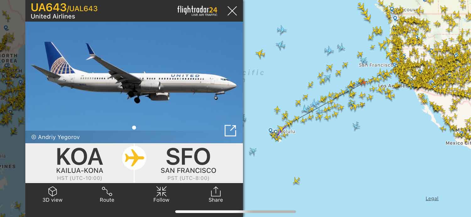
The technology that answers the question “what plane is flying over me” is a masterclass in modern digital integration. It relies on a combination of satellite navigation, ground-based radio receivers, and collaborative crowdsourcing that has democratized aviation data once reserved only for air traffic controllers.
Understanding the Tech: How Flight Tracking Works
The backbone of modern flight tracking is a technology known as Automatic Dependent Surveillance-Broadcast (ADS-B). To understand how your phone identifies a plane, one must first understand how the plane identifies itself to the world.
The Role of ADS-B
Unlike traditional radar, which works by bouncing radio waves off an object to determine its position, ADS-B is “dependent” because it relies on the aircraft’s own navigation system. The aircraft determines its position using GPS and then periodically broadcasts that information—along with its identity, altitude, and velocity—via a transponder.
This signal is transmitted on a frequency of 1090 MHz. Because these signals are unencrypted, they can be intercepted by anyone with the right equipment. This openness is what allows third-party apps to aggregate data and present it to the public in real-time. By 2020, the FAA mandated that nearly all aircraft operating in controlled airspace must be equipped with ADS-B Out technology, which has led to a gold mine of data for tech-savvy aviation enthusiasts.
Multilateration (MLAT)
Not every aircraft is equipped with the latest ADS-B transponders. Older planes or certain military aircraft may still use Mode S transponders, which do not broadcast GPS coordinates. To track these, tech platforms use a process called Multilateration (MLAT).
MLAT works by measuring the Time Difference of Arrival (TDOA) of a signal at four or more separate ground stations. By calculating the nanosecond differences in when the signal reached each receiver, software can triangulate the aircraft’s precise location. This requires a dense network of ground receivers, which is why tracking is often more accurate in urban areas than in remote wilderness.
Satellite-Based ADS-B
One of the most significant recent leaps in this technology is the transition to space-based ADS-B. Traditionally, ground-based receivers could not track planes over the middle of the ocean or behind mountain ranges. Companies like Aireon have deployed ADS-B receivers on low-earth orbit (LEO) satellites. This tech ensures that even when a plane is mid-Atlantic, its “digital footprint” remains visible on your screen, closing the gap in global flight visibility.
The Best Apps and Platforms for Identifying Planes
The consumer-facing side of this technology consists of highly optimized apps that turn complex radio data into intuitive visual interfaces. Each platform offers different features, ranging from social connectivity to deep technical telemetry.
Flightradar24: The Industry Standard
Flightradar24 is arguably the most popular flight tracking service in the world. Its success lies in its massive network of over 30,000 ground-based receivers. The app’s “AR View” is the quintessential answer to identifying a plane in real-time. By using the smartphone’s gyroscope, GPS, and camera, the app overlays flight data directly onto the live video feed of the sky.
Beyond identification, Flightradar24 provides historical flight data, playback features, and squawk code alerts (such as 7700 for emergencies). Its accessibility has made it a primary tool not just for hobbyists, but for journalists and researchers tracking global events.
FlightAware: The Professional Choice
While Flightradar24 leans toward the consumer and hobbyist, FlightAware is often the choice for those needing predictive data and enterprise-level insights. FlightAware excels at “HyperFeed” technology, which integrates thousands of data sources, including airline schedules, weather reports, and air traffic control feeds.
One of FlightAware’s standout features is its “Where is my plane?” tool, which tracks the incoming leg of a specific aircraft. This is particularly useful for travelers wanting to know if their flight will be delayed based on the physical location of the aircraft hours before boarding.

ADS-B Exchange: The Unfiltered Alternative
For users interested in the “raw” side of technology, ADS-B Exchange offers a different philosophy. Unlike commercial platforms, which often filter out private jets or military movements at the request of owners or governments, ADS-B Exchange is a co-op that promises unfiltered data. It is the go-to source for tracking high-interest aircraft that might be hidden on other platforms, making it a favorite for digital investigators and transparency advocates.
Exploring the Sky with Augmented Reality (AR)
The most impressive technological feat for the average user is the integration of Augmented Reality (AR) into flight tracking. This feature bridges the gap between the physical world and digital data, allowing for instant identification without needing to manually search for a flight number.
Visual Identification Through Your Lens
When you point your phone at a plane and see its details pop up, your device is performing a complex synchronization. It uses the compass to determine which direction you are facing, the GPS to find your coordinates, and the accelerometer to determine the angle of your phone. The app then cross-references this “viewing frustum” with the real-time database of aircraft positions. If a plane’s coordinates fall within that visual path, the data is projected onto your screen.
The 3D Cockpit Experience
Many apps now offer a “3D View” that utilizes Google Earth-style satellite imagery combined with the aircraft’s telemetry data. When you select a plane flying over you, the software can render a 3D model of the aircraft and simulate what the pilot is seeing out of the windshield. This uses real-time altitude, ground speed, and heading data to provide an immersive experience that was once the stuff of high-end flight simulators.
Privacy, Security, and the Future of Aerial Monitoring
As flight tracking technology becomes more pervasive, it has sparked significant debate regarding privacy and security. The tech industry must constantly balance the public’s right to information with the security needs of individuals and nations.
The Challenge of Privacy
Many high-net-worth individuals and corporations prefer not to have their movements tracked in real-time. The FAA’s “LADD” (Limiting Aircraft Data Display) program allows owners to request that their data be hidden by commercial tracking sites. However, because the ADS-B signal is broadcast publicly from the aircraft itself, “unfiltered” sites can still display this data. This has led to a tech-driven cat-and-mouse game where some aircraft use “Privacy ICAO Address” (PIA) programs to frequently change their digital identity to avoid being shadowed.
Cybersecurity in the Skies
Because ADS-B is unencrypted and unauthenticated, it is technically vulnerable to “spoofing”—the act of broadcasting fake aircraft signals to confuse receivers. While this is a known vulnerability, the redundancy of traditional radar and the transition to more secure “next-gen” systems are the primary safeguards. For the hobbyist developer, this highlight’s a fascinating area of digital security: how to verify the authenticity of open-source radio data.
The DIY Tech: Setting Up Your Own ADS-B Receiver
For those who want to move beyond being a consumer and become a contributor to the global data network, the technology is surprisingly accessible. The rise of Software Defined Radio (SDR) has made it possible to build a professional-grade flight tracking station for under $100.
The Hardware Stack
To build a receiver, you typically need:
- A Raspberry Pi: A small, low-cost computer that handles the data processing.
- An SDR USB Dongle: Specifically one tuned to the 1090 MHz frequency.
- An Antenna: Tuned to the wavelength of ADS-B signals.
- Internet Connectivity: To feed your data to global networks.
The Software Ecosystem
Once the hardware is in place, users install software like PiAware or Dump1090. This software decodes the raw radio signals into readable data packets. By feeding this data to sites like Flightradar24 or FlightAware, users often receive “Enterprise” or “Business” level subscriptions for free, creating a symbiotic relationship between the tech provider and the hardware host.
This decentralized network of thousands of “feeders” is what makes modern flight tracking so robust. It is a perfect example of how small-scale IoT (Internet of Things) devices can aggregate to create a massive, global digital utility.

The Convergence of Data and Curiosity
The question “what plane is flying over me” serves as a gateway into a complex world of geospatial data, radio frequency engineering, and cloud computing. Whether you are using a high-end AR interface on a smartphone or building a Linux-based receiver in your backyard, you are participating in a global experiment in information transparency.
As satellite technology continues to expand and AR becomes even more integrated into wearable tech like smart glasses, the sky will become even more readable. The invisible highways above us are no longer a mystery; they are a data-rich environment accessible to anyone with the right tools. This evolution reflects the broader trend in technology: the removal of barriers between the physical world and the digital information that defines it.
aViewFromTheCave is a participant in the Amazon Services LLC Associates Program, an affiliate advertising program designed to provide a means for sites to earn advertising fees by advertising and linking to Amazon.com. Amazon, the Amazon logo, AmazonSupply, and the AmazonSupply logo are trademarks of Amazon.com, Inc. or its affiliates. As an Amazon Associate we earn affiliate commissions from qualifying purchases.