For decades, looking up at a silver speck trailing a white vapor path across the sky invoked a sense of mystery. Today, that mystery is solved in seconds by pulling a smartphone from a pocket. The question “What plane is above me?” has transitioned from a curious thought to a data-driven certainty, powered by a sophisticated ecosystem of transponders, satellite constellations, and global data networks. This evolution represents one of the most successful integrations of crowdsourced hardware and enterprise-level software in the modern digital age.
To understand how you can identify an aircraft at 35,000 feet with pinpoint accuracy, we must look into the underlying technologies that have democratized aviation data, moving it from the exclusive domain of Air Traffic Control (ATC) into the palm of the consumer’s hand.
The Core Technology: How ADS-B Revolutionized the Skies
At the heart of modern flight tracking is a technology called Automatic Dependent Surveillance-Broadcast (ADS-B). Before ADS-B, tracking was primarily reliant on primary radar, which “bounced” radio waves off the fuselage of an aircraft to determine its position. While effective, it lacked the granular data required for modern navigation and consumer-facing applications.
Understanding ADS-B Out and In
ADS-B “Out” is the foundational tech. An aircraft determines its position via GPS and periodically broadcasts this information, along with its altitude, airspeed, and unique identification code, via a transponder operating on the 1090 MHz frequency. Unlike radar, which requires a signal to be sent and received by a ground station, ADS-B is “automatic” because it requires no external stimulus and “dependent” because it relies on the aircraft’s own navigation system.
ADS-B “In” refers to the equipment on the ground or in other aircraft that receives these broadcasts. This is the technology that populates the maps on your favorite tracking apps. Because the signal is unencrypted, it can be intercepted by anyone with the right receiver.
The Role of MLAT in Tracking Older Aircraft
Not all aircraft are equipped with modern ADS-B transponders, particularly older general aviation planes or certain military assets. To track these, tech platforms use Multilateration (MLAT). This process uses the Time Difference of Arrival (TDOA) method. By measuring the tiny differences in the time it takes for a transponder signal to reach four or more separate ground stations, the software can calculate the aircraft’s position through triangulation. This mathematical heavy lifting happens in the cloud, allowing apps to show “non-ADS-B” planes in near real-time.
Satellite-Based ADS-B: Closing the Oceanic Gaps
Until recently, flight tracking went dark over the oceans because ground-based receivers have a limited range of about 250 miles. The latest frontier in aviation tech is space-based ADS-B. Companies like Aireon have placed ADS-B receivers on Iridium NEXT satellites. This ensures that even in the middle of the Atlantic or over the North Pole, the “plane above you” remains visible on the digital grid, creating a truly global surveillance net.
Top Software Solutions and Mobile Applications
The transition from raw radio data to a polished user interface requires massive computational power and elegant software design. Several platforms lead the market, each catering to different niches within the tech community.
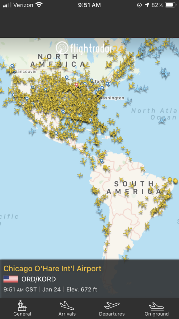
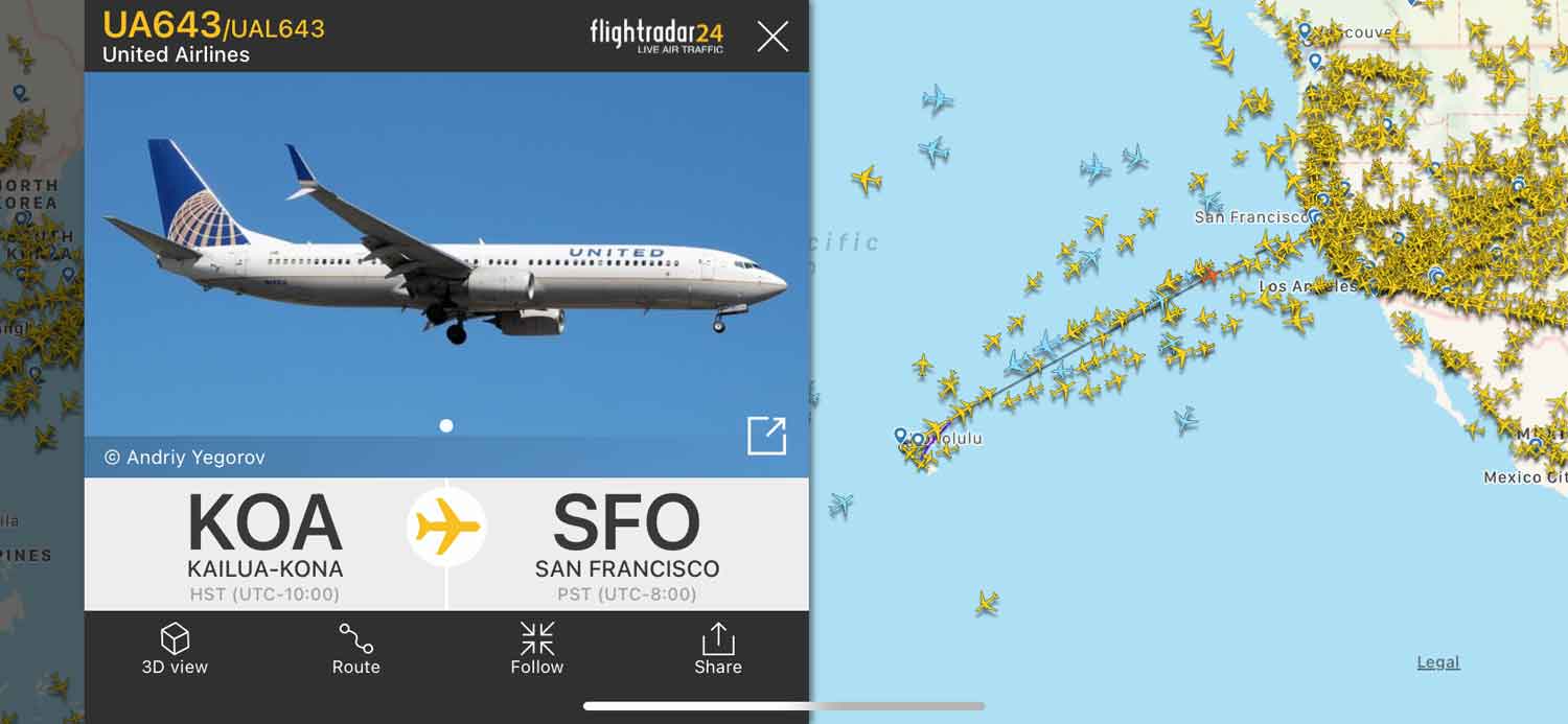
Flightradar24: The Industry Standard for Consumers
Flightradar24 is arguably the most recognizable name in the space. Its success lies in its massive network of over 30,000 ground-based receivers. The software excels at “Sensor Fusion”—the ability to take data from ADS-B, MLAT, and North American Radar Data (radar feeds) and merge them into a single, cohesive movement on a vector map. Their API is widely used by travel apps, demonstrating the robustness of their data pipeline.
FlightAware: Precision Data for Professionals
While Flightradar24 focuses on the enthusiast, FlightAware targets the enterprise and logistics sectors. Their tech stack emphasizes predictive analytics. For example, their “Foresight” machine learning model predicts taxi times and arrival gates by analyzing historical data patterns and real-time weather overlays. For a tech-savvy user, FlightAware offers deeper dives into flight plans, “where is my plane” historical routing, and integration with high-fidelity weather products.
ADS-B Exchange: The Unfiltered Alternative
For those who value data transparency and “raw” tech, ADS-B Exchange is the preferred platform. Unlike commercial competitors, ADS-B Exchange does not filter out aircraft that have requested anonymity (such as private jets of high-net-worth individuals or certain government flights). It is a co-op style platform built on the philosophy of “unfiltered data for the people,” making it a fascinating tool for those interested in the ethics of open-source intelligence (OSINT).
The Intersection of Augmented Reality and Aviation Tech
The most impressive technological feat for the casual observer is the ability to point a camera at the sky and see a digital “tag” hovering over a plane. This is achieved through the fusion of several smartphone sensors.
AR Viewers: Identifying Planes Through Your Camera
When you open an AR view in a flight tracking app, the software utilizes your phone’s GPS to determine your location, the magnetometer to determine which way you are facing, and the gyroscope to calculate the angle of tilt. By cross-referencing this orientation data with the real-time ADS-B database, the app renders a 3D overlay of the aircraft’s information (Flight number, origin, and destination) directly onto your camera feed.
Data Overlay and Real-Time Telemetry
The complexity here involves latency management. Because the aircraft is moving at several hundred miles per hour and your phone has a slight delay in processing GPS data, developers must use interpolation algorithms. These algorithms “guess” where the plane will be in the fraction of a second it takes for the data to travel from the transponder to the server and back to your screen, ensuring the digital tag stays perfectly aligned with the physical aircraft.
Building Your Own Tracking Station: The DIY Tech Movement
One of the most unique aspects of this niche is that the data is largely provided by a global community of hobbyists. You don’t need to be a billionaire to participate in the infrastructure of global aviation.
Raspberry Pi and RTL-SDR Dongles
The barrier to entry for flight tracking hardware has plummeted thanks to the Raspberry Pi. By connecting a low-cost RTL-SDR (Software Defined Radio) USB dongle and a tuned 1090 MHz antenna to a Pi, any tech enthusiast can build a “feeder” station. The software, usually Linux-based (such as PiAware or Dump1090), decodes the raw radio packets into JSON data.
Contributing to Global Data Networks
Once your station is live, you can “feed” your data to the major platforms. In exchange for this data, companies like Flightradar24 and FlightAware often provide users with free “Enterprise” or “Business” level subscriptions (usually worth hundreds of dollars a year). This creates a symbiotic ecosystem where the tech community provides the raw sensor data, and the platforms provide the sophisticated visualization and storage.
The Future of Flight Tracking: AI and Digital Security
As we move forward, the technology behind identifying the plane above us is becoming increasingly integrated with Artificial Intelligence and facing new challenges in cybersecurity.
Predictive Analytics in Flight Paths
Next-generation tracking software is moving beyond “where is it now?” to “where will it be if a storm hits?” AI models are now being trained on millions of previous flights to predict diversions before they happen. By analyzing slight changes in altitude or heading in conjunction with real-time METAR (Meteorological Aerodrome Report) data, software can alert ground crews to potential issues before the pilot even declares an alternate route.
Balancing Transparency with Cybersecurity
The open nature of ADS-B is its greatest strength but also a potential digital security vulnerability. Because the signals are unencrypted, “ghosting”—the act of broadcasting fake ADS-B signals to confuse receivers—is a theoretical risk. Tech firms are currently developing blockchain-based verification methods and advanced signal fingerprinting to ensure that the data appearing on your screen is authentic and has not been tampered with.
Furthermore, as privacy tech evolves, we are seeing a “cat and mouse” game between software that enables plane-spotting and hardware that allows owners to mask their digital footprint. The FAA’s PIA (Privacy ICAO Address) program allows operators to use a temporary, randomized aircraft address to remain anonymous to the public while staying visible to ATC.

Conclusion
The next time you look up and wonder “What plane is above me?”, remember that the answer is a result of a massive, synchronized digital ballet. From the Raspberry Pi in a neighbor’s attic to the Iridium satellites orbiting the earth, the technology of flight tracking is a testament to the power of open data, sensor fusion, and high-speed software. Whether you are a casual observer using an AR app or a hardware enthusiast building your own receiver, you are participating in one of the most transparent and technologically advanced tracking systems ever created.
aViewFromTheCave is a participant in the Amazon Services LLC Associates Program, an affiliate advertising program designed to provide a means for sites to earn advertising fees by advertising and linking to Amazon.com. Amazon, the Amazon logo, AmazonSupply, and the AmazonSupply logo are trademarks of Amazon.com, Inc. or its affiliates. As an Amazon Associate we earn affiliate commissions from qualifying purchases.