
The hum of an aircraft overhead, a silver speck against the vast canvas of the sky, often sparks a universal curiosity: “What plane is that?” For centuries, identifying aircraft was largely the domain of aviation enthusiasts with binoculars, or air traffic controllers with specialized radar systems. Today, thanks to a remarkable convergence of advanced sensors, global networks, and accessible software, answering that question is as simple as glancing at your smartphone. We live in an age where the invisible pathways of the sky are rendered visible, offering a real-time, intricate ballet of commercial, private, and even military aviation.
This isn’t just a trivial pursuit; it’s a testament to how far technology has advanced, transforming complex data streams into intuitive, user-friendly applications. From the casual observer to the seasoned aviation hobbyist, the tools available now provide unprecedented insight into the aerial ballet unfolding above us. This article delves into the technological marvels that make real-time aircraft identification possible, explores the leading applications that put this power in your hands, and examines what these insights mean for understanding the world’s increasingly crowded airspace.
The Technological Backbone of Flight Tracking
Behind every real-time flight tracking app lies a sophisticated network of hardware and software, constantly collecting and interpreting vast amounts of data. This intricate system is a marvel of modern engineering, blending established radar principles with cutting-edge digital communication.
ADS-B: The Core of Modern Identification
At the heart of contemporary flight tracking is Automatic Dependent Surveillance–Broadcast (ADS-B). Unlike traditional radar, which “pings” an aircraft and listens for an echo, ADS-B is a cooperative technology. Aircraft equipped with an ADS-B transponder periodically broadcast their position, altitude, speed, heading, and unique identification code to ground stations and other aircraft. This data is derived from the aircraft’s onboard GPS receiver, making it highly accurate and up-to-the-second.
The “automatic” part means it operates without pilot intervention, and “dependent” refers to its reliance on precise navigation data, typically from GPS. Ground-based ADS-B receivers, often operated by enthusiasts or commercial entities, pick up these signals. When a critical mass of these receivers forms a network, they create a comprehensive real-time map of the sky, far more detailed and frequent than traditional radar could achieve alone. This open, broadcast nature of ADS-B is what truly democratized flight tracking, shifting it from the exclusive realm of government and industry to the public domain.
Beyond ADS-B: Radar, MLAT, and Satellite Data
While ADS-B is dominant, it’s not the only technology contributing to the global flight tracking picture. Traditional radar still plays a crucial role, particularly for older aircraft not yet equipped with ADS-B, or in regions where ADS-B ground coverage is sparse. Air traffic control (ATC) radar systems provide primary and secondary surveillance, ensuring a baseline level of tracking across much of the developed world.
Another vital component is Multilateration (MLAT). For aircraft equipped with older Mode S transponders (which transmit identity but not GPS position), MLAT systems come into play. By measuring the time difference of arrival (TDOA) of a Mode S signal at multiple widely spaced ground receivers, it’s possible to precisely calculate the aircraft’s position. This technique effectively triangulates the aircraft’s location, offering a powerful complement to ADS-B, especially in areas with good ground receiver coverage but perhaps less ADS-B equipped traffic.
Finally, satellite-based ADS-B receivers are revolutionizing coverage in remote areas, over oceans, and polar regions where ground stations are impractical. Satellites equipped with ADS-B receivers collect the broadcast signals directly from aircraft and relay them back to ground stations. This technology, pioneered by companies like Aireon, provides truly global, real-time tracking, eliminating the “dark spots” that once plagued traditional radar and ground-based ADS-B networks, greatly enhancing aviation safety and operational efficiency.
Top Apps and Tools for Real-Time Plane Spotting
The sophisticated technological infrastructure described above is largely invisible to the end-user. What we interact with are the intuitive apps and web platforms that aggregate, visualize, and present this data in an engaging and accessible manner. These tools have democratized plane spotting, bringing the thrill of identifying aircraft to anyone with a smartphone or internet connection.
FlightRadar24 and FlightAware: Industry Leaders
When it comes to real-time flight tracking, two names consistently rise to the top: FlightRadar24 and FlightAware. Both offer robust features, global coverage, and user-friendly interfaces, though they cater to slightly different user experiences and feature sets.
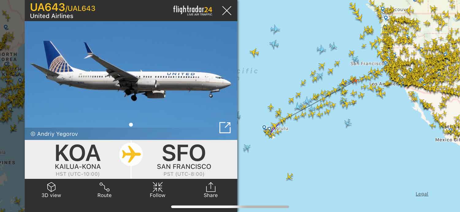
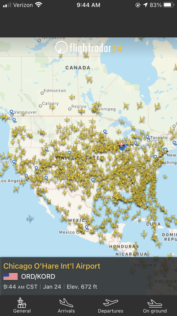
FlightRadar24 is renowned for its visually stunning map interface, often cited as one of the most engaging and comprehensive. It displays thousands of aircraft in real-time, moving smoothly across a global map. Tapping on an aircraft reveals a wealth of information: airline, flight number, aircraft type (including a photo!), altitude, speed, origin, destination, estimated arrival time, and even a 3D cockpit view simulation. Its strength lies in its extensive network of ground-based ADS-B receivers, many contributed by a global community of enthusiasts, supplemented by MLAT and satellite data. FlightRadar24 offers free access with basic features and subscription tiers (Silver, Gold, Business) for advanced data, historical playback, and enhanced filtering.
FlightAware is another powerhouse, particularly popular among aviation professionals and frequent flyers due to its robust historical data and predictive capabilities. While its real-time map is excellent, FlightAware often focuses more on flight status, delays, gate information, and the ability to track specific flights with notifications. It integrates data from a variety of sources, including ATC radar, ADS-B, and its own proprietary MLAT network called FlightAware Global. Its strengths lie in its deep integration with airline operational data and its comprehensive historical archives, making it invaluable for business travelers, logistics, and serious aviation analysis. Similar to FlightRadar24, it offers free functionality alongside premium subscription options.
Niche Alternatives: ADS-B Exchange and Plane Finder
While FlightRadar24 and FlightAware dominate, several other platforms offer unique features or cater to specific niches. ADS-B Exchange stands out for its commitment to unfiltered, raw data. Unlike commercial trackers that might filter out certain government or military flights (at the request of operators), ADS-B Exchange aims to display all ADS-B traffic without censorship. This makes it a favorite among serious plane spotters, journalists, and researchers interested in comprehensive, unadulterated airspace activity. Its interface is less polished than the commercial apps but provides unparalleled data transparency.
Plane Finder is another strong contender, offering a visually appealing interface and similar features to FlightRadar24. It often includes features like augmented reality (AR) views, allowing users to point their phone camera at the sky and see overlayed flight information. This blend of real-time data and immersive visualization enhances the user experience, particularly for those new to plane spotting. Each of these alternatives contributes to a rich ecosystem of flight tracking, offering users choices based on their priorities, whether it’s raw data, visual appeal, or specific features.
Augmented Reality and Future Interfaces
The integration of Augmented Reality (AR) into flight tracking apps represents an exciting evolution in how we interact with aerial data. Apps like Plane Finder, and increasingly others, allow users to point their smartphone or tablet camera towards the sky. The app then overlays digital information directly onto the live camera feed, identifying the specific aircraft currently in view. This means you don’t just see a dot on a map; you see the actual plane, with its flight number, altitude, and destination floating alongside it in your field of vision. This immersive experience bridges the gap between the digital map and the physical sky, making plane identification more intuitive and magical.
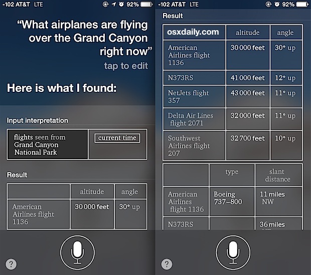
Looking ahead, we can anticipate even more sophisticated interfaces. Imagine smart glasses that automatically identify aircraft as you glance up, or AI-powered systems that can predict the optimal viewing spots for specific aircraft types based on their known flight paths. The convergence of powerful mobile processors, high-resolution cameras, precise GPS, and advanced computer vision algorithms promises a future where our interaction with the airspace above us is as natural and informative as checking the weather.
Decoding the Data: What You Learn From the Sky
Beyond simply identifying an aircraft, the wealth of data provided by flight tracking technology offers a deeper understanding of aviation, geography, and even global events. Each piece of information tells a story, painting a picture of the aircraft’s journey and its place within the broader network of global air travel.
Aircraft Specifics: Tail, Type, and Airline
When you tap on an aircraft in a tracking app, the initial flood of information begins to tell its unique story. The airline logo and flight number immediately contextualize the flight, identifying the operator and its specific service. A glimpse at the aircraft type — whether it’s a Boeing 747, an Airbus A320, or a smaller regional jet — provides insight into its capacity, range, and common uses. Enthusiasts often recognize these types by their distinct silhouettes or engine configurations.
Crucially, the registration number (often called the “tail number” in the US or “callsign” more broadly) is a unique identifier for that specific airframe. This alphanumeric code, usually starting with a country prefix (e.g., N for US, G for UK, F for France), is like the aircraft’s license plate. It allows for tracking the aircraft’s entire operational history, its ownership, and even its previous liveries. This data is invaluable for fleet management, maintenance records, and for those who enjoy cataloging specific aircraft they’ve spotted.
Flight Details: Route, Altitude, and Speed
The real-time data on an aircraft’s route, altitude, and speed paints a dynamic picture of its journey. The origin and destination airports clearly define its intended path, while the current altitude (usually in feet) and ground speed (often in knots or miles per hour) provide a snapshot of its performance. This information allows observers to understand where an aircraft is in its flight profile – ascending, cruising at 35,000 feet, or descending for approach.
You can often see the projected flight path overlayed on the map, along with the estimated time of arrival (ETA). For the curious, comparing the actual path to the expected one can reveal diversions due to weather, air traffic control instructions, or other operational factors. This real-time telemetry not only satisfies curiosity but can also be critical for coordinating pick-ups at airports, understanding potential delays, or simply appreciating the incredible precision required for modern air travel.
Beyond the Basics: Weather, Delays, and Historical Data
Modern flight tracking platforms extend far beyond basic identification, integrating a wealth of additional data that enriches the user’s understanding. Many apps display current weather conditions at the origin, destination, and even along the flight path, helping explain potential delays or diversions. Information on flight status, including predicted or actual delays, gate assignments, and baggage claim details, is invaluable for travelers and those meeting them.
Furthermore, the availability of historical flight data is a game-changer for researchers, hobbyists, and anyone looking to understand past aviation events. Platforms like FlightAware maintain extensive archives, allowing users to look up flights from days, weeks, or even years ago. This data can be used to analyze traffic patterns, investigate incidents, or simply relive a memorable journey. Some advanced platforms even provide insights into the aircraft’s age, engine type, and operator’s details, offering a comprehensive profile that goes far beyond a mere dot on a map, transforming a fleeting glimpse into a deep dive into aviation mechanics and logistics.
Building Your Own Digital Eye in the Sky
For those with a deeper interest in the technology, it’s possible to move beyond merely consuming data and become an active participant in the global flight tracking network. Building your own ADS-B receiver is a rewarding project that offers a hands-on understanding of how these systems work and contributes to the collective knowledge base.
Setting Up a DIY ADS-B Receiver
The heart of a DIY ADS-B receiver is typically a Software Defined Radio (SDR) dongle. These inexpensive USB devices, originally designed for receiving digital TV, can be repurposed to listen to a wide range of radio frequencies, including the 1090 MHz band where ADS-B signals are broadcast. Paired with a suitable antenna (often a basic whip antenna or a more specialized 1090 MHz antenna for better reception), and a small, low-power computer like a Raspberry Pi, you have the core components of a ground station.
The process generally involves installing a Linux-based operating system on the Raspberry Pi, followed by specific software packages that interface with the SDR dongle to decode the ADS-B signals. Open-source projects like dump1090 are widely used for this purpose, providing real-time decoding and output. While it requires some technical know-how, numerous online guides and communities (like those on Reddit or specialized forums) offer step-by-step instructions, making it an accessible project for hobbyists and tech enthusiasts. Once set up, your receiver will passively listen to aircraft broadcasts within its range, typically hundreds of miles, depending on antenna quality and placement.
The Community Aspect: Contributing to Global Tracking
The beauty of the ADS-B network is its decentralized, community-driven nature. Once your DIY receiver is up and running, you can contribute your collected data to major flight tracking platforms like FlightRadar24, FlightAware, and ADS-B Exchange. These platforms actively encourage and support community feeders, often providing free software images for Raspberry Pis and even offering premium subscriptions or hardware incentives in exchange for data contributions.
By feeding data, your receiver becomes a vital node in the global network, extending coverage, particularly in remote or underserved areas. This collective effort significantly improves the accuracy and completeness of the real-time flight maps that millions rely on daily. It’s a tangible way to participate in a large-scale technological endeavor, satisfying the curiosity about “what plane is above me right now” not just for yourself, but for the entire world. This collaborative spirit underscores how open technology and community engagement can achieve far more than any single entity could alone.
Conclusion
The simple question, “what plane is above me right now?” has evolved from a matter of speculation to a query answerable with astonishing precision, thanks to the relentless march of technological innovation. From the subtle radio whispers of ADS-B transponders to the global networks of ground and satellite receivers, and finally to the polished interfaces of our mobile apps, technology has transformed our engagement with the skies.
What was once the exclusive domain of aviation professionals is now accessible to anyone with an internet connection, fostering a deeper appreciation for the intricate ballet of air travel. As AI, augmented reality, and even more sophisticated sensor technologies continue to develop, the future promises an even richer, more immersive understanding of the aerial world. The sky is no longer an inscrutable expanse; it is an open book, and technology has provided us with the means to read its fascinating pages in real-time.
aViewFromTheCave is a participant in the Amazon Services LLC Associates Program, an affiliate advertising program designed to provide a means for sites to earn advertising fees by advertising and linking to Amazon.com. Amazon, the Amazon logo, AmazonSupply, and the AmazonSupply logo are trademarks of Amazon.com, Inc. or its affiliates. As an Amazon Associate we earn affiliate commissions from qualifying purchases.