In the rapidly evolving landscape of digital navigation and geospatial technology, the term “absolute location” serves as the foundational pillar for every application, device, and service that relies on precise positioning. Whether you are using a smartphone to track a courier, deploying an AI-driven fleet management system, or integrating location-based services (LBS) into a mobile application, understanding absolute location is essential for technical accuracy and system performance.
The Technical Definition of Absolute Location
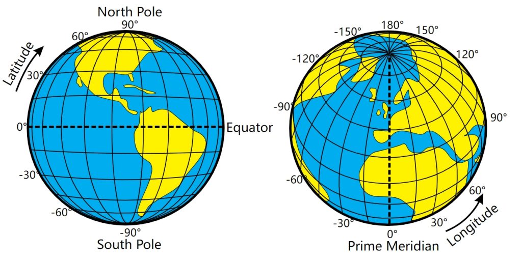
At its core, an absolute location is a precise, fixed point on the Earth’s surface, identified by a specific coordinate system. Unlike relative location, which describes where a place is in relation to other landmarks—such as “two blocks north of the digital hub”—absolute location provides an unchanging mathematical identity.
Geodetic Datums and Coordinate Systems
To define an absolute location, engineers and software developers rely on global coordinate systems, the most prominent being the World Geodetic System 1984 (WGS 84). This system serves as the reference framework for GPS (Global Positioning System). By utilizing latitude and longitude—or in more advanced software architecture, Cartesian coordinates (X, Y, Z)—a system can pinpoint any object with sub-meter accuracy.
The Role of GNSS Technology
Global Navigation Satellite Systems (GNSS) are the engines that power the determination of absolute locations. Devices capture signals from a constellation of satellites, calculating the time delay of signals to triangulate a precise coordinate. In software development, this data is ingested as raw NMEA strings, which developers then parse to trigger location-based logic, such as geofencing, routing algorithms, or asset tracking.
Integrating Absolute Location in Software and AI
For modern software architectures, absolute location is rarely just a set of numbers. It is the raw data input for complex backend processes that drive business intelligence and user experience.
API Implementation and Geospatial Databases
When building applications that require spatial awareness, developers interface with specialized APIs like the Google Maps Platform, Mapbox, or OpenStreetMap. These tools translate absolute coordinates into actionable visual information. Within the database layer, developers utilize extensions like PostGIS for PostgreSQL. These tools allow for complex spatial queries, such as “Find all user devices within a 5-kilometer radius of this absolute coordinate,” executed in milliseconds.
The Intersection with Artificial Intelligence
AI is currently transforming how we interpret absolute location data. Machine learning models are now used to clean “noisy” GPS data—a common issue in urban environments where signal reflection (multipath interference) causes coordinates to jitter. By applying Kalman filters or neural network-based smoothing, AI helps ensure that the absolute location captured by a device reflects its true position. Furthermore, predictive modeling uses historical absolute location logs to forecast traffic patterns, optimize delivery routes, and automate supply chain logistics, significantly reducing operational costs for tech-forward businesses.

Challenges in Digital Positioning
Despite the maturity of GPS technology, achieving a true absolute location in a digital environment faces significant technical hurdles. Acknowledging these limitations is vital for any developer working with location-based software.
Signal Degradation and Urban Canyons
Absolute location accuracy fluctuates based on the environment. In “urban canyons”—areas with high-rise buildings—signals from satellites can bounce off glass and steel surfaces, leading to a calculated coordinate that is meters away from the reality. High-end mobile apps compensate for this by implementing sensor fusion. This technique integrates data from the device’s internal hardware—such as accelerometers, gyroscopes, and magnetometers—to provide an “Inertial Navigation System” (INS) that fills the gaps when GPS signals are unreliable.
Latency and Data Synchronization
In distributed systems, ensuring that all microservices recognize the same absolute location simultaneously is a challenge known as temporal consistency. If a fleet management application receives an absolute location update from a vehicle, that data must be synchronized across the server, the administrative dashboard, and the customer-facing interface instantly. Asynchronous processing and robust message queues are required to prevent “stale” location data from being used in critical decision-making processes.
The Future of Absolute Location: Precision and Integration
As we move toward an era of autonomous vehicles, IoT integration, and augmented reality (AR), the requirements for absolute location are becoming increasingly stringent. We are transitioning from meter-level accuracy to centimeter-level precision.
The Rise of RTK and Differential GPS
Real-Time Kinematic (RTK) positioning is the current gold standard for developers working on high-stakes projects like precision agriculture or autonomous drone navigation. RTK uses a fixed base station with a known absolute location to provide real-time corrections to mobile receivers. By comparing the signal carrier phase, the system can eliminate common errors in GPS data, providing precision down to the centimeter. For software developers, this means writing code that can handle high-frequency data streams and complex differential calculations to ensure safety and reliability.
Geospatial Data Security
As applications rely more heavily on absolute location, the security of this data has become a primary concern. “GPS spoofing”—the intentional broadcast of false satellite signals—can mislead autonomous systems and mobile applications. Securing the location pipeline involves implementing robust encryption for data in transit and validating location sources through cross-referencing with Wi-Fi positioning systems (WPS) and cellular tower triangulation.
In the development of any location-aware ecosystem, security protocols must be designed to detect anomalies where a device’s reported absolute location deviates drastically from expected patterns, serving as a failsafe against malicious actors or hardware malfunction.

Conclusion
Absolute location is the silent language of the digital age. It provides the mathematical certainty required for technology to interact seamlessly with the physical world. For software developers, architects, and technical decision-makers, mastering the concept of absolute location is not merely about understanding coordinates; it is about building resilient, accurate, and scalable systems that can interpret, process, and act upon the geography of our world. Whether through the refinement of GNSS signal processing, the implementation of complex spatial databases, or the application of AI to filter coordinate data, absolute location remains the indispensable metric for progress in modern technology. By integrating these principles into your digital stack, you ensure that your applications remain grounded in the reality of the physical environment, ready to meet the demands of an increasingly connected and automated future.
aViewFromTheCave is a participant in the Amazon Services LLC Associates Program, an affiliate advertising program designed to provide a means for sites to earn advertising fees by advertising and linking to Amazon.com. Amazon, the Amazon logo, AmazonSupply, and the AmazonSupply logo are trademarks of Amazon.com, Inc. or its affiliates. As an Amazon Associate we earn affiliate commissions from qualifying purchases.