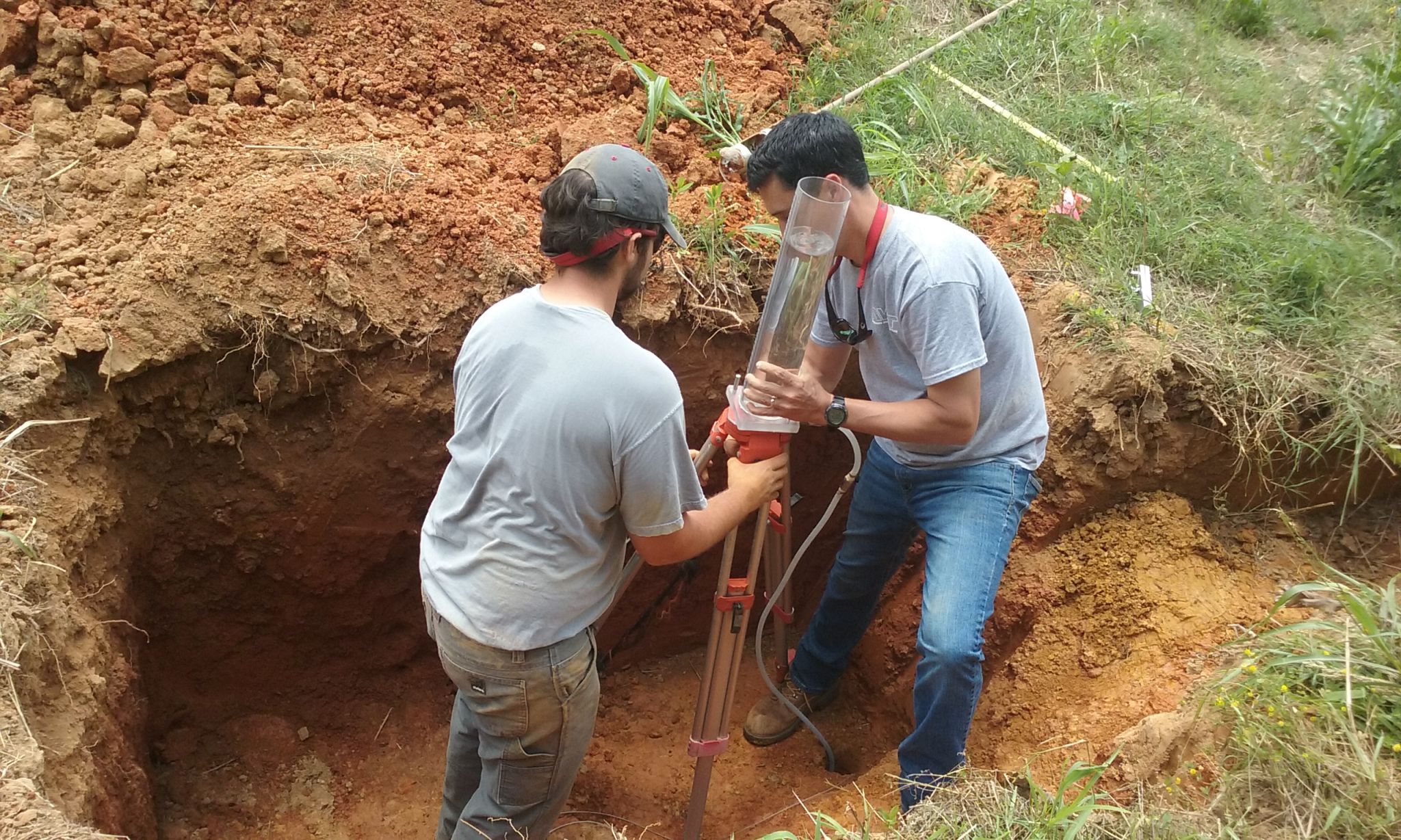
The traditional image of a soil scientist involves a professional in field gear, kneeling in a trench with a trowel, examining the texture and color of the earth. While physical sampling remains a foundational element of the discipline, the modern soil scientist has evolved into a high-tech data architect. Today, the profession sits at the intersection of environmental science and cutting-edge technology, leveraging tools like Artificial Intelligence (AI), Geographic Information Systems (GIS), and the Internet of Things (IoT) to solve some of the planet’s most pressing challenges.
As we move deeper into the 21st century, the role of a soil scientist is increasingly defined by the ability to interpret complex digital datasets. From optimizing food security through precision agriculture to mitigating climate change through carbon sequestration modeling, the “dirt doctor” of the past is now a digital pioneer.
The High-Tech Toolkit of Modern Soil Science
To understand what a soil scientist does today, one must first look at their digital toolkit. The shift from manual surveying to digital mapping has revolutionized how we understand the subterranean world.
Geographic Information Systems (GIS) and Spatial Analysis
The core of modern soil science is GIS. Soil scientists use sophisticated software platforms like ArcGIS or QGIS to create multi-layered digital maps. These maps do more than just show where different soil types are located; they integrate variables such as topography, climate data, and hydrological patterns. By using spatial analysis, scientists can predict how soil will behave under different conditions—such as extreme rainfall or prolonged drought—allowing for better urban planning and agricultural management.
Remote Sensing and LiDAR
Soil scientists no longer need to be physically present on every acre of land they study. Through remote sensing technology, they utilize satellite imagery and multispectral sensors to analyze soil health from space. Light Detection and Ranging (LiDAR) technology is particularly transformative. By sending laser pulses from aircraft or drones, scientists can create high-resolution 3D models of the landscape’s surface. This data helps them identify erosion patterns and sediment transport that are invisible to the naked eye.
Geophysical Surveying Tools
In-situ analysis has been enhanced by non-invasive tech tools like Ground Penetrating Radar (GPR) and Electromagnetic Induction (EMI). These gadgets allow soil scientists to “see” beneath the surface without digging a single hole. These tools measure the electrical conductivity of the soil, which provides data on moisture levels, salinity, and even the presence of buried geological structures or contaminants.
Precision Agriculture: The Integration of AgTech
One of the primary sectors where soil scientists apply their expertise is in the booming field of AgTech (Agricultural Technology). In this context, the soil scientist acts as the bridge between the physical farm and the digital management system.
Variable Rate Technology (VRT)
Soil scientists are the brains behind Variable Rate Technology. By analyzing soil nutrient data and mapping it across a field, they program GPS-guided machinery to apply fertilizers, lime, and water at variable rates. Instead of treating an entire 500-acre farm as a uniform block, the soil scientist uses software to ensure that each square meter receives exactly what it needs. This reduces chemical runoff, saves costs, and optimizes crop yields.
The Role of Big Data in Agronomy
Modern farms generate a massive amount of data. Soil scientists use data analytics platforms to aggregate information from yield monitors, weather stations, and soil probes. By applying “Big Data” methodologies, they can identify long-term trends in soil degradation or fertility. This predictive capability allows farmers to make proactive decisions rather than reactive ones, shifting the paradigm of food production toward total sustainability.
Drone Integration and Multispectral Imaging
Unmanned Aerial Vehicles (UAVs) have become a staple for the modern soil scientist. Equipped with multispectral cameras, these drones capture data in wavelengths that the human eye cannot perceive, such as near-infrared. Soil scientists interpret these images to detect early signs of nutrient deficiency or water stress in crops, which are often symptoms of underlying soil issues. This real-time tech intervention allows for precision “surgery” on specific areas of a field.
AI and Machine Learning in Pedology
Pedology, the study of soil formation and classification, has been supercharged by the advent of Artificial Intelligence. The sheer volume of soil data available globally is too vast for human analysis alone, leading to a surge in AI-driven soil science.
Predictive Soil Mapping (PSM)
Using machine learning algorithms, soil scientists can now generate “Predictive Soil Maps.” By feeding an AI model known soil samples alongside environmental covariates (like temperature and rainfall), the system can predict soil properties in unsampled areas with startling accuracy. This tech is crucial in developing nations where comprehensive soil surveys have historically been too expensive or difficult to conduct.
Automated Soil Classification
AI tools are now being developed to classify soil types through image recognition. By using a smartphone app powered by a deep-learning neural network, a field technician can take a photo of a soil profile, and the AI can provide an instant preliminary classification based on color, structure, and visible inclusions. This democratizes soil science, allowing for faster data collection in the field.
Carbon Sequestration Modeling
As the world looks for ways to pull carbon dioxide out of the atmosphere, soil scientists are using software to model “carbon sinks.” They use complex algorithms to simulate how different land management practices—such as no-till farming or cover cropping—affect the soil’s ability to store carbon. These digital models are essential for the burgeoning carbon credit market, providing the technical verification needed to prove that soil is actually sequestering greenhouse gases.
The Internet of Things (IoT) and Real-Time Monitoring
The “connected farm” or “smart forest” is made possible by IoT sensors that soil scientists deploy to monitor environmental health 24/7. This transition from “snapshot” sampling to continuous data streaming is a game-changer for the industry.
Smart Soil Sensors
Modern soil scientists deploy networks of wireless sensors that measure moisture, temperature, and electrical conductivity in real-time. This data is transmitted via cellular or LoRaWAN networks to a centralized cloud platform. For a soil scientist, this means they can monitor a remote site from their office, receiving alerts if soil moisture drops below a critical threshold or if salt levels rise to toxic heights.
Automated Laboratory Pipelines
Even the laboratory work of a soil scientist has been digitized. High-throughput automated systems now handle soil chemical analysis. Technologies like Mid-Infrared (MIR) spectroscopy allow scientists to analyze the molecular composition of soil samples in minutes without the use of hazardous chemical reagents. The resulting “spectral signature” of the soil is then matched against global databases to determine its organic matter content and mineralogy.
Data Security and Digital Ethics
As soil data becomes more valuable—especially in the context of land valuation and environmental compliance—the soil scientist must also be concerned with digital security. Ensuring the integrity of soil data and protecting the privacy of landholders is a new, tech-centric responsibility within the profession. They must understand data encryption and secure cloud storage to manage the sensitive information they collect.
The Future: Digital Twins and Virtual Reality
Looking forward, the role of the soil scientist will continue to merge with virtual and augmented reality environments. The concept of the “Digital Twin”—a virtual replica of a physical asset—is now being applied to entire landscapes.
Soil Digital Twins
A soil scientist of the near future will likely manage a “Digital Twin” of a watershed or an agricultural region. This virtual model, updated in real-time by IoT sensors and satellite data, allows the scientist to run “what-if” simulations. They can virtually simulate a 100-year flood event or a decade of intensive farming to see how the soil will respond, allowing for unprecedented levels of environmental foresight.
Virtual Reality (VR) for Pedological Training
Education in soil science is also being transformed. VR allows students and professionals to “walk through” a virtual soil pit, examining layers (horizons) and structures in a 360-degree environment. This tech allows for the study of rare or distant soil types—such as permafrost from the Arctic or volcanic ash from the Andes—without the logistical challenges of travel.
Conclusion: The New Frontier of Earth Science
So, what does a soil scientist do? They are the data analysts of the earth. They are the architects of the digital systems that ensure our survival on a changing planet. By mastering GIS, AI, remote sensing, and the IoT, they have moved beyond the shovel and the bucket to become some of the most tech-savvy professionals in the modern workforce. As we face global challenges in food production and climate stability, the tech-driven insights of the soil scientist will be the foundation upon which a sustainable future is built.
aViewFromTheCave is a participant in the Amazon Services LLC Associates Program, an affiliate advertising program designed to provide a means for sites to earn advertising fees by advertising and linking to Amazon.com. Amazon, the Amazon logo, AmazonSupply, and the AmazonSupply logo are trademarks of Amazon.com, Inc. or its affiliates. As an Amazon Associate we earn affiliate commissions from qualifying purchases.