When we discuss the tallest mountains in Europe, the conversation traditionally begins and ends with geography. We look at the rugged peaks of Mount Elbrus in the Caucasus or the iconic white mantle of Mont Blanc in the Alps. However, in the modern era, our understanding of these giants is no longer defined solely by physical exploration. Instead, it is defined by technology. From the precision of satellite laser altimetry to the complex algorithms that resolve continental border disputes, the “tallest” peaks are as much a triumph of data science as they are of tectonic shifts.
In the digital age, mapping these peaks involves a sophisticated stack of hardware and software. We are moving beyond the era of theodolites and toward an era of Digital Twin modeling and real-time biometric tracking. This article explores the technological landscape that governs our interaction with Europe’s highest elevations, examining how software, gadgets, and digital infrastructure are redefining what it means to summit the continent.
Mapping the Giants: Precision Geospatial Tech and the Altitude Debate
The first question any geographer asks is: “How high is it exactly?” While this seems simple, measuring the tallest mountains in Europe requires an immense amount of computational power. The “height” of a mountain changes based on whether you are measuring from the ellipsoid or the geoid (sea level), and tech is the only way to reconcile these variables.
From Theodolites to LiDAR: How We Measure Height Today
For centuries, surveying was a manual process. Today, we utilize LiDAR (Light Detection and Ranging) and GNSS (Global Navigation Satellite System) technology to achieve sub-centimeter accuracy. LiDAR, often mounted on aircraft or high-altitude drones, pulses laser beams toward the mountain surface. By measuring the time it takes for the light to bounce back, software can generate a high-resolution 3D point cloud of the peak.
This technology has been pivotal in settling debates regarding the true height of peaks like Mont Blanc, which fluctuates due to its varying snow cap. Every two years, surveyors use high-precision GPS receivers to monitor these changes, feeding the data into specialized GIS (Geographic Information System) software to analyze the impact of climate change on mountain volume.
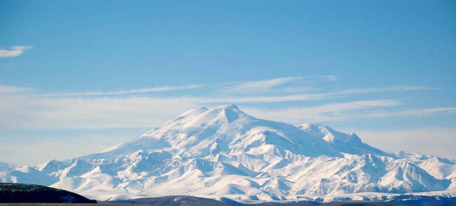
The Elbrus vs. Mont Blanc Controversy: Digital Borders and Definitions
The debate over whether Mount Elbrus (5,642m) or Mont Blanc (4,810m) is the true “tallest mountain in Europe” is a classic case of data interpretation. The answer depends entirely on where a digital map draws the boundary between Europe and Asia.
Modern cartographic software allows us to overlay various geopolitical and geological definitions. Using tectonic plate data and complex spatial analysis, tech helps geographers visualize the “Strahlenberg line” and other historical boundaries. While Elbrus is physically higher, its inclusion in Europe depends on the digital parameters set within world-mapping databases. This highlights a core truth in modern tech: data is only as definitive as the criteria used to filter it.
Survival at Scale: Wearable Tech and IoT on High-Altitude Expeditions
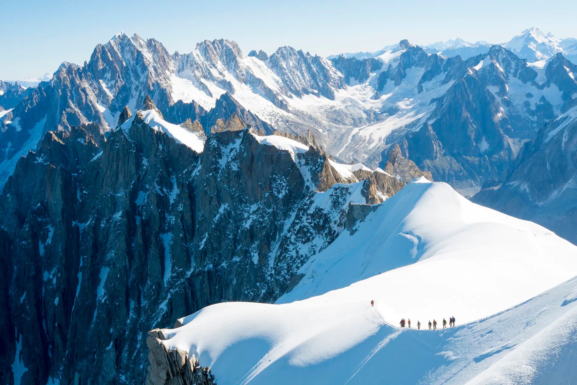
Climbing the tallest mountains in Europe—whether it’s the technical ridges of the Matterhorn or the icy slopes of Elbrus—now involves an array of “Internet of Things” (IoT) devices. Mountaineering has transitioned from a feat of pure grit to a data-driven sport where performance is optimized through wearable technology.
Biometric Monitoring: Real-time Data in Thin Air
At high altitudes, the human body begins to fail. Technology now provides a “digital early warning system.” Modern high-altitude wearables measure oxygen saturation (SpO2), heart rate variability (HRV), and skin temperature.
Advanced algorithms processed within these gadgets can predict the onset of Acute Mountain Sickness (AMS) before the climber even feels the symptoms. By syncing this data to a smartphone app via Bluetooth, climbers can visualize their acclimatization trends. This bio-feedback loop allows for informed decision-making, significantly reducing the mortality rates associated with high-altitude pulmonary edema.
Smart Gear: Integrated Heating and Location Tracking
The hardware of mountaineering has also seen a digital upgrade. “Smart” apparel now includes integrated carbon fiber heating elements controlled via mobile apps, allowing climbers to maintain core temperatures in sub-zero conditions.

Furthermore, the integration of RECCO reflectors and GPS transceivers into gear ensures that if a climber is buried in an avalanche or lost in a whiteout, rescuers can use specialized radar detectors to locate them. These are not just gadgets; they are life-saving nodes in a digital safety net draped over Europe’s highest peaks.
Connectivity Above the Clouds: Satellite Communications and Safety
One of the greatest technological shifts in the last decade is the democratization of connectivity. In the past, standing atop a 5,000-meter peak meant total isolation. Today, the tallest mountains in Europe are increasingly “connected” through low-earth orbit (LEO) satellite constellations.
Starlink and the Future of High-Peak Internet
The arrival of Starlink and similar satellite internet providers has fundamentally changed the logistics of mountain expeditions. High-speed, low-latency internet is now available in remote base camps that were previously dead zones.
This connectivity allows for the transmission of high-definition video for remote coaching, real-time social media updates, and, most importantly, instantaneous access to high-resolution weather models. For expedition leaders, the ability to pull a 100MB weather GRIB file in seconds rather than minutes can be the difference between a successful summit and a disaster.
Emergency Response: The Role of Digital Signaling
Digital security isn’t just about protecting data; on a mountain, it’s about protecting life. Satellite messengers like the Garmin inReach or the iPhone’s Emergency SOS via Satellite utilize proprietary software to bridge the gap between remote peaks and emergency services.
When an SOS is triggered, the software doesn’t just send a ping; it sends a data packet containing GPS coordinates, elevation, and the device’s battery level. This information is automatically routed through a global monitoring center and dispatched to local search and rescue (SAR) teams in the Alps or the Caucasus, streamlining a process that once took hours into one that takes seconds.
Virtual Summits: AI and VR in Mountaineering Education
Not everyone can physically stand on the summit of Europe’s tallest peaks, but technology is making these environments accessible through Virtual Reality (VR) and Artificial Intelligence (AI). This “digital democratization” serves two purposes: entertainment and elite training.
Digital Twins of the Caucasus and Alps
Using the same LiDAR data mentioned earlier, developers have created “Digital Twins” of mountains like the Eiger and Elbrus. These are photorealistic, 1:1 scale virtual environments. Professional climbers use VR headsets to “climb” a route multiple times before ever stepping foot on the mountain. They can study the placement of every crevasse and the angle of every couloir, using software to simulate different lighting and weather conditions.
Predicting Weather with Machine Learning Models
Predicting the weather on Europe’s highest peaks is notoriously difficult due to micro-climates. However, machine learning (ML) is beginning to crack the code. By feeding decades of historical weather data, satellite imagery, and atmospheric pressure readings into neural networks, meteorologists can now predict “windows” of good weather with much higher accuracy.
These AI models can identify patterns that traditional linear models might miss, such as the specific conditions that lead to a sudden storm on Mont Blanc. For the tech-focused mountaineer, the most important tool in their kit isn’t an ice axe—it’s the predictive algorithm that tells them when to stay in their tent.
The Digital Future of the Heights
As we look toward the future, the integration of technology and geography will only deepen. We are entering an era of “Augmented Mountaineering,” where AR glasses might overlay the safest path across a glacier in real-time, or drones might autonomously deliver medical supplies to stranded climbers at 5,000 meters.
The tallest mountains in Europe remain as formidable as they were a century ago, but our “technological lens” has changed them. We no longer see them as unconquerable voids, but as data-rich environments that can be mapped, monitored, and understood through the power of software and hardware. In the end, the peaks of the Alps and the Caucasus serve as the ultimate testing ground for human innovation—a place where the digital world meets the raw, physical limits of our planet.
aViewFromTheCave is a participant in the Amazon Services LLC Associates Program, an affiliate advertising program designed to provide a means for sites to earn advertising fees by advertising and linking to Amazon.com. Amazon, the Amazon logo, AmazonSupply, and the AmazonSupply logo are trademarks of Amazon.com, Inc. or its affiliates. As an Amazon Associate we earn affiliate commissions from qualifying purchases.