
At any given moment, if you were to look up and peer through the clouds, you are likely within a few dozen miles of a pressurized aluminum tube hurtling through the stratosphere at 500 miles per hour. While the human eye might only catch a fleeting contrail, a sophisticated, interconnected web of technology is monitoring that aircraft—and every other one like it—with surgical precision.
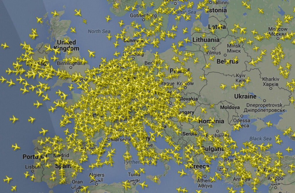
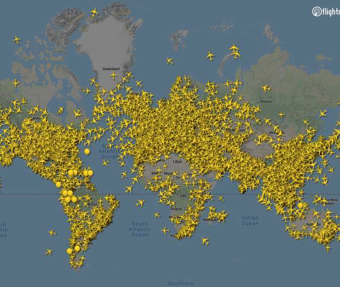
The question “how many airplanes are in the sky right now?” is no longer a matter of estimation or guesswork. Thanks to the convergence of satellite navigation, crowdsourced data, and high-speed cloud computing, we can pinpoint the exact number of active flights in real-time. On average, there are between 8,000 and 20,000 planes airborne at any one time, depending on the time of day and the season. However, the true marvel is not the number itself, but the tech stack that allows us to visualize it on a smartphone screen.
The Backbone of Visibility: Understanding ADS-B Technology
For decades, air traffic control relied almost exclusively on primary radar—a system that bounces radio waves off the fuselage of an aircraft to determine its position. While effective, radar is limited by line-of-sight and distance. Today, the global aviation industry has shifted toward a more digital, precise, and data-rich system: Automatic Dependent Surveillance-Broadcast (ADS-B).
How ADS-B Transponders Work
ADS-B is the foundational technology that makes modern flight tracking possible. Unlike radar, which “asks” where a plane is, ADS-B “tells” the world where the plane is. An aircraft determines its position using GPS and then broadcasts that information, along with its altitude, speed, and flight number, via a transponder.
This broadcast occurs every second, providing a high-fidelity data stream that is far more accurate than traditional radar sweeps. Because the “B” in ADS-B stands for “Broadcast,” the signal is unencrypted and can be picked up by anyone with a compatible receiver. This openness is what paved the way for the consumer-facing flight tracking apps we use today.
The Shift from Ground-Based to Space-Based Tracking
While ADS-B revolutionized tracking over land, it initially struggled with “dead zones” over oceans and remote deserts where ground-based receivers couldn’t reach. The tech industry solved this through Space-Based ADS-B.
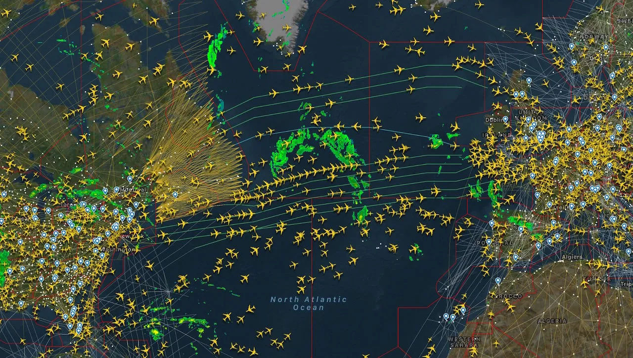
Companies like Aireon have placed ADS-B receivers on low-earth orbit (LEO) satellites. This creates a global mesh network that ensures no aircraft is ever “dark,” even when crossing the Atlantic or flying over the North Pole. This leap in satellite tech has been the single most important factor in providing a 100% accurate count of every plane in the sky at any given microsecond.
From Transponders to Touchscreens: The Software Powering Real-Time Maps
The raw data broadcast by an airplane is just a string of hex codes and coordinates. To answer “how many planes are in the sky,” this data must be captured, processed, and visualized. This is where software engineering and massive data aggregation platforms like Flightradar24, FlightAware, and ADSBexchange come into play.
The Power of Crowdsourced Receiver Networks
One of the most fascinating aspects of modern flight-tracking tech is its reliance on a global community of hobbyists. Thousands of individuals around the world host small, low-cost Raspberry Pi-based receivers equipped with SDR (Software Defined Radio) dongles.
These receivers pick up local ADS-B signals and feed them into a central server via the internet. The software then “stitches” these thousands of individual data feeds into a singular, cohesive global map. This decentralized tech model allows for redundant, high-uptime tracking that would be prohibitively expensive for a single corporation to build from scratch using only proprietary hardware.
Data Fusion and Multilateration (MLAT)
Not every aircraft is equipped with the latest ADS-B Out technology. To fill the gaps, tracking software uses a technique called Multilateration (MLAT). By measuring the “Time Difference of Arrival” (TDOA) of a signal at four or more separate ground stations, the software can use complex geometric algorithms to calculate a plane’s position. This data fusion—combining ADS-B, MLAT, and traditional radar feeds—ensures that the “total count” of aircraft is as comprehensive as possible, including older private jets and certain military transports.
Big Data and Cloud Computing: Managing Millions of Data Points
To visualize 20,000 moving icons on a map, all updating in real-time, requires a robust backend infrastructure. We are talking about millions of data points being processed every second. This is a “Big Data” challenge that relies heavily on cloud computing and efficient database management.
Real-Time Stream Processing
The architecture of a flight-tracking app must prioritize low latency. When an aircraft maneuvers, the icon on the user’s screen needs to reflect that movement almost instantly. Developers use stream-processing frameworks (like Apache Kafka or Flink) to handle the ingestion of data from global receivers. This allows the system to filter, validate, and update flight paths in milliseconds before pushing that data to millions of concurrent users via WebSockets.
Geospatial Indexing and UI Optimization
Showing 20,000 planes on a small mobile screen would result in a cluttered, unreadable mess without clever software design. Tech platforms use geospatial indexing (like H3 or S2 geometry) to cluster aircraft based on the user’s zoom level. As you zoom in, the software dynamically de-clusters the icons, fetching more granular data from the cloud. This optimization is what makes the experience feel fluid and professional, rather than a laggy data dump.
The Role of AI and Predictive Analytics in Airspace Management
Knowing where a plane is is only half the battle; technology is now focused on where a plane will be. As the number of aircraft in the sky continues to grow, Artificial Intelligence (AI) is becoming the primary tool for managing this digital traffic jam.
Machine Learning for ETA and Delay Prediction
Modern flight tracking platforms do more than just show icons; they provide highly accurate Estimated Times of Arrival (ETA). These ETAs are no longer based on simple distance-divided-by-speed calculations. Instead, Machine Learning (ML) models analyze historical flight data, current weather patterns, airport congestion levels, and even taxi times at specific gates. By processing these variables, AI can predict delays before the pilot even announces them, providing a level of transparency that was impossible a decade ago.
Algorithmic De-confliction and Flight Path Optimization
In the cockpit and at Air Traffic Control (ATC) centers, AI tools are being used to optimize flight paths for fuel efficiency and safety. These “NextGen” systems use algorithms to suggest minor adjustments in altitude or speed to ensure that the 15,000+ planes in the sky maintain safe separation without requiring constant human intervention. This automated “de-confliction” is essential as we move toward an era of even more crowded skies.
The Future Frontier: IoT, 6G, and the Integration of Unmanned Systems
The question of “how many planes” is about to get much more complicated. With the rise of commercial drones and Advanced Air Mobility (AAM)—think electric vertical take-off and landing (eVTOL) “air taxis”—the number of objects in the sky could scale from 20,000 to 200,000 in the next two decades.
The Internet of Planes (IoP)
The future of aviation tech lies in the total integration of every airborne object into a single IoT (Internet of Things) ecosystem. Future 6G networks are being designed with “non-terrestrial network” capabilities, meaning the cell tower is in space or on a high-altitude platform. This will provide high-bandwidth connectivity to every aircraft, allowing for the transmission of “Black Box” data in real-time to the cloud, rather than storing it locally on the plane.
Remote ID and Unified Tracking
To manage the influx of drones and air taxis, the tech world is implementing “Remote ID”—essentially a digital license plate for smaller aircraft. This will integrate directly into the same tracking platforms used for jumbo jets. Soon, when you ask how many “planes” are in the sky, the tech will provide a filtered view: commercial airliners, private delivery drones, and emergency medical eVTOLs, all operating within a synchronized, software-defined airspace.
The ability to look at a screen and see the precise location of a flight over the Pacific is a testament to how far technology has come. It is a symphony of hardware, software, and data science working in harmony to make the invisible visible. As we continue to push the boundaries of AI and satellite connectivity, the sky will only become more transparent, more efficient, and more connected.
aViewFromTheCave is a participant in the Amazon Services LLC Associates Program, an affiliate advertising program designed to provide a means for sites to earn advertising fees by advertising and linking to Amazon.com. Amazon, the Amazon logo, AmazonSupply, and the AmazonSupply logo are trademarks of Amazon.com, Inc. or its affiliates. As an Amazon Associate we earn affiliate commissions from qualifying purchases.