
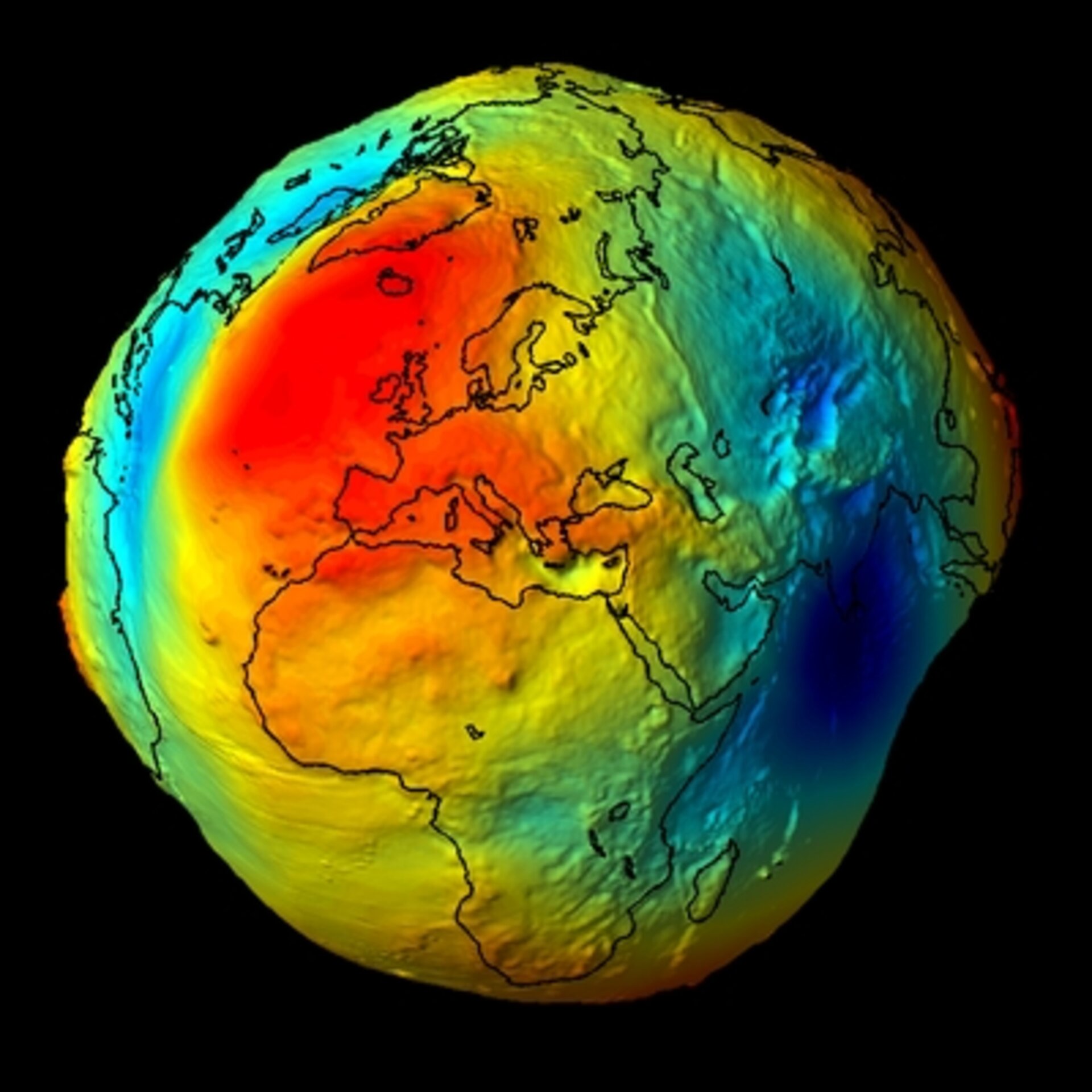
For decades, our collective understanding of Earth’s appearance was defined by a single photograph: the “Blue Marble,” taken by the crew of Apollo 17 in 1972. It showed a fragile, swirling marble of blue and white suspended in the void. However, in the era of rapid digital transformation, the question “What does Earth really look like?” has moved beyond the realm of simple photography. Today, the “real” Earth is a complex, multi-layered data construct.
Through the integration of hyperspectral imaging, Artificial Intelligence (AI), and Digital Twin technology, we are no longer just looking at a picture of our planet; we are interacting with a living, breathing digital organism. This article explores the cutting-edge technology that defines our modern visual and analytical understanding of Earth.
Beyond the Naked Eye: The Evolution of Remote Sensing Technology
Human vision is limited to a tiny fraction of the electromagnetic spectrum. To understand what Earth really looks like, we have had to build technological “eyes” that can see what we cannot. Remote sensing—the process of detecting and monitoring the physical characteristics of an area by measuring its reflected and emitted radiation—has undergone a revolution.
The Transition from Optical to Multispectral Imaging
Traditional satellite imagery relied on optical sensors that mimicked the human eye. While beautiful, these images lacked the depth required for scientific and industrial analysis. Modern satellites, such as the European Space Agency’s Sentinel-2, utilize multispectral imaging. By capturing data across 13 different spectral bands, including near-infrared and short-wave infrared, these sensors allow us to see the “health” of the planet. In these images, Earth doesn’t just look green; it glows with varying intensities that indicate chlorophyll levels in forests or the moisture content in soil.
Hyperspectral Data: Seeing the Unseen
If multispectral imaging is a leap forward, hyperspectral imaging is a quantum jump. Instead of a few wide bands of light, hyperspectral sensors collect hundreds of narrow, contiguous spectral bands. This allows for “spectral fingerprinting.” From orbit, tech can now distinguish between different species of trees, identify specific mineral deposits in the crust, or detect methane leaks that are invisible to the naked eye. To a hyperspectral sensor, Earth looks like a chemical map, where every pixel reveals the molecular composition of the surface.
The Digital Twin: Replicating the Planet in Virtual Space
One of the most ambitious trends in modern technology is the creation of a “Digital Twin” of Earth. A Digital Twin is more than a map; it is a dynamic, virtual representation of a physical object or system that is updated with real-time data.
High-Resolution 3D Mapping and LIDAR
To build a Digital Twin, we need more than flat images; we need geometry. Light Detection and Ranging (LIDAR) technology uses laser pulses to measure distances to the Earth’s surface. When deployed from aircraft or satellites, LIDAR can “see” through dense forest canopies to map the ground beneath, revealing lost civilizations or subtle changes in topography. This creates a high-resolution 3D skeleton of the planet, providing a structural look at Earth that was previously impossible to achieve.
Real-Time Data Integration and the Internet of Things (IoT)
What makes the Digital Twin truly “real” is the integration of real-time data. Through a massive network of IoT sensors—placed in oceans, embedded in urban infrastructure, and strapped to weather balloons—the digital model of Earth updates in near real-time. Software platforms like NVIDIA’s “Earth-2” use these data streams to create massive simulations. In this context, Earth looks like a pulsing network of information, where a storm in the Atlantic or a traffic jam in Tokyo is reflected instantly in the digital realm.
AI and Machine Learning: Interpreting Global Patterns
The sheer volume of data generated by satellites is overwhelming for human analysts. Every day, terabytes of imagery are beamed down to ground stations. To see the “big picture,” we rely on Artificial Intelligence and Machine Learning (ML) to process and interpret what Earth looks like at scale.
Computer Vision and Land-Use Classification
AI algorithms trained in computer vision can scan millions of square kilometers in seconds. These tools identify patterns that human eyes might miss, such as the subtle encroachment of illegal mining in the Amazon or the gradual expansion of urban heat islands. By automating land-use classification, AI transforms raw pixels into actionable insights. To an AI, the Earth looks like a categorized database of assets, risks, and trends, allowing policymakers to see the effects of urbanization and deforestation as they happen.
Predictive Modeling for Climate and Urban Growth
The power of AI lies not just in seeing the present, but in rendering the future. By feeding historical climate data into neural networks, scientists can generate visualizations of what the Earth will look like in fifty years under various carbon-emission scenarios. These predictive visualizations are essential for urban planning and disaster mitigation. We are moving from a static view of the planet to a four-dimensional view that includes time, allowing us to see the Earth’s past, present, and probable future simultaneously.
The Infrastructure of Observation: Satellites, Drones, and Edge Computing
The hardware responsible for showing us the Earth has changed as much as the software. The “NewSpace” movement has shifted the focus from a few massive, government-funded satellites to “constellations” of small, agile devices.
The CubeSat Revolution and Democratized Data
The rise of CubeSats—miniaturized satellites often no larger than a shoebox—has democratized access to Earth observation. Companies like Planet Labs operate hundreds of these satellites, imaging every location on Earth’s landmass every single day. This “persistence” is a fundamental shift. In the past, Earth looked like a series of snapshots taken months apart. Now, it looks like a continuous, high-definition video. This allows for the tracking of moving assets, such as shipping containers or migrating wildlife, in ways that were previously the stuff of science fiction.
Edge Computing in Orbit: Processing Data at the Source
Sending massive amounts of high-resolution data back to Earth is a bottleneck. The latest trend in space tech is “Edge Computing”—processing the data on the satellite itself. By using specialized AI chips in orbit, a satellite can analyze an image, detect a specific event (like a forest fire starting), and send only the relevant alert back to Earth. This reduces latency and changes our relationship with planetary data. The Earth, seen through the lens of edge computing, is a series of prioritized events and triggers, optimized for rapid human response.

Conclusion: A New Perspective on Our Living World
So, what does Earth really look like? The answer is no longer a simple photograph.
To a technologist in the 21st century, Earth looks like a multi-layered, high-resolution, data-rich simulation. It is a composite of infrared heat maps, 3D LIDAR point clouds, and AI-driven predictive models. It is a planet where the “unseen” is now visible, where the distant is now reachable, and where the future is becoming increasingly predictable.
As our tools become more sophisticated, the line between the physical planet and its digital representation continues to blur. We have moved from being passive observers of a “Blue Marble” to active managers of a complex global system. The technology we use to see the Earth doesn’t just change our perspective; it changes our ability to protect, sustain, and understand the only home we have. The real Earth is not just a place we inhabit—it is a massive, interconnected data set that we are only just beginning to truly see.
aViewFromTheCave is a participant in the Amazon Services LLC Associates Program, an affiliate advertising program designed to provide a means for sites to earn advertising fees by advertising and linking to Amazon.com. Amazon, the Amazon logo, AmazonSupply, and the AmazonSupply logo are trademarks of Amazon.com, Inc. or its affiliates. As an Amazon Associate we earn affiliate commissions from qualifying purchases.