
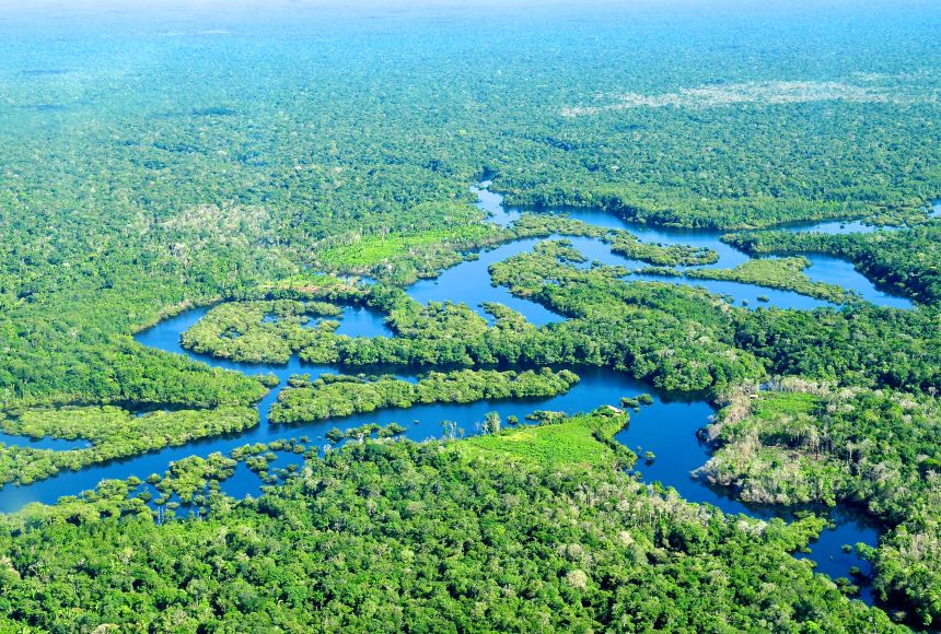
The Amazon Rainforest, a colossal biome often referred to as the “lungs of the Earth,” is a natural wonder whose vastness and ecological complexity are difficult to grasp without the aid of modern technology. While its geographical location is broadly understood to span South America, the intricate details of its borders, its ever-changing landscape, and the myriad threats it faces are increasingly defined and monitored through sophisticated technological applications. In an era where data drives discovery and digital tools empower conservation, understanding “where” the Amazon is—and what it is—has become a testament to humanity’s innovative capacity, transforming a simple geographical question into a narrative of technological ingenuity and environmental stewardship. This article delves into how technology, from geospatial mapping to artificial intelligence, provides unprecedented insights into the Amazon’s location, its dynamic ecosystems, and our collective efforts to protect it.

Pinpointing the Amazon: Geographical Delineation Through Geospatial Technologies
Defining the precise boundaries of an ecosystem as immense and dynamic as the Amazon Rainforest presents significant challenges. Traditional cartography offers a static snapshot, but the Amazon is a living, breathing entity, constantly reshaped by natural processes and human activity. Geospatial technologies have revolutionized our ability to accurately map, monitor, and understand its vast expanse, providing real-time data that is crucial for both scientific research and effective conservation.
Satellite Imagery and Remote Sensing for Accurate Mapping
The bedrock of modern Amazonian mapping lies in satellite imagery and remote sensing. Earth-orbiting satellites, equipped with powerful sensors, continuously scan the planet, capturing detailed images across various spectral bands. Programs like NASA’s Landsat, the European Space Agency’s Sentinel missions, and MODIS (Moderate Resolution Imaging Spectroradiometer) provide an uninterrupted stream of data, allowing scientists to delineate the rainforest’s vast geographical footprint across nine South American countries: Brazil, Peru, Ecuador, Colombia, Venezuela, Guyana, Suriname, French Guiana (an overseas department of France), and Bolivia. These satellites don’t just show green areas; their multi-spectral capabilities differentiate between various types of vegetation, water bodies, and deforested zones, offering critical insights into ecosystem health. High-resolution imagery can even identify individual trees or small clearings, providing an unparalleled level of detail over millions of square kilometers. This consistent, global coverage allows for the creation of accurate baseline maps and, crucially, for tracking changes over time with remarkable precision.
GIS (Geographic Information Systems) for Data Integration and Analysis
While satellite imagery provides the raw data, it is Geographic Information Systems (GIS) that transform this deluge of information into actionable intelligence. GIS platforms are powerful software tools designed to store, manage, analyze, and visualize all types of geographical data. For the Amazon, GIS integrates satellite images with topographical maps, river networks, soil types, administrative boundaries, protected areas, indigenous territories, and even demographic data. This integration allows researchers and policymakers to create comprehensive, multi-layered maps that reveal complex relationships and patterns. For instance, GIS can identify deforestation hotbeds, pinpoint areas affected by illegal mining, track the spread of fires, or model the potential impact of infrastructure projects like roads and dams. The ability to overlay diverse datasets allows for sophisticated spatial analysis, helping to answer questions like: “Where are the most vulnerable parts of the rainforest located?” or “How do climate patterns correlate with deforestation rates in specific regions?” Interactive GIS maps are also invaluable tools for communication, allowing complex environmental data to be understood by a wider audience.
Drone Technology for Micro-Scale Precision
While satellites offer a macro view, drone technology provides a crucial micro-scale perspective. For areas too small or too remote for satellite resolution, or requiring very frequent monitoring, drones offer an agile and cost-effective solution. Equipped with high-definition cameras, thermal sensors, and even LiDAR (Light Detection and Ranging) technology, drones can fly at lower altitudes, capturing ultra-high-resolution imagery and 3D terrain models. In the Amazon, drones are deployed to monitor specific deforestation sites, assess the damage from illegal logging or mining, and map small-scale land-use changes with extreme precision. They are also invaluable for biodiversity surveys, allowing researchers to observe wildlife in their natural habitats without disturbance and to identify tree species in dense canopy. Furthermore, drones are increasingly used by indigenous communities to patrol their ancestral lands, document incursions, and gather evidence against illegal activities, effectively turning local stewards into front-line data collectors.
Tracking Change: AI and Big Data in Environmental Surveillance
The Amazon is not a static entity; it is an ecosystem under immense pressure, experiencing rapid and often devastating changes. Monitoring these transformations across such a vast area in real-time would be an impossible task without the transformative power of Artificial Intelligence (AI) and big data analytics. These technologies sift through petabytes of information, identifying subtle shifts and predicting future trends, thereby providing an early warning system for the planet.
Artificial Intelligence for Deforestation Detection and Prediction
The sheer volume of satellite imagery generated daily is too vast for human analysts alone. This is where AI, particularly machine learning algorithms, comes into play. AI models are trained on historical satellite data to recognize patterns indicative of deforestation, logging roads, illegal mining operations, and fires. They can automatically scan new imagery, flagging suspicious activities with remarkable speed and accuracy. Systems like DETER (Deforestation Detection in Real Time) by Brazil’s National Institute for Space Research (INPE) and Global Forest Watch leverage AI to provide near real-time alerts. Beyond detection, advanced AI models are also being developed for predictive analytics. By analyzing historical deforestation rates, proximity to roads or settlements, land tenure data, and economic factors, these algorithms can predict which areas are at highest risk of future deforestation. This predictive capability allows conservation organizations and governments to allocate resources more effectively, intervening before irreversible damage occurs.
Machine Learning in Biodiversity Monitoring
Monitoring the Amazon’s unparalleled biodiversity—millions of species of plants, animals, and microorganisms—is an equally daunting task. Machine learning is revolutionizing this field by automating data analysis from various sensor networks. Acoustic sensors deployed in the rainforest capture a continuous stream of sounds, which ML algorithms can process to identify and count specific animal species by their calls (e.g., frogs, birds, primates). Camera traps capture thousands of images, and ML models can automatically classify animal species, track their movements, and even identify individual animals through facial recognition or pattern matching. Furthermore, environmental DNA (eDNA) analysis, where DNA shed by organisms into water or soil is sampled and sequenced, relies on sophisticated bioinformatics and ML to identify the species present in an ecosystem, offering a non-invasive way to survey biodiversity across vast areas. These ML-powered tools provide researchers with an unprecedented understanding of species distribution, population dynamics, and ecosystem health indicators.

Cloud Computing and Data Repositories for Global Collaboration
The “big data” aspect of Amazonian monitoring necessitates robust infrastructure for storage, processing, and sharing. Cloud computing platforms like Google Earth Engine (GEE) and Amazon Web Services (AWS) provide the scalable computational power and storage capabilities required. GEE, for instance, offers a multi-petabyte catalog of satellite imagery and geospatial datasets, coupled with high-performance computing capabilities that allow scientists to run complex analyses across decades of data in minutes. These cloud-based platforms democratize access to critical environmental data, enabling researchers, NGOs, and government agencies worldwide to collaborate seamlessly. Data repositories and open-source platforms foster transparency and accelerate scientific discovery, ensuring that the insights gained from monitoring the Amazon are shared globally and contribute to a collective effort towards its preservation.
Empowering Preservation: Tech-Driven Solutions for Conservation and Indigenous Communities
Technology’s role extends beyond mere observation; it actively empowers conservation efforts and provides vital tools for the communities living within the Amazon. By equipping local populations and conservationists with accessible and effective digital tools, technology acts as a force multiplier in the fight against environmental degradation.
Digital Tools for Indigenous Land Rights and Protection
Indigenous communities are the traditional guardians of the Amazon, and technology is increasingly serving as a critical ally in their efforts to protect their ancestral lands. GPS devices, mobile mapping applications, and satellite-enabled communication tools help indigenous groups precisely delineate their territories, monitor incursions by illegal loggers or miners, and document evidence of environmental crimes. Apps like “Forest Watcher” allow indigenous patrols to record observations of deforestation in real-time, even without internet access, with the data automatically uploading when a connection is established. Secure messaging platforms and encrypted communication tools facilitate rapid information sharing within and between communities, allowing them to coordinate responses to threats more effectively. These digital tools empower indigenous peoples to assert their land rights, strengthen their self-governance, and become more effective advocates for their own territories and the wider rainforest.
Innovative Technologies for Sustainable Resource Management
Sustainable resource management is crucial for balancing human needs with ecological preservation within the Amazon. Technology offers innovative solutions across various sectors. In agriculture, precision farming techniques—using sensors, drones, and data analytics—optimize resource use (water, fertilizer), minimize environmental impact, and boost yields on existing cleared land, reducing the pressure to deforest more. In forestry, remote sensing and blockchain technology can ensure the traceability of timber and non-timber forest products, combating illegal logging and promoting sustainable supply chains. Blockchain, in particular, offers immutable ledgers that can track products from their origin in the forest to the consumer, verifying their legality and sustainability claims. Furthermore, renewable energy solutions, such as micro-hydro and solar power, reduce reliance on fossil fuels in remote Amazonian communities, mitigating carbon emissions and supporting local development without environmental compromise.
Citizen Science and Crowdsourcing for Data Collection
The sheer scale of the Amazon means that even with sophisticated satellite systems, localized data collection is essential. Citizen science platforms leverage the power of crowdsourcing, engaging local residents and global volunteers in the collection and analysis of environmental data. Mobile applications allow individuals to report sightings of rare species, document instances of pollution, or monitor changes in local weather patterns. Platforms like iNaturalist or eBird encourage users to upload photos and observations, which are then verified by experts, contributing to vast biodiversity databases. This not only expands the geographical and temporal reach of data collection but also fosters environmental awareness and engagement among local communities. By transforming ordinary citizens into data collectors, technology creates a distributed network of environmental monitoring, providing invaluable ground-truthing for satellite observations and enriching our understanding of the Amazon’s intricate ecosystems.
The Digital Frontier of Amazonian Research and Education
Beyond monitoring and protection, technology is also pushing the boundaries of research and transforming how we learn about and connect with the Amazon. From immersive virtual experiences to advanced predictive models, digital tools are expanding our understanding and fostering a deeper appreciation for this irreplaceable biome.
Virtual Reality (VR) and Augmented Reality (AR) for Immersive Learning
For many, the Amazon Rainforest remains a distant and abstract concept. Virtual Reality (VR) and Augmented Reality (AR) technologies are changing this, offering immersive and interactive experiences that can transport users directly into the heart of the rainforest. VR documentaries and simulations allow individuals to explore vast landscapes, encounter diverse wildlife, and witness the impacts of deforestation firsthand, fostering empathy and urgency without the need for physical travel. AR applications can overlay digital information onto real-world views, allowing students to “see” the layers of the rainforest canopy or visualize the flow of the Amazon River in their classroom. These technologies make learning about the Amazon more engaging, accessible, and impactful, raising global awareness about its significance and the threats it faces.
Advanced Computational Models for Climate Impact Prediction
The Amazon plays a critical role in regulating global climate patterns, acting as a massive carbon sink and influencing rainfall across South America and beyond. Advanced computational models, powered by supercomputers, are essential for understanding these complex interactions and predicting the impacts of climate change and deforestation. These models simulate atmospheric circulation, precipitation patterns, carbon cycling, and vegetation dynamics, allowing scientists to forecast future scenarios, such as the potential for large-scale “savannization” of parts of the rainforest under different climate and deforestation trajectories. By integrating vast datasets on climate, land use, and ecological processes, these models provide critical insights for international climate policy and conservation strategies, highlighting the global consequences of local actions within the Amazon.
In conclusion, the question “where is the Amazon Rainforest located?” transcends simple geography. Today, it encompasses a dynamic and technologically mediated understanding of its exact coordinates, its fluctuating health, and its intricate connections to the global ecosystem. From the panoramic gaze of satellites to the microscopic insights gleaned by AI, technology has become the indispensable lens through which we comprehend, monitor, and strive to protect this vital natural heritage. As environmental pressures intensify, the continued innovation and ethical deployment of technological solutions will be paramount in ensuring that the Amazon Rainforest endures as a beacon of biodiversity and a crucial regulator of our planet’s future.
aViewFromTheCave is a participant in the Amazon Services LLC Associates Program, an affiliate advertising program designed to provide a means for sites to earn advertising fees by advertising and linking to Amazon.com. Amazon, the Amazon logo, AmazonSupply, and the AmazonSupply logo are trademarks of Amazon.com, Inc. or its affiliates. As an Amazon Associate we earn affiliate commissions from qualifying purchases.