
For decades, the question “What time is the storm coming today?” was answered with a shrug and a broad window of “sometime in the afternoon.” Today, that has changed. We live in an era where our smartphones can send a haptic buzz to our wrists, informing us that rain will begin in exactly seven minutes and subside twenty minutes later. This transition from vague guesses to surgical precision is not merely a convenience; it is a triumph of modern technology, blending satellite hardware, massive computational power, and cutting-edge artificial intelligence.

Understanding the “when” of a storm requires more than just looking at the clouds. It involves a complex ecosystem of digital tools and data processing that works around the clock to turn atmospheric chaos into actionable intelligence.
The Evolution of Meteorological Data: From Barometers to Big Data
To understand how we determine the timing of a storm, we must first look at the infrastructure that gathers the data. The “what time” is a product of thousands of variables—humidity, pressure, wind speed, and temperature—collected across the globe and fed into digital models.
The Role of Supercomputing in Atmosphere Modeling
At the heart of every weather forecast are Numerical Weather Prediction (NWP) models. These are complex mathematical simulations of the atmosphere. Historically, these models were limited by the processing power available. However, the rise of petascale and now exascale computing has allowed meteorologists to run simulations with much higher resolution.
In the past, a storm might be tracked on a grid where each “cell” was 20 miles wide. If the storm fell between those cells, the timing would be off. Modern tech has shrunk these grids to less than a mile in some regions, allowing computers to simulate the movement of a storm front with a level of granularity that was previously impossible.
Satellite Constellations and Real-Time Observation
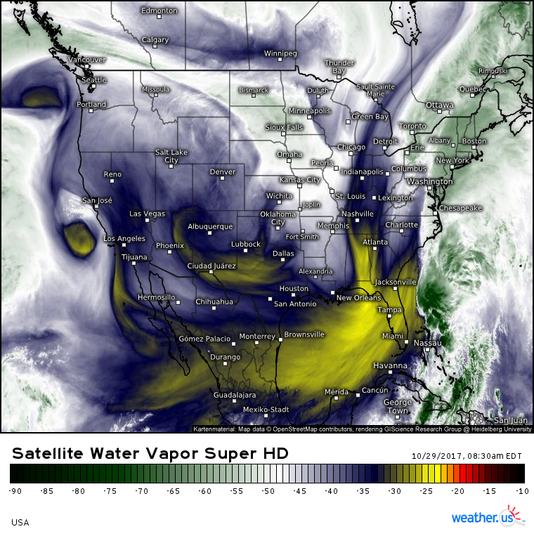
The hardware orbiting our planet has undergone a massive upgrade. The latest generation of Geostationary Operational Environmental Satellites (GOES) provides images with four times the resolution of previous models and updates five times faster. This means that instead of seeing where a storm was 15 minutes ago, forecasters see where it is now. This reduction in “data latency” is the primary reason we can now predict the arrival of a storm down to the minute.
AI and Machine Learning: Predicting the “When” and “Where” with Pinpoint Accuracy
While traditional models rely on physics equations, the latest trend in weather tech is the integration of Artificial Intelligence (AI). AI doesn’t just calculate physics; it learns patterns from decades of historical weather data.
Deep Learning Algorithms for Short-Term “Nowcasting”
“Nowcasting” refers to high-resolution forecasting for the immediate future (usually 0 to 6 hours). This is where the question “What time is the storm coming?” is most relevant. Tech giants like Google and NVIDIA have developed AI models—such as GraphCast and SEEDS—that can outperform traditional models in both speed and accuracy.
These AI tools use deep learning to analyze radar imagery. By looking at the shape, intensity, and trajectory of storm cells, the AI can predict their movement much faster than a human meteorologist. Because AI can process millions of data points in seconds, it can provide real-time updates that adjust as the storm accelerates or slows down.
Reducing the Margin of Error in Storm Velocity Predictions
One of the greatest challenges in timing a storm is “velocity variance.” A storm front may be moving at 30 mph, but internal downdrafts can cause segments of it to surge forward. Machine learning algorithms are particularly adept at identifying these micro-patterns. By analyzing “optical flow”—the pattern of apparent motion of objects in a visual scene—AI can detect when a storm is gaining momentum before it is visible to the naked eye on a standard radar map.
The Essential Toolkit: Top Tech Apps and Gadgets for Real-Time Tracking
The sophisticated data gathered by satellites and processed by supercomputers is useless if it doesn’t reach the end user. The “last mile” of weather technology is the consumer-facing software and hardware that translates “30.02 barometric pressure” into “get inside now.”
Hyper-Local Apps: The Legacy of Dark Sky and Its Successors
The gold standard for “what time” was famously set by the app Dark Sky (now integrated into Apple Weather). This app pioneered the use of hyper-local data, using your phone’s GPS to provide a forecast for your exact street corner rather than your general city.
Today, apps like Carrot Weather, AccuWeather’s MinuteCast, and Windy.com use “crowdsourced” data. Many modern smartphones contain internal barometers to help with GPS calibration; some apps can aggregate this anonymized pressure data from millions of phones to create a real-time, ground-level pressure map. This creates a “mesh” of data points that supplements official weather stations.
Personal Weather Stations (PWS) and IoT Integration
For those who need even more precision, the Internet of Things (IoT) has brought professional-grade hardware to the consumer level. Systems like the Tempest Weather System or Netatmo use haptic rain sensors and sonic anemometers (which have no moving parts) to feed data directly into the cloud.
When you ask your smart home assistant “What time is the storm coming?”, it may be pulling data from a neighbor’s personal weather station three blocks away rather than an airport sensor thirty miles away. This ecosystem of connected gadgets has democratized high-fidelity weather tracking.
Digital Security and Infrastructure During Extreme Weather
Technology doesn’t just tell us when the storm is coming; it has to survive the storm itself. As we become more dependent on digital tools for safety, the resilience of our tech infrastructure becomes a critical topic of digital security and engineering.
Ensuring Cloud Uptime and Data Center Resilience
When a major storm hits, the spike in traffic to weather websites and apps is astronomical. This requires massive scalability in cloud computing. Tech companies use “edge computing” to distribute the load, ensuring that even if one data center is affected by the storm, the “what time” notifications continue to flow.
Furthermore, data centers are now being designed with extreme climate hardening. From liquid cooling systems that handle heat waves to massive UPS (Uninterruptible Power Supply) arrays and redundant fiber-optic lines buried deep underground, the “cloud” is increasingly built to withstand the very storms it predicts.
The Critical Role of Mesh Networks in Emergency Communication
In a severe storm, traditional cellular towers can fail. This is where “off-grid” technology comes into play. Tools like GoTenna or mesh-networking protocols allow smartphones to communicate directly with one another without a central tower. In the context of “what time is the storm coming,” these mesh networks can share emergency alerts and radar updates across a neighborhood, ensuring that even in a total blackout, the data keeps moving.
The Future of Forecasting: Quantum Computing and Beyond
The quest for the perfect answer to “What time is the storm coming?” is leading us toward the next frontier of tech: Quantum Computing.
Simulating the Unpredictable: Quantum’s Edge in Fluid Dynamics
Atmospheric movement is a “chaotic system,” meaning tiny changes in initial conditions can lead to vastly different outcomes (the Butterfly Effect). Traditional binary computers struggle with the sheer number of variables in fluid dynamics.
Quantum computers, however, operate on qubits, which can represent multiple states simultaneously. This allows them to simulate complex weather patterns with a level of detail that covers every possible variable. We are approaching a future where a quantum-powered forecast won’t just tell you what time the storm is coming today, but what time a storm will arrive three weeks from now with 90% accuracy.
Democratizing Data for Global Resilience
The final piece of the technological puzzle is the democratization of this data. Through open-source APIs and global initiatives, high-tech weather data is being made available to developing nations that previously lacked the infrastructure for storm tracking. Tech platforms are now able to send automated SMS alerts to farmers in remote areas, providing them with the same “what time” precision enjoyed by someone in a smart city.
By leveraging the synergy between hardware, AI, and global connectivity, we have transformed the way we interact with the elements. The question is no longer whether we can predict the storm, but how we use the precious minutes that technology provides us to stay safe and prepared. Whether it is through an AI-driven notification on your phone or a quantum simulation in a lab, the “storm” is now a data point we can manage with confidence.
aViewFromTheCave is a participant in the Amazon Services LLC Associates Program, an affiliate advertising program designed to provide a means for sites to earn advertising fees by advertising and linking to Amazon.com. Amazon, the Amazon logo, AmazonSupply, and the AmazonSupply logo are trademarks of Amazon.com, Inc. or its affiliates. As an Amazon Associate we earn affiliate commissions from qualifying purchases.