
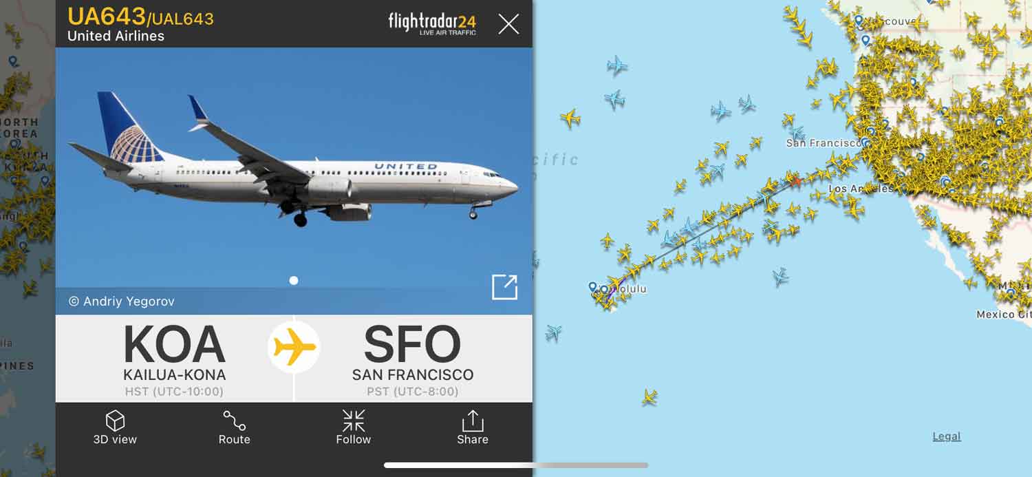
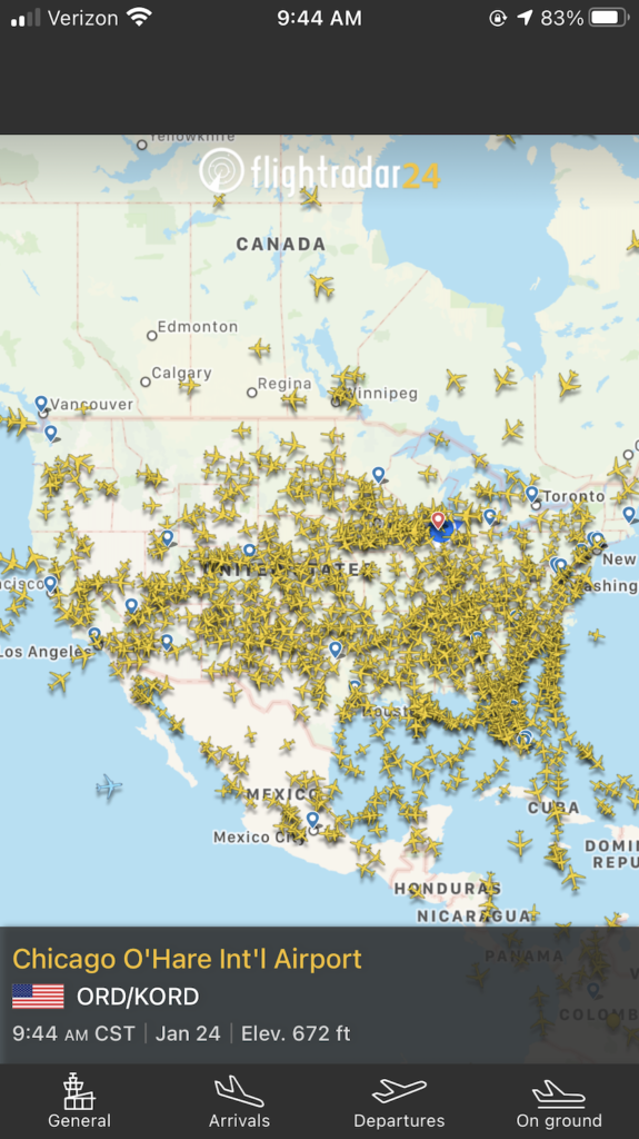
For decades, the answer to the question “what planes are flying above me?” was reserved for air traffic controllers staring at monochromatic green phosphorescent screens in darkened rooms. Today, that information is available to anyone with a smartphone, a web browser, or a handheld radio receiver. The transition of aviation data from classified governmental silos to a democratized digital ecosystem represents one of the most successful implementations of crowdsourced big data and IoT (Internet of Things) technology in the modern era.
To understand how a mobile app can tell you the origin, destination, altitude, and even the vertical speed of a Boeing 787 cruising at 35,000 feet, we must look into the sophisticated hardware and software infrastructure that connects the cockpit to the consumer.
The Foundation of Modern Tracking: ADS-B Technology
The primary technology responsible for modern flight tracking is Automatic Dependent Surveillance-Broadcast (ADS-B). Unlike traditional primary radar, which works by bouncing radio waves off the fuselage of an aircraft to determine its position, ADS-B is a cooperative surveillance technology.
How ADS-B Works
In an ADS-B system, the aircraft determines its own position via satellite navigation (GPS/GNSS). A transponder on the aircraft then periodically broadcasts this position, along with other data such as airspeed, altitude, flight number, and heading, via a radio signal on the 1090 MHz frequency.
This process is “Automatic” because it requires no pilot intervention. It is “Dependent” because it relies on the aircraft’s own navigation system. It is “Surveillance” because it provides position data for air traffic control and other aircraft, and it is “Broadcast” because the signal is sent out to any receiver within range.
The Shift from Ground to Space
Historically, ADS-B relied on ground-based stations. This meant that once a plane flew over the middle of the ocean or a remote mountain range, it disappeared from most real-time tracking maps. However, the tech landscape changed with the introduction of space-based ADS-B. Companies like Aireon have deployed ADS-B receivers on Iridium NEXT satellites. This allows for 100% global coverage, ensuring that even in the most remote regions of the planet, the question of “where is that plane?” can be answered with millisecond precision.
Mode S and Transponder Protocols
ADS-B is part of a broader family of transponder protocols known as Mode S (Select). Mode S provides more information than the older Mode A (identity) or Mode C (altitude) systems. It allows for a unique 24-bit address for every aircraft, which functions much like an IP address for a computer. This unique identifier allows software to query databases and instantly attach a tail number, owner information, and historical flight data to a specific radio signal.
The Global Crowdsourced Network: From Receivers to Cloud
While the aviation industry created the signals, it was the tech community that built the infrastructure to make this data accessible to the public. Websites like Flightradar24, ADSBExchange, and FlightAware do not rely solely on official government feeds. Instead, they utilize a massive, global network of volunteer-operated receivers.
The Role of Software-Defined Radio (SDR)
The democratization of flight tracking was accelerated by the discovery that cheap USB television tuners, based on the Realtek RTL2832U chipset, could be repurposed as wideband Software-Defined Radios (SDR). For less than $30, a hobbyist can set up a station that intercepts 1090 MHz signals.
Software packages like dump1090 act as the bridge between the raw radio waves and readable data. These programs decode the binary messages from the air and convert them into JSON or XML formats that can be pushed to central servers via the internet. This creates a massive distributed computing project where thousands of small nodes contribute to a single, real-time map of the sky.
MLAT: Filling the Gaps with Multilateration
Not every aircraft is equipped with an ADS-B transponder. Many older private planes or military aircraft still use older Mode S or Mode C transponders that do not broadcast GPS coordinates. To track these, the network uses a technique called Multilateration (MLAT).
MLAT is a sophisticated mathematical process that calculates the position of an aircraft by measuring the Time Difference of Arrival (TDOA) of a signal at four or more different ground stations. Because the speed of light is constant, the slight differences in the time it takes for a signal to reach various receivers can be used to triangulate the source. This requires high-precision clock synchronization across the receiver network, often achieved through GPS-disciplined oscillators.
Data Aggregation and API Integration
Once the data reaches a central server, the tech stack becomes even more complex. These platforms must ingest millions of data points per second, filter out noise, and resolve conflicts between different data sources (such as overlapping ADS-B and MLAT reports).

For developers, these platforms offer robust APIs. This allows third-party apps to integrate flight data into travel management tools, logistics software, and even noise-monitoring applications for neighborhoods near airports. The backend usually involves high-performance databases like PostgreSQL with PostGIS for spatial queries, ensuring that when you search for “planes near me,” the system can execute a geographic radius search in real-time.
Consumer Applications and Augmented Reality
The way we interact with this data has moved beyond 2D maps. The integration of high-resolution sensors in modern smartphones—including gyroscopes, accelerometers, and GPS—has birthed the era of Augmented Reality (AR) flight tracking.
AR Overlays and Computer Vision
Many leading flight tracking apps now feature an “AR View.” By pointing your phone’s camera at a plane in the sky, the software uses your device’s current location and the orientation of the camera to cross-reference the live flight database. It then overlays a digital “tag” on the video feed.
This requires incredible precision. The software must account for the curvature of the earth and the atmospheric refraction of light to accurately pin a label on a dot that may be ten miles away. Some advanced experimental systems are even beginning to use computer vision and machine learning to identify aircraft types based on their visual silhouette, providing a secondary layer of verification to the radio data.
Filter and Notification Engines
From a software engineering perspective, the notification engines behind these apps are highly sophisticated. Users can set “triggers” based on specific parameters: “Notify me when a Boeing 747 is within 50 miles,” or “Alert me if a flight squawks 7700 (emergency).” These systems use a pub/sub (publisher/subscriber) architecture to push updates to millions of users simultaneously without overwhelming the server infrastructure.
Security, Privacy, and the Ethics of Open Data
As flight tracking technology becomes more pervasive, it has sparked a significant debate within the tech and aviation communities regarding privacy and security.
Data Encryption and Transparency
Unlike most modern communication protocols, ADS-B signals are unencrypted. This was a deliberate design choice to ensure that any aircraft could “see” any other aircraft to prevent collisions. However, this means that anyone with a $20 receiver can track the movements of high-profile individuals, government officials, or corporate jets.
The “PIA” Program and Censorship
In response to privacy concerns, the FAA (Federal Aviation Administration) in the United States introduced the Privacy ICAO Address (PIA) program. This allows aircraft owners to request a temporary, randomized 24-bit address that isn’t publicly linked to their tail number.
However, the tech community has a divided response. Some platforms, like Flightradar24, honor “block lists” requested by owners. Others, like ADSBExchange, operate on a philosophy of “open data,” showing every signal they receive regardless of the owner’s preference. This tension highlights the ongoing struggle between individual privacy and the transparency afforded by open-source hardware and software.
Cybersecurity Considerations
The lack of encryption in ADS-B also raises theoretical security risks. Researchers have demonstrated that “spoofing”—sending fake ADS-B signals to create “ghost planes” on a controller’s screen—is technically possible with relatively inexpensive hardware. While air traffic control systems have secondary verification methods (like primary radar and flight plan correlation) to mitigate this, the aviation industry is currently working on the next generation of “authenticated” ADS-B to ensure the integrity of the data in an increasingly digital airspace.
The Future: AI and the Autonomous Sky
Looking ahead, the technology used to identify the planes above us will become the backbone of an autonomous air traffic management system. As the skies become more crowded with Unmanned Aerial Vehicles (UAVs) and “air taxis” (eVTOLs), the current human-centric model of air traffic control will reach its limits.
AI-Driven Traffic Management
Machine learning models are already being trained on the massive datasets generated by flight trackers. These models can predict delays hours in advance by analyzing weather patterns, historical gate congestion, and current air traffic density. Eventually, AI will use real-time ADS-B data to autonomously route aircraft for maximum fuel efficiency and minimum noise impact, communicating directly with flight management computers without human intervention.
Integration with the Smart City
In the future, the “planes above you” will be part of a connected urban ecosystem. IoT sensors on buildings will use flight data to adjust indoor acoustics or optimize drone delivery routes. The simple act of looking up and identifying a plane is merely the surface of a deep, interconnected web of radio tech, cloud computing, and planetary-scale data sharing.
What started as a tool for safety has evolved into a global utility. The technology behind flight tracking proves that when we combine open radio standards with a dedicated global community of tech enthusiasts, the world becomes a smaller, more transparent, and more fascinating place. Next time you see a contrail slicing through the blue, remember that you are witnessing the output of a complex, silent digital conversation happening at the speed of light.
aViewFromTheCave is a participant in the Amazon Services LLC Associates Program, an affiliate advertising program designed to provide a means for sites to earn advertising fees by advertising and linking to Amazon.com. Amazon, the Amazon logo, AmazonSupply, and the AmazonSupply logo are trademarks of Amazon.com, Inc. or its affiliates. As an Amazon Associate we earn affiliate commissions from qualifying purchases.