
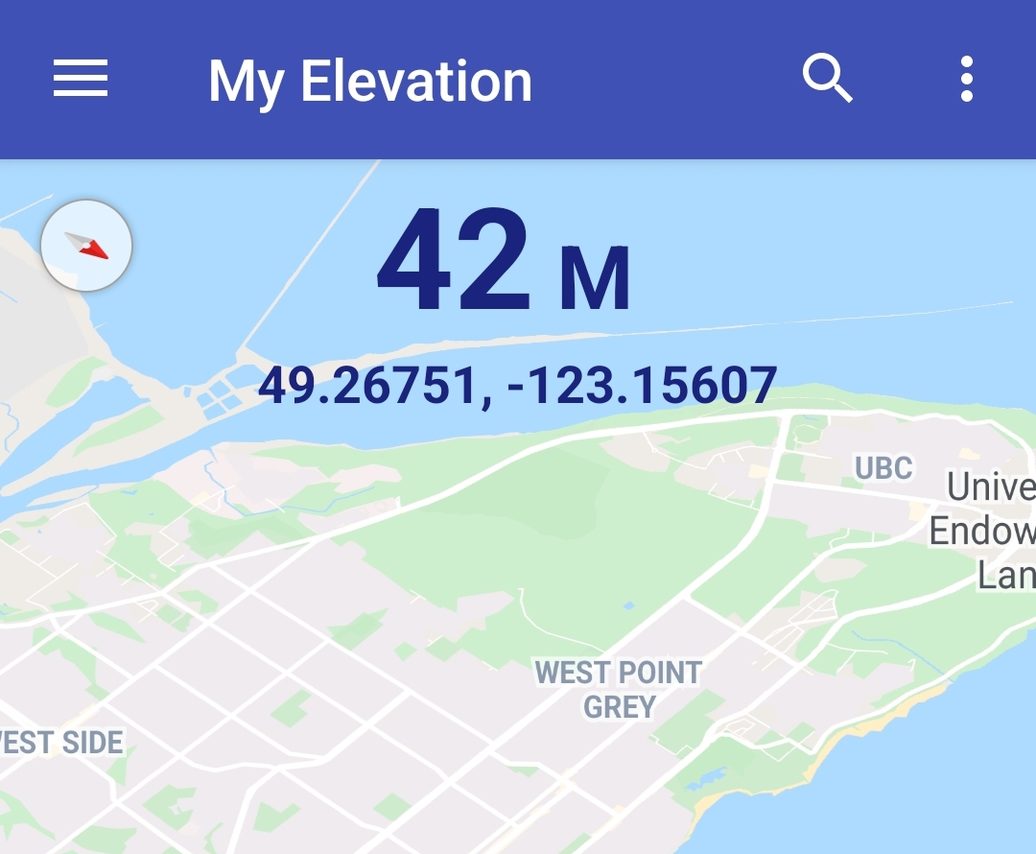
In the contemporary digital era, the question “what is the elevation of my location?” has transitioned from a complex surveying challenge to a simple voice command or a tap on a smartphone. While most users seek this information for recreational activities like hiking or cycling, the technology powering these measurements is a sophisticated intersection of satellite constellations, atmospheric physics, and advanced software engineering. Understanding how your device calculates your height above sea level offers a fascinating glimpse into the world of geospatial technology and the precision of modern data processing.
The Science Behind Elevation: How Your Device Knows Where You Are
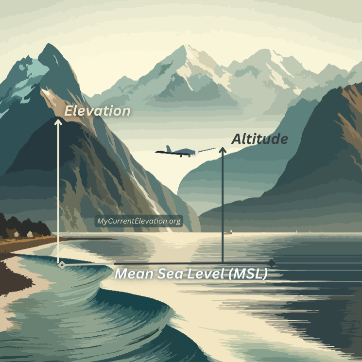
The ability to determine elevation—the vertical distance of a point above a reference surface, usually Mean Sea Level (MSL)—relies on a variety of sensors and data sets. Modern technology does not just “guess” your height; it triangulates your position using global infrastructure.
GPS vs. Barometric Altimeters
Most smartphones and wearable devices use Global Positioning System (GPS) or more broadly, Global Navigation Satellite Systems (GNSS), to determine 3D coordinates. However, GPS is notoriously better at horizontal positioning than vertical. To provide high-accuracy elevation, many premium tech devices, such as the Apple Watch Ultra or Garmin handhelds, include a barometric altimeter. This sensor measures changes in atmospheric pressure. As you go higher, the air pressure drops. By combining GPS data with local pressure readings, these devices can provide real-time elevation changes with incredible granularity, often down to a few centimeters.
Global Digital Elevation Models (DEMs)
When you use a web-based tool to check your elevation, the software often references a Digital Elevation Model (DEM). A DEM is a 3D computer graphics representation of a terrain’s surface. These models are built using data from the Shuttle Radar Topography Mission (SRTM) or satellite-based LiDAR (Light Detection and Ranging). When you input your coordinates, the application queries a massive database that has mapped the entire planet into a grid, returning the specific elevation value assigned to that “pixel” of the earth’s surface.
Height Above Ellipsoid (HAE) vs. Mean Sea Level (MSL)
A common technical hurdle in elevation software is the difference between the Earth’s mathematical shape (the ellipsoid) and its actual gravitational shape (the geoid). Pure GPS data usually provides “Height Above Ellipsoid,” which can vary from the actual “sea level” by over 100 meters in certain parts of the world. Modern mapping software utilizes “Geoid Undulation” tables to automatically correct these readings, ensuring that when you ask for your elevation, you receive a number that matches the physical reality of the terrain relative to the ocean.
Top Software Tools and Apps for Finding Your Elevation
The tech market is saturated with applications designed to interpret geospatial data for the average consumer. From built-in OS features to specialized professional software, the accuracy of your results often depends on the tool you select.
Built-in Mobile Features (iOS & Android)
For most users, the quickest way to find elevation is through native apps. On iOS, the “Compass” app provides a live readout of your current elevation and coordinates. This tool leverages the device’s internal barometric sensor for immediate feedback. Android users often rely on Google Maps, though the elevation data is frequently hidden within the “Terrain” view or requires a long-press on a location to see the metadata. These tools are excellent for general use but may lack the calibration options required for professional surveying.
Specialist GIS and Mapping Web Apps
For those requiring high-fidelity data, Geographic Information System (GIS) tools are the gold standard. Platforms like ArcGIS or Google Earth Pro allow users to visualize elevation profiles over distance. These platforms use multi-layered data, combining satellite imagery with topographic contours. Web-based tools such as “FreeMapTools” or “What is my Elevation” use APIs (Application Programming Interfaces) to query the Google Maps Elevation API or the USGS (United States Geological Survey) databases, providing quick, data-rich results that can be exported for research or engineering projects.
The Rise of Dedicated Outdoor Tech
Wearable technology has revolutionized how we interact with elevation data. Devices from companies like Suunto and Polar are designed specifically for “vertical gain.” These gadgets use “FusedAlti” technology—a software algorithm that combines GPS altitude with barometric altitude to eliminate “drift” caused by changing weather patterns. This ensures that if a storm rolls in and the pressure drops, the watch doesn’t falsely report that you have climbed a mountain while sitting in your tent.
The Role of AI and Machine Learning in Precise Elevation Mapping
As we move deeper into the decade, Artificial Intelligence (AI) is playing an increasingly vital role in refining how we perceive and measure the earth’s surface. Raw data from satellites is often “noisy” due to cloud cover, vegetation, or urban structures (the “urban canyon” effect).
Improving LiDAR Data with Neural Networks
LiDAR technology uses laser pulses to map the ground, but these lasers often bounce off treetops or buildings rather than the actual soil. AI algorithms are now being trained to distinguish between “canopy” and “ground.” By processing billions of data points through neural networks, tech companies can create “Bare Earth” models that strip away trees and structures to provide the most accurate ground elevation possible. This is crucial for flood modeling and telecommunications infrastructure planning.
Real-time Data Correction and Augmented Reality
AI is also being used to enhance the user experience on mobile devices. Augmented Reality (AR) apps can now overlay elevation data directly onto your camera view. By using computer vision, your phone can recognize mountain peaks in the distance and label them with their exact heights in real-time. This requires the AI to synthesize your GPS location, the phone’s orientation, and a vast database of topographic features simultaneously.
Practical Applications of Elevation Data in the Digital Age
Knowing the elevation of your location is more than a point of curiosity; it is a critical data point for several modern industries and daily tech-driven activities.
Smart Infrastructure and Urban Planning
In the realm of “Smart Cities,” elevation data is foundational. Engineers use high-resolution elevation maps to design drainage systems and predict how water will flow during extreme weather events. Furthermore, the placement of 5G small cell towers is heavily dependent on elevation. Because 5G signals have a shorter range and are easily blocked, software must calculate the “Line of Sight” (LoS) between nodes, which requires knowing the exact elevation of every building and street corner.
Outdoor Tech, Fitness Tracking, and Bio-metrics
For athletes, elevation is a key metric for calculating “Work” and “Caloric Burn.” Standard GPS tracking only measures distance on a 2D plane. However, running 5 miles on flat ground is vastly different from running 5 miles with 1,000 feet of elevation gain. Modern fitness software like Strava or TrainingPeaks uses elevation data to calculate “Grade Adjusted Pace” (GAP), providing a more accurate tech-driven analysis of human performance and cardiovascular strain.
Aviation and Drone Technology
The drone (UAV) industry is perhaps the most tech-dependent consumer of elevation data. Flight controllers must know the elevation of the take-off point versus the surrounding obstacles to comply with “Above Ground Level” (AGL) regulations. Sophisticated “Terrain Follow” features allow drones to maintain a consistent height above the ground as the landscape rises and falls, a feat made possible by integrating real-time sensor data with pre-loaded digital elevation maps.
Cybersecurity and Privacy Concerns in Geospatial Tracking
While the technology to find your elevation is impressive, it also introduces significant digital security and privacy considerations. Location data is among the most sensitive information a user can share.
Geofencing and Metadata Vulnerabilities
When you use an app to find your elevation, you are often providing that app with your exact XYZ coordinates. This data can be stored in the metadata of photos or shared with third-party advertisers. High-precision elevation data can actually make you more identifiable. For instance, knowing someone is at a specific latitude and longitude is one thing; knowing they are on the 42nd floor of a specific building (based on elevation) provides a level of granular tracking that can be exploited if not properly encrypted.
Protecting Your Digital Footprint
To mitigate these risks, users should be mindful of “Location Services” permissions. Many apps do not need your precise location or elevation to function. Tech-savvy users often use “Fuzzy” location settings or VPNs, though these will obviously interfere with the accuracy of elevation readings. The tech industry is currently moving toward “Differential Privacy” models, where companies can collect aggregate elevation data for mapping without tying it to a specific, identifiable user ID.
In conclusion, asking “what is the elevation of my location?” triggers a chain reaction of technological marvels. From satellites orbiting 20,000 kilometers above the earth to AI algorithms scrubbing LiDAR data for noise, the answer is a product of some of the most advanced software and hardware ever created. Whether you are an engineer planning a city or a hiker checking your progress, the digital elevation data at your fingertips is a testament to the incredible precision of the modern tech landscape.
aViewFromTheCave is a participant in the Amazon Services LLC Associates Program, an affiliate advertising program designed to provide a means for sites to earn advertising fees by advertising and linking to Amazon.com. Amazon, the Amazon logo, AmazonSupply, and the AmazonSupply logo are trademarks of Amazon.com, Inc. or its affiliates. As an Amazon Associate we earn affiliate commissions from qualifying purchases.