In the modern era of instant communication and global positioning systems, the humble postal code—known in the United States as the ZIP Code—might seem like a relic of a pre-digital age. However, beneath its five-digit surface lies a sophisticated technological framework that powers global logistics, e-commerce, and data analytics. Far from being a simple sorting tool, the U.S. postal code system is a masterpiece of data architecture that has evolved alongside the computer age, transitioning from manual sorting racks to high-speed optical character recognition (OCR) and complex machine-learning algorithms.

The Evolution of the ZIP Code: From Manual Sorting to Automated Data Infrastructure
The term “ZIP” stands for Zone Improvement Plan, a system introduced by the United States Postal Service (USPS) in 1963. At its inception, the goal was simple: to manage the exploding volume of mail by creating a standardized numerical hierarchy. However, the true tech story begins with how this numerical system was designed to be machine-readable long before modern computing was ubiquitous.
The Birth of the Zone Improvement Plan (ZIP)
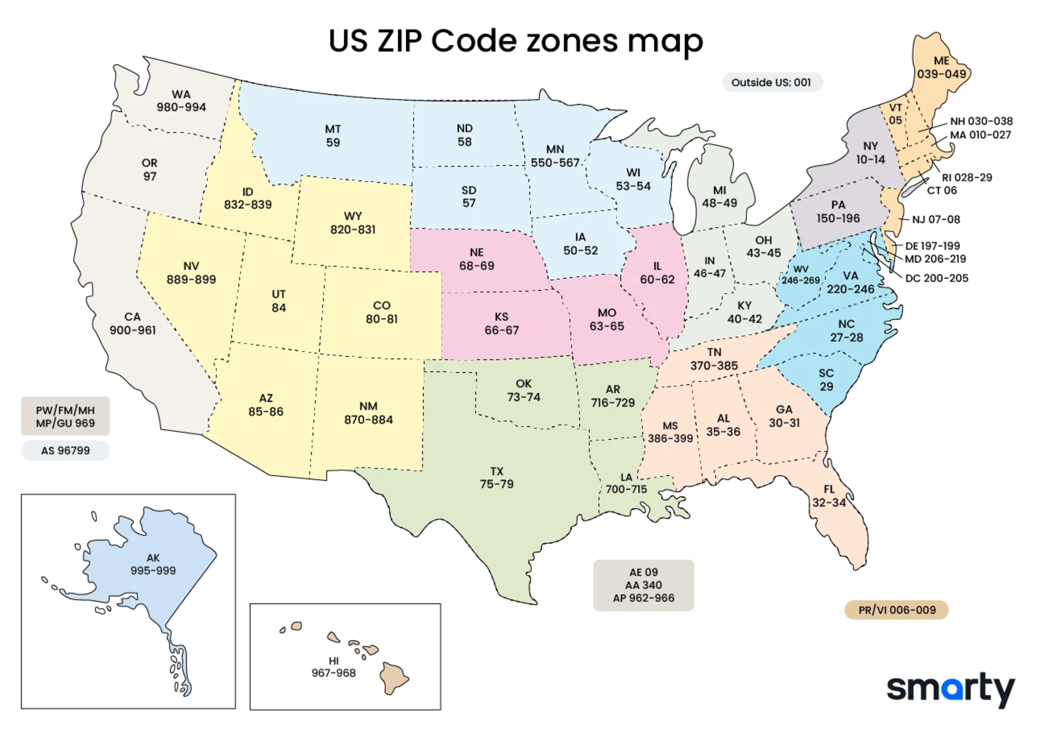
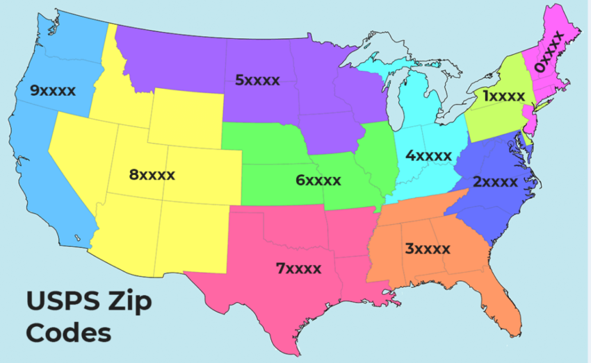
The initial five-digit code was designed as a data hierarchy. The first digit represents a group of U.S. states, the second and third digits represent a central mail processing facility (a sectional center facility), and the final two digits represent the specific post office or delivery area. This hierarchical structure was the precursor to modern database indexing, allowing the USPS to “shard” the massive task of national delivery into manageable digital and physical segments.
Digitizing the Grid: Transitioning to the ZIP+4 System
In 1983, the system underwent a significant technological upgrade with the introduction of ZIP+4. By adding a hyphen and four extra digits, the USPS created a more granular data map. The first two digits of the +4 code represent a specific sector (such as a group of streets or large buildings), while the last two digits represent a specific segment (such as one side of a city block). This transition allowed for a level of precision that modern logistics software relies on for “last-mile” delivery optimization.
How Optical Character Recognition (OCR) Revolutionized Sorting
One of the greatest leaps in postal technology was the implementation of Optical Character Recognition. Today, high-speed sorters can read thousands of envelopes per minute. These machines utilize advanced image processing to identify handwritten or printed ZIP codes, cross-reference them with the USPS National Address Database, and print a POSTNET or Intelligent Mail barcode (IMb) on the envelope. This process is a foundational example of computer vision and automated data entry that paved the way for modern AI-driven image recognition tools.
Integrating Postal Data into Modern Software Ecosystems
For developers and tech companies, the U.S. postal code system is more than a mailing address; it is a primary key in the world’s most extensive geospatial databases. Integrating this data into modern applications requires a deep understanding of APIs, data standardization, and geospatial analysis.
API Integration: Powering E-commerce and Logistics Apps
Every time a user enters a ZIP code on an e-commerce site to calculate shipping or find a store, an API (Application Programming Interface) is working behind the scenes. Developers typically use the USPS Web Tools API or third-party services like Smarty or Google Maps Platform. These APIs take a raw ZIP code and return structured data, including city, state, and even latitude/longitude coordinates. This seamless integration is critical for modern UX/UI design, reducing friction by auto-populating address fields and providing real-time shipping estimates.
Geocoding and Geospatial Analysis
In the tech world, “geocoding” is the process of converting an address or ZIP code into geographic coordinates. This is a cornerstone of Data Science and GIS (Geographic Information Systems). Organizations use ZIP code data to create heat maps, identify service gaps, and optimize supply chain routes. Because ZIP codes are “polygons” (areas) rather than “points” (specific spots), sophisticated spatial software is required to calculate the centroid of a ZIP code or to determine which ZIP code a specific GPS coordinate falls into.
Validating User Data: The Role of Address Standardization Tools
Data integrity is a major challenge for any enterprise software. The USPS maintains the “Coding Accuracy Support System” (CASS), which allows software developers to certify their address-matching software. By running user input through CASS-certified tools, tech platforms ensure that addresses are valid and complete. This prevents “dirty data” from entering the system, which saves millions of dollars in failed delivery costs and ensures that digital databases remain accurate and searchable.
The Intersection of Postal Codes and Digital Security
In the realm of digital security and fintech, the ZIP code serves as a vital layer of authentication. While it may seem like a public piece of information, its role in fraud prevention and data privacy is foundational to modern digital transactions.
Verification as a Fraud Prevention Tool (AVS)
The Address Verification Service (AVS) is a system used by credit card processors to verify that the billing address provided by a customer matches the one on file with the card issuer. Specifically, the ZIP code is one of the two primary pieces of data checked (alongside the house number). If a hacker has a credit card number but doesn’t have the associated ZIP code, the transaction is often flagged or declined. This simple numerical check acts as a primary firewall in the multi-layered world of cybersecurity.
Data Privacy in Geolocation Services
As privacy regulations like GDPR and CCPA become more stringent, the way tech companies handle ZIP codes has shifted. While a full street address is considered Personally Identifiable Information (PII), a ZIP code is often treated as “pseudonymous” data. Tech companies use ZIP codes to provide localized content (like weather or news) without needing to track a user’s exact GPS location. This allows for a balance between personalization and digital privacy, making the postal code a “privacy-friendly” way to handle location data in software development.
Cybersecurity Challenges in National Logistics Networks
The infrastructure that manages ZIP code data is a component of critical national infrastructure. Protecting the USPS databases from cyberattacks is a massive undertaking involving the Postal Inspection Service and federal cybersecurity agencies. A breach or a “data poisoning” attack on the national address database could paralyze supply chains, highlighting the fact that postal codes are central nodes in the nation’s digital and physical security architecture.
Future Trends: AI and the Next Generation of Autonomous Delivery
Looking forward, the U.S. postal code system is being re-imagined through the lens of Artificial Intelligence and autonomous technology. As we move toward a world of drone deliveries and self-driving trucks, the data nested within a ZIP code is becoming even more dynamic.
Machine Learning in Route Optimization
Modern logistics giants like UPS and FedEx use machine learning models that ingest millions of data points associated with specific ZIP codes—traffic patterns, historical delivery times, and even weather forecasts. These algorithms use the ZIP code as a baseline to predict the most efficient route for a delivery vehicle. By optimizing these routes at the “micro-zone” level (the ZIP+4 level), companies can save millions of gallons of fuel and significantly reduce their carbon footprint.
The Role of Postal Data in Smart City Infrastructure
As cities become “smarter,” ZIP code data is being integrated into IoT (Internet of Things) frameworks. Sensors in utility grids, waste management systems, and public transit networks often use postal boundaries to categorize and report data. This allows city planners to use real-time analytics to manage resources. For example, AI can analyze energy consumption patterns by ZIP code to predict grid strain during a heatwave, allowing for proactive adjustments.
Autonomous Delivery and the “Digital Doorway”
The future of the postal code may involve “digital doorways”—virtual identifiers that tell an autonomous drone exactly where to land. While the traditional ZIP code provides the general area, new tech layers are being built on top of it to provide 3D spatial data (including altitude and clearance). In this context, the ZIP code remains the “root directory” of the location, while AI-driven spatial mapping provides the “file path” to the customer’s exact doorstep.
Conclusion
The United States postal code system is far more than a sequence of numbers on a letter; it is a foundational technology that has adapted to every major shift in the digital landscape. From the early days of OCR to the complex API integrations of today’s e-commerce giants, the ZIP code remains a vital piece of data architecture. As we look toward an AI-driven future, the postal code will continue to serve as the bridge between our physical locations and the digital systems that serve them, proving that even in a world of instant data, the “architecture of location” is as relevant as ever.
aViewFromTheCave is a participant in the Amazon Services LLC Associates Program, an affiliate advertising program designed to provide a means for sites to earn advertising fees by advertising and linking to Amazon.com. Amazon, the Amazon logo, AmazonSupply, and the AmazonSupply logo are trademarks of Amazon.com, Inc. or its affiliates. As an Amazon Associate we earn affiliate commissions from qualifying purchases.