
In an increasingly interconnected world, understanding and pinpointing your precise location has become a fundamental aspect of daily life, driven almost entirely by advancements in technology. The simple query “What is my cross street?” once required local knowledge or a physical map; today, it’s a question effortlessly answered by a suite of digital tools and sophisticated underlying systems. From navigating bustling cityscapes to summoning emergency services, technology has transformed how we perceive and interact with our geographical context, making location data indispensable.
The Digital Compass: Foundational Location Technologies
At the heart of our ability to instantly determine a cross street or any other location data lies a complex interplay of several core technologies. These systems work in concert, often seamlessly, to provide the accurate and real-time positioning we rely on.
Global Positioning Systems (GPS)
The most prominent of these technologies is the Global Positioning System (GPS). Developed by the United States government and made globally available, GPS relies on a constellation of Earth-orbiting satellites. Each satellite continuously broadcasts precise timing signals and orbital data. A GPS receiver, common in smartphones, smartwatches, and dedicated navigation devices, listens for these signals from at least four different satellites. By measuring the time it takes for these signals to reach the receiver and knowing the exact position of each satellite at that moment, the receiver can calculate its own position through a process called trilateration.
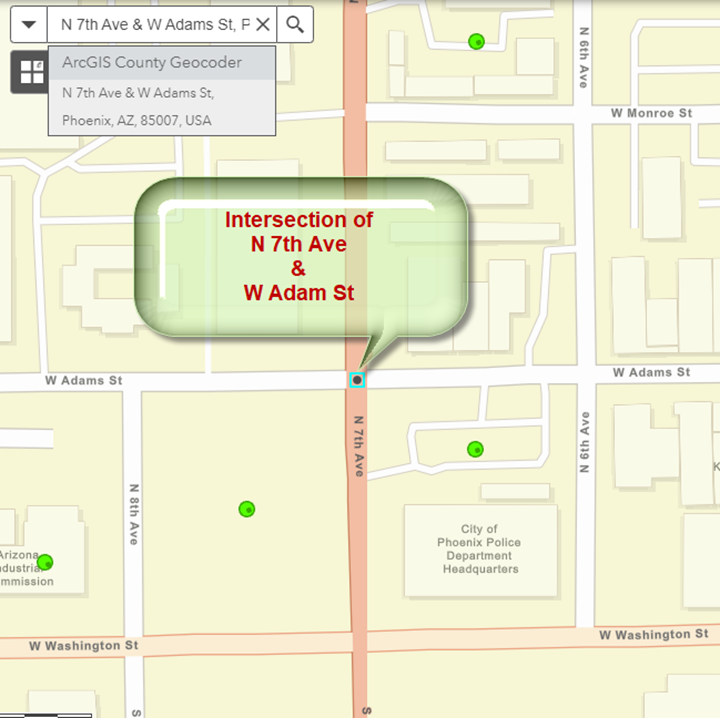
The accuracy of GPS can vary depending on environmental factors like “urban canyons” (tall buildings obstructing signals), heavy tree cover, or atmospheric conditions. Modern GPS receivers, however, often integrate with additional satellite navigation systems like Russia’s GLONASS, Europe’s Galileo, and China’s BeiDou, creating a Global Navigation Satellite System (GNSS) that enhances accuracy and availability worldwide. For a user asking “what is my cross street?”, GPS provides the foundational latitude and longitude coordinates that digital maps then translate into human-readable street addresses and intersections.
Cellular and Wi-Fi Triangulation
While GPS is exceptionally powerful, it’s not always the sole or even primary method for location determination, especially indoors or in dense urban areas where satellite signals can be weak. This is where cellular and Wi-Fi triangulation come into play, providing crucial supplementary data.
Cellular triangulation works by using the signals from nearby cell towers. When a device is connected to a cellular network, it communicates with multiple towers. By measuring the signal strength and time-of-flight from different towers, the network can estimate the device’s approximate position. This method is generally less precise than GPS, typically accurate to within tens or hundreds of meters, but it’s effective in areas with good cellular coverage and serves as a vital fallback.
Wi-Fi positioning, on the other hand, leverages the vast network of Wi-Fi access points. Many tech companies maintain massive databases of Wi-Fi access point locations, often crowdsourced from users. When a device scans for Wi-Fi networks, it detects the unique MAC addresses of nearby access points. By comparing these detected MAC addresses against its database, a device can quickly and accurately estimate its position, often with precision comparable to or even better than GPS in certain indoor environments. This is particularly useful in buildings, shopping malls, or other areas where GPS signals struggle to penetrate. Most smartphones and location-aware devices combine GPS, cellular, and Wi-Fi data, along with accelerometer and gyroscope readings, to produce a highly refined and continuously updated location estimate, providing a seamless experience when seeking your cross street.
Everyday Applications: Your Smartphone as a Locator
The convergence of these powerful location technologies within ubiquitous devices like smartphones has democratized access to precise geographical information. Your smartphone is arguably the most powerful personal location tool ever created, capable of answering “what is my cross street?” with remarkable ease.
Mapping and Navigation Apps
The most common way users interact with location technology is through mapping and navigation applications. Apps like Google Maps, Apple Maps, Waze, and HERE WeGo integrate GPS, Wi-Fi, and cellular data to display your current position on a detailed map. When you open one of these apps, it quickly identifies your location and often displays it as a blue dot. To find your cross street, you simply look at the nearest intersection displayed on the map, or many apps will even vocalize your current address upon request.
These applications do more than just show your current spot; they provide real-time traffic updates, public transit information, walking directions, and points of interest. Their sophisticated algorithms constantly analyze location data to offer the most efficient routes and estimate arrival times, making them essential for daily commutes, travel, and even exploring new areas without getting lost. The continuous refinement of their underlying map data, often crowdsourced and updated in real-time, ensures that street names and intersections are always current, accurately reflecting even recent urban developments.
Voice Assistants and Smart Devices
Beyond visual map interfaces, voice assistants embedded in smartphones and smart home devices offer an incredibly convenient, hands-free way to discover your location. A simple command to Siri, Google Assistant, or Amazon Alexa, such as “Hey Siri, where am I?” or “Okay Google, what’s my address?” will prompt the assistant to use the device’s location services to articulate your current street address and, frequently, the nearest cross street.
This functionality extends beyond smartphones to smart speakers and displays. While smart speakers themselves might not have onboard GPS, they rely on your associated smartphone’s location data or the Wi-Fi network they are connected to. For instance, if your smart speaker is set up in your home, it often knows its default location and can retrieve local information, including directions starting from that point. This integration of location services with natural language processing makes information retrieval incredibly intuitive and accessible, particularly useful in situations where a user cannot physically interact with a screen.
Web-Based Geolocation Services
Even without a dedicated app or voice assistant, various web-based services can pinpoint your location and provide details like your cross street. Many websites use your IP address, or request permission to access your device’s geolocation services, to customize content, suggest nearby businesses, or offer location-specific information.

Services like WhatIsMyIPAddress.com can show your public IP address and a general geographical area based on that IP. While not precise enough for finding a specific cross street, it gives a broad region. More advanced websites or web APIs that request explicit location access can use the browser’s access to your device’s GPS, Wi-Fi, or cellular data to provide highly accurate coordinates, which they then translate into a physical address using geocoding services. This is commonly seen in online delivery services, ride-sharing platforms, or local search engines, which ask for your location to provide relevant results. Understanding how these web services use your location permissions is crucial for both convenience and privacy.
Advanced Techniques and Future Trends
The quest for ever more precise and contextually aware location information continues to drive innovation. Beyond basic cross street identification, technology is enabling new ways to interact with and understand our surroundings.
Real-Time Location Sharing and Tracking
Real-time location sharing has become a standard feature in many communication and social networking apps. Users can opt to share their live location with friends, family, or colleagues for a specified period, enhancing safety, coordination, and social interaction. Apps like WhatsApp, Google Maps, and Apple’s Find My allow users to see each other’s movements on a map, providing peace of mind and simplifying meet-ups. This capability leverages the same underlying GNSS and Wi-Fi/cellular technologies but adds a layer of constant data transmission and visualization.
Beyond personal sharing, commercial applications for real-time tracking are extensive. Logistics companies track fleets, ride-sharing services monitor drivers and passengers, and public safety agencies can locate individuals in emergencies. The continued development in low-power wide-area networks (LPWAN) and 5G connectivity is set to make real-time tracking even more ubiquitous, reliable, and energy-efficient, extending its reach to a wider array of devices and use cases.
Indoor Positioning Systems (IPS) and Augmented Reality
While GPS excels outdoors, navigating large indoor spaces like airports, shopping malls, or hospitals remains a challenge. This is where Indoor Positioning Systems (IPS) come into their own. IPS technologies utilize a variety of methods, including Wi-Fi signals, Bluetooth Low Energy (BLE) beacons, magnetic fields, and even visible light communication, to accurately pinpoint a user’s location within a building. Combined with detailed indoor maps, IPS can guide users to specific stores, gates, or departments, making “what is my cross street?” evolve into “what is my nearest store entrance?”
Augmented Reality (AR) further enhances the location experience by overlaying digital information onto the real world. AR navigation apps, for example, can use your smartphone camera to show arrows and directions superimposed on the live street view, making it easier to follow complex routes or identify specific buildings and landmarks. This technology, combined with precise location data, offers an intuitive and immersive way to interact with geographical information, turning your environment into an interactive guide.
The Internet of Things (IoT) and Ubiquitous Location
The proliferation of Internet of Things (IoT) devices is leading to a future where location awareness is not just confined to smartphones but embedded into countless objects. From smart city sensors tracking traffic flow to asset trackers monitoring valuable equipment, the ability of devices to know their location and communicate it is becoming foundational. Smart vehicles, drones, and even wearable devices are constantly collecting and sharing location data, contributing to a more comprehensive and dynamic understanding of our physical world. This ubiquitous location data fuels smarter services, more efficient resource allocation, and new forms of interaction with our environment, far beyond simply finding a cross street.
Navigating Privacy and Security in a Location-Aware World
The incredible utility of location technology comes with inherent responsibilities regarding privacy and security. As devices become more adept at pinpointing our every move, understanding how this data is used and how to manage it is paramount.
Managing Location Permissions
Most modern operating systems (iOS, Android, Windows, macOS) provide granular control over which applications and services can access your location data. Users can typically choose to grant location access:
- Never: The app cannot access your location.
- While Using the App: Location access is granted only when the app is actively open and in use.
- Always (or All the Time): The app can access your location in the background, even when not actively open.
It is crucial to regularly review and adjust these permissions for all your apps. Granting “Always” access should be reserved for apps where continuous location tracking is genuinely necessary and beneficial, such as navigation apps, fitness trackers, or family safety tools. For others, “While Using” is often sufficient, minimizing the risk of unnecessary background tracking.
Understanding Data Collection and Usage
Beyond explicit permissions, it’s important to be aware of how location data is collected, stored, and potentially used by tech companies. Many services use aggregated and anonymized location data to improve their products (e.g., real-time traffic updates) or for targeted advertising. While individual privacy is often protected through anonymization, the sheer volume of data collected provides powerful insights into population movements and behaviors. Reading privacy policies and understanding data retention practices can help users make informed decisions about the services they use and the data they share.

Strategies for Enhanced Privacy
For users who prioritize location privacy, several strategies can be employed:
- Turn off Location Services: When not actively needing location functionality, temporarily disabling location services on your device can prevent all apps from accessing your position.
- Use a Virtual Private Network (VPN): While a VPN won’t hide your device’s physical location from GPS, it can mask your IP address, making it harder for websites and online services to broadly infer your geographical location based solely on your internet connection.
- Be Mindful of Geotagging: Photos and social media posts often include geotags (location metadata). Reviewing privacy settings on social media platforms and being cautious about sharing geotagged content publicly can prevent unintended disclosure of your whereabouts.
- Incognito/Private Browsing: While not directly affecting device location services, using private browsing modes can prevent websites from storing cookies and other trackers that might contribute to location profiling.
In conclusion, answering “what is my cross street?” is no longer a challenge but an example of how profoundly technology has embedded itself into our lives. From the satellites orbiting Earth to the microchips in our pockets, a vast technological ecosystem works tirelessly to provide us with instant, accurate, and actionable location intelligence. As these technologies continue to evolve, they promise even greater convenience and richer interactions with our physical world, underscoring the ongoing need for informed decision-making regarding our digital footprint and privacy.
aViewFromTheCave is a participant in the Amazon Services LLC Associates Program, an affiliate advertising program designed to provide a means for sites to earn advertising fees by advertising and linking to Amazon.com. Amazon, the Amazon logo, AmazonSupply, and the AmazonSupply logo are trademarks of Amazon.com, Inc. or its affiliates. As an Amazon Associate we earn affiliate commissions from qualifying purchases.