In the realm of meteorology, a “Lake Effect Snow Warning” is far more than a simple weather advisory; it is the culmination of a sophisticated digital ecosystem. While the average resident in the Great Lakes region or the Tug Hill Plateau sees it as a signal to grab a shovel, the tech industry views it as a triumph of high-performance computing, remote sensing, and algorithmic precision. Understanding what a Lake Effect Snow Warning is requires a deep dive into the software, hardware, and data science that transform raw atmospheric variables into life-saving digital alerts.
This article explores the technological infrastructure required to issue these specific warnings, the AI tools currently revolutionizing snowband prediction, and the digital communication networks that ensure these alerts reach the right screens at the right time.
The Algorithmic Precision of Modern Meteorology
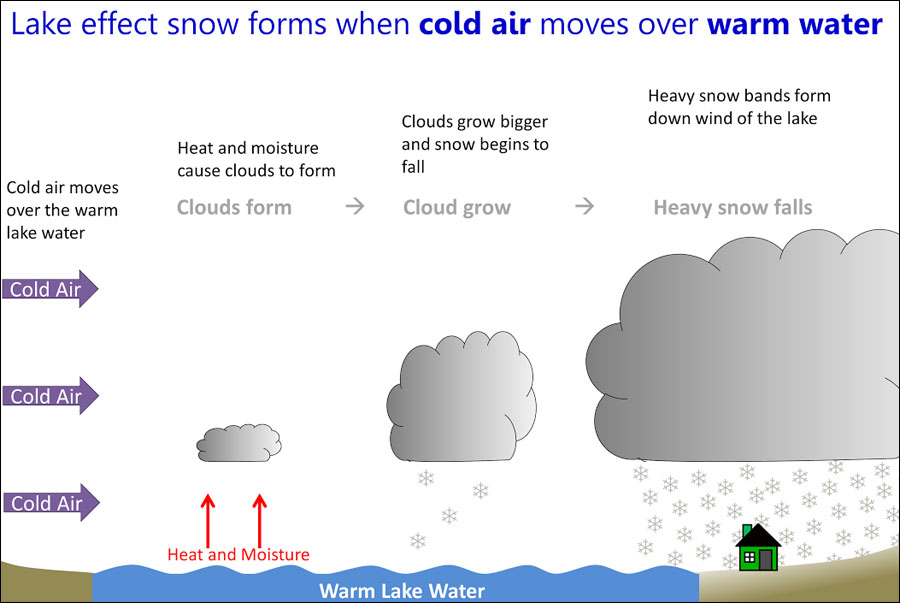
At its core, a Lake Effect Snow Warning is a data-driven threshold event. In the United States, the National Weather Service (NWS) issues these warnings when a localized “lake effect” snow event is expected to produce significant accumulation—usually seven inches or more in 12 hours. However, identifying the exact moment these conditions are met relies on a complex stack of software and hardware.
Doppler Radar and Dual-Polarization Technology
The primary hardware tool for detecting lake effect snow is the NEXRAD (Next-Generation Radar) system. Modern radar has been upgraded to “Dual-Polarization” (Dual-Pol), which sends and receives both horizontal and vertical pulses. This allows software to identify the shape of the particles in the air. In the context of a lake effect warning, this tech is crucial because it allows meteorologists to distinguish between light, fluffy snow, heavy “wet” snow, and non-weather artifacts like birds or insects. The algorithms processing this Dual-Pol data provide the high-resolution imagery necessary to see narrow snowbands that might be only a few miles wide but incredibly intense.
High-Resolution Rapid Refresh (HRRR) Models
The “software” that predicts these warnings is largely comprised of numerical weather prediction (NWP) models. The High-Resolution Rapid Refresh (HRRR) is a real-time 3-km resolution, hourly updated, cloud-resolving atmospheric model. Unlike older global models, the HRRR is specifically tuned to the mesoscale—the scale where lake effect snow lives. It simulates the interaction between the warm lake surface and the cold air mass, using complex physics engines to predict exactly where a band will “lock in.” Without this high-fidelity modeling software, the “warning” would lack the geographical specificity needed for modern digital mapping.
Artificial Intelligence and Predictive Analytics in Snow Forecasting
The challenge of lake effect snow is its volatility. A shift of five miles in wind direction can mean the difference between a dusting and three feet of snow. This is where Artificial Intelligence (AI) and Machine Learning (ML) are beginning to play a transformative role in the issuance of warnings.
Machine Learning for Pattern Recognition
Meteorologists are now utilizing machine learning algorithms to analyze decades of historical lake effect data. These AI tools can recognize “signatures” in the atmosphere that preceded historical blizzard-level events. By training models on petabytes of historical radar and satellite data, software can now alert forecasters to the probability of a warning-level event hours before the first snowflake falls. These predictive analytics tools act as a force multiplier for human forecasters, highlighting subtle trends in wind fetch and moisture levels that might otherwise be missed.
The Role of Big Data in Mesoscale Modeling
The “Warning” is the output of a Big Data process. Modern forecasting systems ingest data from thousands of sources, including oceanic buoys, weather balloons (radiosondes), and commercial aircraft. This data is fed into supercomputers that run trillions of calculations per second. The goal is to solve the “Navier-Stokes equations,” the complex mathematical formulas that govern fluid dynamics in the atmosphere. The “Lake Effect Snow Warning” is essentially a user-friendly interface for a massive data science project, translating complex fluid dynamics into a simple, actionable digital notification.
Digital Alert Systems: From Satellites to Smartphones

Once the technology identifies that a Lake Effect Snow Warning is necessary, the focus shifts to the digital infrastructure of dissemination. A warning is only effective if it reaches the user, and the tech behind this “last mile” of communication is incredibly intricate.
Integrated Public Alert and Warning System (IPAWS)
The backbone of the warning delivery is the Integrated Public Alert and Warning System (IPAWS). This is a modern, internet-based platform that aggregates various communication channels. When a meteorologist clicks “send” on a Lake Effect Snow Warning within their software suite, IPAWS automatically routes that data to the Emergency Alert System (EAS), Wireless Emergency Alerts (WEA), and NOAA Weather Radio. This ensures that the digital alert is transformed into a push notification on your smartphone within seconds.
Cloud-Based Dissemination and Geofencing
One of the most significant tech advancements in weather safety is geofencing. In the past, a snow warning might cover an entire county, even if the snowband only affected a small portion of it. Today, the NWS uses “storm-based warnings” or polygons. These are digital shapes drawn on a map in a specialized software environment. Through GPS and cellular tower triangulation, the warning system “pings” only the devices physically located within that polygon. This high-tech precision reduces “warning fatigue” and ensures that the digital noise is relevant to the user’s exact coordinates.
IoT and Sensor Networks: Enhancing Ground-Truth Data
The accuracy of a Lake Effect Snow Warning is constantly being refined by the Internet of Things (IoT). The gap between what a satellite sees from space and what is happening on the ground is bridged by a growing network of connected sensors.
Automated Surface Observing Systems (ASOS)
The ASOS is a suite of sensors located primarily at airports. These systems use laser-based “ceilometers” to measure cloud height and visibility, and ultrasonic sensors to measure snow depth in real-time. This data is streamed via dedicated digital networks back to the forecasting offices. If the sensors detect a sudden drop in visibility—common in lake effect “whiteouts”—the software can trigger an automatic escalation of the warning status.
Citizen Science and Crowdsourced Data Apps
Modern tech has turned every smartphone user into a potential data point. Apps like mPING (Meteorological Phenomena Identification Near the Ground) allow users to submit real-time reports of weather conditions. This crowdsourced data is fed directly into the NWS workstation software. For a lake effect event, where conditions vary wildly over short distances, this “human-sensor” network provides the “ground truth” that validates the radar data. It is a perfect example of a decentralized, digital-first approach to public safety.
The Future of Winter Tech: Quantum Computing and Beyond
As we look toward the future, the “Lake Effect Snow Warning” will become even more precise, driven by the next generation of computing power.
Quantum Computing and Atmospheric Simulation
Standard binary computers are reaching their limits in terms of how fast they can simulate the atmosphere. Quantum computing offers the potential to process the massive variables of lake effect snow—water temperature, air temperature, wind shear, and ice cover—simultaneously. This would allow for “hyper-local” warnings that could predict snowfall amounts down to the specific city block, rather than the general region.

The Integration of Autonomous Vehicle Tech
The technology behind the warning is also beginning to communicate directly with other machines. For instance, smart city infrastructure and autonomous vehicle (AV) software can now ingest weather warning data via API. When a Lake Effect Snow Warning is issued, the digital “handshake” can automatically update the routing algorithms of self-driving trucks or adjust the timing of smart traffic lights to account for slick conditions. In this context, the warning is no longer just a message for humans; it is a critical data input for an increasingly automated world.
In summary, a Lake Effect Snow Warning is the visible tip of a massive technological iceberg. It is the result of high-resolution radar hardware, AI-driven predictive software, and a global network of IoT sensors and cloud-based communication systems. As these technologies continue to evolve, the “warning” will transform from a broad advisory into a hyper-precise digital tool, saving lives and protecting infrastructure through the power of data.
aViewFromTheCave is a participant in the Amazon Services LLC Associates Program, an affiliate advertising program designed to provide a means for sites to earn advertising fees by advertising and linking to Amazon.com. Amazon, the Amazon logo, AmazonSupply, and the AmazonSupply logo are trademarks of Amazon.com, Inc. or its affiliates. As an Amazon Associate we earn affiliate commissions from qualifying purchases.