
In the rapidly evolving landscape of spatial data science, one software package stands out as the definitive tool for professionals: ArcGIS Pro, often referred to simply as ArcPro. Developed by Esri, the global leader in geographic information systems (GIS), ArcPro is a high-performance, 64-bit desktop application that enables users to visualize, analyze, and manage geographic data. Unlike its predecessors, it is designed to meet the demands of a modern, interconnected digital world, bridging the gap between traditional cartography and advanced data science.
For the uninitiated, ArcPro might seem like a sophisticated mapping tool. However, for those in the tech sector, it represents a robust platform for spatial modeling, big data integration, and collaborative cloud workflows. It is the core component of the broader ArcGIS ecosystem, providing the engine that powers everything from local municipal planning to global environmental monitoring.
The Evolution of Geospatial Technology: From ArcMap to ArcGIS Pro
To understand what ArcPro is today, one must first understand its lineage. For decades, the industry standard was ArcMap, a 32-bit application that served GIS professionals well but eventually began to reach the limits of modern computing hardware. As datasets grew in size and complexity, the need for a more powerful architecture became undeniable.
The Transition to 64-bit Architecture
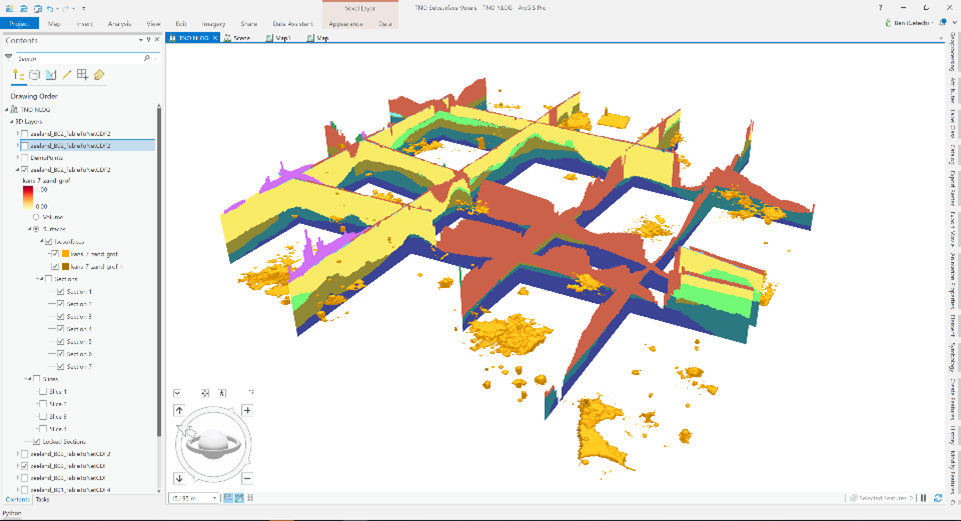
The shift from ArcMap to ArcPro was not merely a cosmetic update; it was a fundamental re-engineering of the software’s core. By adopting a 64-bit, multi-threaded architecture, ArcPro can leverage the full power of modern processors and high-performance RAM. This allows for significantly faster processing of massive datasets, smoother rendering of complex 3D scenes, and the ability to run multiple geoprocessing tools simultaneously without crashing the system. For developers and data analysts, this performance leap transformed GIS from a slow, methodical process into a dynamic, real-time exploration of spatial patterns.
The Modern User Interface: Contextual Ribbons
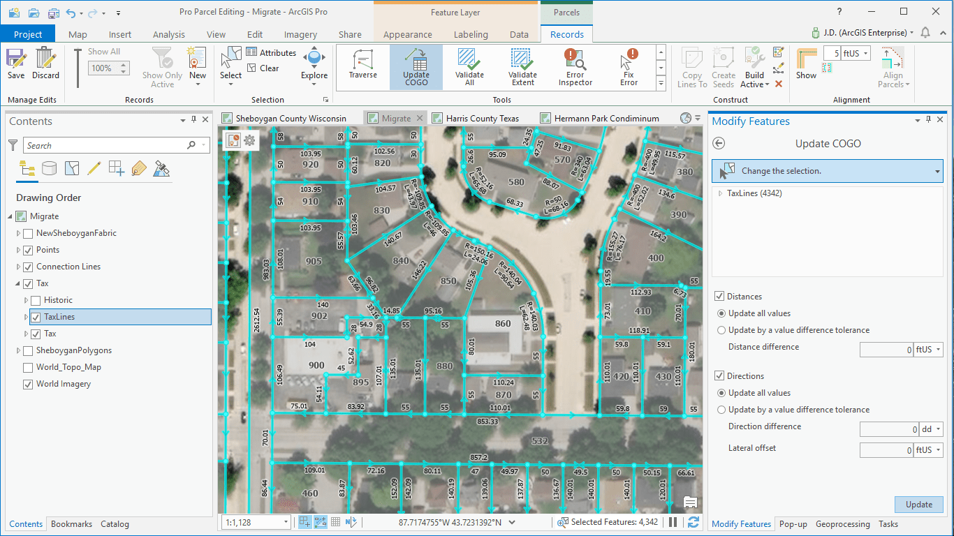
One of the first things users notice when moving to ArcPro is its interface. Esri moved away from the cluttered toolbars and nested menus of the past in favor of a modern, ribbon-based interface similar to Microsoft Office. This design is contextual; the tools you see on the screen change based on the data you have selected or the task you are performing. This reduces the “search time” for specific functions and streamlines the workflow, making the software more accessible to new users while maintaining the depth required by power users.
Core Capabilities and Features of ArcPro
At its heart, ArcPro is designed to be a “workstation” for spatial data. It is where raw data is transformed into actionable intelligence through a suite of integrated features.
Unified 2D and 3D Visualization
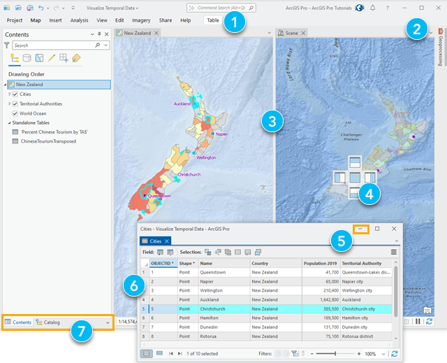
In the past, working in 2D and 3D required separate applications (ArcMap and ArcScene/ArcGlobe). ArcPro eliminates this barrier. Users can work with 2D maps and 3D scenes side-by-side within the same project. This unification is critical for industries like urban planning and telecommunications, where the vertical dimension—such as building heights or signal propagation—is just as important as the horizontal coordinates. The software’s ability to link these views ensures that any change made in a 2D map is instantly reflected in the 3D scene, providing a holistic view of the data.
Advanced Spatial Analysis and Geoprocessing
The true power of ArcPro lies in its analytical engine. It contains over 1,000 geoprocessing tools that allow users to perform complex spatial operations. This includes everything from simple proximity analysis (buffer zones) to advanced statistical modeling and predictive analysis.
Beyond standard vector and raster analysis, ArcPro excels in specialized fields. Its Network Analyst tools help logistics companies optimize delivery routes, while the Spatial Analyst extension provides deep insights into terrain, suitability modeling, and hydrological flows. By leveraging the software’s processing power, users can run “what-if” scenarios that were previously too computationally expensive to perform on a desktop.
Data Management and Multi-user Editing
ArcPro is built for data integrity. It supports a wide array of data formats, including CAD files, BIM (Building Information Modeling) data, Lidar point clouds, and real-time sensor feeds. Its integration with enterprise databases allows for multi-user editing environments where entire teams can contribute to a single “versioned” database. This ensures that as dozens of technicians update utility lines or land parcels, the master dataset remains accurate, consistent, and secure.
Integration within the Modern Tech Stack
In the current tech ecosystem, no software is an island. ArcPro is designed to be highly connective, functioning as the desktop “client” for a much larger web-based infrastructure.
Seamless Connectivity with ArcGIS Online and Enterprise
ArcPro is inherently a “web-GIS” application. It is built to communicate natively with ArcGIS Online (SaaS) and ArcGIS Enterprise (PaaS). This means that once a map or a model is created in ArcPro, it can be published directly to the web with a few clicks. These web layers can then be consumed by mobile apps in the field, embedded in dashboards for executive decision-making, or shared with the public through interactive story maps. This seamless loop—from desktop analysis to cloud distribution and mobile collection—is what makes the ArcGIS ecosystem so dominant in the corporate and government sectors.
Python Integration and the Power of ArcPy
For tech professionals, the inclusion of Python is perhaps ArcPro’s most compelling feature. ArcPro comes bundled with a dedicated Conda environment and the ArcPy library. This allows users to automate repetitive tasks, create custom tools, and integrate GIS workflows into broader data science pipelines.
By using Jupyter Notebooks directly within the ArcPro interface, analysts can combine live code, visualizations, and narrative text. This integration allows GIS to speak the same language as data science, enabling the use of libraries like Pandas, NumPy, and SciPy alongside spatial data. Automation via Python doesn’t just save time; it ensures reproducibility and precision in complex scientific workflows.
Deep Learning and Artificial Intelligence (GeoAI)
As AI continues to reshape technology, ArcPro has integrated Geospatial AI (GeoAI) tools into its core. The software provides built-in tools for object detection, pixel classification, and feature extraction from imagery. Using pre-trained deep learning models, an organization can automatically identify every swimming pool in a county from satellite imagery or detect cracks in pavement from drone footage. ArcPro acts as the interface for these AI models, providing the training environment and the visualization platform to interpret the results.
Industry Use Cases: How Organizations Leverage ArcPro
The versatility of ArcPro means it is utilized across nearly every industry that relies on physical assets or location-based services.
Urban Planning and Smart Cities
In the realm of urban development, ArcPro is used to create “Digital Twins” of cities. Planners use the software to model new developments and analyze their impact on sunlight, traffic flow, and existing infrastructure. By visualizing 3D buildings and zoning regulations together, cities can communicate complex plans to stakeholders and the public more effectively.
Environmental Monitoring and Conservation
Environmental scientists use ArcPro to track changes in land cover, monitor wildlife habitats, and model the effects of climate change. By analyzing multi-spectral satellite imagery, researchers can detect deforestation or track the health of agricultural crops over time. The software’s ability to handle time-series data allows for the visualization of environmental shifts over decades, providing crucial data for policy decisions.
Utility Management and Infrastructure
Utility companies (water, gas, electricity) use ArcPro to maintain precise digital records of their underground and overhead assets. In the event of a pipe burst or a power outage, ArcPro’s network analysis capabilities allow engineers to quickly identify which valves to turn off or which segments of the grid are affected, minimizing downtime and improving public safety.
Getting Started with ArcPro: Best Practices and Future Trends
Transitioning to or starting with ArcPro requires a modern approach to IT infrastructure. Because of its 64-bit nature and heavy reliance on graphics rendering, the hardware requirements are steeper than traditional office software.
System Requirements and Performance Optimization
To get the most out of ArcPro, a dedicated Graphics Processing Unit (GPU) is highly recommended. The software offloads much of the rendering task to the GPU, which is essential for working with 3D data or large raster datasets. Furthermore, utilizing Solid State Drives (SSDs) and at least 16GB (preferably 32GB) of RAM ensures that the data bottleneck is minimized, allowing the multi-threaded architecture to perform at its peak.
The Future of Desktop GIS
The roadmap for ArcPro suggests a move toward even tighter integration with cloud computing and real-time data. We are seeing a shift where the desktop application acts as a portal to massive cloud-based data warehouses, where the processing happens in the cloud but the visualization and control remain on the analyst’s desk.
As we move forward, the role of ArcPro will continue to expand from a mere mapping tool to a central hub for spatial intelligence. It remains the most powerful bridge between the physical world and the digital data that represents it, making it an essential skill for any professional in the modern technology and data science sectors. Whether you are managing a city’s infrastructure or modeling the next global environmental trend, ArcPro provides the framework to see what others cannot.
aViewFromTheCave is a participant in the Amazon Services LLC Associates Program, an affiliate advertising program designed to provide a means for sites to earn advertising fees by advertising and linking to Amazon.com. Amazon, the Amazon logo, AmazonSupply, and the AmazonSupply logo are trademarks of Amazon.com, Inc. or its affiliates. As an Amazon Associate we earn affiliate commissions from qualifying purchases.