
The natural world is replete with awe-inspiring formations, yet few capture the imagination quite like sand dunes. These dynamic, shifting landscapes, sculpted by the relentless forces of wind and sand, represent a complex interplay of physics, geology, and environmental factors. While seemingly simple accumulations of granular material, understanding their formation, movement, and impact requires sophisticated technological approaches that push the boundaries of remote sensing, data analytics, and computational modeling. Far from merely a geological curiosity, sand dunes are vital indicators of climate change, pose significant challenges to infrastructure, and offer unique insights into granular physics, all explored and managed through advanced technological means.

Decoding Dynamic Formations: Sand Dunes Through the Lens of Technology
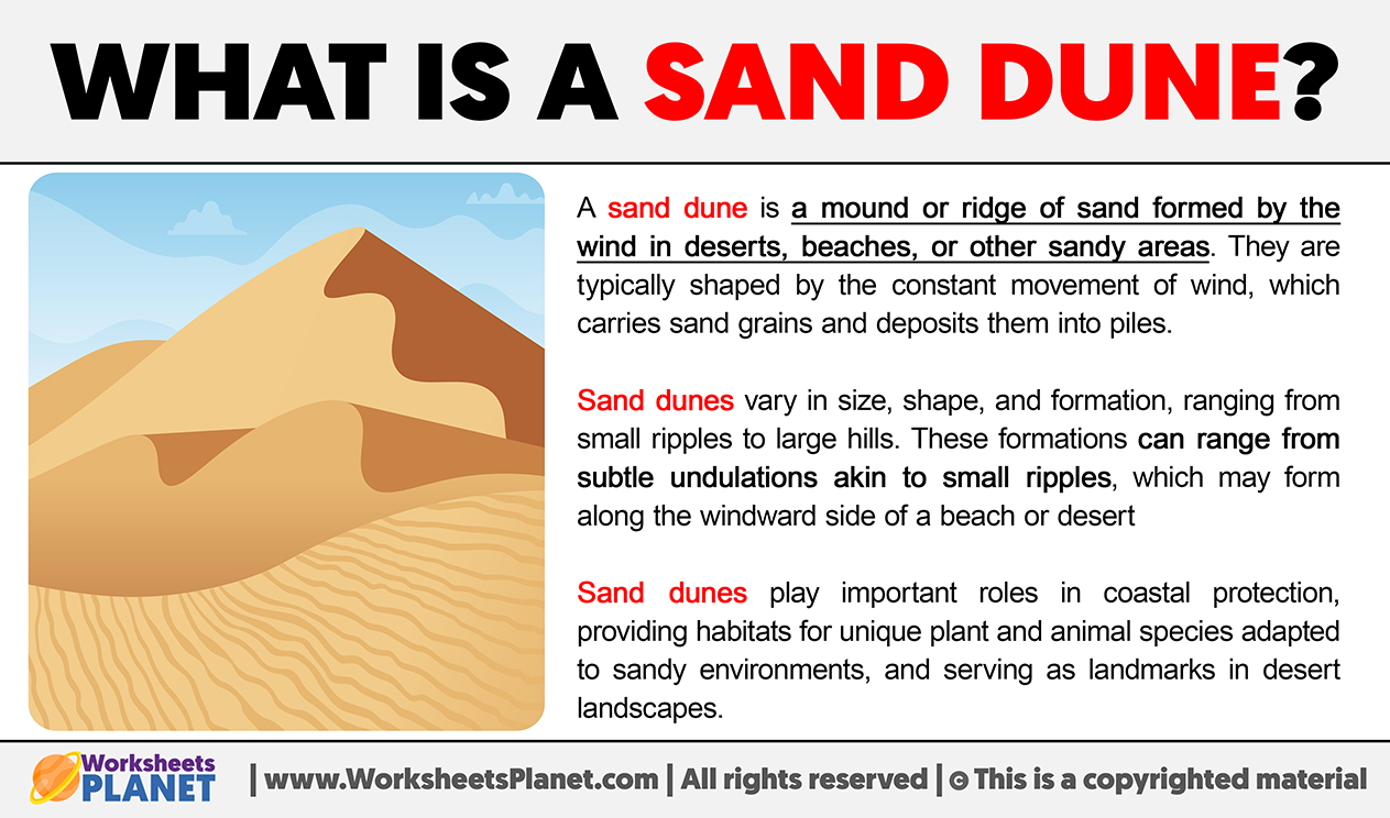
At its core, a sand dune is a mound, ridge, or hill of loose sand piled up by wind. The formation begins when wind encounters an obstacle, causing sand particles to accumulate. As more sand collects, the mound grows, and the wind flow over and around it begins to shape it further. The wind picks up sand particles on the windward side, carries them over the crest, and deposits them on the leeward (slip) face. This continuous process of erosion and deposition drives the dune’s migration.
Understanding the intricate mechanics of these dynamic formations is no longer solely the domain of field geologists; it is profoundly enhanced by cutting-edge technology. Remote sensing and aerial mapping tools have revolutionized our ability to study sand dunes on scales ranging from individual dunes to vast desert landscapes.
Remote Sensing and Aerial Mapping for Dune Morphology
LiDAR (Light Detection and Ranging) technology provides unparalleled precision in mapping dune topography. By emitting pulsed laser light and measuring the time it takes for the light to return, LiDAR systems create highly detailed 3D models of the terrain. This allows researchers to accurately measure dune height, slope, and volume, as well as track subtle changes in their morphology over time. For instance, comparing LiDAR scans from different periods reveals the precise rate and direction of dune migration, crucial for predicting their impact on human infrastructure.
Satellite imagery and aerial photography, often captured by drones equipped with high-resolution cameras and multispectral sensors, offer continuous monitoring capabilities. These tools provide invaluable data on the spatial distribution of dune fields, their types (e.g., barchan, linear, star dunes), and the vegetation patterns influenced by or influencing dune stability. Advanced image processing algorithms can automatically detect changes in dune boundaries, identify areas of active sand transport, and even infer wind directions based on dune orientations. The sheer volume of data generated by these platforms necessitates sophisticated Geographic Information Systems (GIS) for organization, analysis, and visualization, transforming raw sensor data into actionable insights for environmental management and scientific research.
Predictive Modeling and AI for Dune Management
The transient nature of sand dunes, particularly their ability to migrate across vast distances, poses significant challenges to human activity, impacting everything from agricultural land to critical infrastructure like roads, pipelines, and settlements. Mitigating these impacts requires accurate prediction of dune movement, a task increasingly handled by advanced computational models and artificial intelligence.
Granular Physics Simulations
Simulating the behavior of sand dunes is a complex computational problem due to the vast number of individual sand grains and their chaotic interactions. However, advances in granular physics simulations and Computational Fluid Dynamics (CFD) have enabled researchers to model these systems with increasing fidelity. These software tools simulate the interaction between wind flow and sand particles, predicting how different wind speeds and directions will sculpt dunes, initiate movement, and influence their growth or decay. Such simulations help engineers design more effective barriers or re-routing strategies to protect assets from encroaching sand. They are also crucial for understanding fundamental processes, like how small ripples merge into larger dunes, offering insights into complex systems beyond just sand.
Machine Learning for Environmental Monitoring and Forecasting
Machine learning (ML) algorithms are increasingly deployed to analyze the massive datasets generated by remote sensing platforms. ML models can be trained on historical satellite imagery, LiDAR data, and meteorological records to identify patterns in dune behavior. For example, neural networks can predict future dune migration rates based on current weather conditions, dune morphology, and sediment supply.
Beyond prediction, AI-powered tools assist in environmental monitoring by automating the detection of subtle changes that might indicate environmental degradation or shifts in desertification patterns. By processing vast amounts of data more efficiently than human analysts, AI helps in rapidly assessing risk and informing timely interventions, such as the strategic planting of vegetation to stabilize dunes or the deployment of sand fences. This integration of AI brings a new level of foresight and precision to desert land management.
Robotics and Automation in Sandy Environments
Operating in sandy, often remote and harsh, environments presents unique logistical and engineering challenges. Robotics and autonomous systems are emerging as critical tools for data collection, exploration, and even direct intervention in these terrains, minimizing risks to human personnel while maximizing efficiency.
Dune-Traversing Robots and Sensors
Developing robots capable of efficiently traversing loose, shifting sands is a significant engineering feat. Traditional wheeled or tracked vehicles often struggle with traction and can easily get bogged down. This has led to the development of specialized robotic platforms with innovative locomotion mechanisms, such as articulated legs or serpentine designs, engineered to navigate complex dune fields. These robots can carry an array of sensors—including ground-penetrating radar, multispectral cameras, and atmospheric probes—to collect data directly from dune surfaces and subsurface layers. This includes data on sand composition, moisture content, temperature profiles, and even microbial life, offering a closer look at the dune ecosystem than remote sensing alone can provide.
Drone Technology for High-Resolution Data Capture
Drones (Unmanned Aerial Vehicles or UAVs) are indispensable for collecting high-resolution data in sand dune environments. Their ability to fly at low altitudes and navigate complex terrains allows for the capture of extremely detailed imagery and 3D models using photogrammetry. Drones equipped with thermal cameras can identify subtle temperature variations, which might indicate subsurface moisture or differences in sand compaction. Multispectral and hyperspectral sensors carried by drones can detect variations in vegetation health or mineral composition, providing insights into ecological processes and geological features that are invisible to the naked eye. This level of detail is vital for micro-level studies of dune morphology, sediment transport dynamics, and the impact of localized wind patterns.
Digital Preservation and Virtual Exploration of Sand Dunes
Beyond physical study and management, technology plays a crucial role in preserving the knowledge and experience of sand dunes for future generations, researchers, and the public through digital means.
3D Modeling and Virtual Reality for Immersive Study
The creation of accurate 3D models of sand dunes, derived from LiDAR and photogrammetry data, enables their digital preservation. These models can be used for detailed morphometric analysis, allowing researchers to study every curve and ripple of a dune’s surface without the need for physical presence. Furthermore, these 3D models can be integrated into Virtual Reality (VR) and Augmented Reality (AR) environments. This allows geologists, students, and enthusiasts to “walk” through a digital representation of a dune field, explore different dune types, and visualize the impact of wind and time on their shapes. VR simulations can also be used for educational purposes, providing immersive experiences that teach about desert environments, dune formation, and the challenges of desertification, making complex geological concepts accessible and engaging.
Sustainable Technologies for Sand Dune Regions
The interaction between human development and dynamic sand dune landscapes necessitates innovative technological solutions for sustainable coexistence. From infrastructure protection to renewable energy, technology offers pathways to manage and mitigate the challenges posed by these natural phenomena.

Innovative Materials and Engineering for Stabilization
Engineers are developing new materials and construction techniques specifically designed to withstand or interact beneficially with sand dune environments. This includes designing structures with aerodynamic shapes that minimize sand accumulation, utilizing permeable barriers that allow sand to pass through while reducing its speed, and developing novel polymer-based or biological stabilization agents for sand itself. Technologies for geotextiles and bio-engineering techniques, such as planting drought-resistant vegetation enhanced by smart irrigation systems, are crucial for stabilizing mobile dunes that threaten human settlements or agricultural land. These solutions are often informed by data from predictive models, ensuring they are strategically placed for maximum effectiveness and long-term sustainability.
Furthermore, sand dune regions, particularly deserts, are prime locations for renewable energy technologies, especially solar power. Innovative engineering is required to protect solar arrays from abrasive sand particles and to optimize their performance in high-temperature, low-humidity environments. Robotic cleaning systems for solar panels and advanced material coatings are examples of technological adaptations that make large-scale solar energy production viable in these challenging but resource-rich areas.
In conclusion, “what is a sand dunes” is a question that, when fully explored, leads directly into the heart of modern technological innovation. From understanding their fundamental physics to predicting their movements, mitigating their impacts, and preserving their grandeur, technology provides the essential tools that allow humanity to interact with these powerful and beautiful natural formations in an informed, sustainable, and increasingly insightful manner.
aViewFromTheCave is a participant in the Amazon Services LLC Associates Program, an affiliate advertising program designed to provide a means for sites to earn advertising fees by advertising and linking to Amazon.com. Amazon, the Amazon logo, AmazonSupply, and the AmazonSupply logo are trademarks of Amazon.com, Inc. or its affiliates. As an Amazon Associate we earn affiliate commissions from qualifying purchases.