
The reappearance of Tulare Lake in California’s Central Valley was one of the most significant hydrological events of the last century. Once the largest freshwater body west of the Mississippi, the “ghost lake” had been largely dry for decades, reclaimed by industrial agriculture and complex irrigation systems. However, the historic atmospheric rivers of 2023 brought it back to life, flooding thousands of acres of farmland. While the physical water was the story for the general public, for the tech sector, the event served as a high-stakes proving ground for modern geospatial technology, artificial intelligence, and remote sensing software.
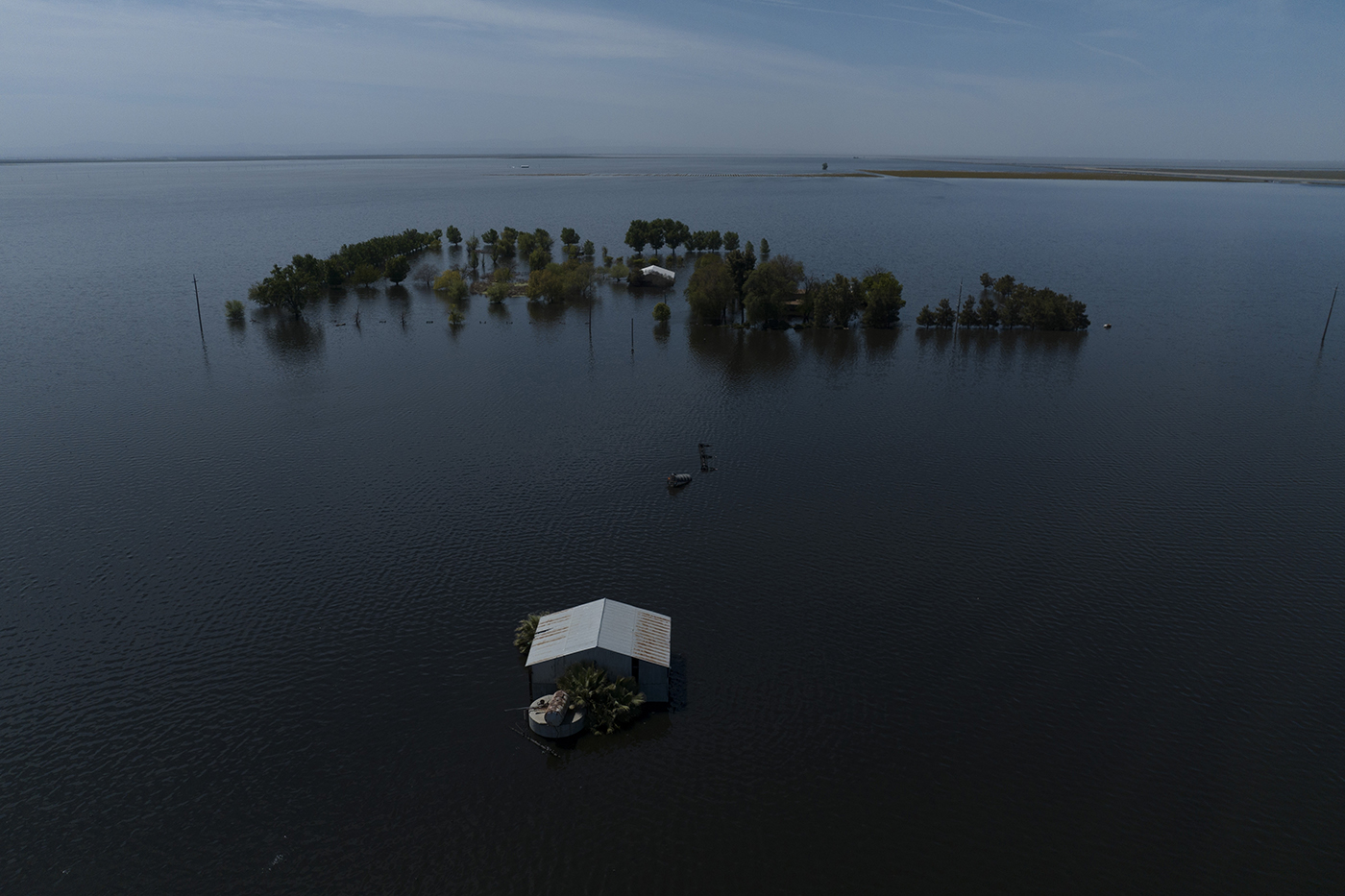
Understanding what happened to the lake—and predicting its future—requires looking past the surface of the water and into the sophisticated digital infrastructure that now monitors California’s hydro-geography. From high-frequency satellite constellations to machine learning algorithms that predict snowmelt runoff, the management of this “new” lake has been a triumph of data science over traditional observation.
Digital Eyes: Satellite Imagery and Remote Sensing in Water Management
When the Tulare Lake basin began to fill, the scale of the flooding made ground-level monitoring nearly impossible in several zones. The transition from terrestrial surveys to orbital observation represents a paradigm shift in how environmental disasters are managed. Technology providers like Maxar, Planet Labs, and the European Space Agency (ESA) provided the raw data necessary to map the lake’s rapid expansion in real-time.
Sentinel-2 and Landsat: High-Resolution Change Detection
The backbone of the monitoring effort rested on multispectral imaging. The Sentinel-2 and Landsat-8 satellites provide high-resolution imagery that allows software to differentiate between liquid water, saturated soil, and vegetation. By using specific wavelengths—particularly the Near-Infrared (NIR) and Short-Wave Infrared (SWIR) bands—agencies were able to create precise digital masks of the lake’s boundaries.
This data was fed into automated Change Detection software. These tools use pixel-by-pixel comparison algorithms to identify exactly how many meters the shoreline advanced over a 24-hour period. For tech firms and government agencies, this wasn’t just about taking pictures; it was about generating actionable vector data that could be imported into Geographic Information Systems (GIS) to determine which infrastructure was most at risk.
SAR Technology: Piercing Through the Atmosphere
One of the greatest challenges in tracking the return of the lake was the very weather that created it. Heavy cloud cover often obscures optical sensors during peak flooding events. To solve this, technologists deployed Synthetic Aperture Radar (SAR). Unlike optical sensors, SAR pulses microwave signals to the Earth’s surface and measures the backscatter.
Because water acts as a specular reflector (bouncing the signal away from the sensor), it appears dark in SAR imagery, regardless of cloud cover or time of day. The use of SAR allowed hydrological engineers to maintain a 24/7 digital pulse on the lake’s depth and breadth. Software like Google Earth Engine and ESRI’s ArcGIS Pro processed these radar returns, providing a “clear” view of the flooded basin even during the height of the atmospheric river storms.
The AI Frontier: Predictive Modeling for Hydrological Fluctuations
While satellites show us what is happening now, artificial intelligence (AI) is being used to tell us what will happen next. The “ghost lake” is notoriously difficult to manage because its volume is dictated by the Sierra Nevada snowpack. As that snow melts, the runoff must be accounted for months in advance.
Machine Learning in Snowpack Assessment
The integration of AI into snowpack modeling has revolutionized California’s water tech landscape. Traditional models often relied on manual “snow pillows” and historic averages. However, current tech stacks utilize machine learning models trained on decades of historical climate data, current atmospheric conditions, and LIDAR (Light Detection and Ranging) surveys.
LIDAR-equipped aircraft fly over the mountains, using lasers to map the snow’s depth with centimeter-level precision. AI algorithms then process these massive point-cloud datasets to calculate the “Snow Water Equivalent” (SWE). By understanding exactly how much water is locked in the mountains, predictive software can estimate the total volume of water destined for the Tulare basin, allowing for more strategic releases from upstream dams and reservoirs.
Neural Networks for Flood Risk Mitigation
Beyond simple volume calculations, Recurrent Neural Networks (RNNs) and Long Short-Term Memory (LSTM) networks are being deployed to model the “routing” of water through the Central Valley’s complex network of canals and levees. These AI tools can run thousands of simulations per hour, testing “what-if” scenarios.

For example, if a specific levee in the Kings River district were to fail, how would the water spread across the basin? How would it affect the surrounding fiber-optic infrastructure or the regional power grid? By simulating these events in a virtual environment, engineers can prioritize the deployment of physical resources. This proactive tech approach saved millions of dollars in potential infrastructure damage during the 2023 resurgence.
IoT and the Smart Infrastructure of California’s Water Grid
What happened to the lake in California is as much a story of hardware as it is of software. The modern “plumbing” of the Central Valley is increasingly governed by the Internet of Things (IoT). As the lake expanded, the need for precision control over water gates, pumps, and diversion channels became paramount.
Real-Time Telemetry and Sensor Networks
Distributed throughout the Tulare basin are thousands of IoT sensors equipped with cellular and satellite telemetry. These sensors provide real-time data on water level, flow velocity, and turbidity. This data is aggregated in cloud-based dashboards, giving water managers a “mission control” view of the entire region.
The transition to “Smart Dams” and automated headgates has changed the response time for flood management. Previously, a technician might have had to drive to a remote location to manually turn a wheel. Today, SCADA (Supervisory Control and Data Acquisition) systems allow for remote, software-driven adjustments. This connectivity ensures that the lake’s expansion is managed with surgical precision, diverting water to designated spreading grounds to protect inhabited areas.
Digital Twins: Simulating the Return of Tulare Lake
Perhaps the most advanced tech application in this context is the creation of a “Digital Twin” of the California water system. A Digital Twin is a virtual replica of a physical asset or environment, updated with real-time data to mirror its physical counterpart.
Companies specializing in hydraulic modeling software have developed digital twins of the Tulare Lake basin. These models incorporate topographical data, soil permeability, and existing infrastructure. When the lake began to refill, the Digital Twin allowed scientists to visualize the subterranean impact. The tech monitored how the reappearance of the lake was recharging depleted aquifers, a critical data point for California’s long-term water security. This level of insight was previously impossible without the massive compute power and high-speed data pipelines available today.
Software Ecosystems and Data Democracy
The story of the lake is also a story of how software has democratized environmental data. In previous decades, information about water levels and flood risks was often siloed within government agencies. Today, open-source platforms and cloud-based API integrations have made this data accessible to the public, tech developers, and the agricultural industry.
Open-Source Platforms for Accountability
Platforms like Global Surface Water Explorer and various GitHub-hosted hydrological libraries allow independent developers to build their own tools for monitoring the lake. Using Python-based libraries such as Geopandas and Xarray, data scientists can pull satellite imagery and perform their own spatial analyses.
This transparency has led to the development of third-party apps that provide farmers and residents with localized flood alerts and water-quality metrics. By moving water data into the cloud (utilizing AWS and Google Cloud’s massive storage capabilities), the state has created a more resilient and transparent system. The “black box” of water management is being replaced by an open-sourced digital ledger.

The Future of Cloud-Based Water Resource Planning
As the lake begins to recede—or as we prepare for its inevitable return in future wet years—the focus is shifting toward long-term data storage and “big data” analytics. The 2023 event generated petabytes of data. Tech firms are now using this data to train the next generation of climate-resilience software.
Software-as-a-Service (SaaS) platforms are being developed specifically for California’s Sustainable Groundwater Management Act (SGMA). These tools use the data gathered during the lake’s resurgence to help local agencies plan for a future where water is increasingly volatile. The goal is a fully integrated digital ecosystem where every drop of water is tracked from the moment it falls as snow until it reaches the Pacific or sinks into the ground.
What happened to the lake in California is a testament to the power of the modern tech stack. We are no longer passive observers of the environment; through the lens of AI, satellite imagery, and IoT, we have built a digital framework that allows us to understand, predict, and manage the most complex hydrological systems on the planet. The return of Tulare Lake wasn’t just a natural phenomenon—it was a data event that has rewritten the playbook for environmental technology.
aViewFromTheCave is a participant in the Amazon Services LLC Associates Program, an affiliate advertising program designed to provide a means for sites to earn advertising fees by advertising and linking to Amazon.com. Amazon, the Amazon logo, AmazonSupply, and the AmazonSupply logo are trademarks of Amazon.com, Inc. or its affiliates. As an Amazon Associate we earn affiliate commissions from qualifying purchases.