
Have you ever looked up at a condensation trail cutting through the blue sky and wondered exactly where that aircraft is headed, how fast it is traveling, or what kind of machinery is carrying its passengers across the globe? A decade or two ago, answering that question required specialized radio equipment or a job in an Air Traffic Control (ATC) tower. Today, the answer is literally at your fingertips.
The ability to identify “what flights are flying above me” is the result of a massive, decentralized technological ecosystem. It combines satellite navigation, terrestrial radio receivers, and high-speed data processing. This article explores the sophisticated technology, software tools, and hardware infrastructure that have democratized aviation data, turning the sky into an open book for tech enthusiasts and travelers alike.
Understanding the Invisible Network: How Flight Tracking Technology Works
The backbone of modern flight tracking is not the traditional primary radar we see in old movies—the sweeping green line on a dark screen. Instead, the industry has shifted toward cooperative surveillance technologies that are more accurate, faster, and accessible to the public.
The Role of ADS-B (Automatic Dependent Surveillance-Broadcast)
ADS-B is the “Tech” hero of the modern sky. Unlike traditional radar, which “pings” an aircraft to find its location, an aircraft equipped with ADS-B uses GPS to determine its precise position. It then “broadcasts” that information—along with its altitude, speed, and flight number—via a transponder operating at 1090 MHz.
This signal is unencrypted and can be picked up by anyone with a relatively simple antenna and receiver. This transparency is what allows third-party apps to show you exactly which flight is passing overhead in real-time. By 2020, most major aviation authorities, including the FAA in the United States and EASA in Europe, mandated ADS-B Out capabilities for aircraft operating in controlled airspace, effectively making the vast majority of the world’s fleet visible to the public.
Multilateration (MLAT) and Ground-Based Radar
Not every aircraft is equipped with the latest ADS-B tech. For older planes or certain military craft, tracking sites use a technique called Multilateration (MLAT). This process utilizes a network of ground-based receivers. By measuring the “Time Difference of Arrival” (TDOA) of a signal at four or more different locations, a central server can calculate the aircraft’s position with high precision. While more computationally intensive than ADS-B, MLAT ensures that the digital map of our skies remains comprehensive.
Satellite-Based Tracking: Filling the Gaps Over Oceans
One of the biggest technological hurdles in aviation has been tracking planes over “black holes”—vast stretches of ocean or uninhabited deserts where ground-based receivers cannot reach. The solution is Space-based ADS-B. Companies like Aireon have launched payloads onto satellite constellations (such as Iridium NEXT) that “look down” at the Earth. These satellites pick up ADS-B signals from above, ensuring that a flight from New York to London never disappears from the map, even when it is thousands of miles from the nearest coastline.
Essential Tools and Apps for Real-Time Flight Monitoring
To translate these raw radio signals into a user-friendly interface, several software platforms have become industry leaders. These tools leverage cloud computing and advanced data visualization to provide a seamless experience for the end-user.
FlightRadar24: The Industry Standard for Enthusiasts
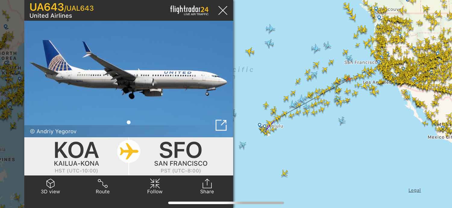
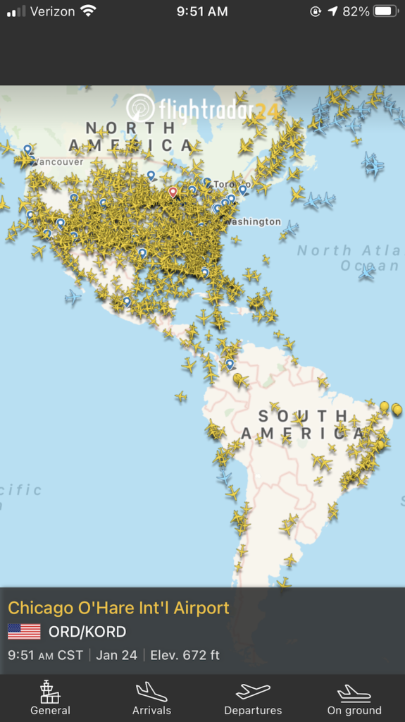
FlightRadar24 is perhaps the most well-known consumer application in this space. Its success lies in its massive network of over 30,000 ground-based receivers. The app’s “Augmented Reality” (AR) feature is a standout piece of software engineering; by pointing your smartphone at a plane in the sky, the app uses your phone’s GPS, compass, and gyroscope to overlay the flight’s data directly onto your camera view. This is the most direct answer to the question, “What is that plane above me?”
FlightAware: Precision Data for Professionals
While FlightRadar24 leans toward the enthusiast, FlightAware is often the tool of choice for tech-heavy logistics and corporate environments. It integrates “HyperFeed” technology, which aggregates data from over 45 countries’ ATC systems, global satellite links, and its proprietary receiver network. For developers, FlightAware offers robust APIs (like AeroAPI) that allow businesses to integrate real-time flight data into their own software solutions, from hotel booking engines to airport shuttle services.
ADS-B Exchange: The Unfiltered View of the Skies
For those who prefer an “open-source” ethos, ADS-B Exchange is a unique player. Unlike other commercial platforms that may filter out certain aircraft (like private jets or government planes) at the owner’s request, ADS-B Exchange prides itself on being a “no-filter” data feed. From a tech perspective, it is a fascinating example of a crowd-sourced data cooperative where users contribute their raw data feeds to create a global, transparent map.
The Hardware Side: How You Can Track Flights Locally
The most exciting aspect of flight tracking technology is that it is not a closed system. You can participate in the data collection process by building your own ground station, often for less than the cost of a video game.
Building a DIY ADS-B Receiver with Raspberry Pi
The “Maker” community has embraced flight tracking with enthusiasm. Using a Raspberry Pi (a low-cost, credit-card-sized computer) and a specialized USB dongle known as an RTL-SDR (Software Defined Radio), anyone can set up a receiver. The software—usually Linux-based—processes the 1090 MHz radio waves and converts them into digital data packets.
Software Defined Radio (SDR) and Antennas
The “Tech” at the heart of DIY tracking is the SDR. Traditional radios are hardware-defined, meaning they are built to receive a specific frequency. An SDR, however, uses software to handle the tuning and decoding. When paired with a tuned 1090 MHz vertical antenna placed on a rooftop, a hobbyist can often “see” aircraft within a 200-to-250-mile radius.
Contributing to the Global Data Network
Once your hardware is running, you can “feed” your data to the global platforms mentioned earlier. In exchange for providing local coverage (especially useful if you live in a remote area), sites like FlightRadar24 or FlightAware usually provide you with a free premium subscription. This creates a symbiotic relationship between the tech hobbyist and the global data provider, ensuring the most accurate real-time maps possible.
Privacy, Security, and the Ethics of Open-Source Skies
As with any technology that provides radical transparency, flight tracking brings up significant questions regarding privacy and cybersecurity. The tech that allows us to see a commercial airliner also allows us to see much more sensitive movements.
Identifying Military and Government Aircraft
The digital “footprint” of military aircraft is a complex topic. While many tactical missions are flown with transponders off (for obvious security reasons), routine transport and training missions often leave their ADS-B on for safety in civilian corridors. Tech-savvy observers often use these data points to track geopolitical movements, a practice known as “OSINT” (Open Source Intelligence). This has transformed how journalists and researchers monitor global events in real-time.
The Controversy of Tracking Private Jets
High-net-worth individuals and corporations often prefer privacy. Programs like the FAA’s LADD (Limiting Aircraft Data Display) allow owners to request that their tail numbers be hidden from public-facing websites. However, because the ADS-B signal is fundamentally a public broadcast, “unfiltered” sites can still display this data. This has led to ongoing debates between tech-enabled transparency and the right to privacy for aircraft owners.
Data Integrity and Cybersecurity in Aviation Tech
From a digital security standpoint, the lack of encryption in ADS-B signals is a known vulnerability. While it makes the data easy for enthusiasts to access, it theoretically allows for “spoofing”—the creation of “ghost” aircraft on a map by broadcasting fake signals. The aviation industry is currently working on the next generation of surveillance technology that adds layers of authentication to prevent such cyber-attacks, ensuring that the data we see on our screens remains a faithful representation of reality.

The Future of the Sky in Your Pocket
The technology that answers “what flights are flying above me” is moving toward even greater integration. We are entering an era where “Urban Air Mobility”—drones and electric vertical take-off and landing (eVTOL) vehicles—will fill our lower altitudes. Tracking these smaller, more numerous craft will require even more dense receiver networks and more sophisticated AI-driven software to manage the data.
The evolution from secretive radar screens to interactive 3D maps on our smartphones is a testament to the power of open data and distributed hardware. Whether you are a casual observer, a dedicated “planespotter,” or a developer building the next great aviation app, the tech behind the sky ensures that you are never more than a click away from knowing exactly what is happening in the air above you.
aViewFromTheCave is a participant in the Amazon Services LLC Associates Program, an affiliate advertising program designed to provide a means for sites to earn advertising fees by advertising and linking to Amazon.com. Amazon, the Amazon logo, AmazonSupply, and the AmazonSupply logo are trademarks of Amazon.com, Inc. or its affiliates. As an Amazon Associate we earn affiliate commissions from qualifying purchases.