
In the world of software development, database management, and digital logistics, the two-letter state abbreviation is far more than a simple shorthand. While the average person views these abbreviations as a convenience for addressing an envelope, tech professionals recognize them as a critical data standard. Whether you are building an e-commerce checkout flow, optimizing a delivery algorithm, or managing a massive customer relationship management (CRM) system, the way your software handles “CA,” “TX,” or “NY” determines the integrity of your geographic data.
This article explores the technical foundations of state abbreviations, their role in modern software architecture, and the best practices for implementing them within digital ecosystems.

The Evolution of Data Standards in Modern Computing
The transition from full state names to standardized abbreviations was a precursor to the data normalization protocols we use today. Before the digital age, state abbreviations were inconsistent; for example, “California” might be written as “Calif.,” “Cal.,” or “Ca.” For early computer systems with limited memory and processing power, these inconsistencies were a nightmare.
From Manual Entry to ISO-3166-2 Compliance
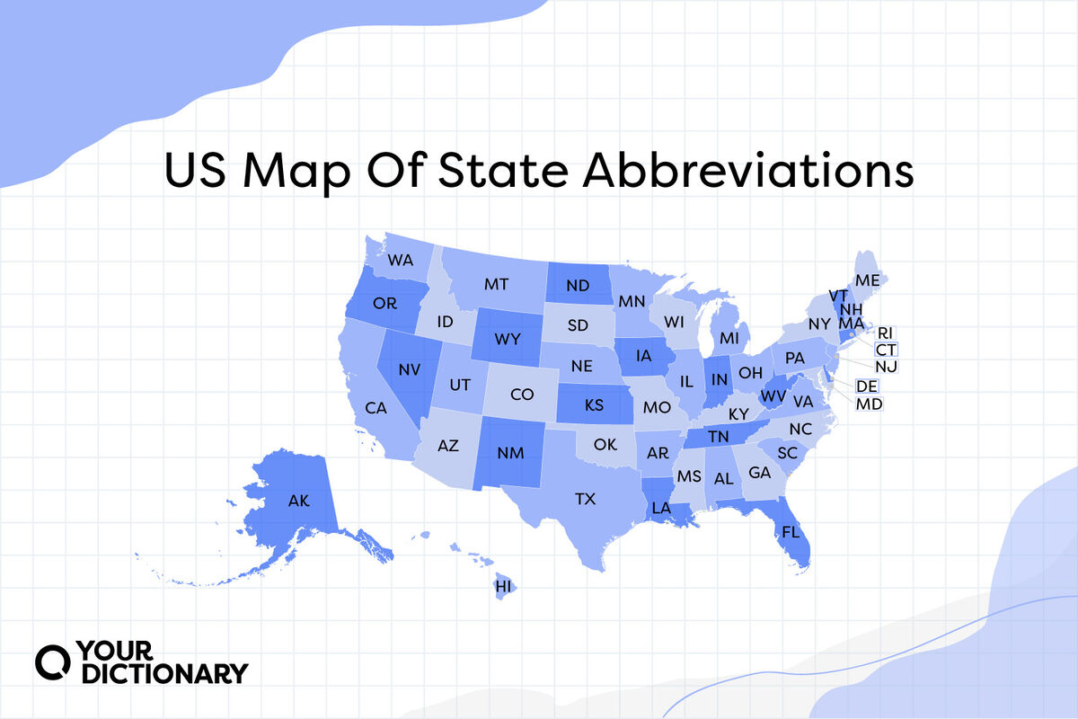
The modern two-letter standard we use in tech today was primarily driven by the United States Postal Service (USPS) in 1963 to facilitate the implementation of ZIP codes and automated mail sorting. In the tech sector, this standard was eventually codified under ISO-3166-2:US.
For developers, adhering to this ISO standard is essential for interoperability. When your system communicates with third-party APIs—such as Stripe for payments or FedEx for shipping—they expect the two-letter ISO code. Deviating from this standard by using full names or non-standard abbreviations (like “Penna.” for Pennsylvania) leads to API call failures and data fragmentation.
Why 2-Letter Codes Are the Industry Standard
From a tech perspective, the two-letter abbreviation is the “Goldilocks” of data storage. It is short enough to be stored in a CHAR(2) database column, which is significantly more efficient than a VARCHAR field that must accommodate “Massachusetts.”
Furthermore, 2-letter codes provide a consistent character length. This consistency is vital for fixed-width file formats still used in legacy banking systems and for designing clean, predictable user interfaces. When every state is exactly two characters, data validation becomes a simple check of string length and a lookup against a predefined array.
Integrating State Abbreviations into Software Development
Implementing state abbreviations isn’t just about creating a list; it’s about how that data moves through your stack. From the frontend to the backend, the handling of regional codes must be seamless.
Database Normalization and State Lookup Tables
In high-level database design, “hard-coding” state abbreviations directly into a user table is often considered a “code smell.” Instead, senior architects recommend using a lookup table or a dedicated geographic schema.
By creating a states table that includes columns for state_id, abbreviation, and full_name, you ensure data integrity. In your users or addresses table, you store the foreign key to this lookup table. This normalization prevents “data rot”—where a typo like “AL” instead of “AK” could go unnoticed—and allows you to easily update display names without altering millions of individual user records.
API Best Practices for Location Data
When building RESTful or GraphQL APIs, how you transmit state data matters. Best practices suggest that APIs should always accept and return the two-letter abbreviation as the primary identifier.
For example, a JSON payload for a shipping address should look like this:
{

  "street": "123 Tech Lane",

  "city": "San Francisco",

  "state": "CA",

  "zip": "94105"

}
Internally, your backend logic should validate this “CA” against a whitelist of 50 states (plus territories like DC, PR, etc.). If the API receives “California,” it should either reject the request with a 400 Bad Request or use a normalization function to convert the string to “CA” before processing. This ensures that downstream systems—like tax calculation engines or shipping labels—receive uniform data.
UI/UX Challenges: Designing the Perfect State Selection Interface

The way users input state abbreviations can make or break a conversion funnel. While the abbreviation is a “tech” standard, the user interface (UI) must bridge the gap between human intuition and machine requirements.
Dropdowns vs. Autocomplete for Regional Data
For decades, the “Select State” dropdown was the industry standard. However, from a UX perspective, it is often criticized. On mobile devices, scrolling through 50+ items in a native picker is tedious.
Tech-forward companies are increasingly moving toward “Smart Autocomplete” fields. As a user types “N,” the system suggests “NY,” “NJ,” “NC,” etc. This reduces cognitive load. Another popular tech solution is “Zip-to-City-State” mapping. By using a lookup API (like the Google Maps Geocoding API), the software can automatically populate the state abbreviation as soon as the user enters their ZIP code, eliminating manual entry errors entirely.
Handling Internationalization (i18n) and Localized Labels
If your software operates globally, the “State” field becomes more complex. In the UK, they use counties; in Canada, provinces. A robust tech implementation uses “Administrative Area” as the internal variable name.
When the user selects “United States” as their country, the UI should dynamically update the label to “State” and provide the USPS abbreviations. If they select “Canada,” it should switch to “Province” and use the two-letter Canadian codes (e.g., “ON” for Ontario). This level of dynamic UI logic requires a well-structured frontend state management system (like React’s Context API or Redux) to ensure the geographic context is maintained across the session.
Data Security and Validation in Regional Field Processing
Because state abbreviations are often part of sensitive transactions—like credit card billing or shipping high-value goods—they are targets for data injection and validation errors.
Preventing Injection Attacks via Geography Inputs
Even a simple “State” field can be an entry point for SQL injection if not properly sanitized. Because we know a US state abbreviation should never be more than two characters and should only contain alphabetic characters, developers should implement strict server-side validation.
A common security practice is to “whitelist” inputs. Instead of sanitizing whatever the user sends, the system checks: Is the input exactly two letters? Does it exist in our predefined list of 50? If the answer to either is no, the request is discarded. This prevents malicious actors from trying to pass script tags or SQL commands through the state field.
Regular Expressions (Regex) for State Abbreviation Validation
For frontend validation, Regular Expressions (Regex) are an efficient tool. A simple Regex for US states might look like ^[A-Z]{2}$. However, a more “insightful” approach involves a Regex that specifically matches valid abbreviations:
^(A[LKSZR]|C[AOT]|D[EC]|F[L]|G[AU]|HI|I[DLNA]|K[SY]|L[A]|M[EHDAINSOT]|N[EVHJMYCD]|O[HKR]|PA|RI|S[CD]|T[NX]|UT|V[AT]|W[AIVY])$
Using this level of precision in your client-side validation logic ensures that the user finds out they’ve made a mistake (like typing “ZZ”) before they even hit the “Submit” button, saving server resources and improving the user experience.
The Future of Spatial Data: Beyond the Two-Letter Code
As we move deeper into the era of AI and real-time location analytics, the humble state abbreviation is evolving. We are seeing a shift from static string data to dynamic spatial data.
GeoJSON and Real-Time Location Analytics
Modern tech stacks often bypass the “State” string entirely when performing analytics. Instead, they use GeoJSON objects that define the boundaries of a state using longitude and latitude coordinates. When a user logs in, the system uses “Reverse Geocoding” to determine their state based on their IP address or GPS data.
For developers, this means the “State” is no longer just a field in a form; it is a polygon in a database (like PostGIS). When a tech company wants to see where their users are located, they don’t just count the “NY” strings; they visualize the density of coordinates within the New York polygon.
Machine Learning and Geographic Normalization
Artificial Intelligence is also playing a role in cleaning up “dirty” geographic data. Natural Language Processing (NLP) models are now used to scan unstructured data—like support tickets or social media bios—to extract state information. If a user writes “I’m currently in the Big Apple,” an NLP model can programmatically map that to “NY.” This allows companies to derive structured state data from unstructured human communication, bridging the gap between how people talk and how databases think.
In conclusion, while the abbreviations of the states may seem like a relic of the postal era, they remain a vital component of the modern tech stack. By treating these two-letter codes with the same technical rigor as any other data standard—through normalization, secure validation, and thoughtful UI design—developers ensure that their systems remain robust, scalable, and user-friendly in an increasingly data-driven world.
aViewFromTheCave is a participant in the Amazon Services LLC Associates Program, an affiliate advertising program designed to provide a means for sites to earn advertising fees by advertising and linking to Amazon.com. Amazon, the Amazon logo, AmazonSupply, and the AmazonSupply logo are trademarks of Amazon.com, Inc. or its affiliates. As an Amazon Associate we earn affiliate commissions from qualifying purchases.