
The simple act of looking up at a condensation trail streaking across the sky has transformed from a moment of idle curiosity into a data-rich experience. For decades, the identity of those silver specks was the exclusive domain of air traffic controllers and professional pilots. Today, thanks to a convergence of satellite technology, radio frequency innovation, and mobile software, the question “What airplanes are above me right now?” can be answered with surgical precision in a matter of seconds.
The digital ecosystem that allows us to identify a Boeing 787 cruising at 35,000 feet is a masterclass in modern networking. It involves a global infrastructure of terrestrial receivers, orbital satellites, and sophisticated algorithms that translate raw radio pulses into the interactive maps we carry in our pockets.
The Technology Powering the Global Sky Map
At the heart of modern flight tracking is a technology known as ADS-B, or Automatic Dependent Surveillance-Broadcast. This system represents the most significant shift in air traffic management since the invention of radar. Unlike traditional radar, which relies on ground stations “bouncing” radio waves off the fuselage of an aircraft to determine its position, ADS-B is proactive.
How ADS-B Works
ADS-B equipped aircraft use GPS to determine their precise position in three-dimensional space. The aircraft’s onboard transponder then broadcasts this information, along with its altitude, airspeed, and unique identification code, at a frequency of 1090 MHz. Because this signal is unencrypted and broadcast in all directions, it can be intercepted by anyone with the right equipment.
There are two primary components to this system:
-
ADS-B Out: The aircraft’s ability to transmit its data.
-
ADS-B In: The ability of ground stations or other aircraft to receive that data.
For the casual observer using a smartphone app, the magic happens when these “ADS-B Out” signals are picked up by a vast network of thousands of ground-based receivers. These receivers, often hosted by hobbyists and aviation enthusiasts, feed the data into central servers, where it is aggregated and mapped against global flight schedules and registration databases.
Multilateration (MLAT)
Not every aircraft is equipped with the latest ADS-B transponders, particularly older general aviation planes or certain military assets. To track these, tech platforms use Multilateration (MLAT). By measuring the slight difference in the “Time of Arrival” (TOA) of a signal at four or more separate ground stations, the system can triangulate the aircraft’s exact location. This requires high-precision synchronization and massive computing power to execute in real-time, showcasing the invisible software architecture that supports our digital view of the sky.
Space-Based ADS-B
The final frontier of this technology is orbital. Until recently, planes were “lost” to trackers when they flew over the middle of the ocean or remote polar regions where no ground stations existed. Now, companies like Aireon have deployed ADS-B receivers on low-earth orbit (LEO) satellite constellations. This ensures 100% global coverage, meaning that when you ask what is above you, the answer is accurate even if you are standing on a remote island or in the middle of the Sahara.
Top Software and Apps for Real-Time Flight Identification
The interface through which we interact with this data is just as impressive as the hardware gathering it. A handful of software platforms have become the gold standard for real-time aviation tracking, each offering unique features ranging from augmented reality to deep-dive technical analytics.
Flightradar24: The Industry Leader
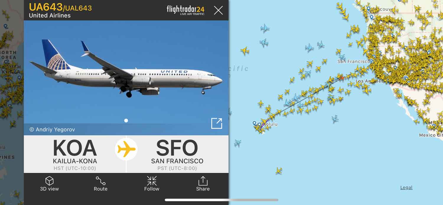
Flightradar24 is perhaps the most recognizable name in the space. Its success stems from its massive proprietary network of over 30,000 ground stations. For the user, the standout feature is the “AR View.” By utilizing the gyroscope, GPS, and camera on a smartphone, the app allows users to point their device at a plane in the sky. The software overlays a digital label on the live camera feed, identifying the flight number, origin, destination, and even the specific airframe’s history.
FlightAware and HyperDrive AI
While Flightradar24 excels in visual identification, FlightAware is a powerhouse of predictive data. They utilize a proprietary AI engine called “HyperDrive.” This machine learning tool analyzes historical flight patterns, weather conditions, and taxi times to provide a more accurate “Estimated Time of Arrival” than even the airlines themselves often provide. For tech enthusiasts, FlightAware’s integration with enterprise APIs makes it the go-to for building custom aviation dashboards.
ADS-B Exchange: The “Unfiltered” Alternative
Most commercial tracking apps honor “block lists” where private owners or government agencies can request their tail numbers be hidden from public view. ADS-B Exchange takes a different approach. As a community-driven project, it does not filter its data. This makes it a favorite for investigative journalists and tech hobbyists who want to see the “raw” sky, including military movements and private jets that might be scrubbed from more corporate platforms.
The Hardware Ecosystem: From Silicon to Sky
While apps provide the front-end experience, there is a thriving “maker” culture centered on the hardware that feeds these networks. You don’t need a multi-million dollar radar dish to track planes; in fact, you can build a professional-grade receiver for less than the cost of a video game.
Software Defined Radio (SDR)
The core component of a DIY tracking station is an SDR USB dongle. Originally designed for digital TV reception, these gadgets can be tuned to the 1090 MHz frequency used by aircraft. When paired with a Raspberry Pi (a low-cost, credit-card-sized computer), an enthusiast can create a “feeder station.”
This hardware setup decodes the raw radio waves into data packets. By contributing this data to global networks, hobbyists often receive “Enterprise” or “Business” level subscriptions to tracking software for free. This creates a symbiotic relationship between the tech companies and the global community, ensuring the map remains populated with real-time data.
Smartphone Integration and Sensors
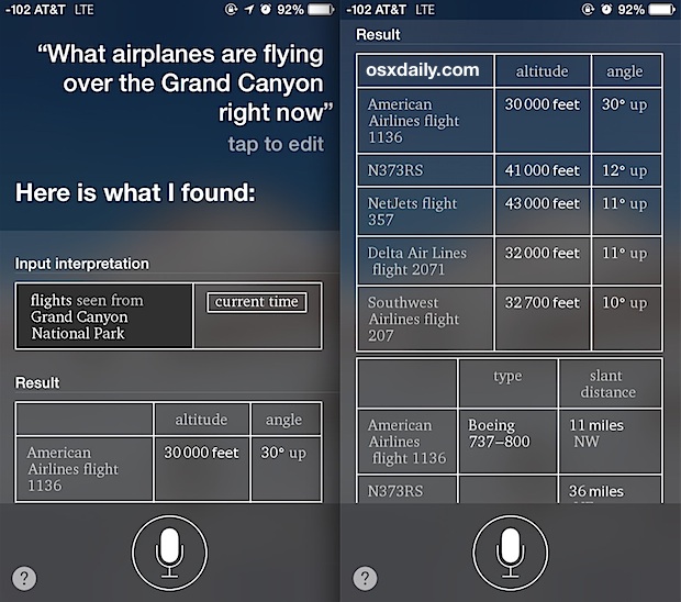
The “Point and Identify” feature of modern apps is a marvel of sensor fusion. It isn’t just using the internet; it is pulling data from:
-
The Magnetometer: To act as a compass and know which direction the phone is facing.
-
The Accelerometer and Gyroscope: To understand the pitch and tilt of the device.
-
The GNSS (Global Navigation Satellite System) Chip: To determine the user’s exact coordinates.
The software then performs a “cone of vision” calculation, matching the user’s vector against the coordinates of every plane in the global database to find a match.
Data Security and Privacy in the Open Skies
As tracking technology becomes more accessible, it has sparked a significant debate regarding digital privacy and security. The transparency of ADS-B is both its greatest strength and its most controversial feature.
The Ethics of Public Tracking
Because ADS-B signals are unencrypted, anyone can listen to them. This has led to the rise of automated bots that tweet the movements of high-profile individuals, corporate jets during merger negotiations, or government assets. From a tech standpoint, this raises questions about whether aviation protocols designed in a pre-internet era are fit for a world where everyone has a data-connected supercomputer in their pocket.
Cyber Security Concerns
There is also the technical concern of “spoofing.” Since the ADS-B protocol lacks a robust authentication layer, it is theoretically possible to broadcast “ghost planes”—signals that trick receivers into thinking an aircraft exists where there is none. While aviation authorities have secondary systems to verify these signals, the potential for digital “noise” in the sky is a growing area of study for cybersecurity researchers.
The Future of Air Traffic Monitoring
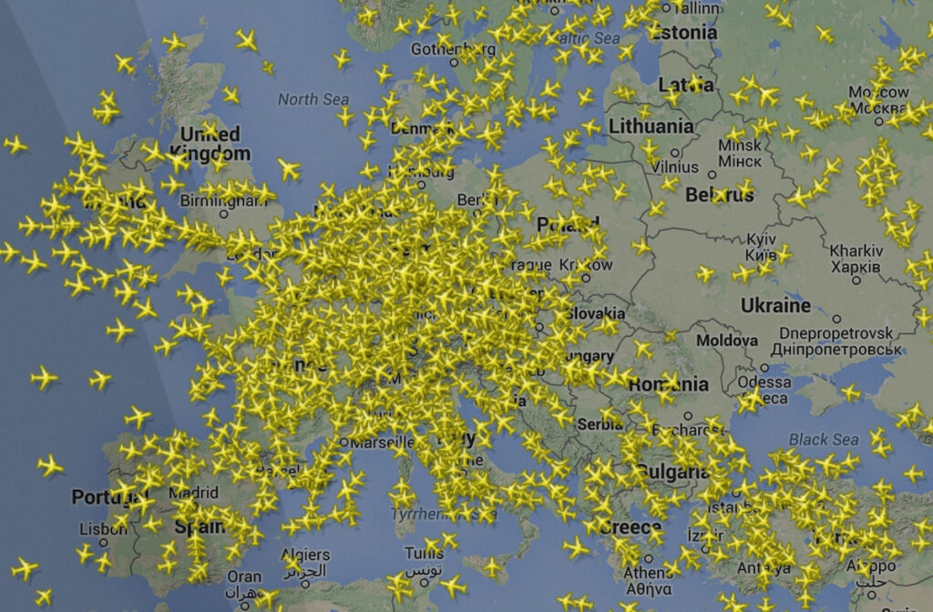
Looking ahead, the technology used to identify the airplanes above us is set to become even more integrated. We are moving toward a concept known as “Traffice Information Service-Broadcast” (TIS-B), where the digital map in the cockpit and the digital map on your phone become increasingly identical.
As we integrate Unmanned Aerial Vehicles (UAVs) and “air taxis” into urban environments, the density of the data will increase exponentially. Future versions of these apps won’t just show a few dozen commercial airliners; they will likely track thousands of smaller delivery drones and short-range electric aircraft, all communicating via a mesh network.
Artificial Intelligence will play a larger role in synthesizing this data. Instead of just identifying a plane, future software will be able to predict turbulence based on the real-time “bumping” of the planes ahead of you or suggest the best side of the aircraft to sit on for a view of the sunset, based on the projected flight path and sun angle.
The next time you look up and see a plane, remember that you aren’t just seeing a machine. You are seeing a data point in a massive, global, real-time computational network. The technology that puts that plane’s identity, speed, and history into your hand is a testament to how far our digital reach has extended into the physical world. Through ADS-B, SDR hardware, and sophisticated mobile software, the sky has never been more transparent.
aViewFromTheCave is a participant in the Amazon Services LLC Associates Program, an affiliate advertising program designed to provide a means for sites to earn advertising fees by advertising and linking to Amazon.com. Amazon, the Amazon logo, AmazonSupply, and the AmazonSupply logo are trademarks of Amazon.com, Inc. or its affiliates. As an Amazon Associate we earn affiliate commissions from qualifying purchases.