
In an increasingly interconnected world, the ability to monitor the movement of aircraft in real-time has transitioned from a niche interest to a widely accessible and incredibly valuable tool. Whether you’re a frequent flyer wanting to track a loved one’s journey, an aviation enthusiast fascinated by the intricate dance of air traffic, or a logistics professional needing precise operational data, plane tracking technology offers unparalleled insights into the skies above. This guide delves into the technological underpinnings, essential tools, practical applications, and advanced techniques for effectively tracking planes, providing a professional and engaging overview for anyone looking to unlock the power of real-time flight data.
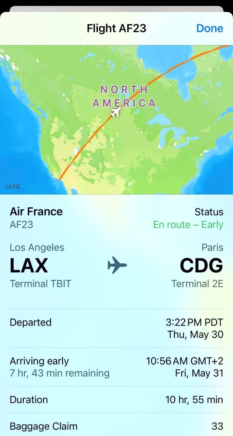
The Technology Behind Real-Time Flight Tracking
At its core, modern plane tracking relies on a sophisticated interplay of various technologies that collect, process, and disseminate vast amounts of data. Understanding these foundational elements is key to appreciating the accuracy and global reach of contemporary flight tracking services.
Understanding ADS-B: The Backbone of Modern Tracking
The primary technology driving today’s real-time flight tracking is Automatic Dependent Surveillance-Broadcast (ADS-B). ADS-B is a surveillance technology in which an aircraft determines its position via satellite navigation and periodically broadcasts it, enabling it to be tracked. The “automatic” part means it transmits without pilot intervention, “dependent” because it relies on the aircraft’s navigation system for position data, and “broadcast” because it’s a continuous, unrequested transmission.
ADS-B Out, the transmitting component, allows an aircraft to broadcast information such as its GPS position, altitude, ground speed, heading, and aircraft identification to ground stations and other equipped aircraft. These ground stations, often operated by flight tracking companies or a network of voluntary enthusiasts, receive these signals. When a signal is picked up by multiple receivers, the data can be triangulated or simply aggregated to provide highly accurate positional information. The adoption of ADS-B has been mandated in many parts of the world, including the United States and Europe, significantly enhancing air traffic control capabilities and improving the accuracy of public flight tracking. While highly effective, ADS-B has limitations, primarily that its range is line-of-sight from the aircraft to the ground receiver, meaning coverage can be sparse over oceans or remote land areas.
Beyond ADS-B: Radar, Satellite, and Multilateration (MLAT)
While ADS-B is dominant, it’s not the only player. Traditional radar, which has been the cornerstone of air traffic control for decades, still plays a significant role. Primary radar detects aircraft by sending out radio waves and listening for reflections, while secondary radar interrogates aircraft transponders for identity and altitude information. Although less precise for public tracking purposes than ADS-B, radar data fills gaps, especially in older air traffic control systems or for aircraft not equipped with ADS-B.
For comprehensive global coverage, especially over vast oceanic regions where ground-based ADS-B receivers are impractical, satellite-based ADS-B receivers are crucial. Companies like Aireon have deployed ADS-B receivers on low Earth orbit satellites, enabling the tracking of ADS-B equipped aircraft anywhere on the planet, including over oceans and polar regions. This innovation has been transformative for air traffic management and flight tracking, eliminating previous blind spots.
Multilateration (MLAT) is another vital technology, particularly useful for tracking aircraft that are not ADS-B equipped or in areas with poor ADS-B coverage. MLAT systems work by deploying a network of ground receivers that passively listen for signals from an aircraft’s transponder. By measuring the time difference of arrival (TDOA) of these signals at multiple receivers, the aircraft’s position can be accurately calculated. This technology is often used by tracking services to supplement ADS-B data and provide more complete coverage, particularly for older aircraft or those operating in specific regions. The combination of ADS-B, radar, satellite, and MLAT creates a robust and layered system that ensures near-universal tracking capability for commercial and many private flights.
The Global Network: Crowdsourcing and Data Integration
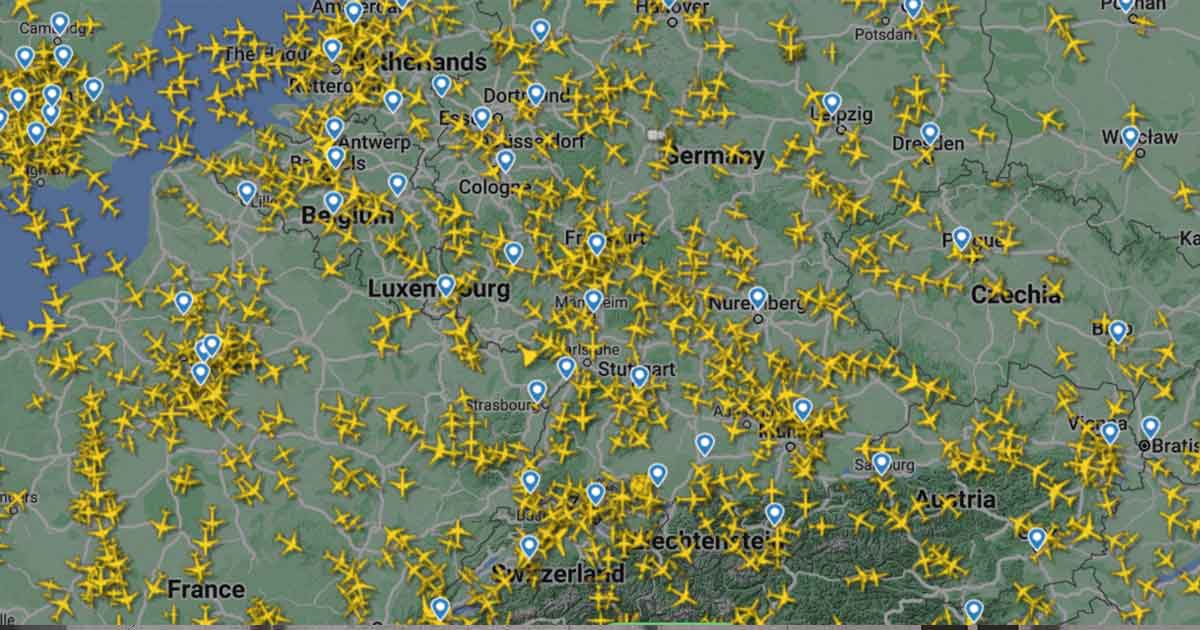
The extensive reach and accuracy of real-time flight tracking services are largely due to a remarkable global network that leverages both commercial infrastructure and a massive community of volunteers. Flight tracking companies operate their own networks of ADS-B receivers, strategically placed at airports and other key locations. However, a significant portion of the data, particularly the ground-based ADS-B information, is crowdsourced. Thousands of aviation enthusiasts around the world operate their own inexpensive ADS-B receivers and feed the data they collect to central flight tracking platforms. This decentralized approach creates a dense network of receivers, vastly improving coverage and redundancy, especially in populated areas.
Once collected, whether through company-owned receivers, volunteer feeders, satellite networks, or integrated radar sources, this raw data undergoes sophisticated processing. Algorithms filter out erroneous data, merge overlapping information, and extrapolate flight paths to ensure seamless tracking. This integrated data stream is then presented to users through intuitive interfaces, offering a dynamic and detailed view of air traffic worldwide. The synergy between advanced technology, global infrastructure, and community participation makes real-time plane tracking a truly impressive technological feat.
Essential Tools and Applications for Plane Tracking
With the underlying technology in place, numerous platforms have emerged to make real-time flight tracking accessible to everyone. These tools vary in their features, coverage, and user experience, catering to different needs and preferences.
Leading Flight Tracking Websites and Apps
Several platforms dominate the flight tracking landscape, each offering unique strengths.
- FlightAware: One of the oldest and most comprehensive flight tracking services. FlightAware provides real-time flight tracking data, historical flight data, and predictive analytics. It integrates ADS-B, MLAT, and satellite data, along with radar and air traffic control information. Its website offers detailed maps, flight status, airport delays, and even weather overlays. The FlightAware app is robust, offering push notifications for flight changes, gate assignments, and arrival/departure information. It’s particularly popular for its extensive historical data, often used by aviation professionals and researchers.
- FlightRadar24: Known for its user-friendly interface and impressive global coverage, FlightRadar24 visualizes air traffic on a map in a highly engaging way. It boasts one of the largest networks of ADS-B receivers, including satellite ADS-B. Users can click on any aircraft to view detailed information, including aircraft type, airline, callsign, altitude, speed, and origin/destination. The app often includes 3D cockpit view simulations and augmented reality features, allowing users to point their phone at the sky to identify planes overhead. FlightRadar24 is highly popular among aviation enthusiasts and general users alike for its dynamic visualization.
- ADS-B Exchange: This platform stands out for its commitment to raw, unfiltered data. Unlike some commercial services, ADS-B Exchange aims to provide as much data as possible without restrictions or filtering, making it a favorite for researchers, journalists, and power users. It aggregates data from thousands of volunteer feeders and offers a wealth of information, including military and private flights that might be filtered on other platforms. While its interface might be less polished than FlightRadar24 or FlightAware, its data integrity and comprehensive nature are highly valued.
- PlaneFinder: Another strong contender, PlaneFinder offers real-time tracking with a clean interface and good global coverage. It provides similar features to its competitors, including detailed flight information, aircraft identification, and replay functionality. PlaneFinder also offers an augmented reality view in its mobile app, allowing users to identify planes by pointing their device at the sky.
Each of these platforms offers free access with premium subscription options that unlock advanced features like enhanced data, historical access, and ad-free experiences.
Mobile Tracking: Bringing the Skies to Your Smartphone
The convenience of mobile applications has revolutionized how people track planes. Most leading services offer highly functional apps for both iOS and Android, turning smartphones and tablets into powerful flight tracking devices. These apps often go beyond simply displaying a map:
- Push Notifications: Users can set up alerts for specific flights, receiving notifications for departures, arrivals, delays, gate changes, and even when a plane is within a certain proximity. This is invaluable for travelers and those picking up passengers.
- Augmented Reality (AR): As mentioned, apps like FlightRadar24 and PlaneFinder leverage AR. Pointing your phone’s camera at the sky can overlay flight information directly onto the live camera feed, identifying visible aircraft in real-time – a feature that blends digital data with the physical world in an intuitive way.
- Detailed Aircraft Information: Beyond basic flight status, mobile apps provide a wealth of data about each aircraft, including its registration, type, age, speed, altitude, vertical speed, and even a photo of the specific plane.
- Offline Maps and Filtering: Some apps allow for downloading maps for offline use and offer extensive filtering options to display only specific types of aircraft, airlines, or flights to/from certain airports.
The proliferation of powerful mobile devices means that real-time air traffic information is literally at one’s fingertips, making plane tracking more accessible and intuitive than ever before.
Building Your Own ADS-B Receiver: The DIY Approach
For the truly tech-savvy and aviation enthusiasts, building a personal ADS-B receiver offers a unique and rewarding way to contribute to the global tracking network and gain hyper-local data. This DIY approach typically involves:
- Hardware: A low-cost Software Defined Radio (SDR) dongle (often a modified DVB-T TV tuner), a Raspberry Pi or similar single-board computer, and an external antenna optimized for the 1090 MHz ADS-B frequency.
- Software: Open-source software like PiAware (for FlightAware) or FR24feed (for FlightRadar24) is installed on the Raspberry Pi to process the raw ADS-B signals received by the SDR.
- Connectivity: The Raspberry Pi connects to the internet to feed the decoded data to the chosen flight tracking service.

Setting up a home receiver provides real-time data for your local area, often with better accuracy and refresh rates than commercial services might offer for that specific location. In return for contributing data, feeder operators often receive premium subscriptions to the flight tracking services, unlocking advanced features. This hobbyist pursuit exemplifies the spirit of crowdsourcing that underpins much of the modern flight tracking infrastructure.
Practical Applications and Benefits of Plane Tracking
The utility of real-time plane tracking extends far beyond mere curiosity, offering tangible benefits across various user groups.
For Travelers and Loved Ones: Peace of Mind and Logistics
For anyone involved in air travel, tracking planes offers significant practical advantages:
- Monitoring Flights for Arrivals and Departures: Relatives picking up passengers can track inbound flights to time their arrival at the airport perfectly, avoiding long waits and unnecessary parking fees. Travelers can track their connecting flights or outbound flights to monitor for delays and gate changes.
- Real-time Delay Information: Before heading to the airport, a quick check can confirm if a flight is on schedule, delayed, or even canceled, allowing for adjustments to travel plans and reducing stress.
- Weather and Route Information: Observing a flight’s progress can also provide insights into weather conditions along the route or at the destination airport, offering a more complete picture of the journey.
- Peace of Mind: For those with loved ones in the air, tracking their flight provides reassurance and a sense of connection, knowing their journey is progressing safely.
Aviation Enthusiasts and Hobbyists: Deep Dive into Air Traffic
The aviation community finds immense value in these tools, elevating their hobby to new heights:
- Aircraft Spotting: Spotters can use tracking apps to identify incoming or outgoing aircraft, noting their type, registration, and airline, making it easier to log their sightings and capture rare aircraft.
- Understanding Air Traffic Patterns: Observing flight paths around major airports or over specific regions helps enthusiasts understand air traffic control procedures, common routes, and peak times.
- Identifying Unique Aircraft: Military aircraft, private jets, cargo planes, and special charter flights often appear on trackers, allowing enthusiasts to identify and learn about diverse aviation operations that might otherwise go unnoticed.
- Historical Analysis: Access to historical flight data allows for detailed analysis of past flights, accident investigations (unofficially), and understanding long-term trends in air traffic.
Operational Insights for Businesses and Emergency Services
Beyond individual users, real-time flight tracking provides critical operational insights for various professional sectors:
- Logistics and Supply Chain Management: Companies relying on air cargo can track shipments in real-time, anticipate arrival times, and coordinate ground logistics more efficiently. This is crucial for perishable goods, urgent deliveries, or just-in-time inventory systems.
- Airport Operations: While airports have their own sophisticated systems, public trackers can offer supplementary data or a readily available external view of incoming and outgoing traffic, aiding ground handlers, catering services, and maintenance teams in scheduling.
- Search and Rescue (SAR): In situations where an aircraft is overdue or in distress, real-time tracking data can provide the last known position, trajectory, and speed, significantly narrowing down the search area and expediting rescue efforts.
- Air Traffic Control (ATC) Augmentation: While ATC uses dedicated primary systems, the broad coverage of ADS-B networks can offer valuable supplementary information, especially in less-controlled airspace or for corroborating transponder data.
- Emergency Response Planning: Knowing the real-time position of all aircraft in a given airspace can be vital for emergency planners during major events, natural disasters, or security incidents, helping to manage airspace and deploy resources effectively.
Maximizing Your Tracking Experience and Advanced Tips
To truly leverage the power of real-time plane tracking, understanding how to interpret the data and utilize advanced features is paramount.
Interpreting Flight Data: Beyond the Basics
Basic tracking shows a plane on a map, but a wealth of information lies beneath the surface:
- Callsigns: Each flight has a unique callsign (e.g., “SWISS137” or a specific aircraft registration like “N12345”). Understanding these helps identify the airline, flight number, or specific aircraft.
- Altitude and Speed: These metrics are crucial. Altitude is typically given in feet (FL for flight level), and speed in knots (ground speed or indicated airspeed). Observing these changes helps understand ascent, descent, and cruise phases.
- Squawk Codes: These are 4-digit octal codes transmitted by an aircraft’s transponder, set by air traffic control. Specific codes denote emergencies (7700), radio failure (7600), or unlawful interference (7500), offering critical alerts.
- Aircraft Type and Registration: Knowing the model (e.g., Boeing 737, Airbus A320) and registration number (e.g., G-XXXX, NXXXXX) adds depth, allowing users to learn about specific aircraft and their history.
- Flight Plans and Route: Some platforms display the filed flight plan, showing the intended route, which can be compared against the actual trajectory.
Customizing Alerts and Notifications
Most modern tracking apps offer sophisticated alert systems:
- Specific Flight Alerts: Set up notifications for a particular flight, ensuring you’re informed about any status change, delay, or arrival.
- Aircraft Alerts: Track a specific aircraft by its registration, useful for hobbyists following a particular plane or fleet.
- Airport-Specific Alerts: Receive notifications for all arrivals or departures at a certain airport, or for flights involving specific airlines at that airport.
- Geofence Alerts: Be notified when any aircraft enters or leaves a defined geographical area, which can be useful for local monitoring.
These customizable alerts transform passive tracking into an active, intelligent monitoring system, ensuring you receive critical information precisely when you need it.
Privacy Concerns and Data Limitations
While generally transparent, plane tracking does have its limitations and privacy considerations:
- Military and Sensitive Flights: Many military aircraft and certain government or private jets may block their ADS-B transmissions or scramble their data for security reasons, making them untrackable by public services. Some platforms filter this data even if received.
- Data Accuracy and Refresh Rate: While generally high, data accuracy can vary based on receiver coverage, signal quality, and the specific technology being used. Refresh rates also differ, leading to slight delays in real-time updates, especially in remote areas.
- Coverage Gaps: Despite satellite ADS-B, very remote areas or low-flying aircraft can still experience tracking gaps due to line-of-sight limitations for ground receivers and satellite connectivity challenges.
- Data Use and Ethics: While the data is generally public, ethical considerations around tracking individuals or specific private jets without consent exist, prompting some platforms to implement privacy filters.
Understanding these limitations helps set realistic expectations and fosters responsible use of flight tracking technologies.
Conclusion
The ability to track planes in real-time has evolved from a nascent concept to an incredibly sophisticated and widely adopted technological marvel. Driven by advancements like ADS-B, supplemented by radar, MLAT, and satellite networks, and empowered by a global community of data providers, these tools offer an unprecedented window into the world’s airspace. From ensuring peace of mind for travelers to providing critical operational insights for businesses and fueling the passion of aviation enthusiasts, the applications of plane tracking are diverse and impactful. As technology continues to advance, we can anticipate even greater accuracy, coverage, and integration, further solidifying real-time flight monitoring as an indispensable element of our digital lives and the broader aviation ecosystem.
aViewFromTheCave is a participant in the Amazon Services LLC Associates Program, an affiliate advertising program designed to provide a means for sites to earn advertising fees by advertising and linking to Amazon.com. Amazon, the Amazon logo, AmazonSupply, and the AmazonSupply logo are trademarks of Amazon.com, Inc. or its affiliates. As an Amazon Associate we earn affiliate commissions from qualifying purchases.