
The ability to track a commercial or private aircraft in real-time was once a capability reserved exclusively for air traffic controllers and military installations. Today, this technology is democratized, accessible to anyone with a smartphone or a web browser. The digital transformation of the aviation industry has moved tracking from green-screen radar monitors to high-fidelity, data-rich interfaces. Understanding how to track an airplane flight effectively requires a look at the sophisticated interplay between satellite systems, ground-based transponders, and the software algorithms that aggregate massive datasets into a seamless user experience.
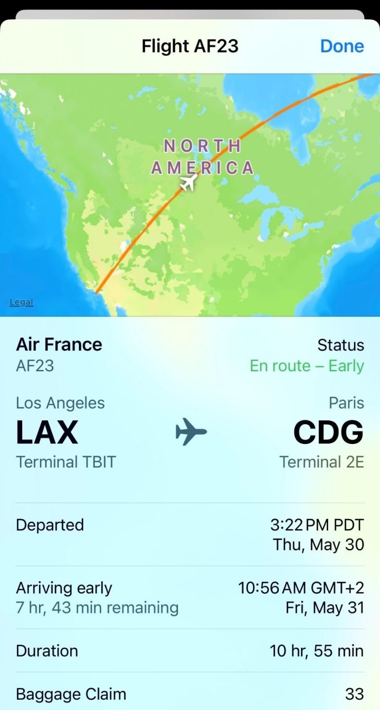
The Underlying Infrastructure of Flight Tracking
To track a flight with precision, one must understand the technical framework that enables aircraft to broadcast their location. The shift from traditional primary radar to modern secondary surveillance systems has revolutionized how data is collected and visualized.
ADS-B: The Gold Standard of Tracking Technology
Automatic Dependent Surveillance-Broadcast (ADS-B) is the cornerstone of modern flight tracking. Unlike traditional radar, which “pings” an aircraft to determine its position, ADS-B-equipped aircraft determine their own position via GPS and periodically broadcast it. This broadcast includes the aircraft’s identification, altitude, velocity, and intent.
Most modern flight tracking software relies on a global network of ADS-B receivers. These are often maintained by a community of hobbyists and professionals who use small, low-cost receivers like the Raspberry Pi equipped with a Software Defined Radio (SDR) dongle. When an aircraft broadcasts its signal on the 1090 MHz frequency, these ground stations capture the data and upload it to central servers in real-time.
MLAT (Multilateration)
For older aircraft or certain military planes that do not yet have ADS-B Out capabilities, tracking is achieved through Multilateration (MLAT). This process uses a technique known as Time Difference of Arrival (TDOA). By measuring the exact time it takes for a signal from an aircraft’s transponder to reach four or more separate ground receivers, software can calculate the aircraft’s position with high accuracy. While slightly less precise than ADS-B, MLAT is essential for maintaining a comprehensive view of the skies, particularly in regions where fleet modernization is still underway.
Satellite-Based ADS-B
One of the historical limitations of flight tracking was the “black hole” of oceanic and remote desert coverage. Ground-based receivers have a limited range, usually around 250–450 kilometers depending on altitude. To solve this, companies like Aireon have deployed ADS-B receivers on low-Earth orbit satellites. This allows for 100% global coverage, ensuring that a flight over the middle of the Atlantic Ocean is just as visible as one landing at Heathrow or JFK.
Leading Software and Platforms for Real-Time Monitoring
The consumer tech market for flight tracking is dominated by a few key players, each offering different layers of data granularity and technical features. Choosing the right tool depends on whether you are looking for a simple arrival time or deep telemetry data.
Flightradar24: The User Interface Leader
Flightradar24 is arguably the most popular flight tracking app globally, known for its intuitive graphical interface. It provides a real-time map populated with yellow and blue aircraft icons. Beyond simple location, the platform offers technical “squawk” codes—four-digit identifiers used by pilots to communicate with Air Traffic Control (ATC). For instance, seeing an aircraft pulse red with a squawk of 7700 indicates an on-board emergency, a feature frequently monitored by aviation enthusiasts and journalists.
FlightAware: Enterprise-Grade Data and Predictive Analytics
While Flightradar24 excels in visual representation, FlightAware is often the choice for those needing robust historical data and enterprise-level insights. Its proprietary “FlightAware Foresight” engine uses machine learning and AI to predict arrival times more accurately than the airlines themselves. It analyzes weather patterns, runway configurations, and historical “turnaround” times to provide a technical estimate of when a plane will actually touch down, rather than just the scheduled gate arrival.
RadarBox: Diversity in Data Sources
RadarBox differentiates itself by integrating a wider variety of data sources beyond just ADS-B, including FLARM (used by gliders and light aircraft) and various government data feeds. This makes it a powerful tool for tracking a diverse range of aerial vehicles that might not appear on more mainstream platforms.

Advanced Features and Power User Tools
For tech-savvy users, tracking a flight involves more than just looking at a map. Modern applications offer a suite of advanced features that turn a smartphone into a portable control tower.
Augmented Reality (AR) View
Many top-tier tracking apps now include an AR mode. By utilizing the smartphone’s gyroscope, GPS, and camera, the app overlays flight data onto the live camera feed. If you see a plane in the sky, you can point your device at it to instantly see its flight number, origin, destination, and current altitude. This is a prime example of computer vision and sensor fusion being applied to consumer aviation tech.
Digital Alerts and Filters
Power users utilize sophisticated filtering systems to monitor the skies. You can set push notifications for specific “hex codes” (unique 24-bit addresses assigned to every aircraft), specific flight numbers, or even specific aircraft types like the Boeing 747 or the Airbus A380. These filters allow users to ignore the noise of standard commercial traffic and focus on unique or historically significant flights.
3D Cockpit Views
Using a combination of real-time telemetry and high-resolution satellite imagery (often provided by Google Earth or Mapbox), several tracking platforms offer a “Pilot’s View.” This feature simulates what the pilot sees from the cockpit in a 3D-rendered environment. While the visuals are simulated, the movement, pitch, and bank of the “camera” are driven by the actual data being broadcast by the aircraft’s transponder.
Privacy, Security, and Technical Ethics
As flight tracking technology has become more accessible, it has sparked significant debate regarding privacy and security. The transparency provided by these tools occasionally clashes with the operational security requirements of governments and the privacy desires of high-net-worth individuals.
The LADD and PIA Programs
In the United States, the FAA (Federal Aviation Administration) manages the Limiting Aircraft Data Displayed (LADD) program. This allows aircraft owners to request that their flight data be hidden from public view. Furthermore, the Privacy ICAO Address (PIA) program allows operators to use a temporary, randomized aircraft address to mask their true identity. However, because ADS-B is an unencrypted broadcast, dedicated hobbyists can often circumvent these “blocks” by tracking the raw signal rather than the filtered FAA data feed.
Cybersecurity in Aviation Data
The unencrypted nature of ADS-B has raised concerns about “spoofing.” In theory, a sophisticated actor could use a high-powered SDR to broadcast false ADS-B signals, creating “ghost planes” on tracking software. While this does not affect the actual radar used by ATC (which uses more secure, encrypted secondary radar), it highlights a vulnerability in the public-facing side of aviation technology. Developers are constantly refining their algorithms to verify data integrity by cross-referencing ADS-B signals with MLAT calculations and satellite verification.
The Future of Tracking: AI and the Internet of Planes
The next frontier in flight tracking is the integration of Artificial Intelligence and the expansion of the “Internet of Planes.” As we move toward a more connected airspace, the data generated by a single flight will become even more granular.
Predictive Maintenance and Real-Time Telemetry
Airlines are beginning to share limited telemetry data—such as engine health and fuel consumption—over digital networks. While not yet fully public, the trend suggests a future where tracking an airplane flight could include seeing the real-time fuel efficiency of the aircraft or the status of its mechanical systems.

Integration with Smart Cities
In the future, flight tracking data will likely be integrated into broader “Smart City” infrastructures. Imagine a ride-sharing app that automatically dispatches a vehicle based on the real-time landing data from an ADS-B feed, or noise-canceling window technology in homes that activates specifically when tracking data indicates a low-flying aircraft is approaching.
Tracking an airplane flight has evolved from a niche hobby into a sophisticated technological endeavor. By leveraging global networks of sensors, satellite relays, and advanced data processing, we have achieved a level of transparency in the skies that was previously unimaginable. Whether for logistical efficiency, security, or simple curiosity, the digital tools available today represent the pinnacle of modern telecommunications and data science in the aviation sector.
aViewFromTheCave is a participant in the Amazon Services LLC Associates Program, an affiliate advertising program designed to provide a means for sites to earn advertising fees by advertising and linking to Amazon.com. Amazon, the Amazon logo, AmazonSupply, and the AmazonSupply logo are trademarks of Amazon.com, Inc. or its affiliates. As an Amazon Associate we earn affiliate commissions from qualifying purchases.