
The sky above us, seemingly vast and empty to the casual observer, is in fact a meticulously managed highway, a complex ballet of human ingenuity and technological precision. At any given moment, thousands of aircraft are traversing continents, bridging oceans, and connecting communities across the globe. The seemingly simple question, “how many airplanes are flying right now?”, unlocks a fascinating exploration into a world underpinned by sophisticated technology – from ground-based radar systems and satellite networks to advanced software algorithms and AI-driven predictive analytics. Answering this question, not just an estimate but a real-time, dynamic count, is a testament to the seamless integration of diverse technological innovations that ensure the safety, efficiency, and interconnectedness of modern air travel. This article delves into the technological infrastructure that makes such real-time monitoring not only possible but a cornerstone of contemporary aviation.
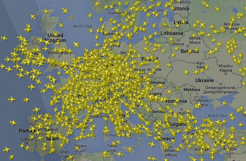
The Technological Backbone: How We Track the Skies
The ability to track thousands of aircraft simultaneously, in real-time, is not a singular invention but a symphony of interconnected technologies. These systems work in concert, gathering vast amounts of data, processing it, and disseminating it to various stakeholders, from air traffic controllers to curious enthusiasts.
Radar and ADS-B: The Primary Sensors
For decades, radar has been the workhorse of air traffic control. Primary radar sends out radio waves that bounce off aircraft and return to a receiver, providing range and bearing. Secondary radar (SSR) interrogates aircraft, which then respond with a transponder signal containing identifying information, altitude, and speed. While effective, traditional radar has limitations, including range, terrain interference, and a relatively slow refresh rate.
Enter ADS-B (Automatic Dependent Surveillance-Broadcast), a revolutionary technology that has fundamentally changed how aircraft are tracked. Instead of waiting to be “pinged” by radar, ADS-B equipped aircraft continuously broadcast their precise position, altitude, speed, and other data derived from GPS and other onboard systems. These signals are received by ground stations and even satellites, offering a more accurate, faster, and cost-effective method of surveillance. ADS-B provides superior coverage, especially at lower altitudes and in remote areas where radar coverage is sparse, and has become mandatory in many regions for modern aircraft, signifying a significant leap in aviation surveillance technology.
Satellite Communication and Global Coverage
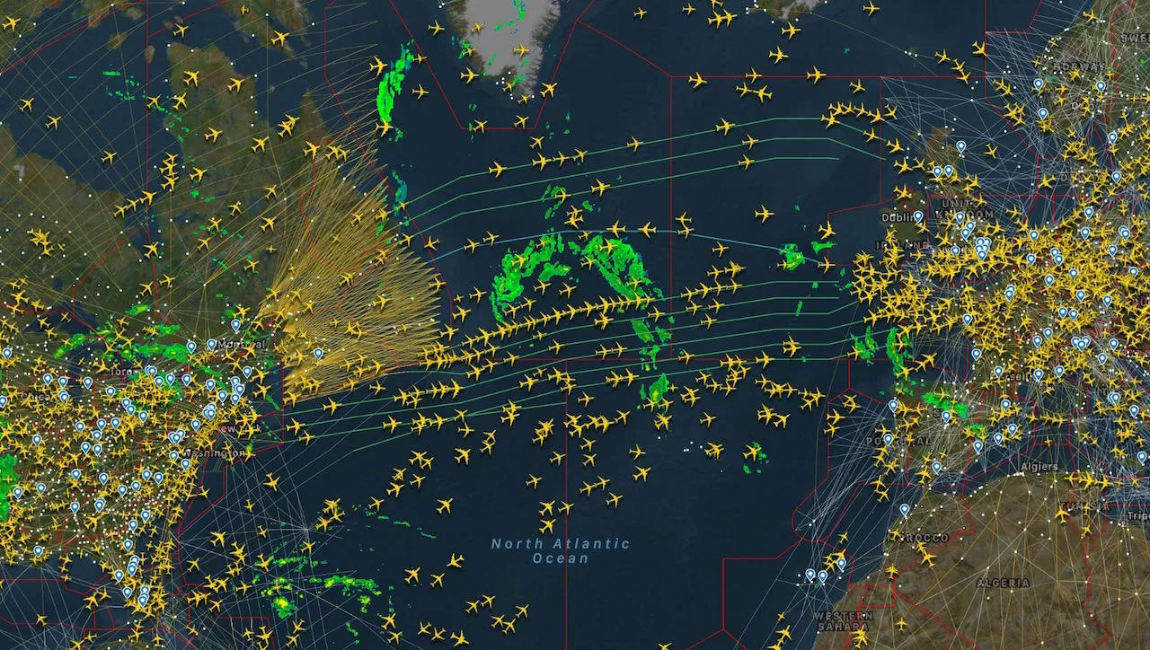
While ground-based ADS-B receivers offer excellent coverage over populated landmasses, they cannot extend far over oceans or extremely remote regions. This is where satellite communication steps in to provide truly global surveillance. Companies like Aireon utilize constellations of satellites equipped with ADS-B receivers. These satellites collect ADS-B signals from aircraft flying anywhere on Earth, including oceanic and polar regions previously only trackable via infrequent satellite voice/data links or traditional procedural control.
This satellite-based ADS-B network closes critical surveillance gaps, significantly enhancing safety by providing continuous real-time tracking of flights over areas that were once “dark spots.” Furthermore, it allows for more efficient flight paths, reducing fuel consumption and travel times, as controllers have a complete, real-time picture of air traffic across the globe, leading to a profound impact on international air traffic management and environmental sustainability.
Data Aggregation and Processing Networks
The sheer volume of data generated by radar, ADS-B, and satellite systems is immense, requiring sophisticated data aggregation and processing networks. Millions of data points – position, speed, altitude, flight number, aircraft type – are collected every second from various sources worldwide. These raw data streams are then fed into powerful servers and cloud-based infrastructure, where they undergo rigorous processing.
This processing involves filtering out erroneous data, correlating multiple data sources for accuracy, and normalizing information into a standardized format. Advanced algorithms are employed to identify individual aircraft, track their trajectories, and predict their movements. These networks are built with redundancy and high availability to ensure continuous operation, as even a momentary lapse in data can have significant safety implications. The infrastructure leverages high-speed fiber optics, secure network protocols, and distributed computing architectures to manage this continuous, global data flow, transforming disparate signals into a cohesive, real-time picture of the world’s airspace.
From Raw Data to Real-Time Visualization: The Software Ecosystem
Collecting data is only half the battle; making it intelligible and actionable requires a sophisticated software ecosystem. This layer of technology transforms raw data into user-friendly interfaces, supporting critical operational decisions and empowering public engagement.
Air Traffic Control (ATC) Systems: The Operational Core
At the heart of air traffic management are highly specialized Air Traffic Control (ATC) systems. These intricate software platforms take the aggregated and processed data from surveillance networks and present it to air traffic controllers in a digestible, real-time visual format. Controllers see aircraft as distinct symbols on a digital map, complete with flight information tags, allowing them to monitor flight paths, manage separation between aircraft, and issue clearances.
Modern ATC systems incorporate advanced features like conflict detection algorithms, which can alert controllers to potential collisions or airspace infringements, and trajectory prediction tools that assist in optimizing flight paths. These systems are designed with extreme reliability and security in mind, often running on redundant hardware and custom-built operating systems to ensure uninterrupted service. The graphical user interfaces (GUIs) are meticulously crafted for clarity and efficiency, minimizing cognitive load on controllers who are responsible for ensuring the safety of millions of passengers daily.
Public Tracking Platforms: Empowering the Enthusiast
Beyond the professional domain of ATC, a fascinating array of public tracking platforms like FlightAware and FlightRadar24 have democratized access to real-time flight data. These popular web and mobile applications aggregate data from various sources, including ADS-B receivers operated by a global network of volunteers, satellite data, and even official air traffic control feeds (where permissible).
These platforms transform complex aviation data into intuitive, interactive maps where users can see aircraft moving across the globe in real-time. Users can click on individual aircraft to view detailed information such as airline, flight number, aircraft type, origin, destination, speed, altitude, and even specific flight history. These platforms have not only fueled the passion of aviation enthusiasts but also provide practical tools for travelers to track their loved ones’ flights, monitor delays, and gain insights into global air traffic patterns, showcasing the power of open data and community-driven networks.
Predictive Analytics and AI in Air Travel
The future of air traffic management is increasingly being shaped by predictive analytics and Artificial Intelligence (AI). By analyzing vast historical and real-time flight data, weather patterns, and operational variables, AI algorithms can predict future traffic flows, potential bottlenecks, and even the likelihood of delays with remarkable accuracy. This allows air traffic controllers and airline operators to proactively manage resources, optimize routes, and make more informed decisions.
AI-powered systems can identify optimal takeoff and landing slots, minimize holding patterns, and suggest dynamic re-routing to avoid adverse weather or congested airspace. Machine learning models are also being developed to assist in maintaining aircraft, predicting component failures before they occur, thus enhancing safety and reducing downtime. The integration of AI not only promises to further enhance the efficiency and safety of air travel but also paves the way for more autonomous systems and a more fluid, adaptive global airspace management strategy.
The Impact and Implications of Hyper-Connected Skies
The technological advancements in air traffic tracking have profound implications, extending far beyond simply answering “how many airplanes are flying right now.” They shape the very fabric of air travel, influencing safety, operational efficiency, and even environmental policy.
Enhancing Safety and Efficiency
The most critical impact of real-time air traffic tracking technology is the unparalleled enhancement of safety and efficiency. Constant, precise tracking dramatically reduces the risk of mid-air collisions and allows for immediate response in emergency situations. Controllers have a clear picture of every aircraft’s position, enabling them to maintain safe separation distances and guide pilots through complex airspace.
On the efficiency front, these technologies allow for optimized flight paths and more precise scheduling. Reduced holding patterns over airports, direct routing over oceanic areas made possible by satellite ADS-B, and better management of airspace capacity all contribute to lower fuel consumption, reduced emissions, and shorter travel times. This technological precision translates directly into tangible benefits for airlines, passengers, and the environment.
Economic and Environmental Monitoring
Beyond operational control, the data generated by these tracking systems offers invaluable insights for economic and environmental monitoring. Governments and industry analysts can use real-time and historical flight data to gauge economic activity, track logistics, and understand travel demand patterns. The ability to see exactly how much air traffic is moving through specific regions or between certain economic hubs provides a powerful indicator of trade, tourism, and business connectivity.
From an environmental perspective, tracking technologies enable precise measurement of aircraft emissions. By monitoring flight paths, altitudes, and speeds, researchers can quantify the environmental footprint of air travel with greater accuracy. This data is crucial for developing and implementing strategies to reduce aviation’s impact on climate change, from optimizing routes for fuel efficiency to evaluating the effectiveness of new aircraft technologies or alternative fuels.
The Future of Air Traffic Management: Drones and Urban Air Mobility
Looking ahead, the same technological principles underpinning current air traffic tracking are being adapted and expanded for the burgeoning fields of drones and Urban Air Mobility (UAM). The proliferation of drones, from recreational quadcopters to commercial delivery vehicles, necessitates a robust, low-altitude air traffic management system. Technologies like UTM (Unmanned Aircraft System Traffic Management) are emerging, utilizing networked sensors, advanced communication, and AI to track and manage drone operations safely within shared airspace.
Similarly, the vision of UAM – electric vertical takeoff and landing (eVTOL) aircraft ferrying passengers within cities – demands an entirely new layer of sophisticated, highly automated air traffic control. This future will rely even more heavily on real-time data fusion, predictive analytics, and AI to manage dense, multi-layered air traffic with unprecedented levels of automation and precision, transforming urban transportation as we know it.
Challenges and Innovations in Air Traffic Data
While current systems are incredibly robust, the ever-increasing demand for air travel and the emergence of new aerial technologies present ongoing challenges and drive continuous innovation in air traffic data management.
Cybersecurity and Data Integrity
With the entire global air traffic system reliant on digital data, cybersecurity and data integrity become paramount concerns. Protecting sensitive flight information, preventing unauthorized access to control systems, and ensuring the unalterable accuracy of tracking data are critical. Cyberattacks could disrupt operations, compromise safety, or lead to significant financial losses.
Innovations in this area include advanced encryption protocols, secure network architectures, robust authentication systems, and continuous monitoring for anomalous activities. Blockchain technology is even being explored for its potential to create immutable records of flight data, enhancing trust and security across the complex ecosystem of aviation stakeholders. The ongoing battle against cyber threats requires constant vigilance and investment in cutting-edge security solutions.
Scalability and Latency for Global Coverage
Managing a network that tracks thousands of aircraft simultaneously, with data refreshing every few seconds, across the entire planet, presents immense challenges in scalability and latency. The system must be able to handle surges in traffic, integrate new data sources seamlessly, and deliver information with minimal delay to ensure real-time decision-making.
Future innovations are focusing on distributed cloud computing, edge computing at ground stations to process data closer to the source, and the adoption of more efficient data transmission protocols. The goal is to reduce latency even further, enabling even faster response times for air traffic controllers and more immediate updates for public tracking platforms, ensuring the system can grow to meet the demands of an expanding global fleet.
Next-Generation Tracking: From 5G to Quantum Computing
The horizon of air traffic tracking is filled with exciting possibilities, driven by technologies like 5G and potentially quantum computing. The rollout of 5G networks, with their ultra-low latency and massive bandwidth, could revolutionize aircraft-to-ground communication, enabling even faster and more reliable data exchange for tracking and air-to-air collision avoidance systems. It could also support a higher density of sensors and more complex real-time data analytics.
Looking further ahead, quantum computing holds the promise of processing immense datasets at speeds currently unimaginable. While still nascent, quantum algorithms could potentially optimize flight paths in real-time across an entire continent, dynamically re-route thousands of aircraft simultaneously to avoid turbulence or congestion, and solve complex air traffic management problems that are beyond the capabilities of even the most powerful supercomputers today. These futuristic technologies could unlock unprecedented levels of efficiency, safety, and automation in air travel.
The Unseen Symphony: A Global Snapshot
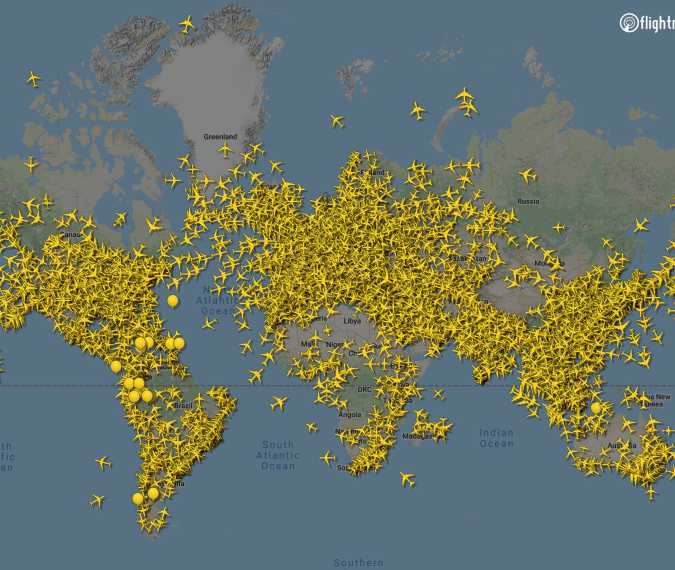
To answer the original question, “how many airplanes are flying right now?”, one would typically consult one of the aforementioned public tracking platforms. At any given moment, depending on the time of day and global air traffic patterns, that number fluctuates, but it frequently hovers between 8,000 and 20,000 commercial and cargo flights aloft simultaneously, with tens of thousands more if private, military, and general aviation aircraft are included. This ever-changing figure represents a dynamic snapshot of a world in motion.
This intricate global dance is not merely a collection of individual journeys but an “unseen symphony” orchestrated by a vast, sophisticated network of technologies. From the electromagnetic whispers of radar and ADS-B signals to the complex algorithms churning through petabytes of data in cloud servers, and finally to the glowing screens of air traffic controllers and public tracking apps – every component plays a vital role. This continuous, real-time monitoring ensures that the vast, complex, and potentially dangerous endeavor of air travel remains one of the safest modes of transportation, a testament to humanity’s relentless pursuit of technological mastery and seamless global connectivity. The next time you look up at the sky, remember the invisible technological threads weaving together thousands of journeys above.
aViewFromTheCave is a participant in the Amazon Services LLC Associates Program, an affiliate advertising program designed to provide a means for sites to earn advertising fees by advertising and linking to Amazon.com. Amazon, the Amazon logo, AmazonSupply, and the AmazonSupply logo are trademarks of Amazon.com, Inc. or its affiliates. As an Amazon Associate we earn affiliate commissions from qualifying purchases.