
The geological concept of sedimentary rock, fundamental to understanding Earth’s history and resources, is increasingly being defined, analyzed, and characterized through the lens of advanced technology. While the intrinsic scientific definition remains rooted in natural processes, the modern interpretation and application of this definition are heavily reliant on digital tools, data science, and sophisticated instrumentation. From geological software platforms that model their formation to AI algorithms that classify their types, technology reshapes how we understand and interact with these critical Earth materials, offering a dynamic and data-rich “definition” beyond traditional observation.
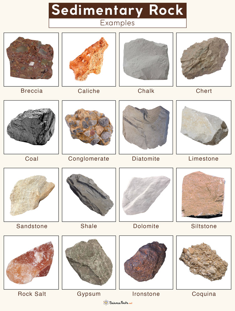
Digitalizing Geological Definitions: Sedimentary Rock in Data Models and AI
In the era of big data and artificial intelligence, the very “definition” of sedimentary rock extends beyond textbooks into complex digital frameworks. Geologists and data scientists now leverage computational power to store, process, and interpret vast amounts of information related to these rocks, creating a dynamic, multi-faceted digital definition that enhances traditional understanding.
Schema and Ontologies for Earth Science Data
The foundational step in defining sedimentary rock technologically involves structuring geological data. Earth science relies on robust data schemas and ontologies – formal representations of knowledge – to systematically categorize and interrelate geological concepts. For sedimentary rocks, this means defining attributes such as grain size, mineral composition, matrix type, cementation, sorting, texture, and depositional environment within standardized digital formats. These schemas allow for consistent data entry, efficient querying, and interoperability between different software applications. An ontology, for instance, might establish that “sandstone” is a subclass of “clastic sedimentary rock,” which in turn is a subclass of “sedimentary rock,” inheriting common properties while adding specific ones. This hierarchical digital definition enables automated reasoning and advanced data analysis, moving beyond simple text descriptions to a computable representation of geological knowledge. Projects like GeoSciML (Geoscience Markup Language) provide such frameworks, allowing geological surveys and research institutions worldwide to share and integrate their data on sedimentary rock types and formations seamlessly.
The Role of GIS in Mapping Sedimentary Formations
Geographic Information Systems (GIS) provide a crucial technological layer for defining sedimentary rocks by mapping their spatial distribution and relationships. A GIS definition of a sedimentary rock isn’t just its inherent properties, but also its location, depth, thickness, and lateral extent within a three-dimensional geological model. By integrating remote sensing data (satellite imagery, aerial photography), geophysical surveys (seismic data, magnetics), and borehole logs, GIS platforms create comprehensive digital maps and models of sedimentary basins. These models allow for the visualization of rock units in cross-section and 3D, enabling geoscientists to “define” the rock’s geometry and spatial context. Advanced GIS tools facilitate the analysis of geological structures, faulting, and unconformities, all of which are critical for understanding the formation and deformation history of sedimentary rock bodies. This spatial definition is essential for resource exploration, environmental management, and hazard assessment, allowing for precise, location-based understanding.
AI and Machine Learning in Sedimentary Rock Classification
Artificial intelligence and machine learning algorithms are revolutionizing how sedimentary rocks are classified and “defined” from various data sources, moving beyond manual interpretation to automated, data-driven insights. These technologies can process vast datasets at speeds and scales impossible for human geologists alone, identifying subtle patterns and correlations that refine our understanding.
Image Recognition and Hyperspectral Analysis
AI-powered image recognition is transforming the classification of sedimentary rocks. Deep learning models can be trained on vast datasets of core images, thin sections, and outcrop photographs to automatically identify rock types, sedimentary structures, and even diagenetic features. For example, convolutional neural networks (CNNs) can differentiate between sandstone, shale, and limestone based on textural patterns, grain shapes, and color variations. Hyperspectral imaging, which captures data across a wide spectrum of light, provides even richer information. Machine learning algorithms can analyze these spectral fingerprints to identify specific minerals, fluids, and even organic matter within sedimentary rocks, providing a high-resolution “chemical definition” that is crucial for understanding provenance and economic potential. These technologies allow for rapid, consistent, and objective classification, significantly speeding up geological surveys and resource characterization.
Predictive Modeling of Sedimentary Basins
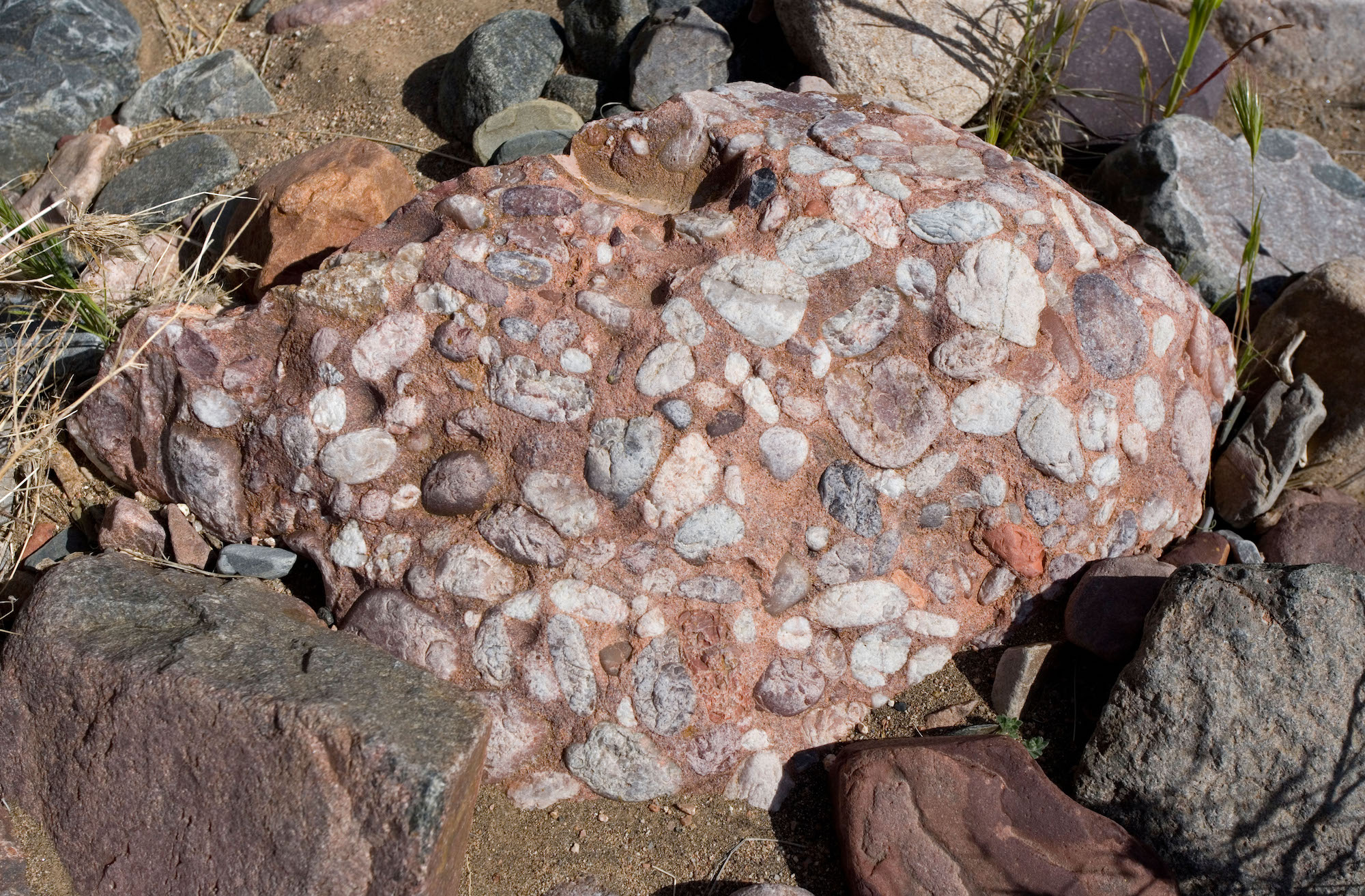
Machine learning also extends the definition of sedimentary rocks into the realm of prediction. By analyzing existing geological, geophysical, and geochemical data from known sedimentary basins, ML models can learn complex relationships and predict the likely presence, characteristics, and distribution of sedimentary rock types in unexplored or poorly understood areas. These predictive models can forecast properties like porosity, permeability, and fluid saturation – key attributes that define a rock’s economic value. For instance, in oil and gas exploration, AI algorithms can integrate seismic attributes, well log data, and regional geological models to predict the most prospective sedimentary rock reservoirs, effectively “defining” potential economic targets before drilling. This capability shifts the definition from purely descriptive to predictive, allowing for more efficient resource exploration and risk assessment.
Simulation and Virtualization: Experiencing Sedimentary Rock Digitally
Beyond classification and mapping, technology allows for the simulation and virtualization of sedimentary rocks, offering new ways to interact with and “experience” their properties and processes in a digital environment. This immersive approach deepens understanding and facilitates complex analysis.
3D Modeling and Virtual Reality in Geological Education
Three-dimensional modeling software and virtual reality (VR) environments provide dynamic digital “definitions” of sedimentary rocks, enabling unprecedented visualization and interaction. Geoscientists and students can explore virtual outcrops, navigate through subsurface stratigraphy, and manipulate geological models in ways that are impossible in the field. VR simulations allow users to “walk through” ancient sedimentary environments, observing how different rock types form and relate to each other in a paleo-geographic context. This level of immersion helps define the spatial relationships and structural integrity of sedimentary rock bodies, improving intuitive understanding and training. For complex datasets, 3D models consolidate diverse information into a coherent visual definition, making it easier to identify features like facies changes, unconformities, and subtle stratigraphic traps.
Reservoir Simulation and Resource Exploration
In the energy sector, sophisticated reservoir simulation software defines the dynamic behavior of fluids within porous sedimentary rocks. These simulators create digital twins of subsurface reservoirs, modeling the flow of oil, gas, and water through the rock’s pore network under various production scenarios. The definition of the sedimentary rock in this context includes not just its static properties (porosity, permeability, lithology) but also its dynamic response to fluid injection, pressure changes, and extraction. These simulations are critical for optimizing hydrocarbon recovery, evaluating CO2 sequestration potential, and managing geothermal reservoirs. By running multiple scenarios, engineers can effectively “define” the economic viability and long-term performance of a sedimentary rock reservoir, making informed decisions on development strategies.
The Technological Tools for Sedimentary Rock Analysis
Defining sedimentary rock accurately and comprehensively relies heavily on a suite of advanced technological tools that gather and process data from various scales, from remote sensing across vast landscapes to microscopic analysis in the laboratory.
Remote Sensing Technologies
Remote sensing provides a macroscopic technological definition of sedimentary rocks by analyzing electromagnetic radiation reflected or emitted from the Earth’s surface. Satellite-based sensors (e.g., Landsat, Sentinel) capture data across various spectral bands, allowing for the identification and mapping of different rock units based on their unique spectral signatures. For instance, distinguishing between sandstones, shales, and limestones from orbit can be achieved by analyzing their characteristic absorption and reflection patterns across visible, infrared, and thermal wavelengths. Lidar (Light Detection and Ranging) technology offers precise topographic data, enabling the creation of detailed digital elevation models that highlight sedimentary structures such as bedding planes, folds, and faults. These remotely acquired datasets offer a broad, regional “definition” of sedimentary rock distribution and structural context, guiding more detailed fieldwork and resource exploration efforts.

Advanced Laboratory Instruments and Data Integration
At the microscopic and elemental level, laboratory technologies provide highly detailed analytical “definitions” of sedimentary rocks. Electron microscopes (SEM, TEM) reveal the texture, grain morphology, and mineralogy at nano-scale, providing insights into diagenetic processes and porosity evolution. X-ray diffraction (XRD) and X-ray fluorescence (XRF) define the mineralogical and elemental composition, respectively, offering quantitative data on bulk rock properties. Mass spectrometry can identify isotopes, providing clues about the rock’s age and provenance. Crucially, the power of modern technology lies not just in individual instruments but in the integration of data from these diverse sources. Specialized software platforms are used to combine and interpret these multi-scale datasets, creating a holistic and multi-dimensional “definition” of the sedimentary rock that encompasses its physical, chemical, and petrographic characteristics, from the scale of a mineral grain to an entire geological basin.
In conclusion, while the fundamental geological definition of sedimentary rock remains constant, technology has profoundly expanded how we understand, categorize, model, and apply this definition. From digital data structures and AI-driven classification to virtual reality simulations and advanced analytical instruments, technological advancements provide increasingly precise, predictive, and interactive “definitions” of sedimentary rocks, essential for scientific research, resource management, and environmental stewardship in the 21st century.
aViewFromTheCave is a participant in the Amazon Services LLC Associates Program, an affiliate advertising program designed to provide a means for sites to earn advertising fees by advertising and linking to Amazon.com. Amazon, the Amazon logo, AmazonSupply, and the AmazonSupply logo are trademarks of Amazon.com, Inc. or its affiliates. As an Amazon Associate we earn affiliate commissions from qualifying purchases.