
In the landscape of modern engineering and tactical operations, a mission system is defined as a complex integration of hardware, software, sensors, and communication interfaces designed to achieve specific operational objectives. When a system is described as “GPS-dependent,” it implies that the Global Positioning System—a constellation of satellites providing precise time and location data—is the foundational anchor for the system’s navigation, timing, and synchronization capabilities.
Without the continuous stream of signals from these satellites, a GPS-dependent mission system faces immediate degradation or total failure. These systems are prevalent across defense, autonomous logistics, maritime navigation, and critical infrastructure. Understanding their architecture, vulnerabilities, and reliance on satellite signals is essential for engineers and systems architects working within the technology sector.

The Architectural Foundation of GPS-Dependent Systems
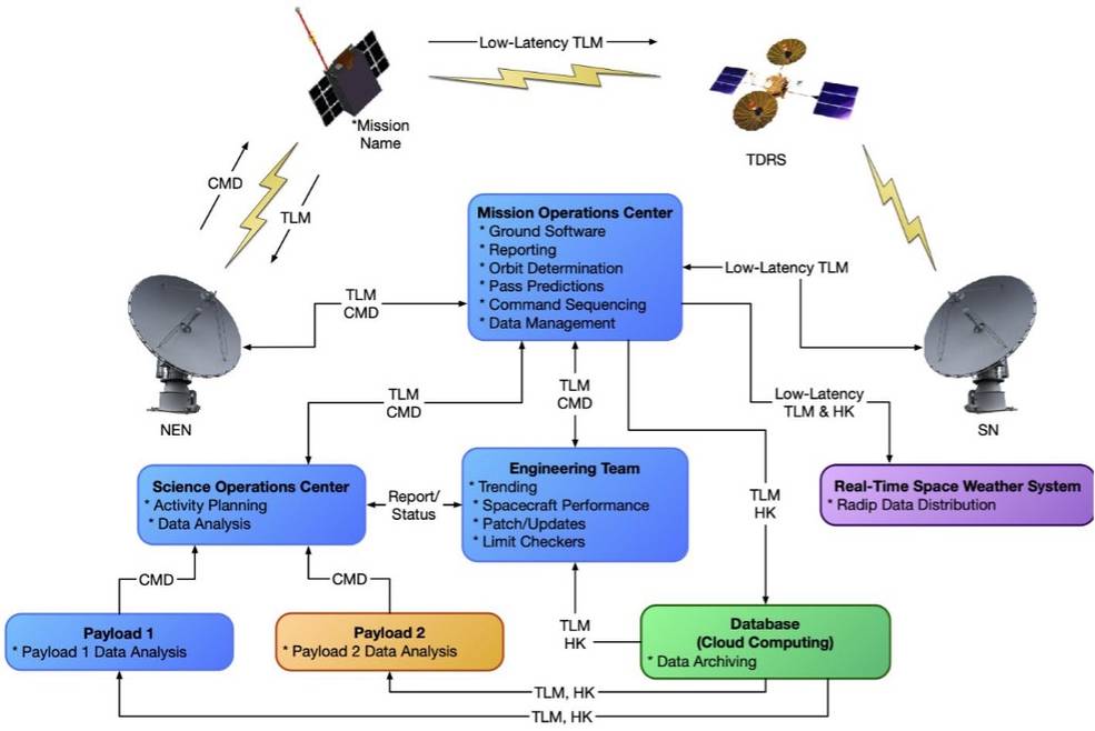
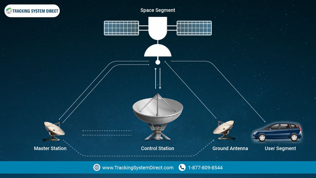
At its core, a mission system reliant on GPS functions through the constant triangulation of signals. The system’s onboard receiver tracks at least four satellites to determine its three-dimensional position (latitude, longitude, and altitude) and its precise time offset. This data is fed into a Mission Management Computer (MMC), which acts as the central brain of the platform.
Navigation and Spatial Awareness
For mobile mission systems—such as Unmanned Aerial Vehicles (UAVs) or autonomous ground robots—GPS provides the “truth” regarding location. The mission software processes this GPS coordinate stream to execute pre-programmed flight paths, maintain station-keeping in variable weather conditions, and ensure the platform reaches its target objective. In these systems, the GPS data is not merely a reference; it is the primary input for the platform’s control loops. If the GPS signal is interrupted, the system must immediately pivot to secondary navigation aids, such as Inertial Navigation Systems (INS) or visual odometry, to prevent drifting or mission failure.
Temporal Synchronization
Beyond location, GPS is the world’s most accurate source of timing. Many mission systems, particularly those involved in high-speed digital communications or coordinated sensor arrays, depend on the “Time of Arrival” data from GPS satellites. This synchronization allows multiple distributed sensors to timestamp data packets accurately. In tactical environments, if the timing signal from GPS drifts, the entire network’s ability to correlate data from different sensors—such as radar, infrared, and optical cameras—collapses, rendering the mission system unable to build a coherent picture of the operating environment.
Critical Vulnerabilities and Technical Dependencies
While GPS provides unparalleled accuracy, its reliance on radio frequency (RF) signals transmitted from space makes it a vulnerable link in the mission chain. The signals are relatively weak by the time they reach the Earth’s surface, which presents significant technical challenges for systems designers.
The Signal-to-Noise Challenge
The primary weakness of a GPS-dependent system is the reliance on a signal that can be easily masked or overwhelmed. Because the satellites operate on low-power broadcasts, the signal is susceptible to electromagnetic interference, whether intentional (jamming) or unintentional (atmospheric distortion or dense urban multipath effects). An effective mission system must incorporate ruggedized receivers that utilize advanced signal processing techniques, such as beamforming and null-steering, to filter out interference and prioritize legitimate satellite data.
Dependence on External Infrastructure
A mission system that depends on GPS is essentially tethered to an infrastructure it does not control. If the mission parameters require high-reliability operation in “GPS-denied” environments—areas where the signal is intentionally blocked or physically obstructed—the reliance on satellite constellations becomes a liability. Engineers must design software architectures that allow for “graceful degradation.” This involves the implementation of multi-modal navigation, where the system seamlessly switches from GPS-centric logic to dead reckoning, terrain contour matching, or celestial navigation without user intervention.
Integration Strategies for Resilient Mission Systems
To mitigate the risks associated with GPS dependency, modern software and hardware design has shifted toward the concept of “PNT” (Positioning, Navigation, and Timing) diversification. Building a system that relies on GPS is no longer a matter of simply integrating a receiver; it is about building a hierarchy of sensors that respect the GPS feed while maintaining the ability to operate independently of it.
Sensor Fusion and Kalman Filtering
Sophisticated mission systems utilize Kalman filters to manage sensor fusion. This mathematical approach estimates the state of the system by combining inputs from multiple sources. In a typical configuration, the GPS provides the primary location data, while accelerometers, gyroscopes, and magnetometers provide continuous, high-frequency motion data. The filter constantly compares these inputs. If the GPS data becomes erratic or disappears, the mission software automatically relies on the dead-reckoning sensors to estimate the vehicle’s position. The resilience of the mission system depends entirely on how effectively this software can weight these different inputs in real-time.
Overcoming Signal Obscuration
In environments like deep urban canyons or heavily forested regions, GPS signals are often blocked or reflected (the multipath problem). Mission systems designed for these environments must incorporate “High-Sensitivity” receivers and integration algorithms that detect reflected signals. By analyzing the time delay of signals bouncing off buildings, the software can differentiate between a direct line-of-sight signal and a multipath reflection, ensuring that the mission data remains accurate even under adverse conditions.
The Future of Mission Systems in GPS-Degraded Environments
The trajectory of technology trends points toward the total abstraction of navigation inputs. Future mission systems will likely be “position-agnostic,” meaning the primary mission logic will remain the same regardless of which sensor is providing the data.
Edge Computing and Localized Navigation
With the rise of localized edge computing, mission systems are becoming increasingly capable of processing vision-based navigation at the edge. By using onboard AI and computer vision models, systems can “recognize” their surroundings and map their location relative to physical landmarks. This development is pivotal for reducing the dependency on GPS. By using Simultaneous Localization and Mapping (SLAM) technology, a system can navigate with centimeter-level precision within a localized area, even if the GPS constellation is completely inaccessible.
The Shift Toward Multi-Constellation Support
While the U.S. Global Positioning System is the most recognizable, modern mission systems are increasingly designed to support GNSS (Global Navigation Satellite System) broadly. By integrating support for European Galileo, Russian GLONASS, and Chinese BeiDou, mission systems improve their resilience. The more satellite signals available to the receiver, the higher the probability of maintaining a valid position lock, even if one specific constellation suffers from performance degradation or intentional interference.
Ultimately, the term “GPS-dependent” describes a system built upon a foundation of incredible precision. As software design becomes more robust, the challenge for engineers is to ensure that while GPS remains the “gold standard” for input, it does not become a single point of failure. The evolution of these mission systems relies on creating layers of data autonomy, where the technology intelligently balances the ease of GPS with the necessary reliability of internal, localized navigation sensors. Through this multi-layered approach, mission systems can maintain their operational efficacy in an increasingly complex and contested electromagnetic environment.
aViewFromTheCave is a participant in the Amazon Services LLC Associates Program, an affiliate advertising program designed to provide a means for sites to earn advertising fees by advertising and linking to Amazon.com. Amazon, the Amazon logo, AmazonSupply, and the AmazonSupply logo are trademarks of Amazon.com, Inc. or its affiliates. As an Amazon Associate we earn affiliate commissions from qualifying purchases.