
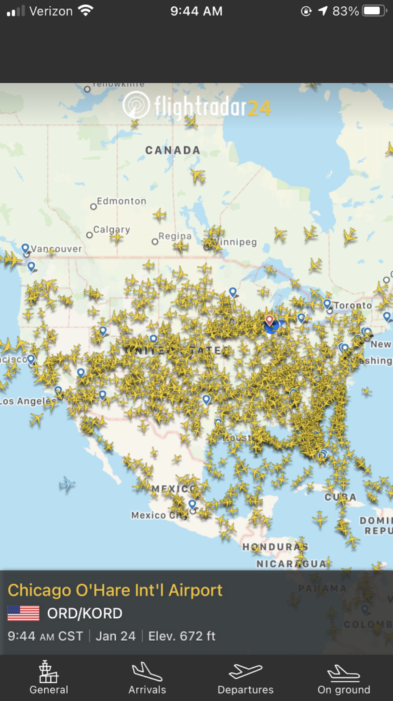
The sky above us, once a vast and largely empty expanse save for the occasional bird or commercial airliner, is rapidly transforming into a bustling highway of technological innovation. From miniature drones flitting across urban landscapes to constellations of satellites beaming data from low Earth orbit, what “flies above me” today represents a profound shift in how we observe, connect, and interact with our world. This aerial revolution, powered by advancements in robotics, artificial intelligence, and network infrastructure, is not merely a collection of fancy gadgets but a fundamental re-engineering of possibilities across industries and daily life. As we delve into the intricate layers of this airborne ecosystem, we uncover a future where the sky is not the limit, but the next frontier of technological exploration and utility.
The Ascent of Unmanned Aerial Vehicles (UAVs)
The most visible and perhaps most democratized aspect of the aerial revolution is the proliferation of Unmanned Aerial Vehicles, commonly known as drones. What began as military technology has swiftly transitioned into consumer electronics and indispensable industrial tools, fundamentally altering numerous sectors. These aren’t just remote-controlled toys; they are sophisticated platforms integrating advanced sensors, communication systems, and increasingly, autonomous capabilities.
From Niche Gadget to Industrial Workhorse
The evolution of drones from hobbyist toys to vital industrial assets is a testament to rapid technological maturation. Early consumer drones offered basic flight and rudimentary camera capabilities. Today, professional-grade UAVs boast centimeter-level GPS accuracy, multi-spectral cameras for agricultural analysis, thermal imaging for infrastructure inspection, and LiDAR sensors for precise 3D mapping. Companies in construction use drones for site surveys and progress monitoring, reducing costs and improving safety. Energy companies deploy them to inspect vast networks of power lines and pipelines, identifying issues far more efficiently than traditional methods. In agriculture, precision spraying drones optimize resource use, while mapping drones provide critical data for crop health analysis, enhancing yields and sustainability. This transition underscores a broader trend in technology: miniaturization, increased processing power, and affordability converging to make advanced tools accessible for diverse applications. The hardware itself – lightweight composites, efficient brushless motors, and long-lasting battery technology – forms the foundation, but it’s the intelligent software stack that truly unlocks their potential.
Software and AI: The Intelligence Behind Flight
A drone is only as good as the software that governs its flight and interprets its data. Modern UAVs rely on complex flight control systems, often leveraging open-source platforms like ArduPilot or PX4, which integrate GPS, accelerometers, gyroscopes, and magnetometers to ensure stable and precise flight. Beyond basic stability, Artificial Intelligence (AI) and machine learning are transforming drone operations. AI algorithms enable drones to perform autonomous navigation, obstacle avoidance, and even object recognition in real-time. For instance, drones can automatically follow predefined flight paths to inspect a bridge, identifying hairline cracks or corrosion with computer vision without direct human control. In logistics, AI-powered systems are being developed to optimize drone delivery routes, manage landing zones, and predict maintenance needs. The data collected by these aerial platforms — often terabytes of imagery and sensor readings — is then fed into AI models for analysis, extracting actionable insights that would be impossible for humans to process manually. This fusion of robust hardware with intelligent software and AI is what truly defines the “smart” drone, moving it from a data collector to an intelligent decision-support system.
Specialized Applications: Agriculture, Infrastructure, and Logistics
The true impact of UAVs is best seen in their specialized applications. In agriculture, drones equipped with hyperspectral and multispectral cameras can monitor crop health, identify disease outbreaks, and even perform targeted pesticide or fertilizer application, leading to “precision agriculture.” For infrastructure inspection, drones offer unparalleled access to dangerous or hard-to-reach areas like wind turbines, cell towers, and elevated pipelines, reducing the need for human personnel at risk and dramatically cutting inspection times. The data gathered provides highly accurate 3D models and detailed imagery for proactive maintenance. In logistics, the dream of drone delivery is steadily becoming a reality, especially for medical supplies in remote areas or last-mile delivery in urban environments. Companies are investing heavily in drone hubs, automated package handling systems, and sophisticated air traffic management software to integrate these aerial couriers into existing supply chains. Each application leverages specific sensor payloads, flight patterns, and data processing pipelines, illustrating the versatility and adaptability of drone technology when paired with targeted software solutions.
Redefining Connectivity and Observation from Orbit
While drones dominate the lower airspace, the upper echelons are witnessing an equally profound revolution driven by satellite technology. What once required massive, government-funded endeavors is now being democratized by commercial enterprises launching constellations of smaller, more affordable satellites, fundamentally altering global connectivity and Earth observation.
The LEO Satellite Constellation Boom
The concept of a single, geostationary satellite providing broad but relatively slow coverage is being challenged by Low Earth Orbit (LEO) satellite constellations. Companies like SpaceX (Starlink), OneWeb, and Amazon (Project Kuiper) are deploying thousands of small, interconnected satellites orbiting just a few hundred kilometers above Earth. The primary technological advantage of LEO satellites is their proximity, which dramatically reduces signal latency compared to geostationary satellites. This makes high-speed, low-latency internet access possible even in the most remote areas, bridging the digital divide and enabling new applications requiring real-time data transfer. The technology behind this boom includes mass-produced, modular satellite designs, advanced propulsion systems for orbital maneuvering, and sophisticated inter-satellite laser links that allow data to hop from one satellite to another without needing to route through a ground station, creating a truly global mesh network in space. Ground stations themselves are becoming smaller and more automated, employing phased array antennas to track and communicate with multiple satellites simultaneously.
Geospatial Data: A New Frontier for Insights
Beyond connectivity, satellites are powerful tools for Earth observation, providing an unprecedented stream of geospatial data. High-resolution imaging satellites capture detailed photographs of the Earth’s surface, offering insights for urban planning, disaster response, and environmental monitoring. Synthetic Aperture Radar (SAR) satellites can penetrate clouds and darkness, providing continuous monitoring capabilities critical for maritime surveillance or tracking deforestation regardless of weather conditions. These satellites collect vast amounts of data—images, spectral signatures, elevation models—which, when combined with AI and machine learning algorithms, yield powerful insights. For example, AI can analyze satellite imagery to detect changes in land use, monitor agricultural health on a global scale, track the movement of ships for supply chain analysis, or assess damage after natural disasters with unparalleled speed and accuracy. This data forms the backbone of countless applications, from precise mapping services to climate change research and predictive analytics for commodity markets, highlighting the critical role of software and AI in transforming raw satellite data into actionable intelligence.
High-Altitude Platforms (HAPs): Persistent Presence

Bridging the gap between drones and satellites are High-Altitude Platform Stations (HAPS). These are typically large, uncrewed aircraft (like solar-powered gliders or stratospheric balloons) designed to operate at altitudes of 18-25 kilometers, well above commercial air traffic but below satellite orbits. Their key advantage is “persistent presence” over a specific region for extended periods (months or even years), offering localized connectivity, surveillance, or environmental monitoring with lower latency than satellites and broader coverage than ground-based infrastructure. Technologically, HAPS rely on advanced lightweight materials, highly efficient solar panels and battery systems for continuous flight, and sophisticated autonomous flight control software. They can act as flying cell towers, providing 5G connectivity to underserved areas, or carry advanced sensors for long-term atmospheric monitoring. While still largely in the research and development phase, HAPS represent a compelling vision for flexible, on-demand aerial infrastructure that can adapt to changing needs, offering a unique blend of satellite and drone capabilities.
The Promise of Urban Air Mobility and Beyond
The aerial revolution isn’t just about what’s above us, but what will soon be around us, transforming how people and goods move within urban environments. The vision of “flying cars” is slowly but surely moving from science fiction to engineering prototypes, giving rise to the concept of Urban Air Mobility (UAM).
Electric Vertical Take-off and Landing (eVTOL) Aircraft
At the heart of UAM are Electric Vertical Take-off and Landing (eVTOL) aircraft. These are essentially larger, passenger-carrying versions of drones, designed to take off and land vertically, eliminating the need for long runways. Companies like Joby Aviation, Archer Aviation, and Lilium are developing various eVTOL designs, ranging from multi-rotor systems akin to giant quadcopters to tilt-wing designs that combine vertical lift with efficient forward flight. The technological challenges are immense: developing high-density, lightweight battery packs, efficient electric motors, advanced flight control systems for precise maneuvering in complex airspaces, and robust safety protocols. The emphasis is on electric propulsion to ensure zero emissions during flight and reduced noise, making them suitable for urban operations. While certification and regulatory hurdles remain significant, prototypes are undergoing rigorous testing, demonstrating the feasibility of these innovative aerial vehicles for short-haul inter-city travel or air taxi services.
Air Traffic Management (ATM) for Lower Airspace
The introduction of thousands of new aerial vehicles—drones, eVTOLs, and potentially HAPS—into the already complex airspace demands a complete overhaul of traditional air traffic management (ATM) systems. Current ATM is designed for relatively few, large aircraft operating on established routes. The future requires a highly automated, dynamic, and scalable system for managing diverse aerial traffic in the lower airspace (typically below 1,500 meters), often referred to as Unmanned Aircraft System Traffic Management (UTM) or UAM traffic management. This involves sophisticated software platforms for flight planning, real-time tracking, conflict detection and resolution, and dynamic airspace allocation. AI will play a critical role in predicting traffic patterns, optimizing routes, and responding to unforeseen events. The technology needs to be highly resilient, secure, and capable of integrating inputs from countless sensors on the ground and in the air, ensuring safety and efficiency in a much denser and more complex aerial environment.
Autonomous Flight and the Future of Transportation
The ultimate goal for much of urban air mobility and other aerial applications is fully autonomous flight. While current systems require human oversight, the trend is towards increasing levels of autonomy, driven by advanced AI, machine learning, and robust sensor fusion. Autonomous flight entails aircraft navigating complex environments, making real-time decisions, and responding to contingencies without human intervention. This requires highly sophisticated software for perception (interpreting sensor data from cameras, LiDAR, radar), planning (generating optimal flight paths), and control (executing maneuvers precisely). The shift to autonomy is not just about convenience; it’s also about safety, as AI-driven systems can react faster and more consistently than humans, eliminating human error from routine operations. The long-term vision includes integrated multimodal transportation systems where autonomous aerial vehicles seamlessly connect with ground-based autonomous vehicles, creating a truly interconnected and efficient mobility network.
Navigating the Perils and Potentials: Regulation, Security, and Ethics
As the sky fills with an increasing array of technological marvels, the implications extend beyond engineering feats. The pervasive nature of aerial technology brings forth critical questions regarding cybersecurity, privacy, and the ethical use of these powerful tools, necessitating robust regulatory frameworks.
Cybersecurity Challenges in Connected Aerial Systems
Every connected device is a potential vulnerability, and aerial systems, with their critical operational roles, are no exception. Drones, satellites, and eVTOLs rely heavily on wireless communication, GPS signals, and complex software. This creates numerous attack vectors for cybercriminals or hostile state actors. Potential threats include GPS spoofing (sending false location data to hijack or misdirect an aircraft), signal jamming (disrupting communication between an aircraft and its controller), software vulnerabilities (allowing unauthorized access or control), and data breaches (compromising sensitive information collected by aerial sensors). Securing these systems requires a multi-layered approach: robust encryption for data and control links, secure boot processes for onboard software, intrusion detection systems, and resilient, redundant communication networks. As autonomous operations become more prevalent, the integrity of AI algorithms and their training data also becomes a critical cybersecurity concern, as malicious data could lead to compromised decision-making.
Privacy Implications of Pervasive Aerial Monitoring
The ability of drones and satellites to collect vast amounts of high-resolution visual, thermal, and spectral data raises significant privacy concerns. Pervasive aerial monitoring, whether for commercial purposes (e.g., real estate surveys, event photography) or public safety (e.g., surveillance), can capture sensitive information about individuals, private property, and daily activities without explicit consent. The potential for misuse of this data – from unauthorized tracking to discriminatory practices based on collected profiles – is a serious ethical challenge. Striking a balance between the legitimate uses of aerial data and the right to privacy requires clear legal frameworks, transparent data collection policies, and technological safeguards like anonymization techniques and restricted access protocols. The public discourse around “what flies above me” must critically examine who owns this aerial data, how it is stored, who can access it, and for what purposes.
The Evolving Regulatory Frameworks for Airspace Integration
The rapid pace of aerial technology development has consistently outstripped existing regulatory frameworks, which were largely designed for traditional aviation. Integrating drones, eVTOLs, and LEO constellations safely and efficiently into national and international airspace requires significant updates and harmonization of laws. Regulators worldwide, such as the FAA in the US and EASA in Europe, are grappling with fundamental questions: How to certify new types of aircraft like eVTOLs? What rules govern autonomous flight? How to manage air traffic in the lower airspace to prevent collisions between diverse aerial vehicles? What are the standards for remote identification and tracking of drones? The creation of “U-space” or “Skyways” – designated airspaces and digital services for managing UAS operations – is a critical step. These frameworks involve the development of new communication protocols, digital charting, and standardized procedures for flight authorization and incident management. The success of the aerial revolution hinges not just on technological advancement, but equally on the ability of governments and international bodies to establish adaptive, robust, and globally harmonized regulatory environments that foster innovation while ensuring safety, security, and public trust.
In conclusion, “what flies above me” today is a testament to humanity’s relentless pursuit of technological advancement. From the precision agriculture enabled by AI-powered drones to the global connectivity provided by LEO satellite constellations and the burgeoning promise of urban air mobility, the skies are becoming a vibrant arena for innovation. However, this future is not without its complexities. The imperative to address cybersecurity threats, safeguard privacy, and establish comprehensive regulatory frameworks is paramount. As engineers, policymakers, and citizens, our collective challenge is to harness the immense potential of this aerial revolution responsibly, ensuring that the benefits of an increasingly connected and observed world outweigh the risks, paving the way for a safer, more efficient, and truly interconnected future.
aViewFromTheCave is a participant in the Amazon Services LLC Associates Program, an affiliate advertising program designed to provide a means for sites to earn advertising fees by advertising and linking to Amazon.com. Amazon, the Amazon logo, AmazonSupply, and the AmazonSupply logo are trademarks of Amazon.com, Inc. or its affiliates. As an Amazon Associate we earn affiliate commissions from qualifying purchases.