
The Amazon Rainforest is not contained within a single political border. It is a vast, transcontinental biome that spans nine South American nations. While Brazil holds the largest portion, approximately 60%, the remaining 40% is distributed across Peru, Colombia, Venezuela, Ecuador, Bolivia, Guyana, Suriname, and the overseas territory of French Guiana. Identifying exactly where the rainforest begins and ends, and which country claims which sector, is no longer a matter of simple cartography. Today, this task is managed through a sophisticated tech stack involving satellite remote sensing, Artificial Intelligence (AI), and Geographic Information Systems (GIS).
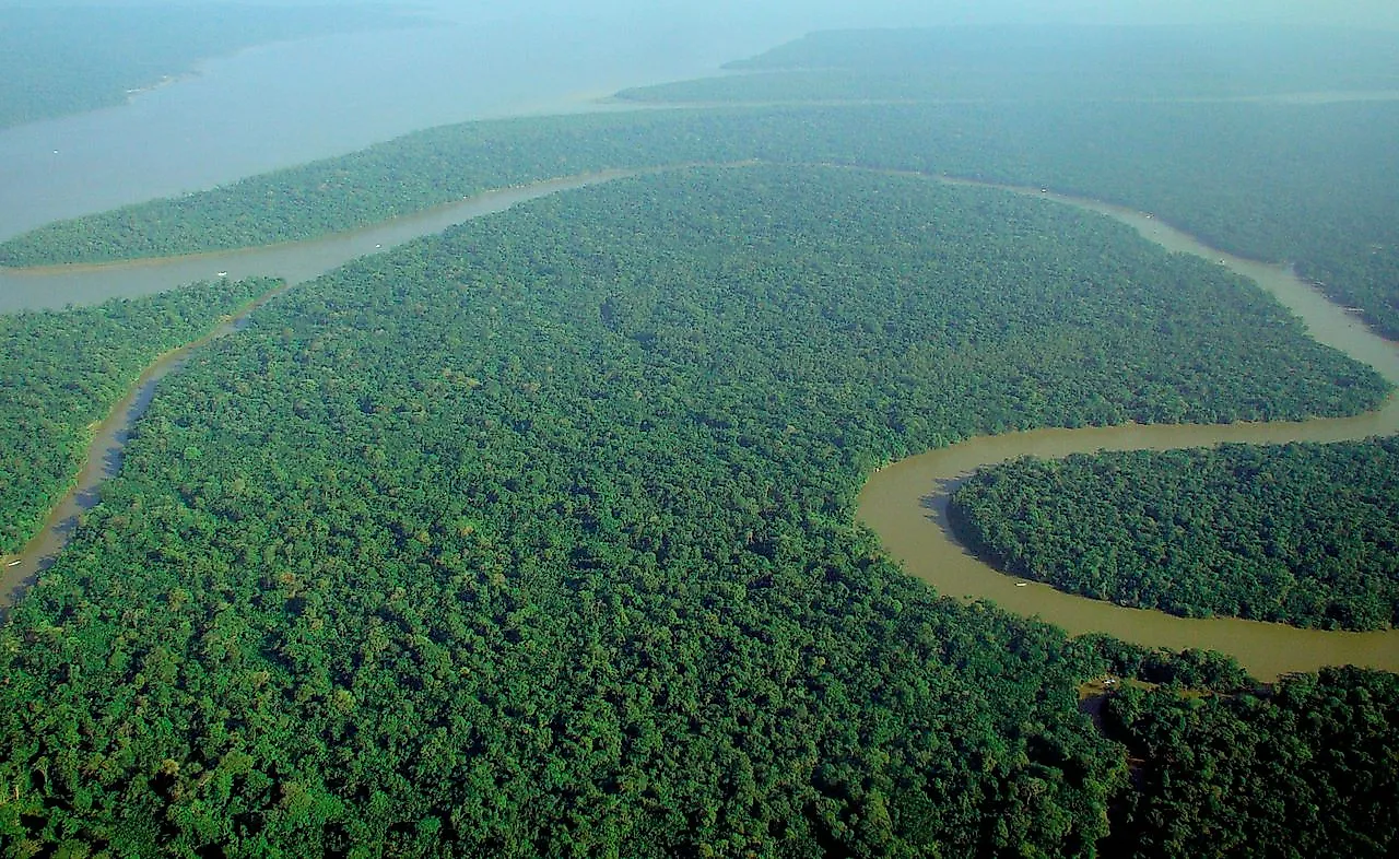
Understanding the distribution of the Amazon requires looking past traditional maps and into the digital infrastructure that monitors this 7-million-square-kilometer basin. For tech professionals, environmental researchers, and data scientists, the question of “what country” is less about names on a map and more about the data protocols and monitoring technologies that define the modern conservation landscape.
The Digital Grid: Satellite Remote Sensing and Multi-National Mapping
To answer which countries the Amazon occupies, scientists rely on the “Eye in the Sky.” Remote sensing technology has revolutionized our ability to draw precise lines around the Amazonian biome. This is a massive data operation that utilizes several key satellite constellations to provide high-resolution imagery and spectral data across all nine jurisdictions.
The Landsat and Sentinel Programs
The backbone of Amazonian monitoring is the Landsat program (a joint NASA/USGS initiative) and the European Space Agency’s Sentinel-2 satellites. These tools provide multi-spectral imagery that allows researchers to differentiate between primary forest, secondary growth, and agricultural land. Because the Amazon crosses nine different sets of national regulations, these satellites provide a neutral, standardized dataset.
By analyzing the “Greenness Index” or Normalized Difference Vegetation Index (NDVI), software can pinpoint exactly where the forest transitions into the Andean foothills in Peru or the savannahs of the Guiana Shield. This data is essential for international climate agreements, as it provides verifiable evidence of forest cover regardless of the country’s internal reporting.
SAR: Seeing Through the Clouds
A significant challenge in mapping countries like Colombia and Ecuador—which contain high-altitude cloud forests—is the persistent cloud cover. Optical satellites struggle to “see” through these obstructions. To solve this, technologists employ Synthetic Aperture Radar (SAR). SAR sensors, such as those on the Sentinel-1 satellite, emit microwave pulses that bounce off the earth’s surface. This allows for 24/7 monitoring, even through thick clouds or smoke from fires. In countries with frequent rainfall, SAR is the primary technology used to track illegal incursions and map the density of the canopy.
AI and Machine Learning: Predicting Deforestation Across Borders
Once the raw data is captured by satellites, the challenge shifts to processing. With millions of hectares to monitor across nine countries, manual review is impossible. This is where AI and Machine Learning (ML) become the primary tools for identifying which country is effectively managing its portion of the rainforest.
Random Forest and Neural Networks
Ironically, the most common algorithm used to map the forest is called “Random Forest.” This ML model is particularly adept at classification tasks. By training neural networks on historical data, AI can distinguish between a natural clearing and an illegal logging road. In Brazil’s “DETER” system (Detection of Deforestation in Real Time), AI scans satellite feeds to identify changes in the canopy. If a road appears in a protected area near the Peruvian border, the system triggers an automated alert.
Predictive Analytics for Prevention
Modern tech solutions are moving from reactive monitoring to predictive analytics. By feeding variables like proximity to existing roads, soil quality, and historical logging patterns into a predictive model, AI can forecast which areas are at the highest risk of being cleared. This “hotspot” mapping allows governments in countries like Bolivia and Peru to deploy resources more efficiently, focusing on the most vulnerable sectors of the biome before the trees are even cut.
The Internet of Trees: IoT and Bioacoustic Monitoring

While satellites provide the “macro” view of the Amazon’s distribution, Internet of Things (IoT) devices provide the “micro” data needed for ground-level verification. These technologies are crucial for verifying that the biodiversity of the rainforest remains intact within each nation’s borders.
Acoustic Sensors and Real-Time Alerts
In recent years, “Top-Down” satellite monitoring has been paired with “Bottom-Up” acoustic monitoring. Non-profits and tech firms have deployed recycled smartphones and specialized sensors equipped with high-sensitivity microphones across the Amazon. These devices use edge computing to analyze forest sounds in real-time.
When the AI onboard a sensor detects the specific frequency of a chainsaw or a truck engine—noises that don’t belong in the deep jungle—it sends an alert via satellite link to local authorities. This “Internet of Trees” creates a digital shield that operates regardless of how remote the location is within the nine-country grid.
Bio-Logging and Species Tracking
Technologists also use GPS-enabled bio-loggers to track the movement of key species across national borders. Many of the Amazon’s most important predators, like the jaguar, do not recognize human-made boundaries. By tracking these animals via satellite telemetry, researchers can identify “biological corridors” that connect the Amazonian portions of different countries. This data is used to advocate for international conservation zones that require cross-border tech collaboration, such as the “Triple A” corridor (Andes-Amazon-Atlantic).
Data Sovereignty and the Cloud: Managing the Amazonian Database
The sheer volume of data generated by monitoring nine countries requires a massive cloud infrastructure. Managing this information involves complex questions of digital security, data sovereignty, and international cooperation.
Google Earth Engine and Big Data
Google Earth Engine (GEE) has become the de facto platform for Amazonian research. It allows scientists to run geospatial analyses on petabytes of satellite data in seconds—tasks that would take a standard computer weeks to process. By providing a centralized cloud platform, GEE enables researchers from Colombia, Brazil, and Peru to collaborate on a single “Digital Twin” of the Amazon. This shared model ensures that all countries are working from the same baseline data when discussing carbon offsets or biodiversity goals.
Blockchain for Carbon Credit Transparency
As the world moves toward “Nature-Based Solutions” for climate change, the tech industry is implementing blockchain to track the economic value of the rainforest. Each country’s portion of the Amazon represents a massive carbon sink. Blockchain technology is being used to tokenize these carbon credits.
By creating a transparent, immutable ledger, blockchain ensures that a single hectare of forest in the Ecuadorian Amazon isn’t sold as a carbon credit to two different buyers. This digital transparency is vital for building trust in international green finance markets, allowing the rainforest to be viewed not just as a geographical feature, but as a high-value, digitally-verified asset.
The Future of Monitoring: Hyperspectral Imaging and Drones
As we look to the future, the technology used to define and protect the Amazon’s presence in each country is becoming even more precise. The next frontier in this tech niche involves hyperspectral imaging and autonomous drone fleets.
Hyperspectral Sensors
Unlike standard satellite imagery, which captures data in three or four color bands, hyperspectral sensors capture hundreds of narrow spectral bands. This allows scientists to identify the specific chemical composition of the forest canopy. From space, we can now distinguish between different tree species and even detect the early signs of drought stress before the leaves turn brown. This level of detail is essential for understanding how climate change is affecting the Amazon differently across its nine host countries.

Drone Swarms for Reforestation
In areas where the forest has already been lost, such as the “Arc of Deforestation” in Brazil, technology is being used for rapid recovery. Autonomous drones equipped with specialized seed-dispersal mechanisms can plant thousands of trees in a single day. These drones use LiDAR (Light Detection and Ranging) to map the terrain in 3D, ensuring that seeds are dropped in the optimal locations for survival.
The answer to “what country is the Amazon rainforest in” is a complex mosaic of nine nations. However, through the lens of modern technology, the Amazon is increasingly seen as a singular, interconnected digital ecosystem. By leveraging satellites, AI, IoT, and the cloud, the global tech community is providing the tools necessary to monitor, manage, and ultimately preserve this vital biome for the entire planet, transcending the very borders that define its geography.
aViewFromTheCave is a participant in the Amazon Services LLC Associates Program, an affiliate advertising program designed to provide a means for sites to earn advertising fees by advertising and linking to Amazon.com. Amazon, the Amazon logo, AmazonSupply, and the AmazonSupply logo are trademarks of Amazon.com, Inc. or its affiliates. As an Amazon Associate we earn affiliate commissions from qualifying purchases.