
In the contemporary landscape of global innovation, soil science is no longer confined to the dusty laboratories of traditional geologists or the manual observations of 20th-century farmers. Today, soil science has transitioned into a sophisticated branch of High-Tech engineering, data science, and biotechnology. Often referred to as “The Internet of Soil,” this field is undergoing a digital transformation that leverages Artificial Intelligence (AI), the Internet of Things (IoT), and advanced remote sensing to decode the most complex biological system on the planet.
Understanding soil science through a technological lens means viewing the Earth’s “living skin” as a massive, heterogeneous database. This database contains information about moisture levels, nutrient cycles, carbon sequestration capacity, and microbial health—all of which are now being harvested through cutting-edge hardware and software solutions.

The Digital Evolution of Pedology: Transitioning to Big Data
Pedology, the study of soil formation and classification, was once a purely descriptive science. However, the integration of Big Data has turned it into a predictive powerhouse. Modern soil scientists utilize massive datasets to create High-Resolution Digital Soil Maps (DSMs) that provide granular insights into land potential.
From Manual Sampling to Big Data
Traditionally, analyzing soil required physically digging “pits” and sending samples to a laboratory, a process that could take weeks. Modern soil tech has replaced this with “In-Situ” digital analysis. Using spectroscopy—specifically Mid-Infrared (MIR) and Near-Infrared (NIR) light—scientists can now identify the chemical composition of soil in seconds. This data is then fed into cloud-based platforms where algorithms compare local samples against global soil libraries, providing instantaneous feedback on soil health and organic carbon levels.
Computational Soil Mapping and Geospatial Modeling
The core of modern soil science lies in Geographic Information Systems (GIS). By layering topographical data with historical climate records and real-time sensor inputs, researchers can create 3D models of the subsurface. These models allow for “Precision Pedology,” where land managers can predict how soil will respond to specific environmental stressors. Software tools like ArcGIS and QGIS, combined with specialized soil plugins, allow for the visualization of nutrient flows and erosion risks before a single seed is planted.
AgTech and the Internet of Soil: Hardware and IoT Integration
The most visible tech trend in soil science is the proliferation of IoT devices. We are currently witnessing the rise of “Smart Dirt,” where fields are embedded with sensors that communicate via Low-Power Wide-Area Networks (LPWAN) to provide a 24/7 pulse on the environment.
Smart Sensors and Real-Time Monitoring
State-of-the-art soil sensors have evolved far beyond simple moisture probes. Today’s hardware can measure NPK (Nitrogen, Phosphorus, and Potassium) levels, electrical conductivity, pH, and temperature simultaneously. Companies like Teralytic have developed wireless sensor probes that can be buried deep within the soil profile, transmitting data via LoRaWAN or cellular networks to a central dashboard. This allows for “Variable Rate Technology” (VRT), where automated machinery applies water or fertilizer only where the digital data indicates a deficit, drastically reducing resource waste.
Autonomous Soil Sampling Drones and Robotics
Robotics is solving the labor-intensive challenge of soil data collection. Autonomous Ground Vehicles (AGVs) equipped with robotic arms are now being deployed to navigate fields, take core samples, and perform on-site analysis without human intervention. Similarly, drones equipped with LiDAR (Light Detection and Ranging) are used to create ultra-precise elevation models that dictate how water will move through the soil. These robots act as the “eyes and ears” of the soil scientist, providing a level of spatial density in data that was previously impossible to achieve.
AI and Machine Learning in Soil Health: Software and Predictive Analytics
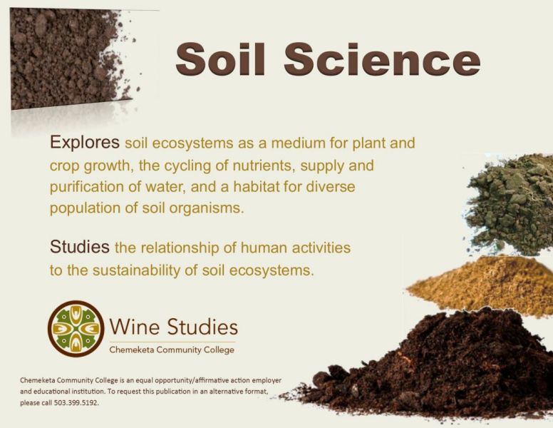
If sensors are the nervous system of modern soil science, then Artificial Intelligence is the brain. The volume of data generated by satellite imagery and IoT sensors is too vast for human analysis. Machine Learning (ML) algorithms are now essential for interpreting these complex ecological signals.
Predictive Modeling for Crop Yield and Risk
Machine Learning models are trained to recognize patterns between soil health and crop performance. By analyzing “Hyper-Local” weather data alongside soil moisture levels, AI can predict harvest yields with up to 95% accuracy months in advance. These software tools help stabilize the global food supply chain by identifying potential failures before they occur. Furthermore, AI can simulate “What-If” scenarios, allowing scientists to see how soil will react to decade-long droughts or extreme flooding events.
Computer Vision for Nutrient Deficiency and Pathogen Detection
One of the most exciting applications of AI in soil science is computer vision. Mobile apps now allow users to take photos of soil or plants, which are then analyzed by Deep Learning models to identify nutrient deficiencies or soil-borne pathogens. This “Digital Diagnosis” democratizes soil science, putting the power of a laboratory in the pocket of any land manager. By training neural networks on millions of images of soil structures, these AI tools can even detect signs of soil degradation or compaction that are invisible to the naked eye.
Remote Sensing and Satellite Intelligence: The View from Above
Soil science is no longer limited to what we can see on the ground. Space-tech has become a fundamental pillar of the industry, with satellites providing a global perspective on the health of the Earth’s crust.
Hyperspectral Imaging from Space
NASA and the European Space Agency (ESA) utilize hyperspectral sensors on satellites like Sentinel-2 to monitor soil organic matter and moisture from orbit. These satellites capture data across hundreds of narrow spectral bands, allowing scientists to “see” the chemical signature of the soil from hundreds of miles above. This technology is critical for monitoring large-scale desertification and the effectiveness of reforestation projects.
Digital Twins of the Earth’s Subsurface
The ultimate goal of tech-driven soil science is the creation of a “Digital Twin” of the Earth’s soil system. By integrating satellite data, drone imagery, and ground sensor feeds, scientists are building dynamic digital replicas of entire ecosystems. These Digital Twins allow for the simulation of carbon sequestration strategies, helping tech companies and governments calculate exactly how much CO2 can be trapped within the soil to combat climate change.
The Future of Soil Tech: Carbon Sequestration and Data Security
As we look toward the future, soil science is intersecting with two critical tech sectors: ClimateTech and Cybersecurity. The ability of soil to store carbon has turned it into a digital asset, and like all valuable data, it must be protected.
Digital Monitoring, Reporting, and Verification (dMRV)
The burgeoning carbon credit market relies heavily on soil science. To sell carbon credits, a landowner must prove that their soil is actually sequestering carbon. This has led to the development of dMRV platforms. These software suites combine satellite imagery with ML to verify carbon storage without the need for expensive, manual lab testing. This digital verification is the backbone of the “Green Finance” movement, turning soil health into a verifiable economic metric.
Edaphic Data Security and Sovereignty
As soil data becomes more economically valuable, the “Security” aspect of Digital Security becomes paramount. “Edaphic data” (data related to soil) can reveal sensitive information about a nation’s food security or a corporation’s land assets. We are seeing the rise of blockchain-based ledgers to record soil health data, ensuring that the information is immutable and transparent for stakeholders while protecting it from cyber-attacks. Ensuring the integrity of this data is vital for global trade and environmental policy.
In conclusion, “What is Soil Science?” is a question that now requires a technological answer. It is the synthesis of pedology with AI, IoT, and remote sensing. By digitizing the ground beneath our feet, we are not just studying dirt; we are building a high-tech infrastructure that ensures food security, enables climate action, and optimizes the natural resources of our planet for the digital age. The future of the Earth is being written in code, and that code is deeply rooted in the soil.
aViewFromTheCave is a participant in the Amazon Services LLC Associates Program, an affiliate advertising program designed to provide a means for sites to earn advertising fees by advertising and linking to Amazon.com. Amazon, the Amazon logo, AmazonSupply, and the AmazonSupply logo are trademarks of Amazon.com, Inc. or its affiliates. As an Amazon Associate we earn affiliate commissions from qualifying purchases.