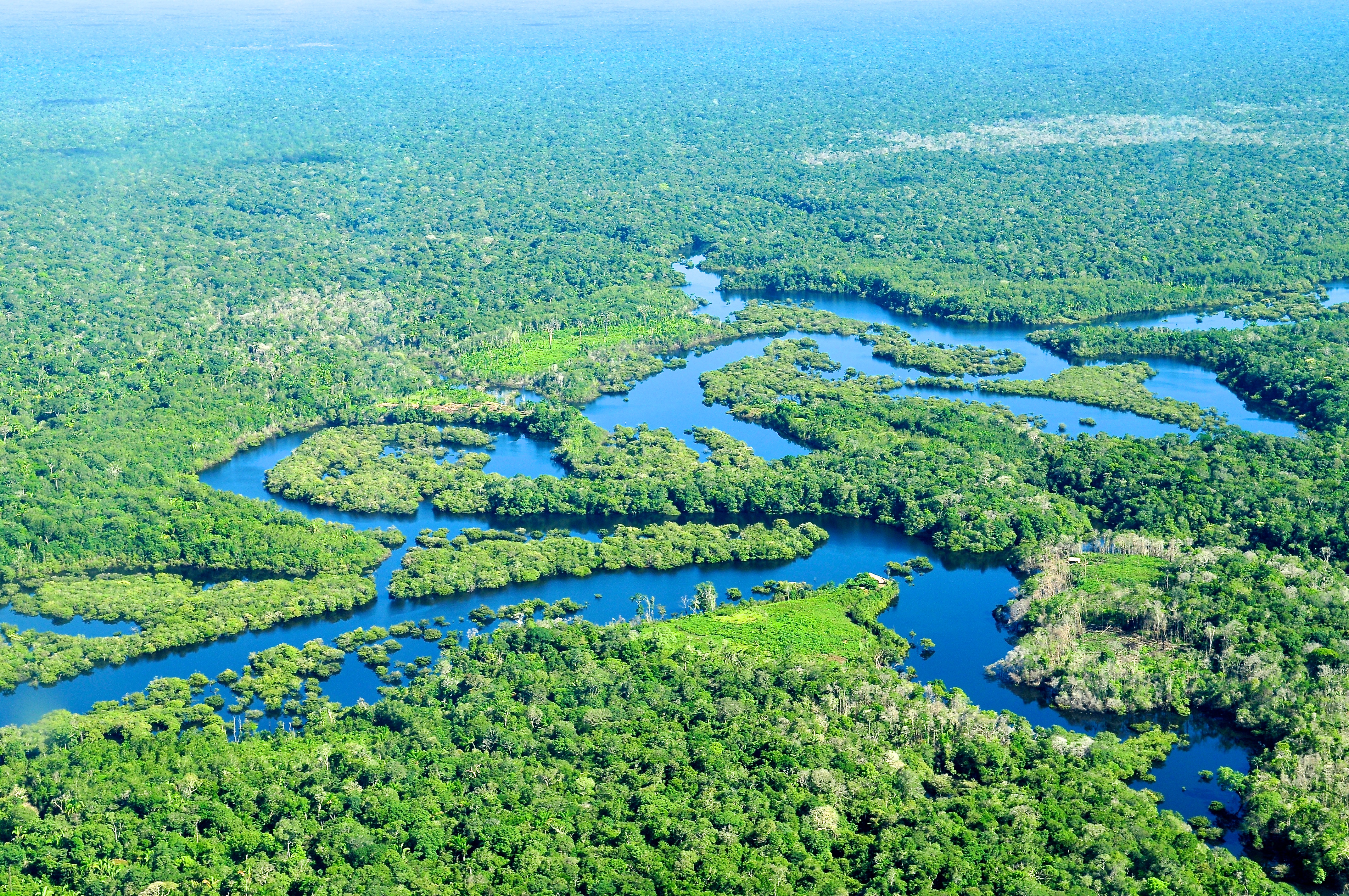
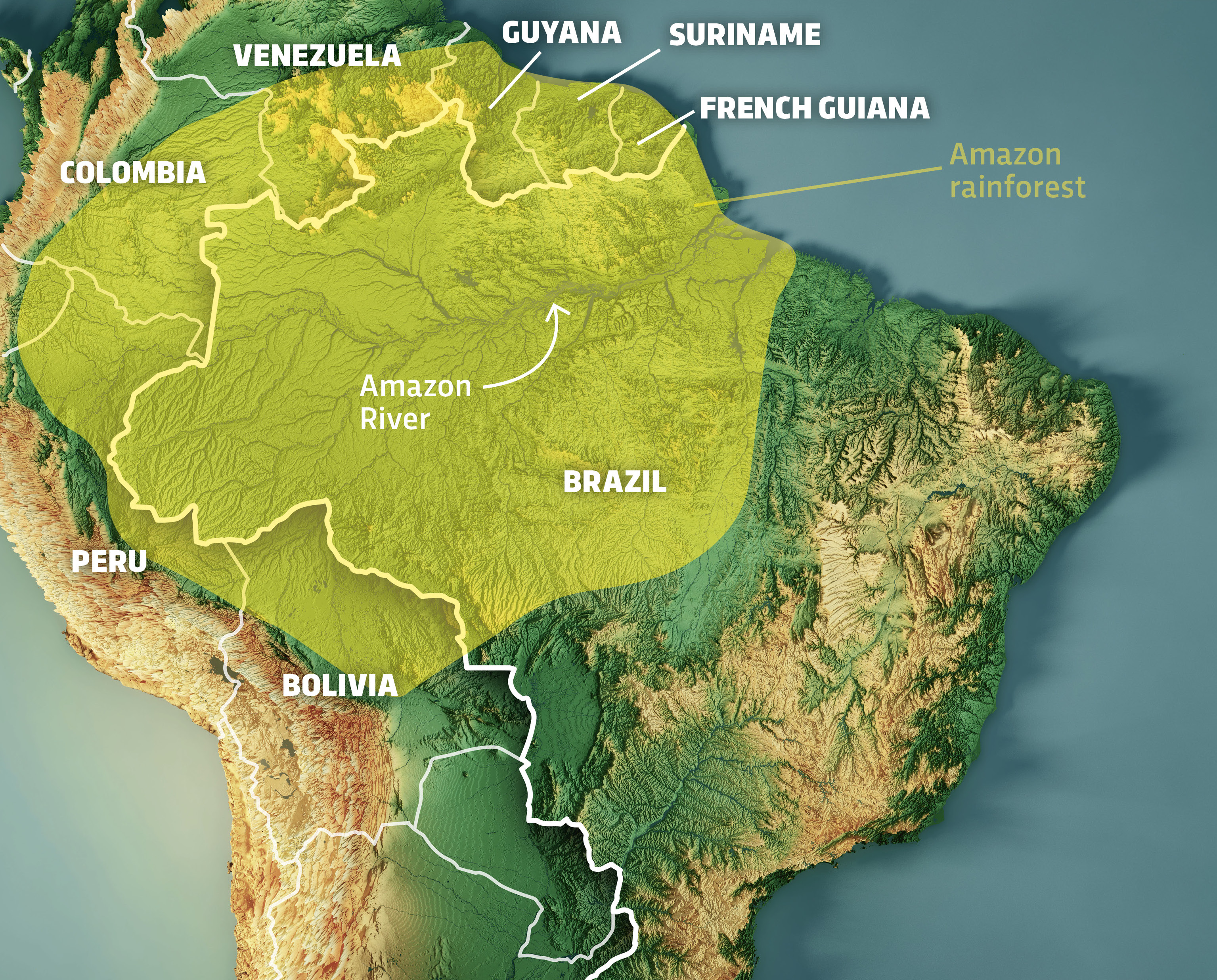
For centuries, the question of where the Amazon forest is located was answered with physical maps and rudimentary surveying. Spanning nine nations and covering over 6 million square kilometers, its borders were often considered static lines on a page. However, in the digital age, the “location” of the Amazon is no longer a fixed geographical coordinate. Today, identifying the boundaries, health, and shifts of the world’s largest rainforest is a task driven by high-resolution satellite imagery, artificial intelligence, and sophisticated geospatial software.
As we navigate an era of rapid environmental change, the tech industry has stepped in to provide the precision tools necessary to monitor this vital biome. From orbital sensors to ground-level IoT devices, technology is redefining our spatial understanding of the Amazon.
Geospatial Intelligence: Redefining the Boundaries of the Amazon
The sheer scale of the Amazon Basin makes traditional ground surveying impossible. To accurately determine where the forest begins and ends—and where it is disappearing—scientists rely on geospatial intelligence (GEOINT). This field combines satellite imagery with data processing to create dynamic models of the Earth’s surface.
The Role of LiDAR in Penetrating the Canopy
One of the most transformative technologies in locating and analyzing the Amazon is Light Detection and Ranging (LiDAR). Unlike traditional photography, which only captures the top layer of the canopy, LiDAR uses laser pulses to “see” through the dense foliage. By measuring the time it takes for light to bounce back from the forest floor, tech platforms can create high-definition 3D maps of the forest structure.
This technology allows researchers to identify the exact location of ancient archaeological sites hidden beneath the trees and, more importantly, to calculate the precise biomass of specific sectors. For tech-driven conservation, knowing the location of high-biomass areas is critical for prioritizing protection efforts.
Satellite Constellations and Real-Time Spatial Data
The question of “where” the forest is located is now answered in real-time by satellite constellations like those operated by Planet, Maxar, and the European Space Agency’s Sentinel program. These satellites provide daily revisits to every point in the Amazon.
Through “change detection” algorithms, software can automatically flag discrepancies between yesterday’s image and today’s. If a patch of green is replaced by brown, the system logs the exact GPS coordinates. This instant data stream has turned the Amazon from a remote wilderness into a monitored digital grid, where every hectare is accounted for.
AI and Machine Learning: From Coordinates to Conservation Insights
While satellites provide the “eyes,” Artificial Intelligence (AI) provides the “brain.” Locating the Amazon forest is one thing; understanding the nuances of its internal shifts requires the processing power of machine learning.
Predictive Modeling for Deforestation Hotspots
Tech giants and startups are increasingly using AI to predict where the Amazon forest will be located in the future. By feeding historical data, road proximity, and economic trends into neural networks, platforms like PrevisIA can predict deforestation “hotspots” with startling accuracy.
These AI tools analyze patterns that are invisible to the human eye. They can identify the “scars” of illegal logging roads before they lead to large-scale clearing. By locating these threats early, technology transitions from a reactive monitoring tool to a proactive defense mechanism, effectively attempting to “pin” the forest in place against the pressures of encroachment.
Automated Species Identification via Bioacoustic Monitoring
Modern technology also helps locate the “biological heart” of the forest. The Amazon isn’t just a collection of trees; it is a dense network of life. Tech-driven bioacoustics involves placing solar-powered sensors throughout the jungle to record the soundscape.
Machine learning algorithms then sift through thousands of hours of audio to identify the calls of specific endangered species. This allows scientists to map the precise “location” of biodiversity. Knowing that a specific jaguar population is located in a particular corridor allows for more surgical and effective land-management policies.
Digital Sovereignty and the Data of the Rainforest
The digital representation of the Amazon has become a matter of global importance. As data becomes the world’s most valuable resource, the tech used to locate and monitor the forest must be transparent and secure.
Blockchain for Land Rights and Location Verification
One of the greatest challenges in the Amazon is the lack of clear land titles. When the “location” of a forest plot overlaps with an unofficial claim, conflict ensues. Blockchain technology is being piloted to create immutable ledgers of land ownership linked to specific geospatial coordinates.
By anchoring GPS data to a blockchain, it becomes nearly impossible to forge land titles or “erase” a forest’s existence on paper to make room for industrial use. This digital verification ensures that the location of the forest is legally recognized and protected by a decentralized system that no single entity can manipulate.
Open-Source Platforms for Global Transparency
Tools like Google Earth Engine and Global Forest Watch have democratized access to Amazonian data. Previously, only governments and elite research institutions could see high-resolution maps of the forest. Now, anyone with an internet connection can verify where the forest is located and how it is changing.
This transparency creates a “digital panopticon” that holds corporations and governments accountable. When software can pinpoint the exact location of a supply chain violation—such as cattle being raised on illegally cleared land—the power dynamics of environmental conservation shift from local authorities to global tech-enabled transparency.
The Future of Environmental Tech: A Digital Twin of the Amazon
The ultimate frontier in locating and understanding the Amazon is the creation of a “Digital Twin.” This is a concept borrowed from industrial engineering and urban planning, where a comprehensive virtual replica of a physical asset is created.
Integrating IoT Sensors for Micro-Climate Mapping
A Digital Twin of the Amazon would involve a massive deployment of Internet of Things (IoT) sensors. These sensors, located at various strata of the forest, would track humidity, temperature, soil moisture, and carbon flux in real-time.
When integrated with satellite data, this creates a living, breathing model of the forest. We would no longer just know where the forest is located in terms of longitude and latitude; we would know its physiological state at any given moment. This level of technical integration allows for “precision conservation,” where interventions can be applied to specific hectares based on real-time data feedback loops.
Cloud Computing and the Scale of Environmental Data
The sheer volume of data required to map the Amazon is staggering. Processing petabytes of imagery and sensor data requires the massive scale of cloud computing. Platforms like Amazon Web Services (AWS) and Microsoft Azure are providing the infrastructure for researchers to run complex simulations on the forest’s future.
These simulations help answer “what if” scenarios. If the global temperature rises by 1.5 degrees, where will the forest’s edges be located by 2050? Tech allows us to peer into the future of the Amazon’s geography, giving us a window of opportunity to change the outcome through informed, data-backed policy.

Conclusion: The Forest as a Digital Frontier
The question of where the Amazon forest is located has evolved from a simple geographical inquiry into a complex technological challenge. In the modern world, the Amazon exists both as a physical entity of trees and soil and as a digital entity of pixels and data points.
The technologies discussed—LiDAR, AI, Blockchain, and Digital Twins—are not merely tools for observation; they are the infrastructure of modern preservation. By using tech to define, locate, and monitor the Amazon with unprecedented precision, we gain the insights necessary to ensure that this global treasure remains on the map for centuries to come. The intersection of technology and ecology is no longer a niche field; it is the primary lens through which we interact with, and protect, the natural world.
aViewFromTheCave is a participant in the Amazon Services LLC Associates Program, an affiliate advertising program designed to provide a means for sites to earn advertising fees by advertising and linking to Amazon.com. Amazon, the Amazon logo, AmazonSupply, and the AmazonSupply logo are trademarks of Amazon.com, Inc. or its affiliates. As an Amazon Associate we earn affiliate commissions from qualifying purchases.