The majestic grandeur of mountains has captivated humanity for millennia, inspiring awe and a deep-seated curiosity about their very essence. Beyond their imposing visual presence, lies a complex geological narrative, a story written in rock, mineral, and time. While ancient civilizations pondered this question through observation and speculation, modern technology has unlocked unprecedented insights into the intricate composition of these terrestrial titans. This article delves into the technological advancements that allow us to dissect the fundamental building blocks of mountains, transforming our understanding from empirical observation to precise scientific analysis.
The Geological Toolkit: Advanced Sensing and Imaging
The ability to understand what mountains are made of is intrinsically linked to the tools we employ to observe and analyze their structure and composition. From the microscopic to the macroscopic, a suite of sophisticated technologies provides geologists with a comprehensive view, revealing the raw materials and the formative processes.

Satellite Imagery and Remote Sensing: A Global Perspective
The advent of satellite technology has revolutionized our ability to study mountains on a global scale. Earth observation satellites equipped with a variety of sensors provide a bird’s-eye view, allowing geologists to map mountain ranges, identify different rock types based on their spectral signatures, and even track geological changes over time.
- Multispectral and Hyperspectral Imaging: These technologies go beyond capturing visible light. Multispectral sensors capture data in several broad bands of the electromagnetic spectrum, while hyperspectral sensors capture data in hundreds of narrow, contiguous bands. Different minerals and rock types reflect and absorb light differently across the spectrum. By analyzing these spectral fingerprints, scientists can differentiate between igneous, sedimentary, and metamorphic rocks, and even identify specific mineral compositions within them, such as quartz, feldspar, or mica, without ever physically touching the mountain.
- LiDAR (Light Detection and Ranging): LiDAR systems, whether deployed from aircraft or satellites, use laser pulses to measure distances and create highly accurate 3D topographic maps. This allows for detailed analysis of landforms, erosion patterns, and the structural geology of mountains, indirectly informing us about the underlying rock formations and their resistance to weathering. By creating digital elevation models (DEMs), geologists can infer rock properties based on how they manifest in the landscape.
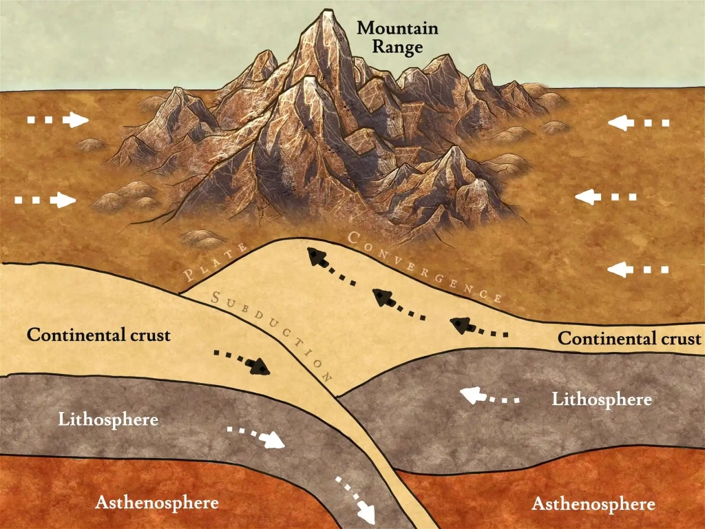
- Radar Interferometry (InSAR): InSAR uses radar signals to detect subtle ground deformation, including uplift and subsidence. This technology is crucial for monitoring active volcanic mountains and understanding the forces that shape tectonic mountain ranges. While not directly revealing mineral composition, it provides vital data on the dynamic processes that build and modify mountains, which are intimately tied to their underlying geological makeup.
Ground-Based Geophysical Surveys: Peering Beneath the Surface
While satellites offer a broad view, ground-based technologies allow for more detailed investigations, probing deep into the Earth’s crust to understand the internal structure and composition of mountains.
- Seismic Imaging: Similar to medical ultrasound, seismic surveys involve generating artificial seismic waves (using controlled explosions or vibrator trucks) and recording how they travel through the Earth’s crust and reflect off different rock layers. By analyzing the travel times and amplitudes of these reflected waves, geoscientists can create detailed 2D and 3D images of subsurface rock formations, revealing the types of rocks present, their density, and their structural arrangement. This is particularly vital for understanding the deep roots of large mountain ranges and the tectonic forces that created them.
- Gravity and Magnetic Surveys: Variations in the Earth’s gravitational and magnetic fields can indicate differences in subsurface rock density and mineral content. Sensitive gravimeters and magnetometers can detect these anomalies, providing clues about the presence of dense igneous intrusions or mineral deposits within mountain ranges. These methods are often used as complementary techniques to seismic surveys for a more complete picture.
- Electrical Resistivity and Induced Polarization: These methods measure how easily electrical currents flow through the ground. Different rock types and mineral compositions have distinct electrical properties, allowing geologists to map out variations in subsurface geology and identify potential mineral-rich zones.
Laboratory Analysis: Unraveling Mineralogical Mysteries
Once samples are collected from mountains – through drilling, rock climbing expeditions, or excavation – a battery of sophisticated laboratory techniques is employed to determine their precise chemical and mineralogical composition. These analytical tools are the bedrock of understanding what mountains are truly made of at the most fundamental level.
Spectroscopic Techniques: Identifying the Elemental Signatures
Spectroscopy is a cornerstone of modern mineralogical analysis, utilizing the interaction of light and matter to identify elements and compounds.
- X-ray Diffraction (XRD): This technique is crucial for identifying crystalline minerals. When X-rays strike a crystalline sample, they diffract in specific patterns determined by the arrangement of atoms within the crystal lattice. By comparing the diffraction pattern to a database of known minerals, geologists can precisely identify the mineral phases present in a rock sample. This reveals whether a rock is composed primarily of quartz, feldspar, calcite, or more complex silicate minerals.
- X-ray Fluorescence (XRF): XRF is used to determine the elemental composition of a sample. When a sample is bombarded with X-rays, the atoms within the sample emit fluorescent X-rays at characteristic energies. By analyzing these emitted X-rays, scientists can quantify the abundance of various elements, such as silicon, aluminum, iron, calcium, and potassium, which are the primary building blocks of most rocks.
- Electron Microprobe Analysis (EMPA): This advanced technique uses a focused beam of electrons to bombard a very small area of a sample. The interaction of the electrons with the sample generates characteristic X-rays, which are then analyzed to determine the elemental composition with high spatial resolution. EMPA allows geologists to analyze the composition of individual mineral grains, revealing variations within a single mineral or the precise ratios of elements in complex mineral structures.
Other Advanced Analytical Methods: Beyond Elemental and Mineralogical
Beyond identifying the basic chemical and mineral components, other technologies help us understand the history and physical properties of the rocks that form mountains.
- Mass Spectrometry: Techniques like Inductively Coupled Plasma Mass Spectrometry (ICP-MS) are used for highly sensitive determination of trace elements and isotopic compositions. This can provide vital information about the origin of the rocks, the processes they have undergone, and their age through radiometric dating. For example, analyzing the isotopic ratios of certain elements can help distinguish between magmatic rocks formed from different mantle sources or identify the age of metamorphic events.
- Scanning Electron Microscopy (SEM): SEM provides high-resolution images of the surface topography and microstructure of mineral grains and rock textures. This allows geologists to study the intricate details of mineral intergrowths, understand the mechanisms of rock deformation, and identify microscopic features that provide clues about the geological history of the mountain.
- Thermogravimetric Analysis (TGA) and Differential Scanning Calorimetry (DSC): These thermal analysis techniques measure how a sample’s properties change with temperature. They are useful for identifying minerals that contain volatile components (like water or carbon dioxide) and for understanding the thermal stability of different minerals. This can inform us about the conditions under which rocks were formed or altered.
Computational Geology and Big Data: Simulating and Understanding Mountain Formation
The sheer volume of data generated by the technologies described above necessitates powerful computational tools for analysis and interpretation. This is where computational geology and the application of big data analytics come into play, transforming raw data into actionable scientific understanding.
Geodynamic Modeling: Simulating Earth’s Processes
Geodynamic models are sophisticated computer simulations that aim to replicate the complex processes of plate tectonics, mountain building (orogeny), and erosion. These models integrate geological, geophysical, and geochemical data to test hypotheses about how mountains form and evolve.
- Finite Element Analysis (FEA): FEA is a numerical technique used to solve complex engineering and physics problems. In geodynamics, it is employed to model the stresses, strains, and deformations within the Earth’s lithosphere, allowing scientists to simulate the forces that buckle and fold rock layers to create mountain ranges.
- Computational Fluid Dynamics (CFD): While not directly related to rock composition, CFD can be used to model the flow of magma beneath volcanoes or the movement of glaciers on mountains, which are integral parts of the mountain-building and erosional processes.

Machine Learning and Artificial Intelligence: Discovering Hidden Patterns
The vast datasets generated by geological surveys and laboratory analyses are fertile ground for machine learning (ML) and artificial intelligence (AI) algorithms. These tools can identify patterns and correlations that might be missed by human observation alone.
- Automated Mineral Identification: ML algorithms can be trained on spectral data from hyperspectral imaging or XRD patterns to automatically identify minerals in large datasets, significantly speeding up the analysis process.
- Predictive Modeling: AI can be used to predict areas with a high likelihood of containing specific mineral deposits or to forecast geological hazards like landslides within mountain regions based on geological and topographical data.
- Data Integration and Fusion: ML excels at integrating diverse datasets from various technological sources – satellite imagery, seismic data, gravity surveys, and lab analyses – to create a more holistic and comprehensive understanding of mountain composition and formation.
In conclusion, the question “What are mountains made of?” is no longer confined to the realm of basic observation. Through a remarkable convergence of advanced sensing, sophisticated laboratory analysis, and powerful computational techniques, technology has empowered us to delve into the very heart of these geological wonders. From the elemental composition of individual mineral grains to the grand tectonic forces that uplift entire continents, technology continues to unveil the profound and intricate story of mountain formation, solidifying our appreciation for these enduring testaments to Earth’s dynamic nature.
aViewFromTheCave is a participant in the Amazon Services LLC Associates Program, an affiliate advertising program designed to provide a means for sites to earn advertising fees by advertising and linking to Amazon.com. Amazon, the Amazon logo, AmazonSupply, and the AmazonSupply logo are trademarks of Amazon.com, Inc. or its affiliates. As an Amazon Associate we earn affiliate commissions from qualifying purchases.