
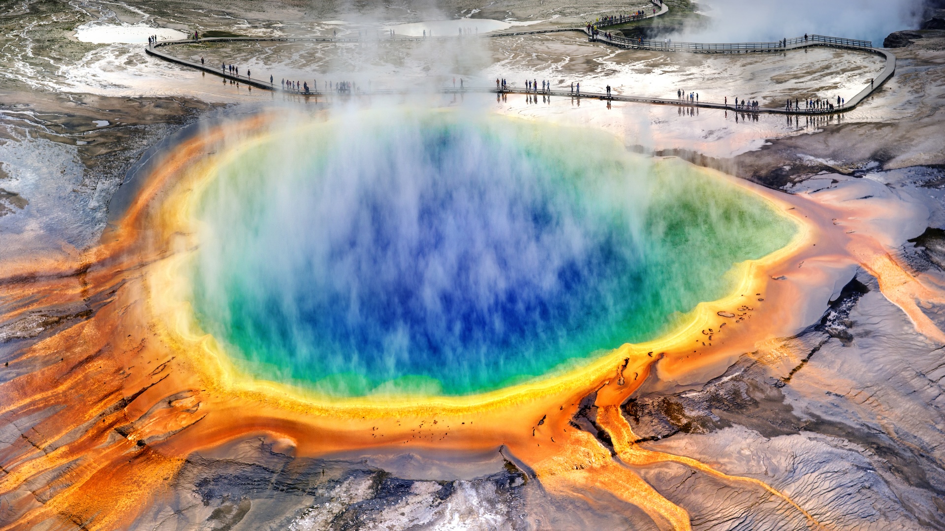
Yellowstone National Park is often viewed through the lens of its natural splendor—its steaming geysers, sprawling valleys, and diverse wildlife. However, beneath this picturesque landscape lies one of the most significant geological features on Earth: the Yellowstone Caldera. Often referred to as a “supervolcano,” this massive system is not a traditional cone-shaped mountain but a vast, restless cauldron of magmatic activity. To understand what volcano is in Yellowstone, one must look beyond the geology and into the sophisticated technological ecosystem that monitors it.
In the modern era, the Yellowstone Caldera is more than a geological site; it is one of the most densely instrumented natural laboratories in the world. From satellite-based radar to AI-driven seismic analysis, the technology deployed at Yellowstone represents the pinnacle of digital transformation in the earth sciences.

The Digital Pulse: Seismic and Geodetic Sensor Networks
The primary challenge of monitoring a volcano of Yellowstone’s scale is its sheer size. The caldera spans approximately 30 by 45 miles. To capture the “pulse” of such a massive system, scientists rely on a sprawling network of hardware known as the Yellowstone Seismic Network (YSN).
Real-Time Data Acquisition and Telemetry
The YSN consists of over 30 stations equipped with broadband seismometers and short-period sensors. These devices are designed to detect even the slightest tremors, many of which are imperceptible to humans. The technological hurdle here is not just the sensitivity of the sensors, but the telemetry required to transmit data from remote, rugged terrain.
Modern stations utilize high-frequency radio links and satellite uplinks to stream data in near real-time to the University of Utah and the USGS Yellowstone Volcano Observatory (YVO). This constant stream of “Big Data” allows geophysicists to map the movement of magma and hydrothermal fluids miles beneath the surface.
InSAR and Satellite Interferometry
While ground sensors detect movement within the earth, satellite technology monitors the earth’s skin. Interferometric Synthetic Aperture Radar (InSAR) is a cornerstone technology used at Yellowstone. By comparing radar signals from satellites like the ESA’s Sentinel-1 over different passes, scientists can create “interferograms.”
These digital maps show ground deformation—the rising and falling of the caldera floor—with millimeter precision. When the ground “breathes” (uplift and subsidence), InSAR provides the high-resolution visual data necessary to determine if the movement is caused by shifting magma or pressurized steam.
Artificial Intelligence and Predictive Modeling
With decades of data accumulated, the challenge has shifted from data collection to data interpretation. This is where Artificial Intelligence (AI) and Machine Learning (ML) have become indispensable tools in the volcanologist’s toolkit.
Machine Learning in Seismology
Yellowstone experiences between 1,500 and 2,500 earthquakes a year. Historically, distinguishing between a tectonic earthquake, a hydrothermal explosion, and a magmatic tremor required manual review. Today, deep-learning algorithms are trained to classify these signals automatically.
By employing neural networks, researchers can filter out “noise”—such as wind or bison herds moving near a sensor—to isolate the specific frequencies associated with volcanic unrest. This automated processing allows for a much faster response time in the event of an anomalous swarm of activity.
Simulating Catastrophic Scenarios
High-performance computing (HPC) is utilized to run complex numerical models that simulate the caldera’s behavior. These simulations take into account fluid dynamics, heat transfer, and structural mechanics. By running “what-if” scenarios through these digital twins, scientists can predict how ash clouds might disperse or how the local crust might fracture under pressure. These models are essential for developing disaster mitigation software and public safety protocols.
Data Management and Public Alert Systems
The technology surrounding the Yellowstone volcano isn’t just for research; it is a critical component of national infrastructure and public digital security. The dissemination of information regarding a potential super-eruption is a high-stakes technological task.
The USGS Volcano Hazards Program Infrastructure
The United States Geological Survey (USGS) maintains a robust digital architecture to ensure that the public has access to transparent, accurate data. The “Volcano Notification Service” (VNS) is a specialized software platform that automates the distribution of alerts via email, social media, and dedicated APIs. This system is built for high availability; it must remain functional even during periods of extreme web traffic or regional infrastructure failure.
Cybersecurity in Natural Hazard Monitoring
As monitoring networks become increasingly interconnected and reliant on the Internet of Things (IoT), cybersecurity has become a paramount concern. The integrity of seismic data is vital. A “spoofing” attack or a “denial of service” (DoS) on Yellowstone’s sensor network could lead to false alarms or, conversely, the masking of real volcanic signals. Consequently, the digital backends of these networks employ military-grade encryption and air-gapped backups to ensure that the data driving public safety decisions is untampered and authentic.
Future Tech: The Next Frontier of Volcanology
As we look forward, the technology used to monitor the volcano in Yellowstone continues to evolve, moving toward more non-invasive and hyper-sensitive methods.
Quantum Sensing and Fiber-Optic Detection
One of the most exciting emerging technologies is Distributed Acoustic Sensing (DAS). This tech repurposes existing underground fiber-optic cables as a massive, continuous seismic array. By sending laser pulses through the glass fibers and measuring the backscatter, researchers can turn miles of cable into thousands of individual sensors. This provides a resolution of the subsurface that was previously impossible, offering a high-definition view of the plumbing system beneath Old Faithful and the surrounding geyser basins.
Drone-Based Gas Analysis and Thermal Imaging
Monitoring gas emissions—specifically carbon dioxide and sulfur dioxide—is a key indicator of magmatic movement. Traditionally, this required dangerous manual sampling. Today, specialized Unmanned Aerial Vehicles (UAVs), or drones, equipped with miniaturized spectrometers and thermal cameras, are being deployed.
These drones can fly directly into hazardous areas to map thermal anomalies and gas concentrations in 3D. The data is then integrated into Geographic Information Systems (GIS) to provide a real-time overlay of the park’s thermal health.

Conclusion: The Silicon Shield
What volcano is in Yellowstone? It is a complex, living system that is currently being shrouded in a “silicon shield” of advanced technology. The Yellowstone Caldera is no longer just a geological mystery; it is a data-driven phenomenon. Through the integration of seismic hardware, satellite imagery, artificial intelligence, and robust digital infrastructure, humanity has developed the tools to listen to the Earth with unprecedented clarity.
As technology continues to advance, our ability to monitor, model, and understand the supervolcano will only improve. While we cannot control the geological forces at play beneath the park, the digital tools we have built ensure that we are never caught off guard, transforming Yellowstone from a source of ancient myth into a triumph of modern technological monitoring.
aViewFromTheCave is a participant in the Amazon Services LLC Associates Program, an affiliate advertising program designed to provide a means for sites to earn advertising fees by advertising and linking to Amazon.com. Amazon, the Amazon logo, AmazonSupply, and the AmazonSupply logo are trademarks of Amazon.com, Inc. or its affiliates. As an Amazon Associate we earn affiliate commissions from qualifying purchases.