
For decades, looking up at a silver speck trailing a white plume in the sky meant wondering where it was going and who was on board. Today, that curiosity can be satisfied in seconds. The ability to identify the exact aircraft cruising at 35,000 feet above your head is not magic; it is the result of a sophisticated global ecosystem of hardware, software, and crowdsourced data. By leveraging a combination of satellite navigation, terrestrial receivers, and high-speed data processing, modern technology has turned the once-opaque world of air traffic control into an open-book resource for anyone with a smartphone or a laptop.
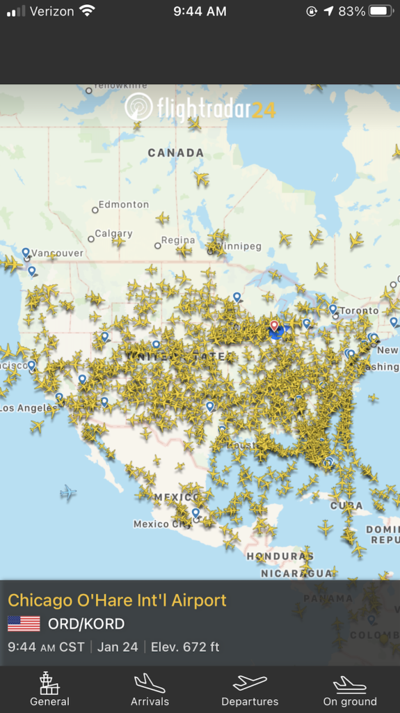
Understanding the technology behind real-time flight tracking requires a deep dive into the protocols that aircraft use to communicate and the distributed networks that capture those signals. From the internal transponders of a Boeing 787 to the Raspberry Pi-powered receivers in the backyards of hobbyists, the “tech stack” of the sky is an impressive feat of modern engineering.
The Foundation of Modern Tracking: ADS-B Technology
The primary driver behind your ability to see flights in real-time is Automatic Dependent Surveillance-Broadcast (ADS-B). This technology represents a paradigm shift from traditional primary radar, which relies on bouncing radio waves off an aircraft’s fuselage to determine its position.
How ADS-B Works
Unlike traditional radar, ADS-B is “automatic” because it requires no pilot or external input to broadcast information. It is “dependent” because it relies on data from the aircraft’s own navigation system—specifically GPS. Every half-second or so, an ADS-B-equipped aircraft broadcasts its precise GPS position, altitude, speed, and a unique identification code via a 1090 MHz radio frequency.
This broadcast is unencrypted and can be intercepted by anyone with the right antenna and receiver. This open nature of the signal is what allowed for the explosion of consumer-facing flight tracking apps. While the aviation industry originally implemented ADS-B to increase safety and efficiency—allowing planes to fly closer together with higher precision—the secondary effect was the democratization of aviation data.
Multilateration (MLAT)
Not every aircraft is equipped with modern ADS-B transponders, especially older private planes or specific military hardware. To track these, tech platforms use a method called Multilateration (MLAT). This relies on a mathematical principle known as Time Difference of Arrival (TDOA).
When an older transponder sends out a signal, multiple ground-based receivers pick it up at slightly different times due to the speed of light and the varying distances between the plane and each receiver. By measuring these micro-differences in arrival time across four or more receivers, software can triangulate the aircraft’s exact position. This complex calculation happens in milliseconds, allowing non-ADS-B aircraft to appear on your screen with surprising accuracy.
Top Platforms and the Software Ecosystem
The data captured by these radio signals must be processed, aggregated, and visualized. Several major tech platforms dominate this space, each offering different tools for the casual observer and the aviation professional alike.
Flightradar24: The Global Leader in Visualization
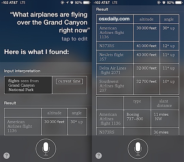
Flightradar24 has become synonymous with flight tracking. Its success lies in its massive terrestrial network of over 30,000 receivers. The software interface translates raw data into smooth, moving icons on a map. One of its most impressive technical features is the “AR View.” By using the gyroscope, GPS, and camera on a smartphone, the app overlays flight data onto the live camera feed. When you point your phone at a plane in the sky, the software calculates your orientation relative to the aircraft’s coordinates and displays the flight number, origin, and destination in real-time.
FlightAware: Big Data and Predictive AI
While Flightradar24 excels at the consumer “live” experience, FlightAware focuses heavily on data depth and predictive analytics. They utilize machine learning algorithms to predict “Estimated Time of Arrival” (ETA) more accurately than airlines often do. Their software considers weather patterns, historical taxi times, and air traffic congestion. For a developer or a tech-focused user, FlightAware’s Firehose API provides a massive stream of flight data that can be integrated into other enterprise applications.
ADS-B Exchange: The Unfiltered Technical Choice
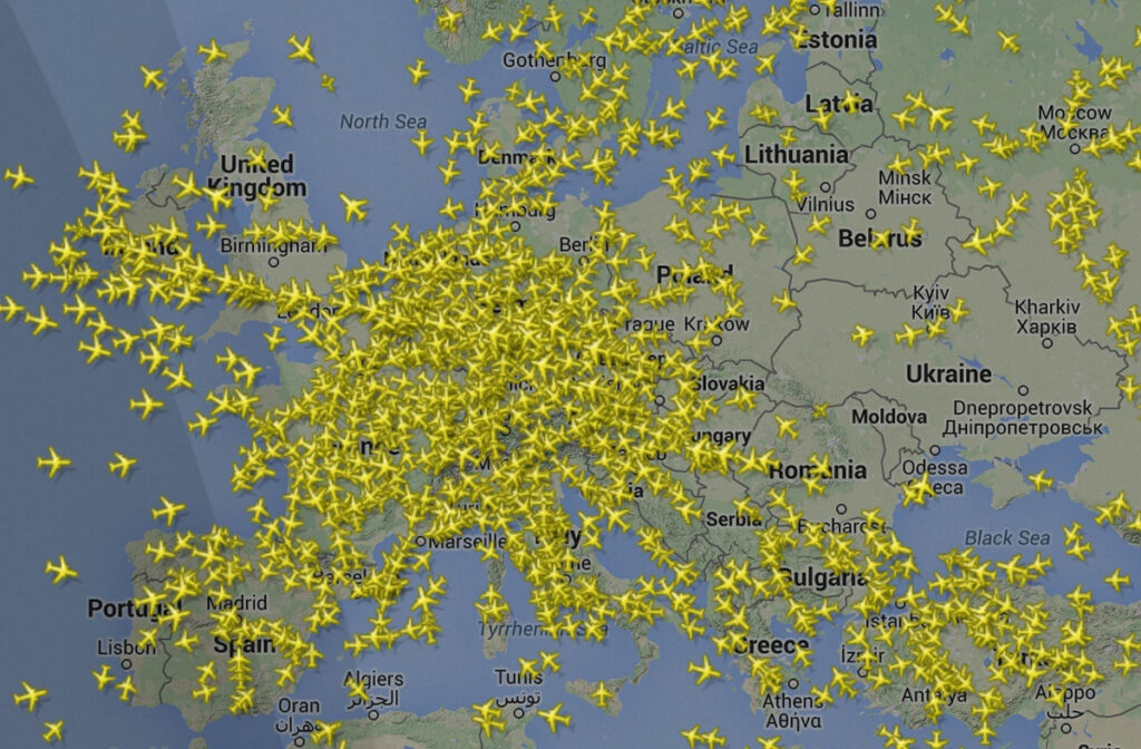
Most mainstream tracking sites filter out specific aircraft—such as private jets of high-net-worth individuals or military transport—based on “Do Not Track” requests. ADS-B Exchange takes a different technical and philosophical approach. It is an unfiltered aggregator that shows everything its receivers pick up. From a tech perspective, it is a fascinating example of a pure crowdsourced data co-op, relying on a community that values data transparency over corporate filtering.
DIY Hardware: Building Your Own Flight Tracker
One of the most rewarding aspects of this technology for enthusiasts is the ability to participate in the network. You don’t need a satellite dish or a professional-grade radar station to track flights; you can build a high-performance receiver using affordable consumer electronics.
The Raspberry Pi and RTL-SDR
The heart of a DIY flight tracker is usually a Raspberry Pi—a small, single-board computer—paired with an RTL-SDR (Software Defined Radio) USB dongle. The RTL-SDR is a versatile piece of hardware that can be programmed to tune into the 1090 MHz frequency used by aircraft.
By installing specialized Linux-based software like Dump1090, the Raspberry Pi decodes the raw radio packets into readable data. This data can then be visualized locally on a web-based map or “fed” to global networks. In exchange for feeding this data, most major platforms provide the user with a free premium subscription, creating a symbiotic relationship between the tech provider and the hardware hobbyist.
Antennas and Signal Processing
The quality of your local “sky view” depends heavily on antenna tech. Because the 1090 MHz signal is line-of-sight, any physical obstruction like a building or a tree can block the data. Tech enthusiasts often build or buy tuned collinear antennas and mount them on rooftops. Adding a Low Noise Amplifier (LNA) and a Band-Pass Filter further refines the signal, stripping away interference from cell towers and FM radio to ensure that only clean aviation data reaches the processor.
The Role of Satellite-Based Tracking
Terrestrial receivers have one major limitation: the ocean. Historically, once a plane flew more than 200 miles off the coast, it disappeared from real-time tracking maps, appearing only as a “projected” icon based on its last known speed and heading. This changed with the introduction of Space-Based ADS-B.
Companies like Aireon have installed ADS-B receivers on the Iridium NEXT satellite constellation. These satellites orbit the Earth and pick up the signals broadcast by aircraft from above, rather than below. This data is then beamed back down to ground stations and integrated into tracking software. This technological leap has effectively eliminated the “black holes” in global aviation, ensuring that every flight—whether it is over the Sahara Desert or the middle of the Atlantic—is visible in real-time.
The Future of Aviation Transparency and AI
As we move forward, the intersection of AI and aviation data will yield even more sophisticated tools. We are entering an era where flight tracking is not just about “where is that plane?” but “what will happen to that plane?”
AI-Driven Anomaly Detection
New software tools are being developed to monitor the global feed for anomalies. If a plane deviates from its assigned flight path or altitude by a certain percentage, AI algorithms can flag the event instantly. This provides a layer of safety and monitoring that exceeds the capabilities of human controllers alone.
Integrating IoT and Weather Data
The next generation of tracking tech involves integrating Internet of Things (IoT) sensors from the aircraft itself. Modern engines generate terabytes of data regarding fuel efficiency, vibration, and temperature. While this data isn’t currently public, the trend toward “Connected Aircraft” suggests a future where real-time tracking might include technical health stats of the plane, visible to maintenance crews on the ground before the plane even lands.
The technology that answers the question “what flights are above me” is a masterpiece of distributed computing and radio engineering. It turns the sky into a digital grid, accessible to anyone with the curiosity to look up and the tools to look in. Whether through a sleek mobile app or a home-built radio receiver, the transparency of our airspace is a testament to the power of modern software and the collaborative spirit of the global tech community.
aViewFromTheCave is a participant in the Amazon Services LLC Associates Program, an affiliate advertising program designed to provide a means for sites to earn advertising fees by advertising and linking to Amazon.com. Amazon, the Amazon logo, AmazonSupply, and the AmazonSupply logo are trademarks of Amazon.com, Inc. or its affiliates. As an Amazon Associate we earn affiliate commissions from qualifying purchases.