
Determining your precise altitude has evolved from a complex feat of surveying to a task performed in milliseconds by the handheld technology in your pocket. Whether you are a mountain climber tracking your ascent, a drone pilot ensuring compliance with airspace regulations, or simply a curious traveler looking to understand the geography of your current location, understanding the mechanics of elevation tracking is essential. Modern devices leverage a combination of satellite trilateration, barometric pressure sensors, and sophisticated software algorithms to provide data that was once the exclusive domain of professional cartographers.
The Technological Architecture of Elevation Tracking
Modern smartphones and wearable devices do not use a single sensor to determine your altitude. Instead, they rely on a multi-layered approach that fuses data from several internal components. By understanding how these technologies function, you can better interpret the accuracy of the readings you receive on your screen.
Global Navigation Satellite Systems (GNSS)
The foundation of most location-based services is the Global Navigation Satellite System, which includes GPS (USA), GLONASS (Russia), Galileo (EU), and BeiDou (China). These satellite constellations transmit signals that allow a receiver to calculate its distance from multiple satellites in orbit. While horizontal positioning (latitude and longitude) is exceptionally accurate, vertical positioning—or elevation—has historically been more prone to error. This is because satellite geometry often lacks the same depth of precision in the “Z-axis” as it does on the Earth’s horizontal plane.
Barometric Altimeters
To compensate for the limitations of satellite data, most high-end smartphones and sports watches incorporate a micro-electromechanical system (MEMS) barometric pressure sensor. These sensors measure the ambient air pressure of your immediate environment. Because atmospheric pressure decreases as altitude increases, the device can calculate your height above sea level based on the current pressure reading. This method is generally more responsive to vertical changes than GPS, making it the preferred choice for fitness trackers and hiking apps.
Sensor Fusion and Calibration
The most accurate elevation readings occur through sensor fusion, a process where the device’s operating system combines satellite data with barometric pressure readings and digital elevation models (DEMs). Software algorithms calibrate these inputs in real-time, correcting for fluctuating weather patterns that might otherwise trick a barometer into suggesting you are moving when you are stationary.
How to Determine Your Current Elevation Using Software
If you need to know your current altitude, you have a variety of digital tools at your disposal, ranging from native OS features to specialized third-party applications.
Utilizing Native OS Tools
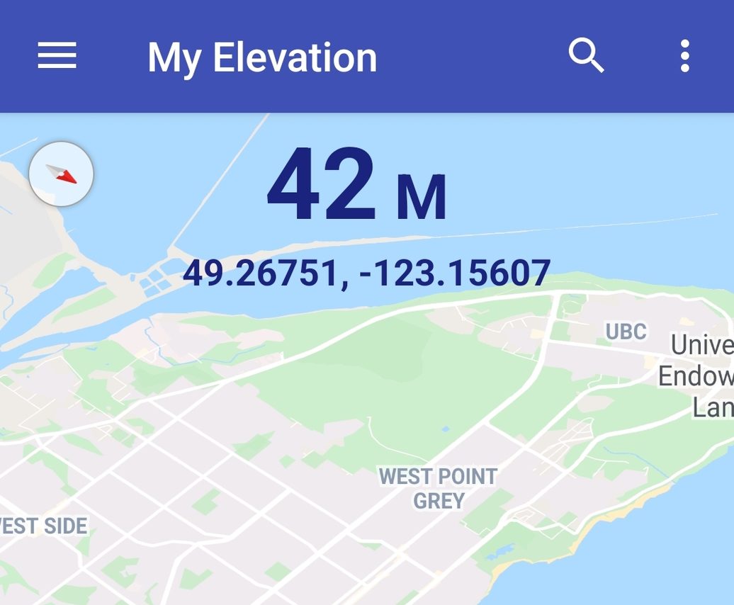
Both iOS and Android have integrated altitude tracking into their core software. On an iPhone, the Compass app provides a real-time readout of your elevation. This is a direct output from the device’s internal sensors and is typically updated continuously as you move. Android users can access similar data through the Google Maps interface or by using dedicated “Altimeter” widgets available in the Google Play Store. These native tools are designed for efficiency, utilizing the device’s sensor hub to minimize battery drain while maintaining reasonable accuracy.
Third-Party Precision Applications
For professional use cases—such as surveying, specialized drone piloting, or mountaineering—native apps may lack the data granularity required. Third-party applications like “Altimeter Pro” or “Gaia GPS” offer advanced features including offline topographic map caching, historical altitude logging, and the ability to calibrate your sensor against known benchmarks. These apps are invaluable for users operating in remote areas where internet connectivity is unavailable, as they rely entirely on the hardware’s onboard processing capabilities.
Factors Affecting Measurement Accuracy
It is a common misconception that elevation data is absolute. In reality, every reading you see is an estimate based on a set of environmental and technical variables. Recognizing these constraints is critical for users who rely on altitude for safety or technical requirements.
The Impact of Weather Patterns
Because barometric altimeters depend on atmospheric pressure, they are highly sensitive to weather changes. A passing storm front or a significant drop in temperature can alter local air pressure, potentially causing your device to report a change in altitude even when you haven’t moved an inch. Most professional-grade devices allow for manual calibration, where you can set a known “reference altitude” (such as a signpost at a trailhead) to reset the baseline and improve the accuracy of subsequent readings.
The Geoid and Ellipsoidal Models
A sophisticated technical challenge in elevation tracking is the difference between an ellipsoid and a geoid. GPS systems typically measure height above the WGS84 ellipsoid—a mathematical representation of the Earth’s shape. However, the Earth is not a perfect sphere; it has uneven mass distribution that affects gravity. To provide an “elevation above sea level” reading, devices must apply a geoid model (like EGM96) to convert the ellipsoidal height into orthometric height. Differences in how software handles these conversions can lead to discrepancies of several meters between different apps or devices.
Practical Applications for Altitude Data
The relevance of elevation data extends far beyond simple curiosity. It serves as a vital data point across several industries and personal health fields.
Aviation and Drone Operations
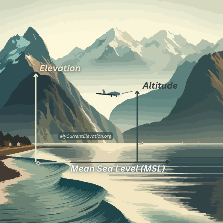
For drone operators, altitude is a matter of legal compliance and safety. Most jurisdictions enforce a strict ceiling for unmanned aerial vehicles (typically 400 feet above ground level) to prevent collisions with manned aircraft. Understanding the difference between “altitude above mean sea level” (AMSL) and “height above ground level” (AGL) is critical for pilots, as terrain elevation changes rapidly during flight.
Fitness and Performance Monitoring
In the realm of sports science, elevation gain is a key metric for endurance athletes. Whether running, cycling, or climbing, the energy expenditure required to overcome gravity is substantial. High-end fitness trackers use sophisticated algorithms to filter out “noise” from the barometric sensor, providing an accurate tally of total vertical ascent over a workout. This data allows athletes to quantify their intensity beyond mere distance and pace, offering a more comprehensive look at the physical demands of their training sessions.
Environmental Research and Urban Planning
Urban planners and environmental scientists use high-resolution elevation data to model drainage patterns, flood risks, and urban heat islands. By leveraging mobile device sensor data as part of a distributed sensor network, researchers can map micro-topography in real-time, providing insights that were previously impossible to gather without expensive, large-scale LIDAR mapping efforts.
Optimizing Your Device for Elevation Tracking
To ensure your device provides the most reliable data, follow these best practices for maintenance and software utilization:
- Keep Sensor Ports Clean: Barometric sensors require an air intake port on the exterior of the device. Ensure this small opening is free of dust, lint, or debris, as blockages can lead to sluggish or incorrect readings.
- Regular Calibration: Whenever you are at a location with a known altitude (such as a mountain summit or a surveyed landmark), check your device’s reading. If it is off by more than a few meters, use the app’s calibration tool to sync your device with the known value.
- Cross-Reference Data: If you are performing a mission-critical task, do not rely on a single data source. Compare the reading from your device’s barometric altimeter with the elevation data found on a high-resolution topographic map.
- Manage Battery/Performance Settings: Some power-saving modes disable the continuous polling of non-essential sensors to preserve battery. If you are tracking a long hike, ensure that the app has permission to keep the barometer and GPS active in the background.
By mastering the integration of satellite technology and barometric measurement, you can transform your smartphone into a precise surveying tool. As sensor technology continues to shrink and improve in resolution, our ability to understand our physical place in the world—down to the very centimeter—will only continue to enhance our capability to navigate, explore, and analyze the landscape around us.
aViewFromTheCave is a participant in the Amazon Services LLC Associates Program, an affiliate advertising program designed to provide a means for sites to earn advertising fees by advertising and linking to Amazon.com. Amazon, the Amazon logo, AmazonSupply, and the AmazonSupply logo are trademarks of Amazon.com, Inc. or its affiliates. As an Amazon Associate we earn affiliate commissions from qualifying purchases.