
In the modern digital era, the question “what is the zip code in my area” is rarely answered by looking at a physical map or a piece of mail. Instead, it is a query processed by a sophisticated stack of technologies ranging from orbiting satellites to ground-level Wi-Fi signals and IP-based databases. Whether you are using a smartphone, a tablet, or a desktop computer, the ability of your device to pinpoint your specific postal code is a marvel of software engineering and hardware integration. This article explores the intricate technology that powers geolocation, the infrastructure of the ZIP code system, and how digital tools provide instant local data.
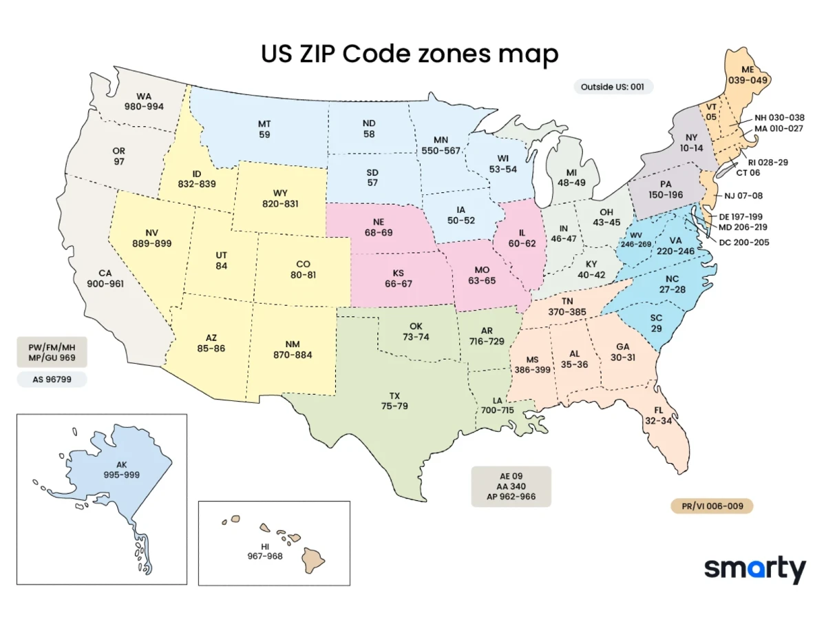
The Mechanics of Geolocation: How Your Device Knows Where You Are
At the heart of identifying your current zip code is the science of geolocation. This is not a single process but a combination of several technical protocols that work in tandem to determine a user’s geographic coordinates (latitude and longitude) and then cross-reference them with postal boundaries.
GPS and Satellite Connectivity
The most well-known method of geolocation is the Global Positioning System (GPS). Controlled by a constellation of approximately 24 to 31 satellites orbiting the Earth, GPS allows a device with a dedicated receiver to calculate its position through a process known as trilateration. By measuring the time it takes for signals from at least four satellites to reach the device, the hardware can calculate its exact position in three-dimensional space. While highly accurate, GPS can struggle indoors or in “urban canyons” where tall buildings block the line of sight to the sky.
Wi-Fi Positioning Systems (WPS)
When you are indoors and ask, “What is my zip code?”, your device likely relies on Wi-Fi Positioning Systems (WPS). Tech giants like Google and Apple maintain massive databases of the MAC addresses (unique identifiers) of Wi-Fi routers worldwide. Your device scans nearby Wi-Fi signals—even those you aren’t connected to—and compares their signal strength and identifiers against these global databases. Because the physical locations of these routers are known, the system can triangulate your position with surprising accuracy, often within a few meters.
Cell Tower Triangulation
For mobile devices, cell tower triangulation serves as a secondary or “assisted” geolocation method (A-GPS). By measuring the signal strength and the time delay from multiple nearby cellular masts, the network can estimate where the handset is located. While less precise than GPS, it is incredibly fast and works in areas where satellite signals are weak.
IP Addresses and Geodatabases: Finding Zip Codes Without GPS
Not all devices have GPS chips or Wi-Fi scanning capabilities. For example, a desktop computer connected via Ethernet relies on an entirely different layer of technology to answer location-based queries.
The Role of IP Geolocation Databases
Every device on the internet is assigned an Internet Protocol (IP) address. While an IP address does not inherently contain a zip code, it is linked to the physical infrastructure of an Internet Service Provider (ISP). Specialized tech companies like MaxMind or IP2Location maintain “Geodatabases” that map IP ranges to specific geographic regions. When you visit a website and it automatically detects your city or zip code, it is querying one of these databases.
Accuracy Limits and Regional Discrepancies
It is important to understand that IP-based geolocation is an estimation rather than a precise measurement. Because IP addresses are often assigned in blocks to ISP data centers, your “IP location” might reflect the location of your provider’s hub rather than your front door. This is why a search for “the zip code in my area” on a desktop might occasionally yield a result for a neighboring town or a regional center. To refine this, modern browsers often use the Geolocation API, which requests permission to use more precise data (like nearby Wi-Fi) to correct the IP-based estimate.
Modern Applications and the Geofencing Revolution
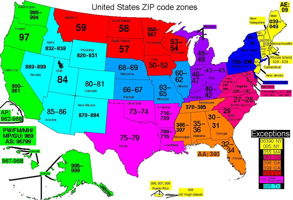
Identifying a zip code is the gateway to “Hyper-Local” technology. Once a software application knows your postal code, it can trigger a variety of automated processes that enhance user experience and operational efficiency.
E-commerce and Logistics Optimization
In the world of logistics tech, zip code identification is critical for “last-mile” delivery. When a user enters a site, the tech stack immediately identifies their area to provide accurate shipping estimates, inventory availability at the nearest warehouse, and localized pricing. Advanced APIs (Application Programming Interfaces) like the Google Maps Platform or the Smarty (formerly SmartyStreets) API allow developers to verify that a zip code is valid and match it against the United States Postal Service (USPS) database in real-time.
Localized Search Engine Results (SERPs)
Search engines use your zip code to personalize the internet. The technology behind “Local Search” ensures that when you look for “weather” or “pizza,” the algorithms prioritize data relevant to your specific postal boundary. This is achieved through “Geocoding”—the process of turning a physical address or zip code into geographic coordinates—and “Reverse Geocoding,” which turns coordinates back into a readable address or zip code.
Privacy and Security in a Geolocation-Enabled World
While the ability to find your zip code instantly is convenient, it raises significant technical questions regarding data privacy and digital security. The technology that tracks your location is a double-edged sword that requires robust management.
Data Harvesting and User Consent
Modern operating systems (iOS, Android, Windows) have implemented strict “Permission Controllers.” When a web app asks for your location, it is requesting access to the device’s Geolocation API. Tech-savvy users must understand that once a zip code is shared, it can be used to build a “digital fingerprint.” Professional digital security involves auditing which apps have “Always On” location permissions and ensuring that location data is encrypted during transmission to prevent “Man-in-the-Middle” (MitM) attacks.
Using VPNs to Mask Physical Locations
A common technological tool used to bypass zip-code-based restrictions or to protect privacy is the Virtual Private Network (VPN). A VPN works by tunneling your internet traffic through a server in a different geographic location. This changes your public IP address. If you are in New York but your VPN server is in Los Angeles, a website’s geolocation tech will identify your zip code as one in California. This highlights the modular and sometimes spoofable nature of IP-based location tech.
The Future of Hyper-Local Technology
The technology used to identify your area is evolving beyond simple zip codes. We are moving toward a future of centimeter-level precision that will redefine how we interact with our immediate environment.
5G and Ultra-Wideband (UWB) Precision
The rollout of 5G networks introduces “Small Cell” technology. Because 5G masts are placed much closer together than 4G towers, the accuracy of cellular geolocation is set to improve exponentially. Furthermore, Ultra-Wideband (UWB) chips—now found in the latest smartphones—allow for “micro-location.” This tech can identify not just your zip code, but exactly which room of a building you are in, enabling seamless interaction with the Internet of Things (IoT).

The Integration of AI and Geolocation
Artificial Intelligence is now being used to predict location patterns and clean up “noisy” GPS data. AI models can analyze historical signal data to provide a more stable location estimate even when a device is moving through a tunnel or a dense forest. As AI becomes more integrated into the tech stack, the question “what is the zip code in my area” will be answered with even greater speed and contextual awareness, linking our physical presence to the digital world with unprecedented fluidity.
In conclusion, the simple task of identifying a zip code is supported by a massive, invisible infrastructure of satellites, servers, and sophisticated software. Understanding these technologies allows us to better navigate the digital landscape, optimize our use of local services, and remain vigilant about our digital privacy. The next time your device identifies your area, remember the complex web of global tech working behind the screen to place you on the map.
aViewFromTheCave is a participant in the Amazon Services LLC Associates Program, an affiliate advertising program designed to provide a means for sites to earn advertising fees by advertising and linking to Amazon.com. Amazon, the Amazon logo, AmazonSupply, and the AmazonSupply logo are trademarks of Amazon.com, Inc. or its affiliates. As an Amazon Associate we earn affiliate commissions from qualifying purchases.