
The question of how long the Amazon rainforest is might seem straightforward at first glance, typically answered with a geographical figure of roughly 4,000 miles (6,400 kilometers) following the winding path of its primary artery, the Amazon River. However, in the modern era of high-resolution geospatial data and sophisticated algorithmic modeling, “length” has become a multi-dimensional metric. To the technologist, the length of the Amazon is not merely a distance on a map; it is a massive data set, a series of temporal coordinates, and a challenge for the world’s most advanced remote sensing and AI tools. Measuring this vast biome requires a complex stack of technology that bridges the gap between terrestrial ecology and orbital computation.

The Evolution of Remote Sensing: Mapping the Immense
Measuring the Amazon’s extent begins with the history of satellite technology. In the late 20th century, our understanding of the rainforest’s scale was limited to low-resolution snapshots that provided only a hazy outline of its boundaries. Today, the “length” of the Amazon is defined by the precision of orbital constellations like the European Space Agency’s Sentinel-2 and NASA’s Landsat program.
Synthetic Aperture Radar (SAR) and Cloud Penetration
One of the greatest technical hurdles in measuring the Amazon is its persistent cloud cover. For traditional optical sensors, the rainforest is often invisible. This is where Synthetic Aperture Radar (SAR) technology becomes essential. Unlike optical sensors that rely on sunlight, SAR transmits its own microwave signals and measures the reflection. Because these waves can penetrate clouds, smoke, and darkness, SAR allows scientists to measure the “length” and breadth of the forest regardless of weather conditions. By analyzing the “backscatter” of these signals, algorithms can determine not just where the forest begins and ends, but the density of the biomass within it.
High-Frequency Revisit Rates
The dimension of time is perhaps the most critical “length” in modern conservation tech. Companies like Planet and Maxar have deployed “constellations” of small satellites (CubeSats) that provide daily imagery of the entire Amazon basin. This high-frequency revisit rate allows for a temporal measurement of the forest. We are no longer looking at a static length; we are looking at a living, breathing digital twin that updates every 24 hours. This allows for the detection of illegal logging roads—the “arteries” of deforestation—within hours of their creation, transforming geographic data into actionable intelligence.
Artificial Intelligence: Processing the Amazon Data Deluge
If satellites are the eyes that see the Amazon, Artificial Intelligence is the brain that interprets it. The sheer volume of data generated by daily satellite passes is far too large for human analysts to process. To determine the true extent of the forest and its health, we rely on Machine Learning (ML) and Deep Learning models.
Computer Vision and Change Detection
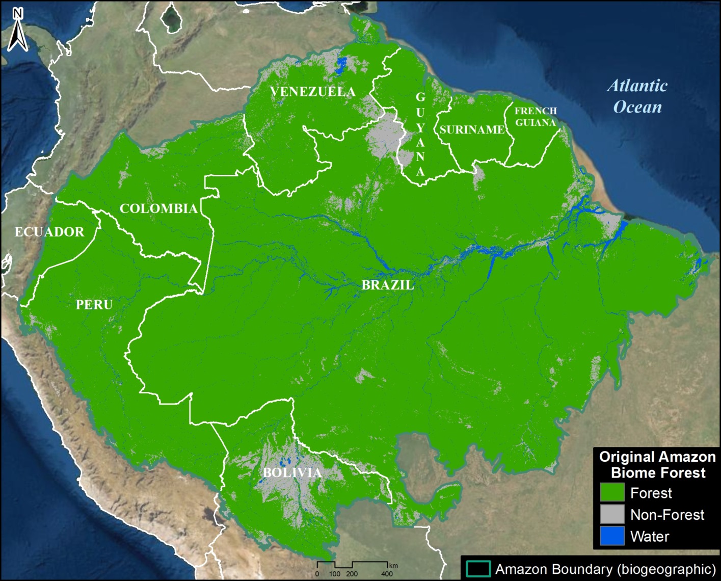
Computer vision algorithms are trained to recognize patterns in satellite imagery that indicate specific types of land use. These models can distinguish between primary forest, secondary growth, agricultural land, and degraded areas. By applying these models across the entire 2.1 million square miles of the Amazon basin, AI can calculate the “effective length” of contiguous forest versus fragmented patches. Fragmentation is a critical metric; a forest may be long in distance but “short” in ecological integrity if it is broken by roads and clearings.
Predictive Modeling and Deforestation Alerts
Advanced platforms like Global Forest Watch and MapBiomas use AI to provide near-real-time alerts. These systems don’t just measure where the forest is; they use historical data to predict where it is likely to be lost next. By analyzing the “length” of new roads and their proximity to protected areas, predictive algorithms can assign risk scores to specific sectors of the Amazon. This transition from descriptive analytics (what happened) to predictive analytics (what will happen) is the hallmark of modern conservation technology.
Lidar and the Vertical Dimension: Measuring the Canopy Height
While “length” typically refers to horizontal distance, the technological measurement of the Amazon must also account for its verticality. This is where Lidar (Light Detection and Ranging) technology revolutionizes our understanding of the rainforest’s scale.
GEDI: The Space-Based Laser
NASA’s Global Ecosystem Dynamics Investigation (GEDI) is a Lidar instrument attached to the International Space Station. GEDI fires laser pulses at the Earth, measuring the time it takes for them to bounce back from the forest floor and the top of the canopy. This creates a precise 3D map of the forest’s structure. When we ask “how long is the Amazon,” Lidar allows us to answer in terms of carbon sequestration—calculating the total volume of the forest by measuring the height and density of the trees across its entire 4,000-mile span.
Drone-Based Lidar for Micro-Mapping
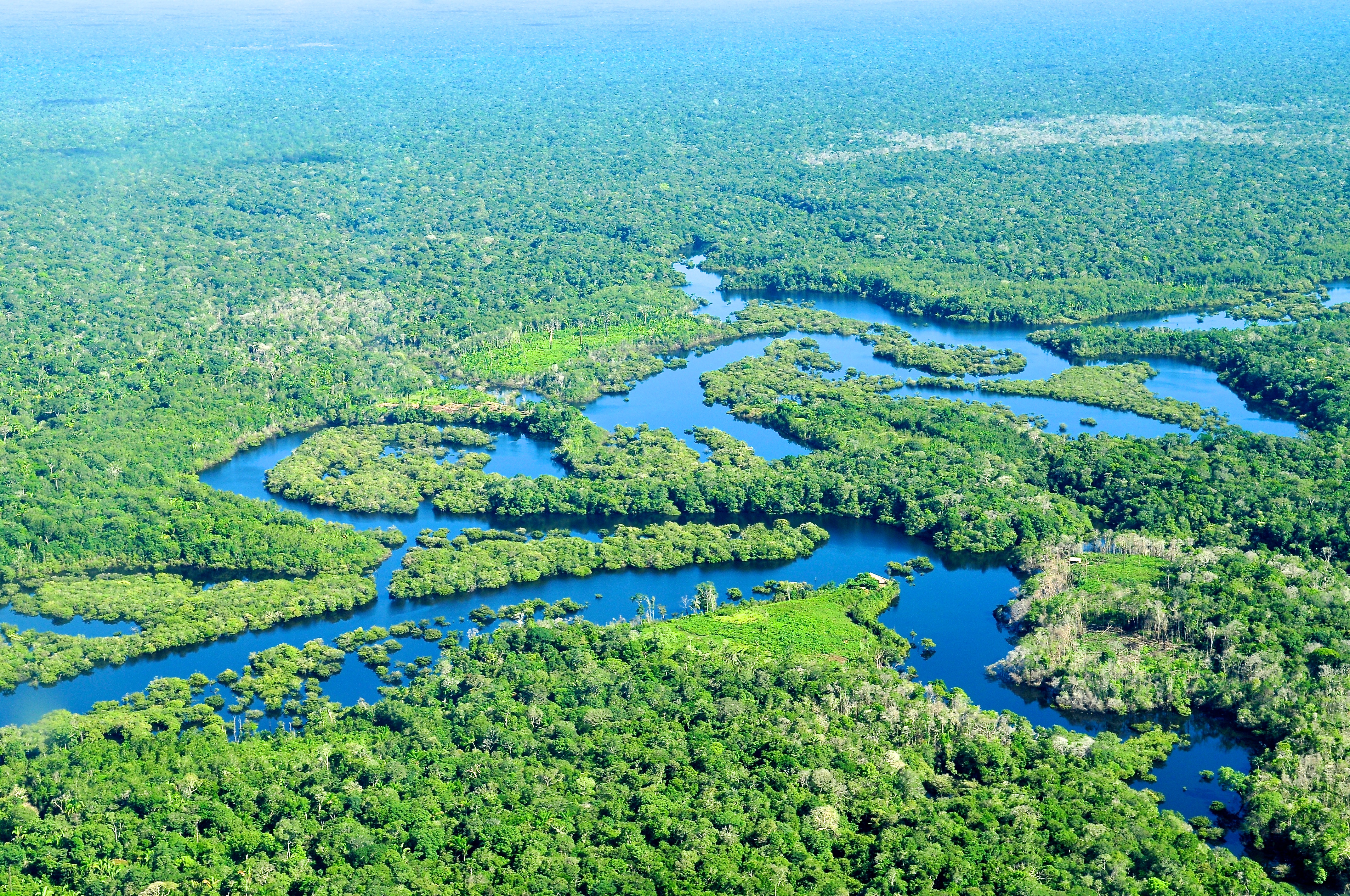
On the ground level, researchers use Lidar-equipped drones to fly beneath the canopy or just above it. These drones capture millions of data points per second, creating “point clouds” that represent individual trees with centimeter-level accuracy. This tech is vital for indigenous communities and local NGOs who need to verify the “length” of their protected boundaries or monitor the growth of reforestation projects. It provides a level of granularity that satellites cannot match, bridging the gap between orbital data and local reality.
The Internet of Trees: IoT and Acoustic Monitoring
The measurement of the Amazon is not limited to what we can see from above; it also involves what we can hear and sense from within. The “length” of the forest’s network is increasingly defined by the Internet of Things (IoT).
Bioacoustic Sensors and AI Auditing
Projects like the “Rainforest Connection” use recycled smartphones and specialized acoustic sensors to monitor the sounds of the jungle. These devices are strategically placed across vast stretches of the forest. Using AI, these sensors can distinguish between the natural calls of biodiversity and the man-made sounds of chainsaws or trucks. The “length” of this acoustic net provides a real-time shield for the forest. When a chainsaw is detected, an alert is sent via the cloud to local rangers, providing a digital perimeter that protects the physical length of the biome.
Edge Computing in Remote Environments
One of the primary challenges of IoT in the Amazon is the lack of connectivity. To solve this, technologists are deploying “edge computing” solutions. Instead of sending raw audio or visual data to the cloud—which would require massive bandwidth—the data is processed on the device itself. Only the high-level “alerts” are transmitted via satellite links. This decentralized tech architecture allows for a massive expansion of the monitored “length” of the rainforest, pushing the boundaries of where technology can operate.
Blockchain and the Digital Verification of Ecological Assets
As we define the length and health of the Amazon through technology, a new question arises: how do we trust this data? This is where blockchain technology and Distributed Ledger Technology (DLT) come into play.
Transparency in Carbon Markets
The Amazon is one of the world’s largest carbon sinks. To monetize this “natural capital” through carbon credits, there must be an immutable record of the forest’s existence. By tethering satellite and Lidar data to a blockchain, organizations can create a transparent record of the forest’s “length” and biomass over time. This prevents “double-counting” of credits and ensures that investments in the Amazon are backed by verifiable, unchangeable data.
Smart Contracts for Conservation
Blockchain also enables the use of smart contracts—self-executing agreements where the terms are written into code. For example, a conservation fund could release payments to local communities only when satellite data verifies that a specific “length” of forest has remained standing for a set period. This creates a direct, technology-driven link between the physical state of the rainforest and the financial systems intended to protect it.
The Digital Twin: The Future of Amazonian Measurement
Ultimately, the goal of these various technologies is to create a “Digital Twin” of the Amazon rainforest. A Digital Twin is a virtual representation that is updated in real-time with data from the physical world. This goes beyond simple measurement; it allows scientists to run “what-if” scenarios.
If we lose a 100-mile “length” of forest in the southern Amazon, how will it affect the “flying rivers” (the atmospheric moisture) that provide rain to the rest of the continent? By integrating climate models, hydrological data, and satellite imagery into a single digital framework, we can see the Amazon not just as a static geographical feature, but as a dynamic, interconnected system. The “length” of the Amazon, in this context, is the length of its survival—a metric that technology is now working tirelessly to extend.
In conclusion, “how long is the Amazon rainforest” is a question that starts with geography but is answered through a sophisticated stack of tech. From SAR satellites that pierce the clouds to AI models that predict the next hectare of loss, and from Lidar lasers that map the canopy to blockchain ledgers that secure its value, the Amazon is being redefined as the world’s most critical piece of biological infrastructure. Our ability to measure it accurately is the first, and perhaps most important, step in ensuring it continues to exist.
aViewFromTheCave is a participant in the Amazon Services LLC Associates Program, an affiliate advertising program designed to provide a means for sites to earn advertising fees by advertising and linking to Amazon.com. Amazon, the Amazon logo, AmazonSupply, and the AmazonSupply logo are trademarks of Amazon.com, Inc. or its affiliates. As an Amazon Associate we earn affiliate commissions from qualifying purchases.