
In the era of hyper-precise satellite imagery and advanced Geographic Information Systems (GIS), the traditional geographical definitions of landforms are being redefined by data. To the casual observer, the difference between a bay and a gulf might seem like a matter of mere semantics or subjective size. However, for software engineers, geospatial analysts, and data scientists working in maritime technology, the distinction is rooted in topological algorithms, bathymetric data, and computational fluid dynamics.
Understanding the difference between a bay and a gulf through a technological lens involves more than just looking at a map. It requires an exploration of how modern sensors, AI-driven feature extraction, and digital mapping protocols categorize these features to facilitate global logistics, environmental monitoring, and autonomous navigation.
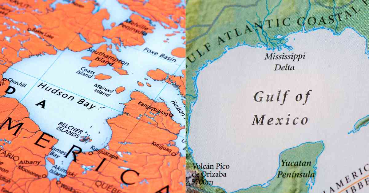
The Algorithm of the Coastline: Defining Water Bodies Through GIS
At the heart of modern geography is GIS technology, which uses complex algorithms to classify geographical features. From a computational standpoint, the distinction between a bay and a gulf is often determined by the “re-entrant” properties of a coastline—how the land curves inward to meet the sea.
Shape Optimization and Curvature Analysis
Geospatial software uses curvature analysis to determine the classification of a coastal indentation. A bay is typically defined in data models as a recessed, coastal body of water that directly connects to a larger main body of water, such as an ocean or a lake. In algorithmic terms, a bay often exhibits a higher “circularity ratio.” GIS tools like ArcGIS or QGIS calculate the area of the water body relative to the square of its perimeter.
A gulf, conversely, is classified by its scale and its “narrowness” of entry relative to its total area. In a digital elevation model (DEM), a gulf is identified as a much larger portion of the ocean that is almost completely surrounded by land. The technology focuses on the “mouth” of the water body. If the ratio of the width of the opening to the total inland area falls below a certain threshold, the software flags it as a gulf rather than a bay. These mathematical parameters are essential for automated mapping tools that need to label features without human intervention.
The Role of Bathymetry and Digital Elevation Models (DEM)
Beyond the 2D shape, the tech industry relies on bathymetric data—the underwater equivalent of topography. Gulfs are generally deeper than bays, a distinction that is vital for maritime software used by deep-sea vessels. Using LiDAR (Light Detection and Ranging) and multibeam echosounders, tech firms create high-resolution 3D models of the seafloor.
In these digital models, a gulf often reveals a complex underwater shelf system, whereas a bay typically shows a more gradual slope consistent with local coastal erosion patterns. For software developers building navigation apps, this bathymetric data is the “source of truth” that differentiates a shallow bay, suitable for recreational tech (like consumer-grade sonar), from a deep gulf capable of hosting massive container ships.
Satellite Imagery and Remote Sensing: Distinguishing Scale and Enclosure
The most visible technology used to differentiate these two features is remote sensing. High-altitude satellites and low-earth orbit (LEO) constellations provide the raw data that allows us to visualize the massive scale of a gulf versus the localized nature of a bay.
High-Resolution Optical Data vs. Synthetic Aperture Radar (SAR)
Optical satellites, such as those operated by Maxar or Planet Labs, capture the visual differences in water color and sediment transport. In a bay, the proximity to various land-based runoff points often results in a distinct spectral signature in the imagery, which can be analyzed to determine water quality or siltation levels.
However, when distinguishing a gulf, Synthetic Aperture Radar (SAR) is often more effective. SAR can “see” through cloud cover and measure the surface roughness of the water. Because gulfs are larger and more enclosed, they exhibit different wave resonance patterns compared to the more open-ended bays. Computational models use this radar data to simulate how energy is trapped within the semi-enclosed system of a gulf, providing a technological basis for its classification.
Automated Feature Extraction in Modern Mapping Apps
For consumer apps like Google Maps or Apple Maps, the process of labeling a bay or a gulf is largely automated through computer vision. Machine learning models are trained on millions of labeled satellite images to recognize the visual patterns associated with each.
These models look for “connectivity pixels.” A bay is usually characterized by a wide connection to the sea, allowing for high levels of water exchange. A gulf’s digital signature shows a more restricted “choke point.” This automated extraction is what allows digital maps to update in real-time as coastlines shift due to tectonic activity or rising sea levels, ensuring that the metadata associated with a location remains accurate for logistical software.
AI and Machine Learning in Coastal Classification
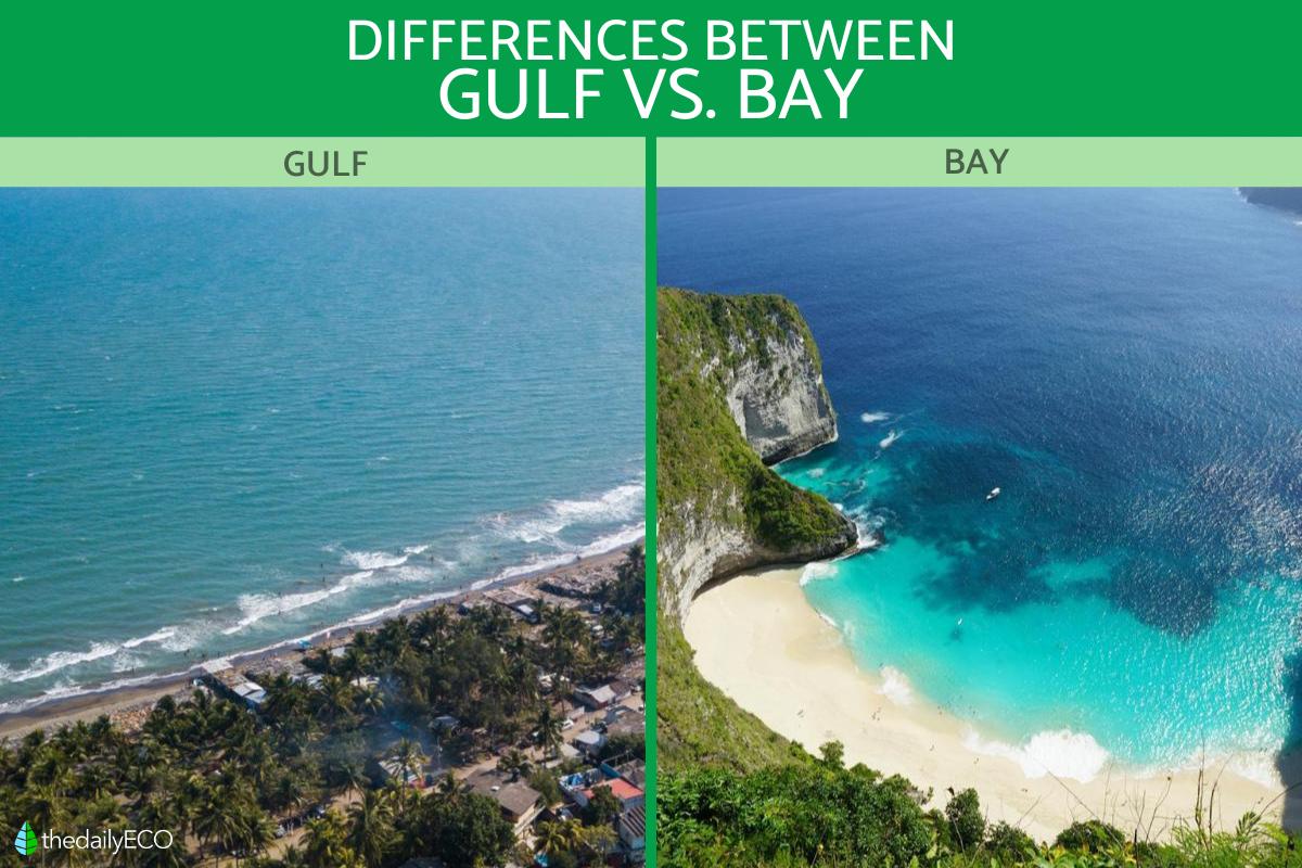
As we move toward “Smart Earth” initiatives, artificial intelligence is playing a larger role in how we categorize the natural world. Neural networks are now being used to analyze historical geographic data and predict how bays and gulfs will evolve over time.
Neural Networks for Topological Recognition
Advanced neural networks, specifically Convolutional Neural Networks (CNNs), are highly adept at pattern recognition. When fed global coastal data, these AI models can identify nuances that traditional geography might miss. For instance, an AI might classify a body of water as a gulf based on its atmospheric pressure influence—gulfs are large enough to generate their own localized weather systems, such as the “Gulf effect” on humidity and wind.
By integrating meteorological data layers with coastal geometry, AI provides a multidimensional definition. A bay is seen by the AI as a localized indentation with minimal impact on regional climate, whereas a gulf is processed as a significant thermal mass that dictates weather patterns across hundreds of miles.
The Impact of Climate Data on Shifting Definitions
Technology is also tracking how the definitions of these bodies of water are changing. With the help of hyperspectral imaging and thermal sensors, scientists are monitoring how rising sea levels are “opening up” certain gulfs or “drowning” bays.
This data is critical for the tech sector involved in coastal engineering and digital twin modeling. If a bay’s “mouth” widens significantly due to erosion, the software may reclassify the area’s risk profile for storm surges. The technological distinction between a bay and a gulf, therefore, isn’t just about naming; it’s about the data-driven risk assessment used by insurance tech (InsurTech) and urban planning software.
The Tech Behind Navigation: From GNSS to Autonomous Shipping
In the world of maritime tech, the difference between a bay and a gulf has massive implications for navigation algorithms and the hardware used to guide ships.
Precision Challenges in Navigating Gulfs vs. Bays
Global Navigation Satellite Systems (GNSS) function differently depending on the environment. In a bay, which is often surrounded by higher landmasses or urban infrastructure, signal multipath errors can occur. Navigation software must account for these reflections to provide centimeter-level accuracy for docking.
In a gulf, the challenges are different. Because of the vast distances and the curvature of the earth, maritime software must utilize different coordinate projection systems to maintain accuracy. The “Great Circle” distance calculations are more prevalent in gulf navigation software than in the localized “Planar” calculations used for small bays.
API Integration for Maritime Logistics
Logistics platforms use APIs (Application Programming Interfaces) to pull real-time data regarding currents, tides, and traffic within these water bodies. A “Gulf API” might provide data on transcontinental shipping lanes and deep-water currents like the Gulf Stream. In contrast, a “Bay API” would focus on localized tidal shifts, recreational vessel tracking, and environmental protection zones.
For developers building these platforms, the data structure for a gulf is optimized for long-range, high-latency updates, whereas bay data is often optimized for high-frequency, real-time updates due to the higher density of traffic and obstacles.

Future Tech: Digital Twins and the Ocean’s Digital Frontier
The ultimate evolution of the bay vs. gulf distinction lies in the creation of “Digital Twins”—virtual replicas of the physical world. Tech giants and environmental organizations are currently building digital twins of the world’s oceans to simulate the impact of human activity and natural disasters.
In a digital twin environment, a bay is a highly detailed, localized node within a larger network. It requires high-resolution textures and complex physics engines to simulate how waves interact with specific piers or beaches. A gulf, in the digital twin, is treated as a macro-environment, requiring massive computational power to simulate ocean-scale currents and thermal layers.
The difference, in this context, is one of computational complexity. To represent a gulf, you need a distributed computing architecture that can handle petabytes of data. To represent a bay, you need a high-fidelity rendering engine that can capture the minute details of the land-water interface.
As our technology continues to advance, the labels “bay” and “qulf” will likely become even more data-dependent. We are moving away from a world where we name things based on what they look like on a paper map, and toward a world where we define them by their digital footprint, their thermal signature, and their mathematical relationship to the rest of the planet. Through the lens of technology, a bay and a gulf are not just bodies of water; they are distinct data sets, each with its own unique requirements for analysis, visualization, and interaction.
aViewFromTheCave is a participant in the Amazon Services LLC Associates Program, an affiliate advertising program designed to provide a means for sites to earn advertising fees by advertising and linking to Amazon.com. Amazon, the Amazon logo, AmazonSupply, and the AmazonSupply logo are trademarks of Amazon.com, Inc. or its affiliates. As an Amazon Associate we earn affiliate commissions from qualifying purchases.