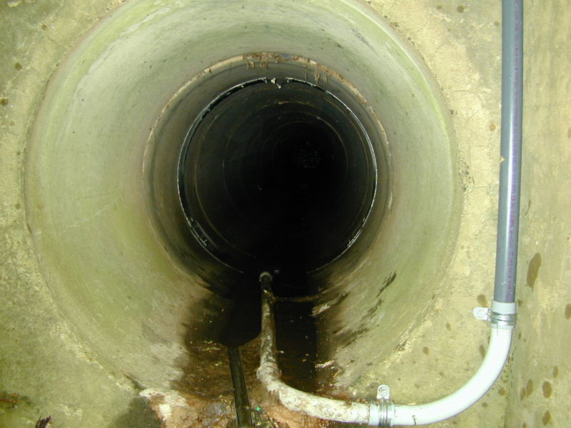
For the average citizen, the question “what does a sewer look like?” typically conjures images from cinematic tropes: dark, cavernous brick tunnels, murky water, and perhaps a labyrinthine network of pipes inhabited by fictional characters. However, in the realm of modern civil engineering and urban technology, the answer is far more sophisticated. Today, a sewer is less of a mystery and more of a data-rich environment. Through the lens of advanced robotics, artificial intelligence, and digital twin technology, the interior of our urban underground is being illuminated like never before.

To understand what a sewer looks like today is to understand the intersection of rugged hardware and cutting-edge software. We no longer rely on guesswork or dangerous manual inspections; instead, we see the sewer through a digital interface that prioritizes structural integrity, preventative maintenance, and long-term urban resilience.
1. The Digital Eye: Robotics and HD Imaging in Subterranean Exploration
The primary way we visualize the interior of a sewer system today is through Robotic Sewer Inspection (RSI). These are not merely cameras on wheels; they are highly specialized mobile laboratories designed to survive one of the most hostile environments on earth.
High-Definition Crawler Robots and 4K Imaging
When an engineer asks what a sewer looks like, they are usually looking at a 4K, high-definition feed transmitted from a “crawler.” These robots are equipped with steerable six-wheel drives, allowing them to navigate over debris, grease build-ups, and varying pipe diameters. Unlike the grainy, analog footage of the 1990s, modern CCTV (Closed-Circuit Television) inspection tools provide crystal-clear imagery that allows technicians to see hairline fractures, chemical corrosion, and root intrusions with surgical precision.
360-Degree Panoramic View and Virtual Reality
The latest evolution in “looking” at a sewer involves panoramic scanning technology. Systems like the PANORAMO use two high-resolution cameras with wide-angle lenses to capture a 360-degree hemispherical image every few inches. This data is then stitched together to create a “virtual” sewer. This allows an engineer sitting in an office miles away to “walk” through the pipe digitally, looking up, down, and around as if they were physically present, all without the safety risks associated with confined-space entry.
2. AI and Machine Learning: Identifying the Invisible
A sewer is more than just a pipe; it is a complex structural asset that is constantly degrading. To the naked eye, a small discoloration might mean nothing, but to an Artificial Intelligence (AI) trained on millions of images, it represents a specific type of structural failure.
Automated Defect Detection and Computer Vision
What a sewer looks like to an AI is a series of patterns and anomalies. Computer Vision algorithms are now used to automatically scan hours of inspection footage. These tools can identify and categorize defects such as “spalling” (where the surface of the pipe flakes off), “offset joints,” and “lateral protrusions” with higher accuracy than human operators. By tagging these issues in real-time, the software creates a heat map of the sewer’s health, turning visual data into actionable maintenance schedules.
Predictive Maintenance and Data Analytics
In the tech-driven view of a sewer, we don’t just see what is there now; we see what will happen in the future. By feeding visual data into machine learning models, municipalities can predict when a pipe is likely to fail. The “look” of the sewer, therefore, becomes a temporal progression. Predictive analytics software takes the current state of corrosion and overlays environmental factors—such as soil acidity and flow velocity—to visualize the “lifespan” of the infrastructure, allowing for interventions before a catastrophic collapse occurs.
3. Smart Infrastructure: IoT and the “Connected” Sewer
The modern sewer is increasingly becoming a “Smart” system. It is no longer a passive concrete tube but a connected network of sensors that provide a multi-sensory “view” of the underground environment.
Ultrasonic Sensors and Flow Monitoring
If you were to look at a sewer through a “Smart City” dashboard, you wouldn’t just see a pipe; you would see a pulse. Internet of Things (IoT) sensors use ultrasonic waves to measure the distance between the sensor and the water level. This data is visualized as real-time flow graphs. During a heavy rain event, these sensors “see” the rising tide of stormwater, allowing digital systems to automatically divert flow to storage basins or treatment plants to prevent overflows.
Gas Detection and Environmental Remote Monitoring
A sewer also has a “look” that is invisible to the human eye: its chemical composition. Tech-integrated sewer systems utilize H2S (Hydrogen Sulfide) sensors to monitor gas levels. High levels of H2S are not only dangerous to workers but are also a primary cause of concrete corrosion. By visualizing these gas concentrations on a digital map, engineers can identify “hot spots” where the pipe is literally being eaten away from the inside, long before the damage becomes visible on a standard camera.
4. Trenchless Technology: Seeing Through the Ground
One of the most impressive feats of modern technology is the ability to see what a sewer looks like without even opening the ground. This is achieved through trenchless technology and advanced geological scanning.
Ground-Penetrating Radar (GPR) and LiDAR
Ground-Penetrating Radar (GPR) allows technicians to visualize the exterior of a sewer pipe and the surrounding soil from the surface. This “X-ray vision” identifies voids—empty pockets of air caused by leaking pipes—that could lead to sinkholes. Additionally, LiDAR (Light Detection and Ranging) is used inside the pipes to create highly accurate 3D point clouds. These point clouds provide a geometric “look” at the sewer, revealing if a pipe has become oval-shaped or deformed under the weight of the earth above it.
Digital Twins and 3D Geospatial Modeling
The pinnacle of modern sewer visualization is the “Digital Twin.” This is a dynamic, 3D virtual representation of the entire underground network integrated with Geographical Information Systems (GIS). When you look at a digital twin of a sewer, you are seeing a comprehensive model that includes pipe material, age, depth, flow rate, and historical repair data. This allows city planners to run simulations—such as “what happens if this main breaks?”—and see the results in a risk-free virtual environment.
The Future of Subterranean Visualization
As we move further into the 21st century, the question “what does a sewer look like?” will continue to evolve. We are already seeing the emergence of drone technology designed for confined spaces. These “Elios” drones can fly through large interceptor sewers, using thermal imaging and LIDAR to map areas that are inaccessible even to robots.
Furthermore, the integration of Augmented Reality (AR) is changing how field technicians interact with the sewer. A worker standing on a street corner can now use an AR headset or a tablet to “see through” the pavement. The software overlays the digital twin of the sewer onto the real-world view, showing exactly where the pipes are located, their depth, and their current condition.
In conclusion, a sewer today looks like a triumph of modern engineering. It is a high-definition, data-driven, and interconnected environment. By moving away from the “out of sight, out of mind” philosophy, technology has allowed us to turn our most vital hidden infrastructure into a transparent, manageable asset. The dark tunnels of the past have been replaced by the bright, precise, and predictive digital models of the future, ensuring that the veins of our cities remain functional for generations to come.
aViewFromTheCave is a participant in the Amazon Services LLC Associates Program, an affiliate advertising program designed to provide a means for sites to earn advertising fees by advertising and linking to Amazon.com. Amazon, the Amazon logo, AmazonSupply, and the AmazonSupply logo are trademarks of Amazon.com, Inc. or its affiliates. As an Amazon Associate we earn affiliate commissions from qualifying purchases.