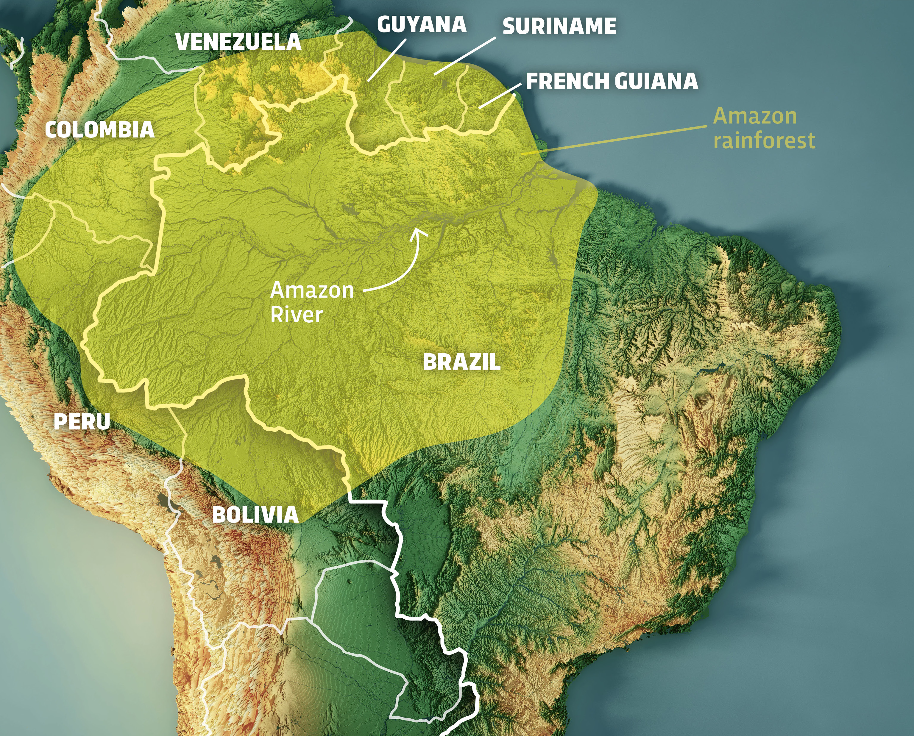
The Amazon rainforest, often dubbed the “lungs of the Earth,” represents an unparalleled natural wonder. Its sheer scale is difficult to grasp, spanning multiple countries and encompassing a staggering portion of global biodiversity. For centuries, understanding the true dimensions, intricate ecosystems, and dynamic changes within this vast wilderness remained a monumental challenge. However, in the modern era, technological advancements have revolutionized our ability to measure, map, and monitor the Amazon jungle, offering unprecedented insights into its colossal size, health, and the threats it faces. Far from a simple geographical measurement, comprehending “how big” the Amazon is today requires a deep dive into the sophisticated technologies that allow us to perceive, analyze, and protect this indispensable natural heritage.
The Scale of the Amazon: A Technological Perspective
To truly appreciate the Amazon’s immensity, one must look beyond traditional cartography and embrace the digital tools that provide a multi-faceted view. Technology doesn’t just give us a number; it gives us a dynamic, evolving understanding of the world’s largest rainforest.
Satellite Imagery and Remote Sensing for Vast Area Measurement
The foundational technology in understanding the Amazon’s vastness is satellite imagery and remote sensing. Before the advent of orbital platforms, precise measurements were practically impossible, limited by the impenetrable nature of the forest. Satellites like Landsat, Sentinel, and MODIS orbit the Earth, continuously capturing images across various spectral bands. These images provide the raw data necessary to delineate the Amazon’s geographical boundaries, calculate its precise area, and track changes over time.
High-resolution optical sensors can distinguish between different types of vegetation, water bodies, and deforested areas. Synthetic Aperture Radar (SAR) systems, unaffected by cloud cover—a common issue in the Amazon—can penetrate the canopy to map forest structure, identify flooding, and even detect subtle changes in land use. This constant stream of data, collected from hundreds of kilometers above the Earth, is the primary means by which scientists accurately determine the Amazon’s millions of square kilometers, making the abstract concept of its “bigness” quantifiable and verifiable. Without these eyes in the sky, much of the Amazon would remain an uncharted mystery.
Geographic Information Systems (GIS) for Comprehensive Data Integration
Once satellite data is collected, it needs to be processed, analyzed, and integrated with other information to create a coherent picture. This is where Geographic Information Systems (GIS) become indispensable. GIS platforms allow researchers to layer diverse datasets—such as topography, hydrological networks, soil types, biodiversity hotspots, human settlements, indigenous territories, and protected areas—onto digital maps.
By combining these layers, GIS provides a multi-dimensional understanding of the Amazon’s complexity and its actual functional “size.” It allows analysts to identify correlations between different environmental factors, model ecological processes, and visualize the spatial distribution of resources and threats. For instance, a GIS can overlay deforestation alerts with road networks and mining concessions to pinpoint drivers of forest loss. It transforms raw data into actionable intelligence, offering not just a measurement of area, but an understanding of the interconnected systems that define the Amazon’s vast ecosystem.
AI and Machine Learning in Processing Petabytes of Environmental Data
The sheer volume of data generated by satellites and other remote sensors is staggering—petabytes of information collected annually. Manually analyzing this data is beyond human capability. This challenge has driven the development and application of Artificial Intelligence (AI) and Machine Learning (ML) algorithms. AI models are trained to recognize patterns in satellite imagery, such as distinguishing primary forest from secondary growth, identifying illegal mining operations, or detecting fires.
Machine learning algorithms can process vast archives of historical data to predict future deforestation trends or identify areas at high risk. They automate the labor-intensive tasks of classification, anomaly detection, and change analysis, allowing scientists to focus on interpretation and strategic responses. For example, AI-powered systems can now flag deforestation events within hours of satellite image acquisition, providing near real-time insights into the Amazon’s changing landscape. This capability ensures that the true “bigness” of the Amazon, in terms of its dynamic state and constant evolution, can be tracked and understood with unprecedented speed and accuracy, transforming our monitoring capabilities from reactive to proactive.
Monitoring the Pulse of the Jungle: Tech for Real-time Insights
Understanding the Amazon’s static size is one thing; monitoring its dynamic health is another. Technology allows us to take its pulse, providing crucial real-time insights into its condition and detecting threats as they emerge.
Early Warning Systems for Deforestation and Illegal Activities
The race against deforestation and illegal activities in the Amazon is largely fought with technology. Early warning systems, powered by satellite imagery and AI, are at the forefront of this battle. Platforms like Brazil’s DETER (Detection of Deforestation in Real Time) and GLAD (Global Land Analysis and Discovery) system, accessible via Global Forest Watch, continuously scan satellite images for signs of forest disturbance.
These systems use sophisticated algorithms to compare current images with historical baselines, identifying new clearings, logging roads, or fires. When a change is detected, alerts are generated and disseminated to government agencies, conservation organizations, and indigenous communities, often within hours or days. This rapid notification allows for quicker intervention by law enforcement or local patrols, dramatically reducing the window of opportunity for illegal activities to escalate. These systems are crucial in providing the intelligence needed to respond to threats across the Amazon’s immense and often remote expanse.
Drone Technology for Hyper-Local Monitoring and Conservation
While satellites provide the macro view, drones offer an invaluable hyper-local perspective. For specific areas of concern, such as indigenous territories, protected areas, or sites of suspected illegal activity, drones can be deployed to capture high-resolution imagery and video. These unmanned aerial vehicles (UAVs) can navigate dense forest canopies, access remote areas inaccessible to ground teams, and provide detailed visual evidence.
Drones are used for a variety of conservation tasks: monitoring wildlife populations, tracking illegal logging operations with pinpoint accuracy, assessing the impact of fires, and supporting reforestation efforts by mapping suitable planting sites. Their agility and ability to capture granular data complement satellite monitoring, allowing for detailed verification of alerts and providing the ground-level context necessary for effective enforcement and conservation strategies. They provide a crucial “boots-on-the-ground” perspective, albeit from the air, in the fight to protect specific parts of the Amazon’s vast territory.
IoT Sensors and Acoustic Monitoring for Biodiversity Tracking

Beyond mapping land cover changes, technology is also delving into the hidden life within the Amazon, allowing us to understand the “bigness” of its biodiversity. Networks of Internet of Things (IoT) sensors are being deployed throughout the rainforest to collect environmental data in real-time. These sensors can monitor microclimates (temperature, humidity), soil conditions, and water quality, providing insights into ecological health.
Acoustic monitoring is a particularly innovative application. Autonomous recording units (ARUs) equipped with microphones are strategically placed in the forest to capture soundscapes. AI algorithms then analyze these recordings to identify the calls of various species—birds, insects, amphibians, mammals—providing non-invasive methods to track biodiversity, monitor species presence, and detect illegal human activity (like chainsaws or vehicles). This passive listening offers a continuous, wide-area method to understand the intricate web of life, revealing the often-unseen richness and health of the Amazon’s vast and diverse ecosystems.
Digital Innovation in Sustainable Resource Management and Conservation
Technology’s role extends beyond mere monitoring; it is also a powerful enabler for sustainable practices and effective conservation strategies across the Amazon’s sprawling landscapes.
Blockchain for Supply Chain Transparency and Ethical Sourcing
The global supply chains for products originating from the Amazon often suffer from a lack of transparency, making it difficult to distinguish legally and sustainably sourced goods from those linked to deforestation or illegal activities. Blockchain technology offers a robust solution by creating immutable, transparent records for every step of a product’s journey from source to consumer.
By tagging products like timber, coffee, or cocoa with unique digital identifiers at their origin, blockchain can track their movement through processing, shipping, and retail. This ledger system verifies the authenticity of sustainable sourcing claims, combats illegal trade, and empowers consumers to make ethical choices. For instance, timber companies can use blockchain to prove their wood comes from responsibly managed forests, assuring buyers that their purchase does not contribute to Amazon deforestation. This digital accountability encourages more sustainable practices across the immense economic footprint connected to the Amazon.
Citizen Science Apps and Platforms for Data Collection and Engagement
Engaging local communities and the broader public is critical for Amazon conservation, and technology facilitates this on an unprecedented scale. Citizen science apps and online platforms empower individuals, including indigenous peoples and local residents, to contribute valuable data to scientific research and conservation efforts.
Through user-friendly mobile applications, people on the ground can record species sightings, report illegal activities, document environmental changes, and upload photos or audio recordings. This crowdsourced data, when validated by experts, significantly augments professional monitoring efforts, especially in remote areas. Platforms like iNaturalist or specific Amazon-focused apps allow indigenous communities to document biodiversity in their territories, fostering a sense of ownership and providing critical local ecological knowledge. This democratizes data collection, multiplying the “eyes and ears” on the ground and creating a broader, more engaged network dedicated to understanding and protecting the Amazon’s vastness.
Predictive Analytics for Climate Modeling and Future Scenarios
Understanding “how big” the Amazon is also means understanding its future “bigness” in terms of ecological footprint and climate impact. Advanced computational models and predictive analytics leverage the vast datasets collected by satellites and sensors to forecast the Amazon’s response to climate change, deforestation, and other pressures.
These models simulate various scenarios, such as different rates of deforestation, changes in rainfall patterns, or increases in global temperatures, to predict their effects on the Amazon’s biodiversity, carbon storage capacity, and hydrological cycle. Scientists can evaluate the potential tipping points, such as the risk of savannization in parts of the forest, and assess the effectiveness of different conservation strategies. By visualizing future scenarios, predictive analytics provides critical insights for policymakers and conservationists, enabling proactive planning and the development of resilient strategies to safeguard the Amazon’s vital role in the global climate system.
Challenges and the Future of Tech in Amazon Conservation
Despite the revolutionary potential, deploying and leveraging technology in the Amazon presents unique challenges, underscoring the ongoing need for innovation and collaborative approaches.
Bridging the Digital Divide: Access and Infrastructure
One significant hurdle is the digital divide. Many remote communities within the Amazon lack access to reliable internet connectivity, electricity, and the technical literacy needed to operate sophisticated equipment. Deploying IoT sensors, drones, or even simple mobile apps requires investment in infrastructure, training, and culturally appropriate engagement strategies. Ensuring that technology empowers, rather than bypasses, local and indigenous communities is paramount for long-term success.
Data Overload and the Need for Interoperability
While AI helps manage the deluge of data, the sheer volume and diversity of information from countless sources (satellites, drones, sensors, citizen science) can still be overwhelming. There’s a persistent need for better interoperability between different systems and databases to ensure that data can be seamlessly shared, integrated, and analyzed across various organizations and countries. Standardizing data formats and creating common platforms are crucial steps to transform raw data into cohesive, actionable insights.

The Ethical Implications of Surveillance and Data Privacy
The increasing use of surveillance technologies, from satellites to drones, also raises ethical concerns, particularly regarding the privacy and autonomy of indigenous communities living within the rainforest. It’s essential to develop clear ethical guidelines and engage communities in the design and implementation of monitoring systems, ensuring transparency, consent, and that technology serves their needs and respects their rights. Balancing the need for ecological monitoring with human rights is a delicate but critical aspect of tech deployment in the Amazon.
The future of Amazon conservation is inextricably linked to technological advancement. From ever more precise satellite sensors and powerful AI algorithms to decentralized data networks and accessible citizen science tools, technology will continue to deepen our understanding of this immense ecosystem. However, these tools are only effective when coupled with strong political will, international cooperation, and, critically, the empowerment and participation of the communities who call the Amazon home. Ultimately, technology helps us not just understand “how big” the Amazon jungle is, but also how big the collective effort must be to protect its irreplaceable legacy.
aViewFromTheCave is a participant in the Amazon Services LLC Associates Program, an affiliate advertising program designed to provide a means for sites to earn advertising fees by advertising and linking to Amazon.com. Amazon, the Amazon logo, AmazonSupply, and the AmazonSupply logo are trademarks of Amazon.com, Inc. or its affiliates. As an Amazon Associate we earn affiliate commissions from qualifying purchases.