
Understanding the geography of Texas through its postal system is more than just a matter of mail delivery; it is a fundamental exercise in navigating the logistics of the second-largest state in the United States. A Texas zip code is a five-digit postal code assigned by the United States Postal Service (USPS) to identify specific geographic areas for the efficient routing of mail. In Texas, these codes function as the backbone of logistical infrastructure, economic data aggregation, and regional identification.
The Architecture of Texas Zip Codes
The United States Postal Service implemented the Zoning Improvement Plan (ZIP) code system in 1963 to improve the speed and accuracy of mail delivery. In Texas, these codes are not assigned randomly; they follow a hierarchical structure that mirrors the state’s sprawling geography.
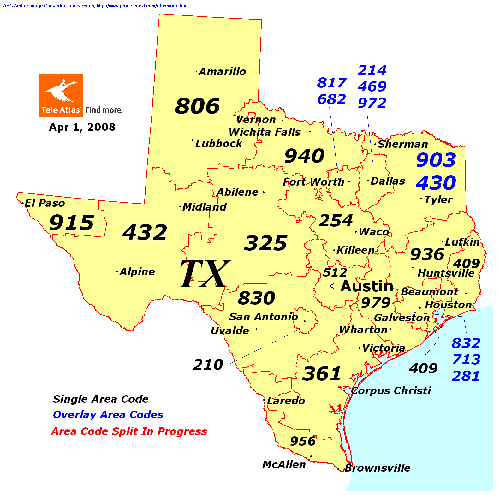
Decoding the First Digit
Texas zip codes, like all those in the United States, are categorized by the first digit. Texas belongs to the “7” range, which it shares with Louisiana and Arkansas. Consequently, every zip code in the Lone Star State begins with the number 7. This grouping allows the USPS to streamline mail processing by directing logistics toward major regional hubs located within this specific geographic zone.
Regional Segmentation via the Second and Third Digits
The second and third digits of a Texas zip code further refine the location. These three-digit prefixes—often referred to as the “sectional center facility” (SCF)—typically designate a major city or a specific region. For example, 750xx through 754xx generally pertain to the Dallas-Fort Worth area, while 770xx through 775xx are associated with the Greater Houston metropolitan region. By the time a package or letter hits the third digit, the USPS has narrowed its destination down to a regional distribution center, from which it is sorted for final delivery.
Precision at the Local Level
The final two digits represent the local delivery area. These might refer to specific neighborhoods, rural routes, or even large buildings or campuses that receive enough mail volume to warrant their own unique code. This granular level of detail is essential for the logistical precision required in a state as vast as Texas, where delivery routes can span hundreds of miles across rural terrain.
Economic and Demographic Implications
While zip codes were designed for mail, they have evolved into essential tools for economic analysis and business strategy. In the modern financial and commercial landscape, a Texas zip code is often the primary variable used to determine market viability, insurance risk, and consumer demographics.
Geographic Data for Business Intelligence
For companies operating in Texas, zip codes serve as the primary unit for market segmentation. Retailers analyze the spending power, median income, and population density of specific zip codes to decide where to open new storefronts. A brand looking to launch a luxury service, for instance, will prioritize high-income zip codes in enclaves like Highland Park (75205) or West University Place (77005). Conversely, service-based industries look at lower-density rural zip codes to identify underserved markets where competition may be lower.

Insurance and Risk Assessment
In the world of finance, specifically within the insurance sector, the zip code is a critical factor in determining risk profiles. Texas is prone to diverse natural events—from hurricanes along the Gulf Coast to tornadoes in North Texas and wildfires in the Hill Country. Insurance providers utilize historical data associated with specific zip codes to calculate premiums. A resident living in a coastal zip code (such as 77550 in Galveston) may face different insurance mandates and costs compared to someone living in the high-plains region of the Panhandle (such as 79101 in Amarillo). This application of zip code data is a fundamental aspect of risk management in Texas’s financial ecosystem.
Real Estate Valuation
The real estate market relies heavily on the “zip code effect.” Potential homebuyers often search for property based on these codes, as they act as a proxy for school district quality, crime rates, and proximity to major employment hubs. Because property taxes in Texas are a primary source of municipal and school district funding, the zip code effectively becomes a shorthand for the socioeconomic health of a community. Investors track zip code appreciation trends to identify emerging markets, moving capital into areas where the zip code boundaries are undergoing rapid gentrification or development.
Logistical Challenges in a Vast State
Texas presents unique logistical hurdles for the USPS and private couriers. With its expansive landmass and the vast distance between major urban centers, the zip code system must be exceptionally resilient.
Managing Urban Density vs. Rural Sprawl
Texas contains some of the fastest-growing urban areas in the nation, such as Austin, Dallas, and Houston. As these cities expand, the density within existing zip codes increases, often forcing the USPS to create “split” codes or assign new zip codes to accommodate the volume. In contrast, rural Texas presents the opposite problem: enormous geographic areas covered by very few zip codes. The logistics of delivering to a ranch address in a remote part of West Texas, such as zip code 79734, requires specialized routing that contrasts sharply with the high-speed sorting utilized in downtown urban centers.
Infrastructure and Routing Efficiency
The effectiveness of the Texas zip code system is measured by its ability to facilitate “last-mile” delivery. Modern logistics providers use sophisticated algorithms to map these codes against GPS data, traffic patterns, and warehouse proximity. In Texas, where inter-city distances are significant, the zip code serves as the trigger for automated sorting machines. If a zip code is incorrectly identified on a package, the logistical delay can be significant, as the package may be sent to an entirely wrong regional hub—a costly error in a state that encompasses over 268,000 square miles.
The Future of Spatial Identification in Texas
As Texas continues to experience rapid population growth and technological advancement, the role of the zip code is shifting. While it remains the standard for postal delivery, its function as a static geographic marker is being augmented by digital tools.
Beyond the Five Digits
Increasingly, businesses are integrating zip code data with geofencing technology. While a zip code provides a broad geographic bucket, mobile technology allows companies to track consumer movement in real-time. Despite this, the zip code remains the most common denominator for tax jurisdiction, voting district allocation, and government service delivery. It is the bridge between the physical reality of a resident’s home and the administrative systems of the state and federal government.

E-commerce and the “Zone” Strategy
For e-commerce giants and logistics hubs operating in Texas, the zip code is the cornerstone of the “zone” strategy. Shipping costs are often determined by the distance between the origin zip code and the destination zip code. Texas’s central location in the U.S. makes it a prime logistics hub for national distribution. By optimizing fulfillment centers based on the proximity of high-volume zip codes, companies can slash shipping times and costs, effectively leveraging the state’s geography to serve the wider North American market.
Ultimately, a Texas zip code is a sophisticated tool of modern society. It is the intersection of postal efficiency, financial risk modeling, real estate strategy, and logistical planning. Whether one is a consumer waiting for a package, an investor analyzing a new market, or a city planner looking to provide infrastructure to a growing neighborhood, the five digits of a Texas zip code provide the essential framework for understanding where people live, how they are connected, and how the state moves forward. As technology continues to evolve, these codes will remain the anchor point for the physical and economic map of Texas, ensuring that despite the state’s massive size, every single point within its borders remains reachable.
aViewFromTheCave is a participant in the Amazon Services LLC Associates Program, an affiliate advertising program designed to provide a means for sites to earn advertising fees by advertising and linking to Amazon.com. Amazon, the Amazon logo, AmazonSupply, and the AmazonSupply logo are trademarks of Amazon.com, Inc. or its affiliates. As an Amazon Associate we earn affiliate commissions from qualifying purchases.