
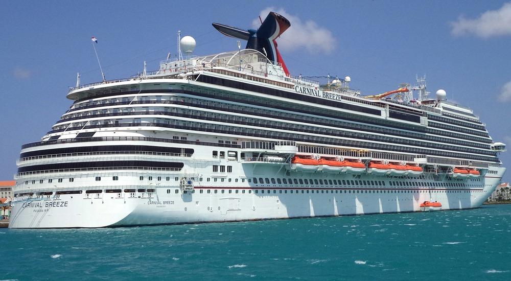
The human fascination with the movement of vessels across vast oceans is as old as seafaring itself. In an era defined by instant information, the question, “where is the Carnival Breeze right now?” is more than just a passing curiosity; it’s a gateway into the sophisticated technological infrastructure that powers global maritime operations. This article delves into the fascinating world of vessel tracking, focusing on the underlying technologies, the tools available to the public, and the broader implications for safety, logistics, and environmental stewardship, all through the lens of a specific, identifiable vessel like the Carnival Breeze.
The Backbone of Maritime Tracking: AIS and Beyond
Understanding the current whereabouts of a vessel like the Carnival Breeze begins with grasping the fundamental technologies that enable such precise, real-time tracking. At the heart of this system is the Automatic Identification System (AIS), a critical component of modern maritime safety and navigation. However, AIS is not alone; it works in conjunction with other advanced technologies to provide a comprehensive picture of global ship movements.
Understanding AIS: How It Works
AIS is an automatic tracking system used on ships and by vessel traffic services (VTS) for identifying and locating vessels by electronically exchanging data with other nearby ships, AIS base stations, and satellites. Designed primarily as a collision avoidance tool, AIS transmits crucial information about a vessel, including its unique identification (MMSI number), position (derived from GPS), course over ground, speed over ground, navigational status (e.g., “at anchor,” “underway using engine”), rate of turn, and even destination and estimated time of arrival. This data is broadcast via VHF radio waves, allowing other AIS-equipped vessels and shore-based stations within range to receive and display this information. The beauty of AIS lies in its universality and its mandatory adoption for most commercial vessels, including cruise ships like the Carnival Breeze, ensuring a robust network of self-reporting vessels.
The Role of GPS and Satellite Communication
While AIS broadcasts local data, its core positional information relies heavily on the Global Positioning System (GPS). GPS receivers onboard vessels continuously determine their exact latitude and longitude by triangulating signals from a constellation of Earth-orbiting satellites. This highly accurate positional data is then fed into the AIS transponder for transmission. For vessels operating far from shore-based AIS receivers, beyond the typical 20-50 nautical mile VHF range, satellite communication becomes paramount. Satellite AIS (S-AIS) systems utilize satellites equipped with AIS receivers to pick up these VHF signals from vessels traversing open oceans. These satellites then relay the collected data back to ground stations, closing the tracking gap and providing global coverage for virtually any vessel equipped with an AIS transponder, regardless of its proximity to land. This hybrid approach—terrestrial AIS for coastal waters and satellite AIS for the high seas—ensures continuous, worldwide tracking capabilities.
Data Transmission and Global Coverage
The raw data collected by AIS receivers, both terrestrial and satellite, is then aggregated and processed. Companies specializing in maritime data collect this vast amount of information, cleanse it, and make it accessible through various platforms. This involves massive data centers, sophisticated algorithms for data processing, and robust network infrastructures to handle the continuous stream of real-time positional updates from tens of thousands of vessels worldwide. The result is an intricate web of data transmission that translates raw AIS signals into understandable and accessible maps, allowing anyone with the right tools to pinpoint the precise location of a vessel like the Carnival Breeze, whether it’s navigating the Caribbean, crossing an ocean, or docked in port. This global coverage underscores the sophistication and collaborative nature of modern maritime tracking technology.
Tools and Platforms for Real-Time Vessel Tracking
The complex technological infrastructure behind maritime tracking culminates in user-friendly applications and websites that put the power of vessel monitoring directly into the hands of the public. Whether you’re a maritime enthusiast, a logistics professional, or simply curious about a particular ship’s journey, a variety of platforms offer real-time data, often for free.
Popular Marine Traffic Websites and Apps
Several prominent platforms have emerged as leaders in making global maritime traffic data accessible. Websites like MarineTraffic.com, VesselFinder.com, and ShipFinder.com are perhaps the most well-known. These platforms aggregate AIS data from thousands of terrestrial receivers and satellite sources, displaying it on interactive maps. Users can search for specific vessels by name (e.g., “Carnival Breeze”), IMO number, or MMSI, and instantly view their current location, past track, speed, course, and other reported data. Many of these services also offer mobile applications for iOS and Android, providing convenient tracking on the go. Beyond simple tracking, these platforms often offer additional features such as port information, vessel photos, historical data, and even predictions for arrival times, making them invaluable resources for a wide array of users.
How to Track the Carnival Breeze (Step-by-Step Guide)
Tracking the Carnival Breeze, or any other major vessel, is a straightforward process using these online tools. Here’s a typical step-by-step guide:
- Choose a Tracking Platform: Open your web browser or preferred marine traffic app (e.g., MarineTraffic, VesselFinder).
- Navigate to the Search Bar: Look for a prominent search bar, usually labeled “Search Vessel,” “Vessel Name,” or “IMO/MMSI.”
- Enter Vessel Name: Type “Carnival Breeze” into the search bar and press Enter or click the search icon.
- Select the Correct Vessel: If multiple results appear (unlikely for a unique name like Carnival Breeze, but possible for common names), ensure you select the correct vessel. You might verify by checking the vessel type (Passenger Ship/Cruise Ship) or IMO number if available.
- View Real-Time Data: The map will then center on the Carnival Breeze’s current location, displaying its icon. Clicking on the vessel icon will typically open a detailed information panel showing its speed, course, destination, last reported position, and other pertinent AIS data. Most platforms also offer a “track” feature to visualize its recent path.
- Explore Additional Features: Take advantage of features like satellite view, weather overlays, or historical data to gain deeper insights into its journey.
This accessibility empowers anyone with an internet connection to monitor the movements of the Carnival Breeze, satisfying both casual curiosity and practical needs.
Carnival Cruise Line’s Own Tracking Tools
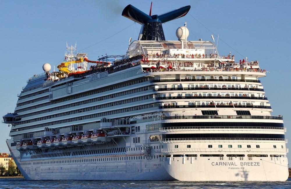
While third-party aggregators are excellent, cruise lines themselves sometimes offer proprietary tracking or informational tools for their fleet. Carnival Cruise Line, for instance, provides information on its ships’ itineraries and expected ports of call. Guests onboard can often use the ship’s internal network or dedicated apps (like the Carnival Hub App) to access ship information, including its current position relative to ports or geographical landmarks. While these proprietary tools might not offer the same global, real-time tracking capabilities as a dedicated AIS aggregator, they provide a branded, guest-centric experience that informs passengers about their journey and sometimes allows family and friends ashore to follow along in a more curated fashion, often focusing on the ship’s schedule rather than its precise, moment-by-moment coordinates.
Beyond Curiosity: The Broader Implications of Vessel Tracking Technology
The ability to track vessels like the Carnival Breeze extends far beyond satisfying a simple question of “where are they now?”. This technology forms a cornerstone of modern maritime operations, impacting safety, efficiency, and environmental efforts on a global scale.
Enhancing Safety and Security at Sea
One of the primary drivers behind the development and mandatory adoption of AIS was the enhancement of maritime safety. By providing real-time positional data and navigational status, AIS significantly reduces the risk of collisions between vessels, especially in busy shipping lanes, restricted waters, and during periods of low visibility. Vessel traffic services (VTS) use AIS data to monitor traffic in ports and waterways, providing pilots and captains with critical information to prevent incidents. In emergency situations, the precise location of a distressed vessel can be immediately identified, dramatically reducing search and rescue times. Furthermore, tracking technology plays a vital role in security, allowing authorities to monitor suspicious vessel movements, detect unauthorized entries into protected areas, and combat piracy and illegal activities like smuggling or illegal fishing. For cruise ships like the Carnival Breeze, this means a safer voyage for thousands of passengers and crew.
Operational Efficiency and Logistics for Shipping Companies
For the broader commercial shipping industry, real-time vessel tracking is an indispensable tool for operational efficiency and logistics management. Shipping companies can monitor their entire fleet, optimizing routes to avoid adverse weather, reduce fuel consumption, and ensure timely arrivals. Port authorities use this data to manage vessel traffic flow, allocate berths efficiently, and plan for cargo handling operations, minimizing turnaround times. Supply chain managers rely on accurate vessel tracking to provide customers with precise estimated times of arrival (ETAs), enabling better inventory management and distribution planning. This level of transparency and predictability, driven by technology, translates directly into cost savings, reduced carbon footprints, and improved customer satisfaction across the global supply chain, extending far beyond the immediate context of a cruise ship.
Environmental Monitoring and Compliance
The environmental implications of advanced vessel tracking technology are increasingly significant. By continuously monitoring ship movements, authorities can track compliance with environmental regulations, such as speed limits in protected marine areas to reduce whale strikes or restrictions on dumping waste. AIS data combined with other sensors can help monitor the discharge of ballast water or emissions, contributing to cleaner oceans and skies. Furthermore, the analysis of historical vessel movement data provides valuable insights for environmental research, helping scientists understand the impact of shipping on marine ecosystems, identify critical habitats, and inform conservation strategies. As environmental concerns gain prominence, the role of precise vessel tracking in fostering accountability and promoting sustainable maritime practices will only continue to grow.
The Future of Maritime Tracking: Innovations on the Horizon
The evolution of maritime tracking is far from over. As technology continues to advance at a rapid pace, the future promises even more sophisticated, integrated, and intelligent systems that will revolutionize how we monitor, manage, and interact with the world’s maritime traffic.
AI and Predictive Analytics in Shipping
One of the most exciting frontiers is the integration of Artificial Intelligence (AI) and machine learning with maritime data. AI can analyze vast datasets from AIS, weather patterns, ocean currents, and port schedules to develop predictive models. This could lead to hyper-optimized routing that not only avoids bad weather but also anticipates port congestion, fuel price fluctuations, and even geopolitical risks, adjusting routes in real-time for maximum efficiency and safety. Predictive analytics can forecast potential mechanical failures, allowing for proactive maintenance and reducing costly downtime. For safety, AI could identify unusual vessel behaviors indicative of distress or illicit activities more effectively than human operators alone, providing early warnings and enabling faster interventions.
Blockchain for Supply Chain Transparency
Blockchain technology, known for its decentralized and immutable ledger, holds significant promise for enhancing transparency and security in the maritime supply chain. While not directly a “tracking” technology in the traditional sense, blockchain can be integrated with tracking data to create an unalterable record of a cargo’s journey, from origin to destination. Each waypoint, each transfer of custody, and each relevant document could be logged on a blockchain, providing an auditable and trustworthy history. This increased transparency can combat fraud, streamline customs processes, and ensure ethical sourcing, benefiting consumers, businesses, and regulators alike. Imagine tracking a container on a ship like the Carnival Breeze’s cargo companion, with every leg of its journey verifiable and secure.
Advanced Satellite Constellations and IoT Integration
The next generation of satellite technology will further enhance global maritime tracking. New constellations of smaller, more numerous satellites are being launched, offering even higher refresh rates for AIS data and potentially enabling real-time broadband connectivity for all vessels, regardless of their location. This increased bandwidth will facilitate the growth of the Internet of Things (IoT) in the maritime sector. Imagine every piece of equipment on a ship, from engines to refrigeration units, being equipped with sensors that continuously transmit data. This IoT integration, combined with advanced satellite communication, will create a comprehensive “digital twin” of a vessel, providing unprecedented levels of operational insight, predictive maintenance capabilities, and real-time performance optimization, pushing the boundaries of what is possible in maritime management.
In conclusion, the simple question “where is the Carnival Breeze right now?” unveils a world of cutting-edge technology. From the foundational AIS and GPS systems to advanced satellite networks and the emerging potential of AI and IoT, maritime tracking has transformed our ability to monitor, secure, and optimize global shipping. This intricate technological web not only satisfies our curiosity about a specific cruise ship’s journey but also underpins a safer, more efficient, and environmentally responsible future for the entire maritime industry.
aViewFromTheCave is a participant in the Amazon Services LLC Associates Program, an affiliate advertising program designed to provide a means for sites to earn advertising fees by advertising and linking to Amazon.com. Amazon, the Amazon logo, AmazonSupply, and the AmazonSupply logo are trademarks of Amazon.com, Inc. or its affiliates. As an Amazon Associate we earn affiliate commissions from qualifying purchases.