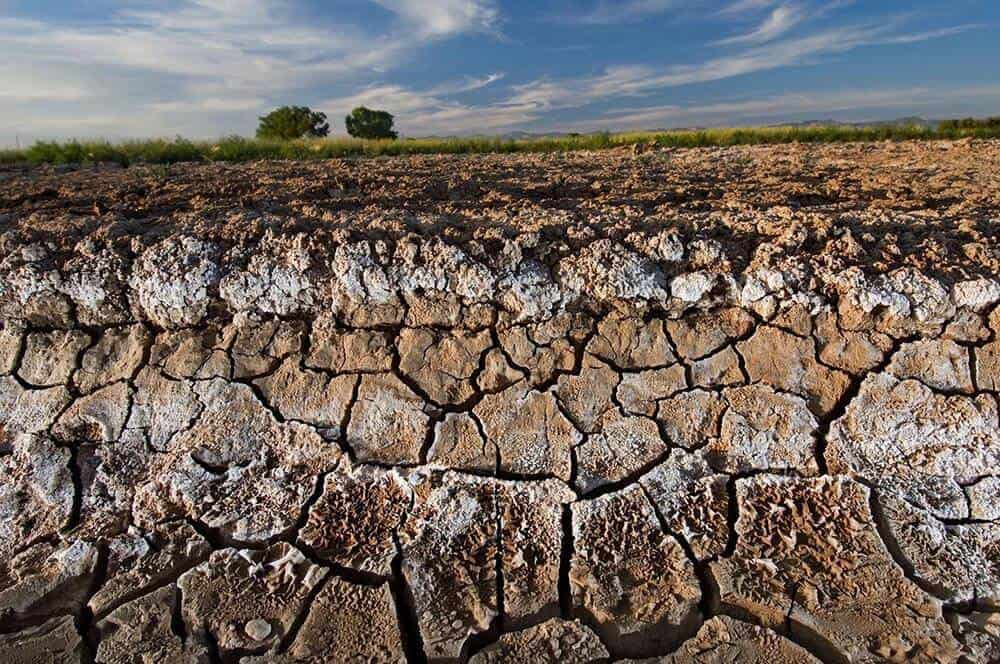
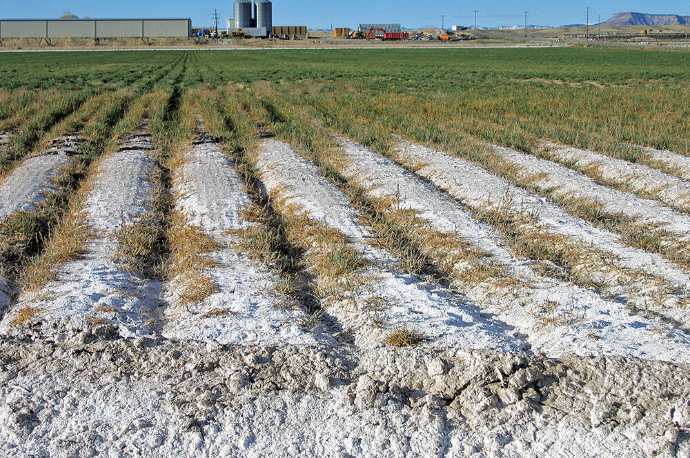
The global agricultural landscape is currently facing a silent, digital, and chemical crisis: soil salinity. While historically viewed as a simple environmental byproduct of over-irrigation or natural mineral weathering, the modern technological era has redefined soil salinity as a complex data challenge. In the context of AgTech (Agricultural Technology), soil salinity refers to the concentration of soluble salts in the soil profile, measured primarily through electrical conductivity (EC). As we strive to feed a growing population with diminishing arable land, the ability to monitor, analyze, and mitigate salinity using high-tech tools has become the cornerstone of precision agriculture.

This article explores how soil salinity is being transformed from a regional farming hurdle into a data-driven frontier, utilizing IoT sensors, satellite imagery, and artificial intelligence to ensure global food security.
1. The Digital Measurement of Salt: IoT and Sensor Integration
Traditional soil testing involved manual sampling and time-consuming laboratory analysis. In the current tech-driven paradigm, this has been replaced by real-time data acquisition through sophisticated sensor networks. Understanding soil salinity today begins with the hardware that detects it at the molecular level.
Electromagnetic Induction (EMI) and Electrical Conductivity (EC)
The primary technological metric for soil salinity is Electrical Conductivity (EC). Because salt ions conduct electricity, AgTech hardware uses Electromagnetic Induction (EMI) sensors to map the sub-surface without ever touching the soil. These sensors, often mounted on autonomous rovers or drones, generate electromagnetic fields to measure how easily an electrical current passes through the earth. High conductivity correlates directly with high salinity. Modern EC meters are now integrated with GPS, allowing farmers to create “salinity heat maps” that serve as the foundational data layer for variable-rate irrigation systems.
Real-Time IoT Monitoring Networks
The “Internet of Things” (IoT) has revolutionized how salinity data is collected over time. Instead of a single snapshot, buried soil sensors—equipped with LoRaWAN or cellular connectivity—provide a continuous stream of data regarding moisture, temperature, and salt concentration. These IoT nodes transmit data to cloud-based dashboards, allowing agronomists to see “salinity spikes” in real-time. This level of granularity enables “Edge Computing” in agriculture, where local devices can make immediate decisions, such as triggering a flushing sequence in an irrigation system before the salt levels reach a threshold that would stunt crop growth.
2. Remote Sensing: Monitoring Soil Health from the Stratosphere
While ground sensors provide depth and precision, satellite and aerial technology provide the scale necessary to combat salinity on a macro level. Remote sensing has become an indispensable tool in the AgTech stack for identifying saline-alkali land from hundreds of miles above the Earth.
Multi-spectral and Hyper-spectral Analysis
Satellites like the ESA’s Sentinel-2 and NASA’s Landsat series are equipped with multi-spectral sensors that capture light beyond the visible spectrum. Soil salinity leaves a “spectral signature.” As salt crusts form on the soil surface or as plants experience salt stress, their reflectance of near-infrared (NIR) and short-wave infrared (SWIR) light changes. By applying specific algorithms, such as the Salinity Index (SI) or the Normalized Difference Vegetation Index (NDVI), data scientists can detect salinity issues before they are visible to the naked eye. This “early warning system” allows for proactive land management rather than reactive damage control.
GIS Integration and Spatial Mapping
Geographic Information Systems (GIS) act as the software brain for remote sensing data. By layering historical salinity data with topographic maps and drainage patterns, GIS software can predict where salt is likely to accumulate. In the tech sector, this is referred to as “predictive spatial modeling.” For large-scale corporate farms, GIS platforms integrate satellite feeds with drone-captured LIDAR data to create 3D models of salt movement through a watershed. This allows engineers to design precision drainage systems that utilize gravity and tech-optimized layouts to leach salts effectively.
3. AI and Machine Learning in Salinity Management
The sheer volume of data generated by sensors and satellites is too vast for human analysis. This is where Artificial Intelligence (AI) and Machine Learning (ML) enter the frame, turning raw numbers into actionable intelligence and automated solutions.
Predictive Modeling for Salt Accumulation
Machine learning algorithms, particularly Random Forest and Neural Networks, are being trained on decades of soil data to predict future salinity trends. By inputting variables such as weather forecasts, irrigation frequency, and soil type, AI models can simulate “what-if” scenarios. For example, a software platform can predict how a 20% reduction in rainfall over the next quarter will impact the root-zone salinity of a specific vineyard. These predictive models are vital for digital twins—virtual representations of physical farms where managers can test different tech interventions without risking actual crops.
Autonomous Irrigation and Desalination Systems
The pinnacle of AgTech salinity management is the closed-loop autonomous system. AI-driven irrigation controllers can now interpret sensor data and automatically adjust water quality. In areas where the only available water is brackish, integrated tech solutions include small-scale, automated desalination units. These units use reverse osmosis or electrodialysis, controlled by AI, to treat water only to the level required by the specific crop’s salt tolerance. This optimizes energy consumption and water use, representing a major leap in sustainable tech-led farming.
4. Data-Driven Solutions and Digital Security in Agriculture
As soil salinity management becomes increasingly digitized, the focus shifts toward data infrastructure, big data analytics, and the security of the agricultural tech stack. The transition from “farming by intuition” to “farming by data” requires a robust digital framework.
Big Data in Global Soil Health
The fight against soil salinity is not limited to individual farms; it is a global data project. Large-scale AgTech platforms are aggregating anonymized salinity data to build global soil health databases. These “Big Data” repositories allow researchers to track how climate change and rising sea levels are accelerating saltwater intrusion in coastal tech-hubs. By utilizing cloud computing, these platforms provide regional governments with the analytics needed to build large-scale tech infrastructure, such as automated sea gates or regional drainage networks, based on real-time salinity trends.
Securing the Agricultural Tech Stack
With the proliferation of IoT sensors and automated irrigation systems, digital security has become a paramount concern. A cyber-attack on a farm’s salinity management system—such as falsifying sensor data to trigger over-irrigation—could destroy an entire season’s yield. Consequently, the next generation of soil salinity tech includes blockchain-verified data logs and encrypted communication protocols. Ensuring that the “salinity data” is untampered with is essential for farms that participate in carbon credit programs or ESG (Environmental, Social, and Governance) reporting, where soil health must be digitally audited and verified.
The Future of Tech-Driven Soil Management
Soil salinity is no longer just a biological or chemical concern; it is a fundamental variable in the global AgTech equation. Through the integration of high-precision IoT sensors, satellite-based remote sensing, and AI-driven predictive analytics, we are entering an era where salt stress can be managed with surgical precision.
The digital transformation of soil management represents a shift toward a more resilient and efficient food system. By treating soil salinity as a data point to be optimized rather than a terminal condition, technology provides a roadmap for reclaiming degraded lands and maximizing the productivity of our planet. As hardware becomes more affordable and AI models more accurate, the “Digital Green Revolution” will be defined by our ability to master the salt—one byte at a time.
aViewFromTheCave is a participant in the Amazon Services LLC Associates Program, an affiliate advertising program designed to provide a means for sites to earn advertising fees by advertising and linking to Amazon.com. Amazon, the Amazon logo, AmazonSupply, and the AmazonSupply logo are trademarks of Amazon.com, Inc. or its affiliates. As an Amazon Associate we earn affiliate commissions from qualifying purchases.