
In the vast, unpredictable expanse of the world’s oceans, the ability to see and be seen is the cornerstone of safety, commerce, and security. As global trade continues to expand, the density of maritime traffic has reached unprecedented levels, necessitating a sophisticated technological solution to prevent collisions and manage the flow of goods. Enter the AIS system—the Automatic Identification System.
Originally developed in the late 20th century as a short-range identification and graphical tracking tool, AIS has evolved into a cornerstone of modern maritime technology. It is a digital, automated tracking system that uses transponders on ships and is used by vessel traffic services (VTS). This article explores the technical intricacies of AIS, its role in the global digital infrastructure, and how it continues to shape the future of maritime tech.
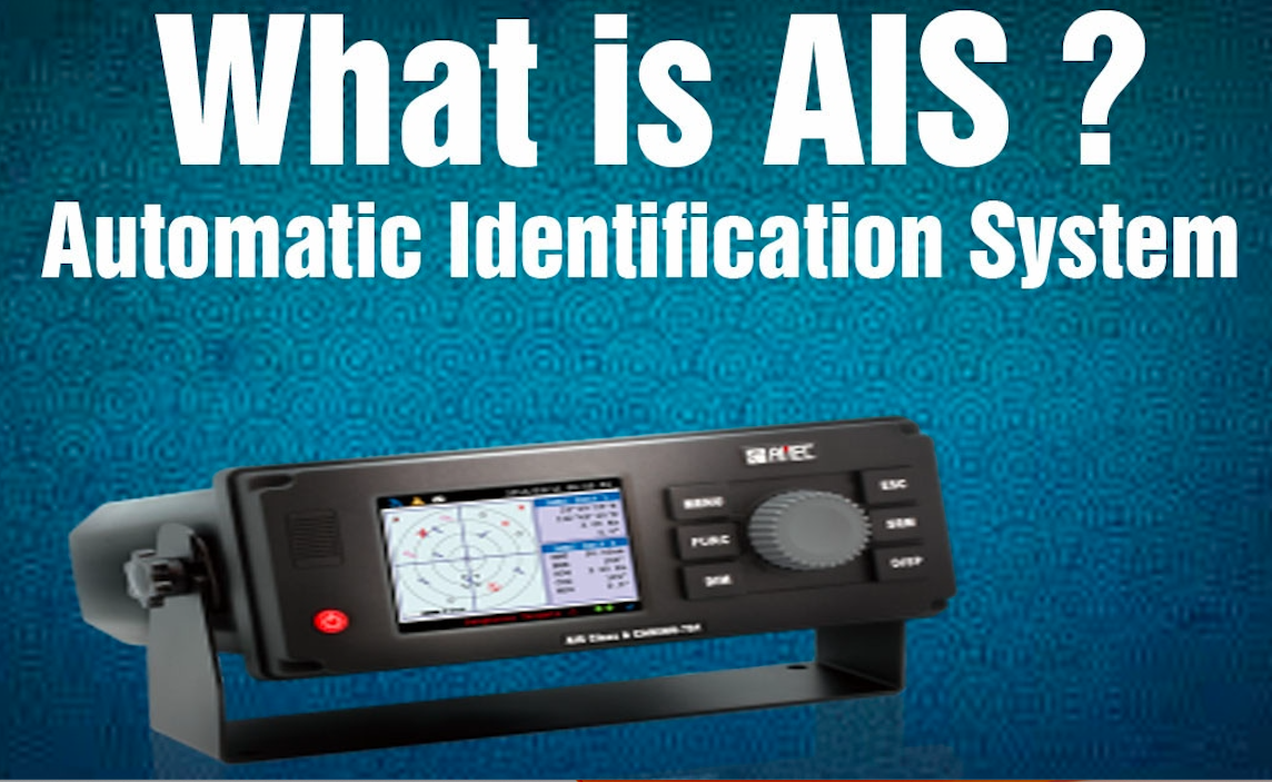
The Fundamentals of AIS: How It Works and Why It Matters
At its core, the AIS system is an autonomous and continuous broadcast system operating in the VHF (Very High Frequency) maritime band. It allows ships to communicate their identity, position, speed, and heading to other ships and shore-based stations automatically. Unlike radar, which relies on radio waves bouncing off a physical object, AIS is a cooperative system; it relies on the active transmission of data from one device to another.
The Core Mechanism: VHF and Data Transmission
AIS works by taking information from the ship’s internal sensors—such as GPS coordinates, Rate of Turn (ROT), and Speed Over Ground (SOG)—and packaging it into digital bursts. These bursts are transmitted over two dedicated VHF channels (87B and 88B). The beauty of the AIS system lies in its use of Self-Organized Time Division Multiple Access (SOTDMA) technology. This protocol allows the system to manage thousands of reports from multiple ships simultaneously without the signals overlapping or “stepping” on each other. By synchronizing with GPS time, each transponder finds an empty “slot” in the radio spectrum to announce its presence.
Types of AIS Transponders: Class A vs. Class B
Not all AIS systems are created equal. The maritime industry categorizes these devices based on the size of the vessel and the requirements of the International Maritime Organization (IMO).
- Class A Transponders: These are mandatory for all vessels 300 gross tonnage and upwards on international voyages, as well as all passenger ships. Class A units have a higher reporting rate, more transmit power (12.5 watts), and use SOTDMA to ensure their signal is always prioritized.
- Class B Transponders: Designed for smaller commercial vessels, fishing boats, and recreational crafts, these units are less expensive and transmit at a lower power (2 watts). They typically use CSTDMA (Carrier Sense Time Division Multiple Access), which waits for a gap in the traffic before transmitting, ensuring they do not interfere with the critical Class A broadcasts of larger ships.
The Role of Satellite AIS (S-AIS) in Global Coverage
One of the primary limitations of traditional AIS is its line-of-sight range, which is typically about 20 to 40 nautical miles due to the curvature of the Earth. To overcome this, the tech industry introduced Satellite AIS (S-AIS). By placing AIS receivers on low-earth orbit (LEO) satellites, we can now track vessels in the middle of the Atlantic or Pacific Oceans, far beyond the reach of coastal towers. This leap in technology has transformed AIS from a local collision-avoidance tool into a global transparency engine.
The Evolution of Maritime Safety and Digital Navigation
The primary driver behind the adoption of AIS was the need to reduce human error in navigation. In the complex environment of a ship’s bridge, AIS provides a layer of digital clarity that radar sometimes lacks, particularly in heavy rain or behind geographical obstructions like islands or bends in a river.
Collision Avoidance and Situational Awareness
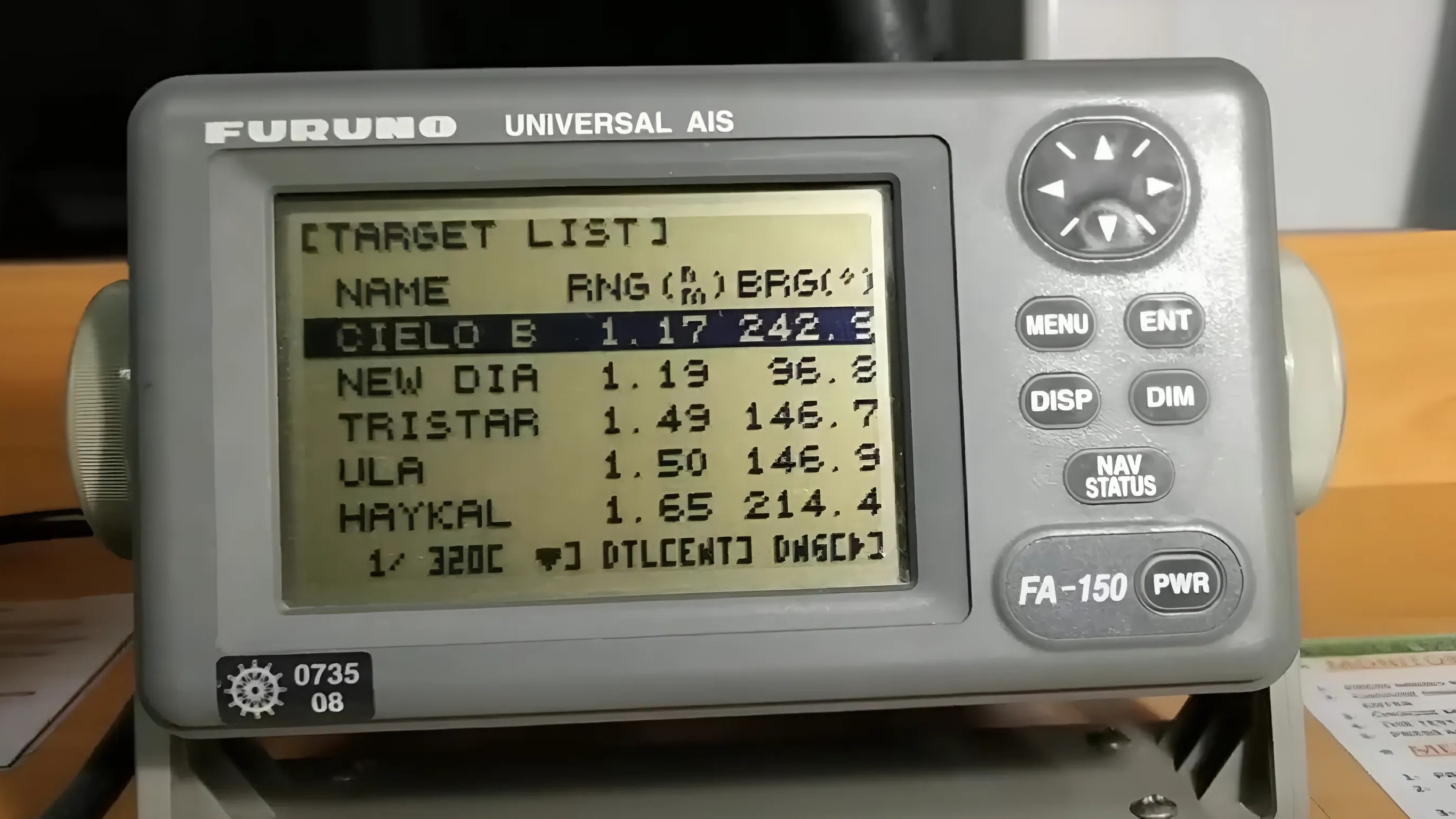
AIS provides a wealth of information that radar cannot easily provide. When a navigator looks at an AIS-enabled display, they don’t just see a “target”; they see the name of the ship, its destination, its status (e.g., “at anchor” or “underway using engine”), and its exact dimensions. This data is critical for calculating the Closest Point of Approach (CPA) and Time to Closest Point of Approach (TCPA). By having this information presented digitally, crews can make informed decisions much earlier than they could by relying on visual sightings or radar echoes alone.
Integration with Electronic Chart Display and Information Systems (ECDIS)
Modern bridge integration is where AIS truly shines as a software marvel. The AIS data stream is fed directly into the ship’s Electronic Chart Display and Information System (ECDIS) or Radar display. This overlay allows the navigator to see real-time ship movements directly on top of their digital charts. The integration of AIS with software-based navigation systems has effectively turned the ocean into a giant, real-time “digital twin,” where every significant move is logged and visualized.
Improving Search and Rescue (SAR) Operations
In emergency situations, time is the most critical factor. AIS has revolutionized Search and Rescue (SAR) through devices like the AIS-SART (Search and Rescue Transmitter) and personal AIS Man Overboard (MOB) beacons. When activated, these gadgets broadcast a unique distress signal that appears immediately on the screens of all nearby vessels. This localized, high-accuracy tracking allows nearby ships to provide assistance much faster than a centralized coast guard response could, potentially saving lives in minutes rather than hours.
AIS Data as a Tool for Global Logistics and Big Data
Beyond the bridge of a ship, AIS technology has birthed a massive sub-sector in the tech industry: maritime analytics. The data broadcast by millions of transponders is collected, processed, and sold to provide insights into the world economy.
Supply Chain Visibility and Fleet Management
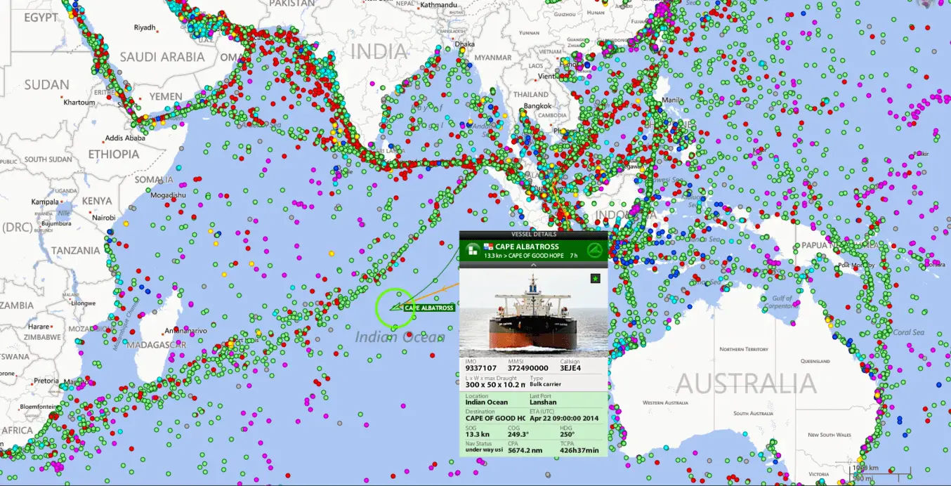
For logistics companies and cargo owners, AIS provides the “where is my stuff?” answer. By integrating AIS data into supply chain software, companies can track the exact progress of a container ship across the globe. They can predict arrival times with high precision, allowing ports to optimize berth scheduling and truck companies to coordinate pickups. This digitalization reduces “dwell time” at ports and increases the overall efficiency of the global trade network.
Monitoring Illegal Fishing and Environmental Protection
AIS has become a powerful tool for environmental NGOs and government agencies. By analyzing the movement patterns of vessels, algorithms can detect “dark” activity. For example, if a fishing vessel suddenly turns off its AIS transponder near a marine protected area, it flags a potential violation. Furthermore, the tech allows for the tracking of “ship strikes” involving whales, enabling authorities to implement slow-speed zones in critical habitats based on real-time traffic data.
API Integration and the Digitalization of the Oceans
The availability of AIS data through APIs (Application Programming Interfaces) has led to the rise of platforms like MarineTraffic, VesselFinder, and various proprietary fleet management tools. These apps aggregate terrestrial and satellite AIS data, providing a user-friendly interface for anyone—from hobbyists to multi-billion dollar shipping firms—to monitor global maritime movements. This level of transparency was unthinkable twenty years ago and represents a major milestone in the digital transformation of the shipping industry.
Cybersecurity and Future Trends in AIS Technology
As with any technology that relies on open radio broadcasts and digital data, the AIS system is not without its vulnerabilities. As we look toward the future, the tech industry is focusing on making AIS more secure and capable of handling even more data.
Addressing Vulnerabilities: Spoofing and Data Security
One of the inherent flaws of the current AIS protocol is its lack of encryption and authentication. It is possible for malicious actors to “spoof” AIS signals—broadcasting a fake position or a fake vessel identity. This can be used to hide illegal activities or to create “ghost ships” on navigation displays. In the realm of digital security, there is an ongoing push to develop “Secure AIS” or “AIS 2.0,” which would incorporate digital signatures to verify that the signal is coming from a legitimate source.
The Shift Toward VDES (VHF Data Exchange System)
The industry is currently transitioning toward VDES, which is often referred to as the second generation of AIS. VDES offers much higher data rates and greater reliability than the current AIS system. While AIS is primarily about “identity and position,” VDES is designed for “data exchange.” This will allow for the transmission of more complex information, such as weather updates, water level data, and digital route plans, directly between ships and shore-based authorities without relying on expensive satellite internet.
The Intersection of AIS and Autonomous Vessels
Perhaps the most exciting tech trend involving AIS is its role in the development of autonomous ships. An unmanned vessel relies entirely on its sensors to navigate. AIS acts as a primary data feed for the ship’s Artificial Intelligence, allowing it to “communicate” its intentions to manned vessels and “understand” the traffic around it. In an autonomous future, AIS will evolve from a tool for human navigators into a vital communication protocol for machine-to-machine (M2M) interaction on the high seas.
Conclusion
The AIS system is far more than a simple radio transponder; it is the heartbeat of modern maritime technology. From its origins as a collision-avoidance tool to its current status as a driver of big data and global logistics, AIS has proven to be an indispensable asset. As we move toward a future defined by autonomous shipping and VDES data exchange, the importance of this technology will only grow. By bridging the gap between physical ships and digital networks, AIS ensures that the world’s oceans—while still vast and dangerous—are more transparent and safer than ever before.
aViewFromTheCave is a participant in the Amazon Services LLC Associates Program, an affiliate advertising program designed to provide a means for sites to earn advertising fees by advertising and linking to Amazon.com. Amazon, the Amazon logo, AmazonSupply, and the AmazonSupply logo are trademarks of Amazon.com, Inc. or its affiliates. As an Amazon Associate we earn affiliate commissions from qualifying purchases.